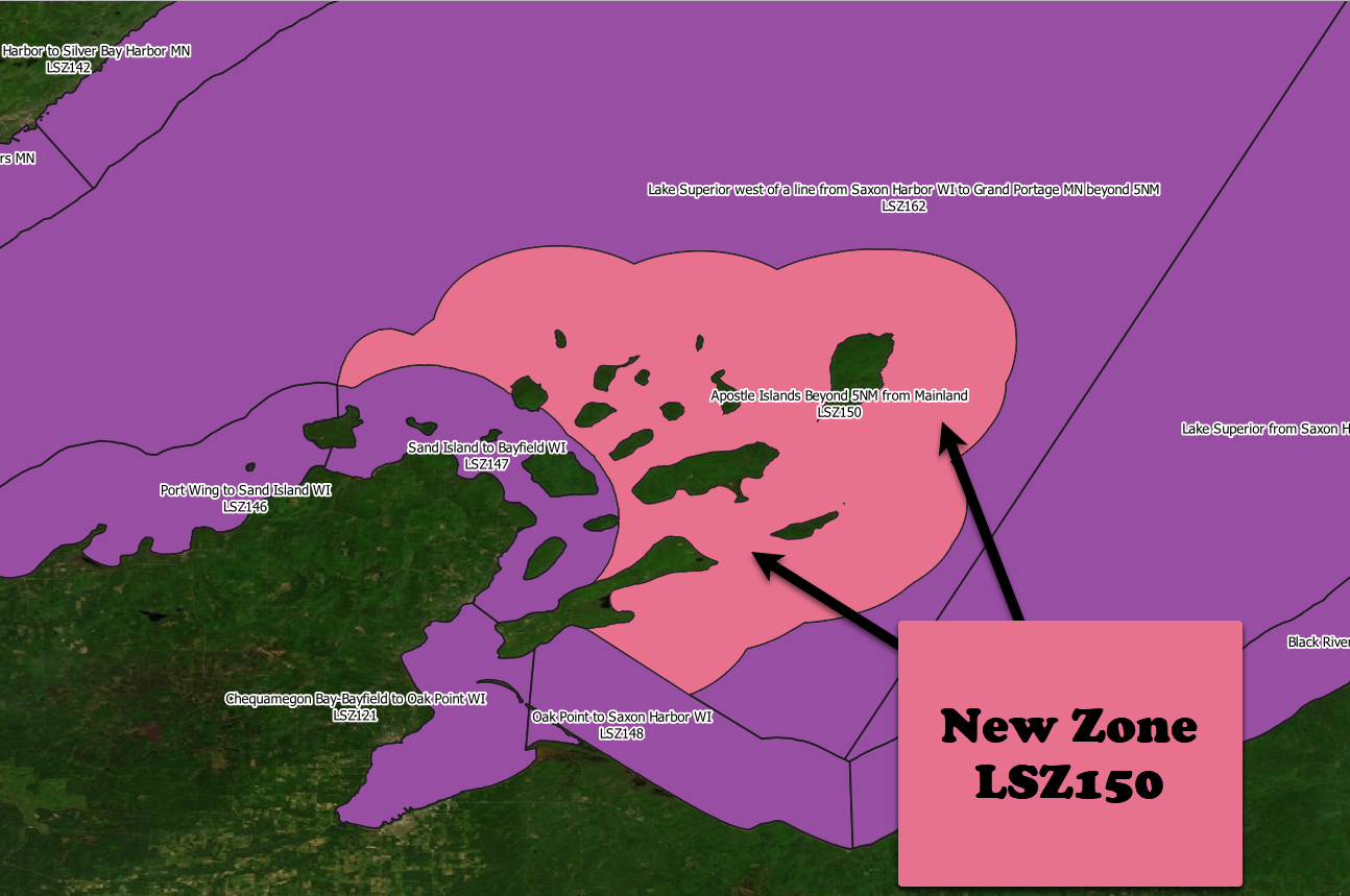
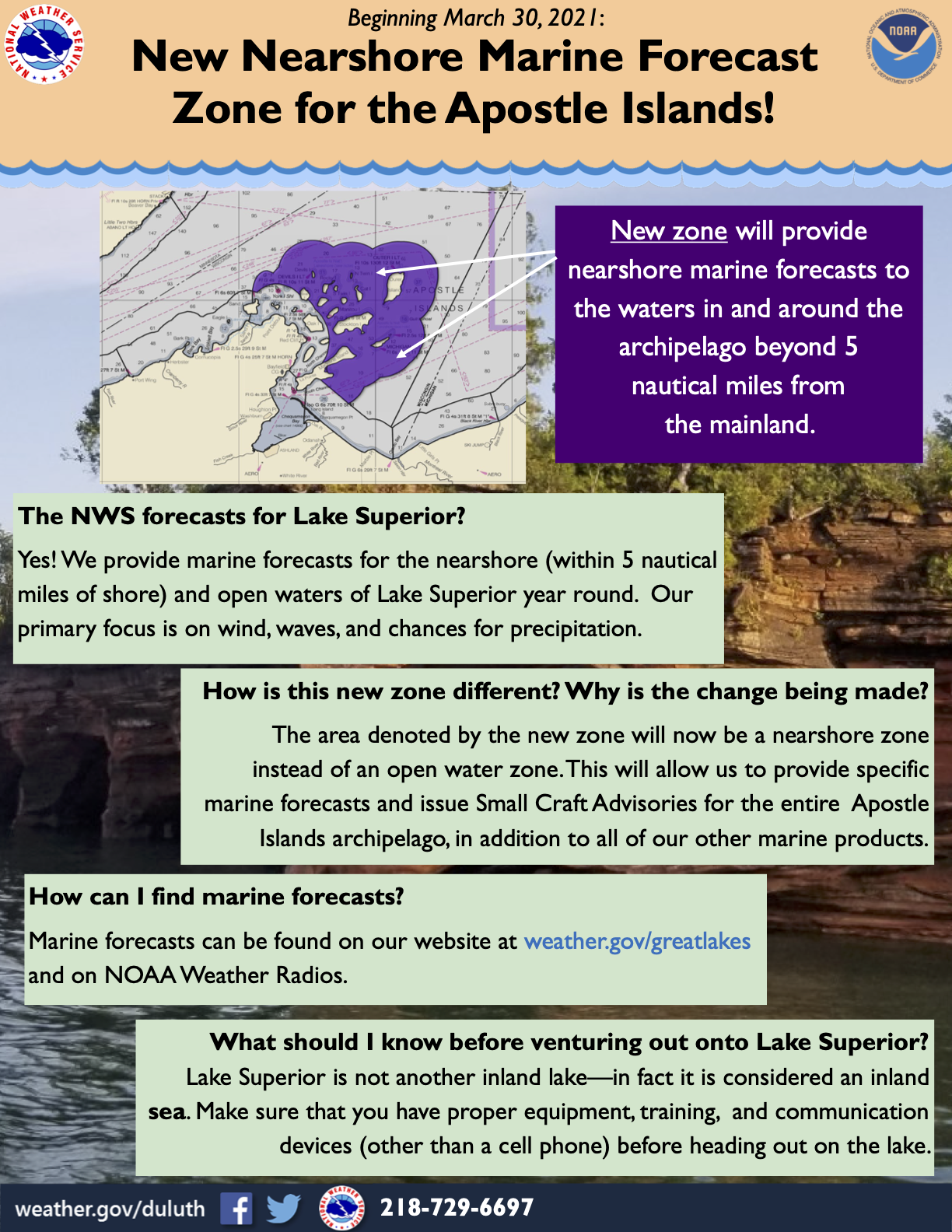
The NWS Weather Forecast Office (WFO) in Duluth, MN (DLH) has added one (1) new marine zone to encompass the outer Apostle Islands beyond 5 NM from the mainland. The zone will extend from the current breakpoint between LSZ146 (Port Wing to Sand Island WI) and LSZ147 (Sand Island to Bayfield WI) out an additional 5 NM from the islands that make up the remaining portion of the Apostle Islands that are located more than 5 NM from the mainland (see map below for details) all the way to the midpoint of LSZ148 (5 NM southeast from Madeleine Island) and then return back along the current boundary of LSZ147 (Sand Island to Bayfield WI). This change will remove a large portion of the offshore zone LSZ162 (Lake Superior west of a line from Saxon Harbor WI to Grand Portage MN beyond 5NM) and turn it into a near shore zone for which small craft advisories can be issued.
For marine forecasts, check out some of the following resources:
|
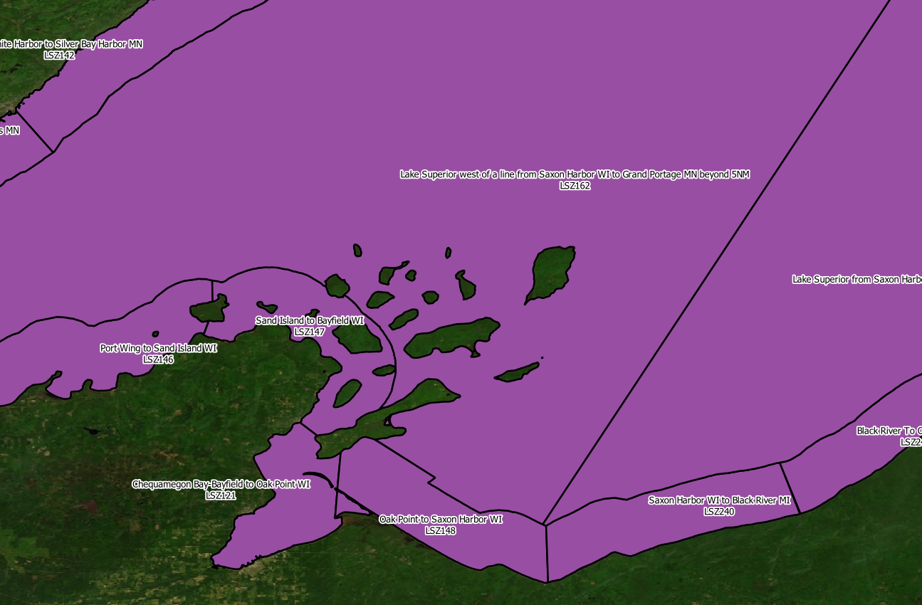
Old Zone Map
|
New Zone Map (Current as of March 30, 2021)
|
(Click to watch video on YouTube.)
The current zone that covered the outer Apostle Islands was part of a huge offshore marine zone (LSZ162), and the forecast for that zone often doesn't reflect the conditions that are observed in the more near-shore influenced Apostle Islands area. Adding this area to a near shore forecast allows small craft advisories to be issued for this geographical area which is a huge advantage due to the high density of inexperienced mariners in this nationally recognized destination (Apostle Island National Lakeshore). There have been incidents where users of our forecast would not have noted the wind shifts that occur around these islands if they were solely using the offshore forecast. An example of this is on August 30, 2018, several people perished while kayaking in this area which occurred within an "Open Waters" zone.
These zone changes require partners and users to take appropriate action to receive the new zone products using the Universal Generic Code (UGC) zone code format (Z) listed in Table 1. Products affected by this change are listed in Table 2.
Removing part of Marquette, Michigan's WFO offshore zone and turning it into a nearshore zone for Duluth, MN's WFO.
| Current Zone Name/ Current UGZ (Z) | New Public/Fire Zone Name / New UGC |
|
Lake Superior west of a line from Saxon Harbor WI to Grand Portage MN beyond 5NM (LSZ162) |
Apostle Islands Beyond 5NM from Mainland (LSZ150) |
| Product Name | WMO Header | AWIPS ID |
|
Nearshore Marine Forecast Special Weather Statement Hazardous Weather Outlook Public Information Statement Area Forecast Discussion Special Marine Warnings Marine Weather Statements Marine Weather Message Watch County Notification |
FZUS53 KDLH WWUS82 KDLH FLUS42 KDLH NOUS42 KDLH FXUS62 KDLH WHUS52 KDLH FZUS72 KDLH WWUS72 KDLH WWUS63 KDLH |
NSHDLH SPSDLH HWODLH PNSDLH AFDDLH SMWDLH MWSDLH MWMDLH WCNDLH |
Updated public and fire zone map shapefiles are available for download at: https://www.weather.gov/gis/AWIPSShapefiles
|
Joe Moore |