
A heat wave over the Southwest will intensify this week, peaking and expanding into the Intermountain West and northern High Plains this weekend. Severe thunderstorms and heavy rainfall are expected over parts of the Upper Midwest to mid-Mississippi Valley today. Critical to extremely critical fire weather conditions from the Northwest and the northern Great Basin on Saturday and Sunday. Read More >
Event Overview
|
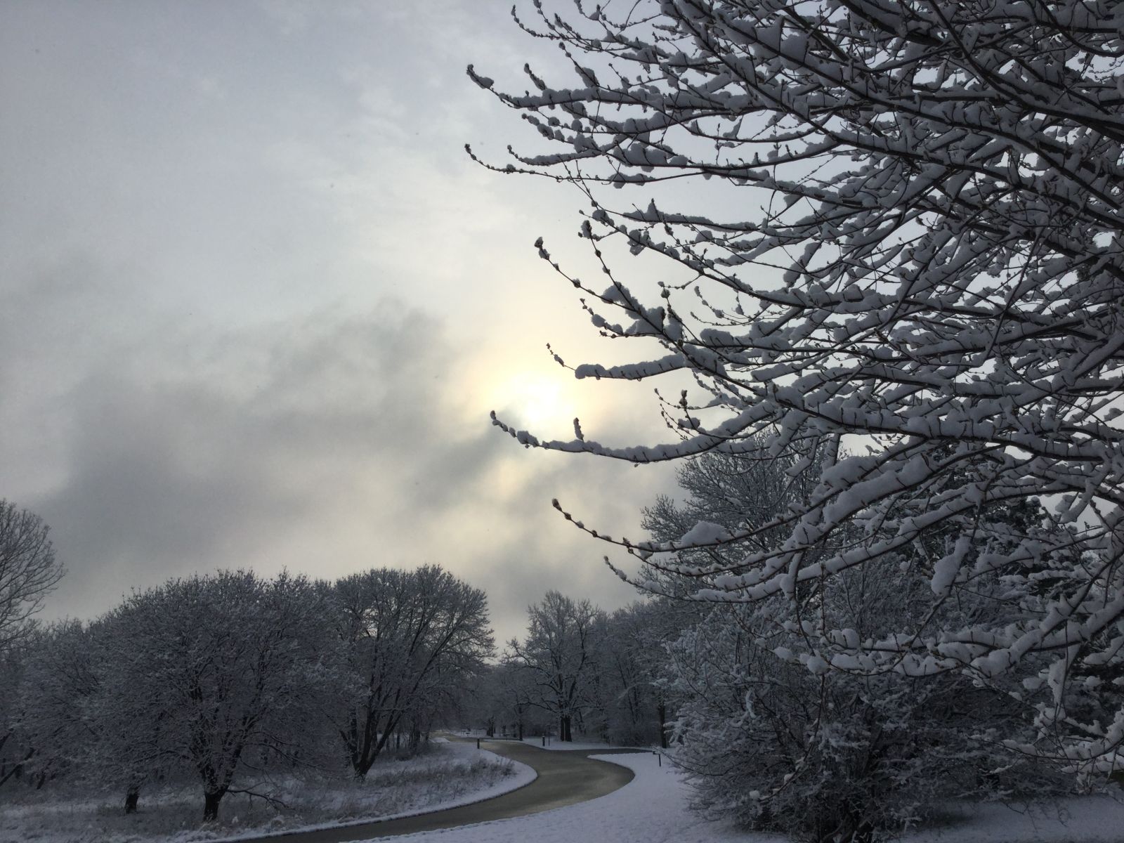
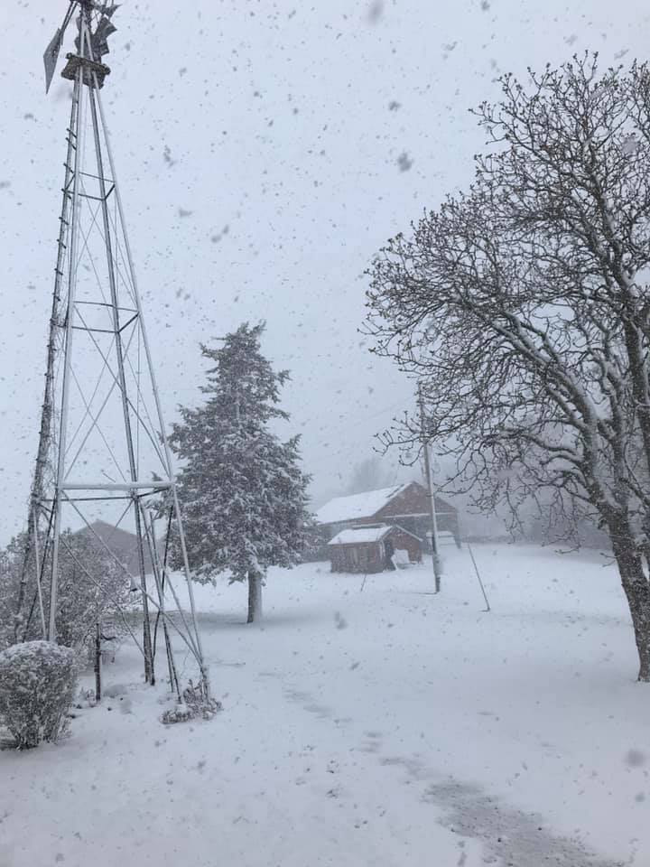
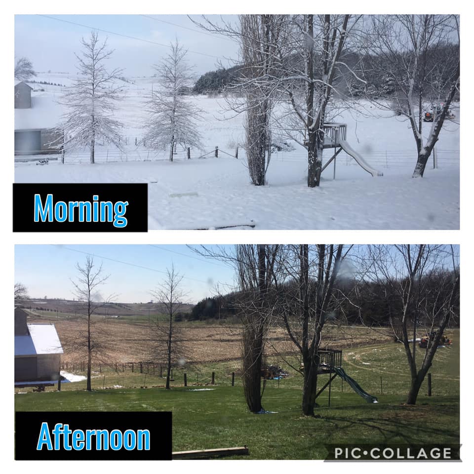
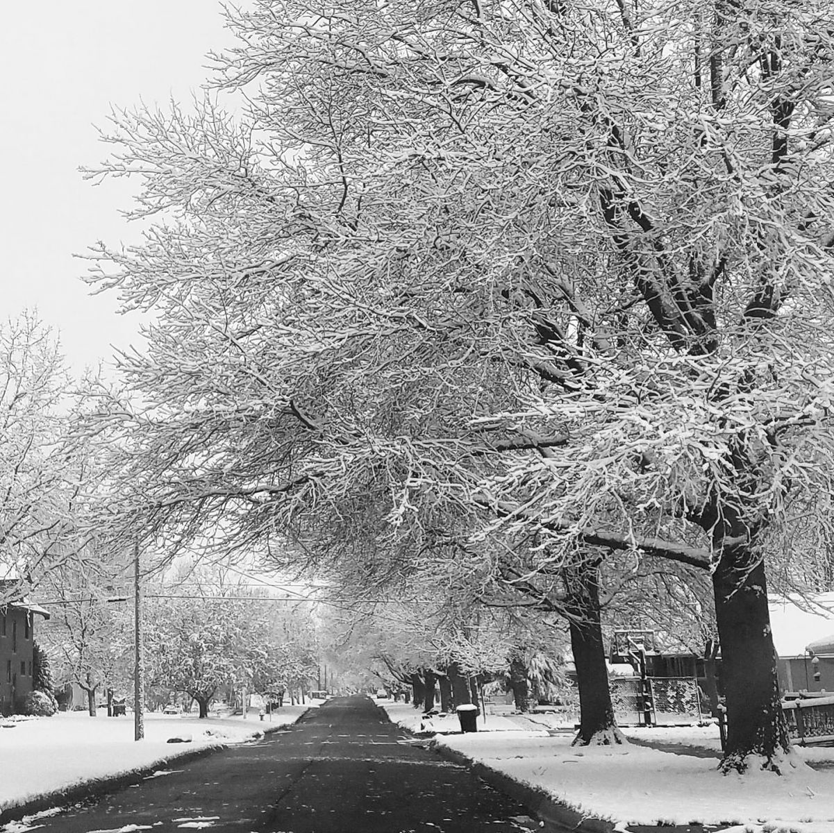
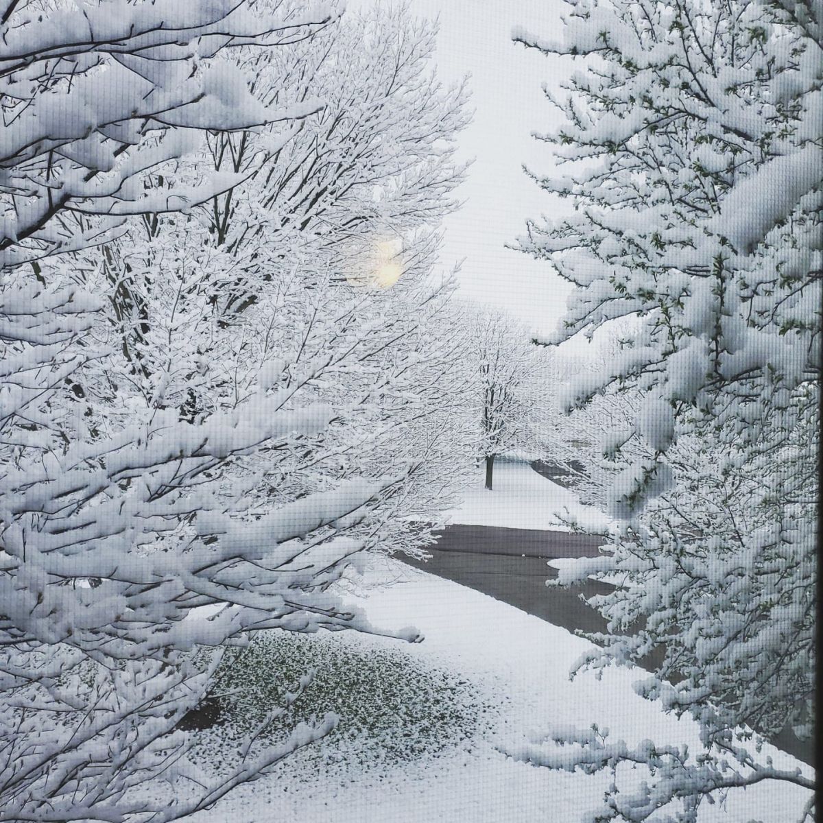
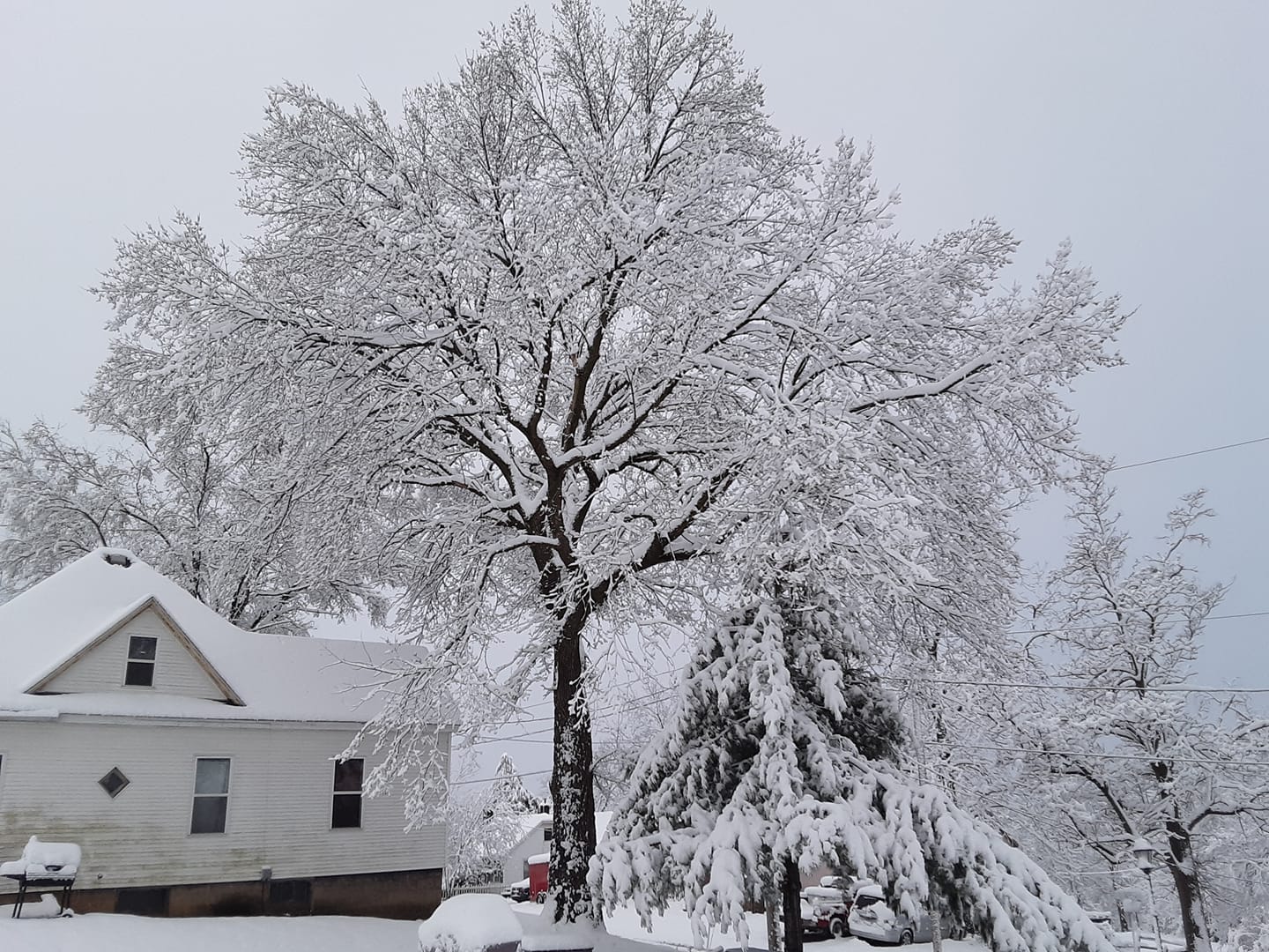
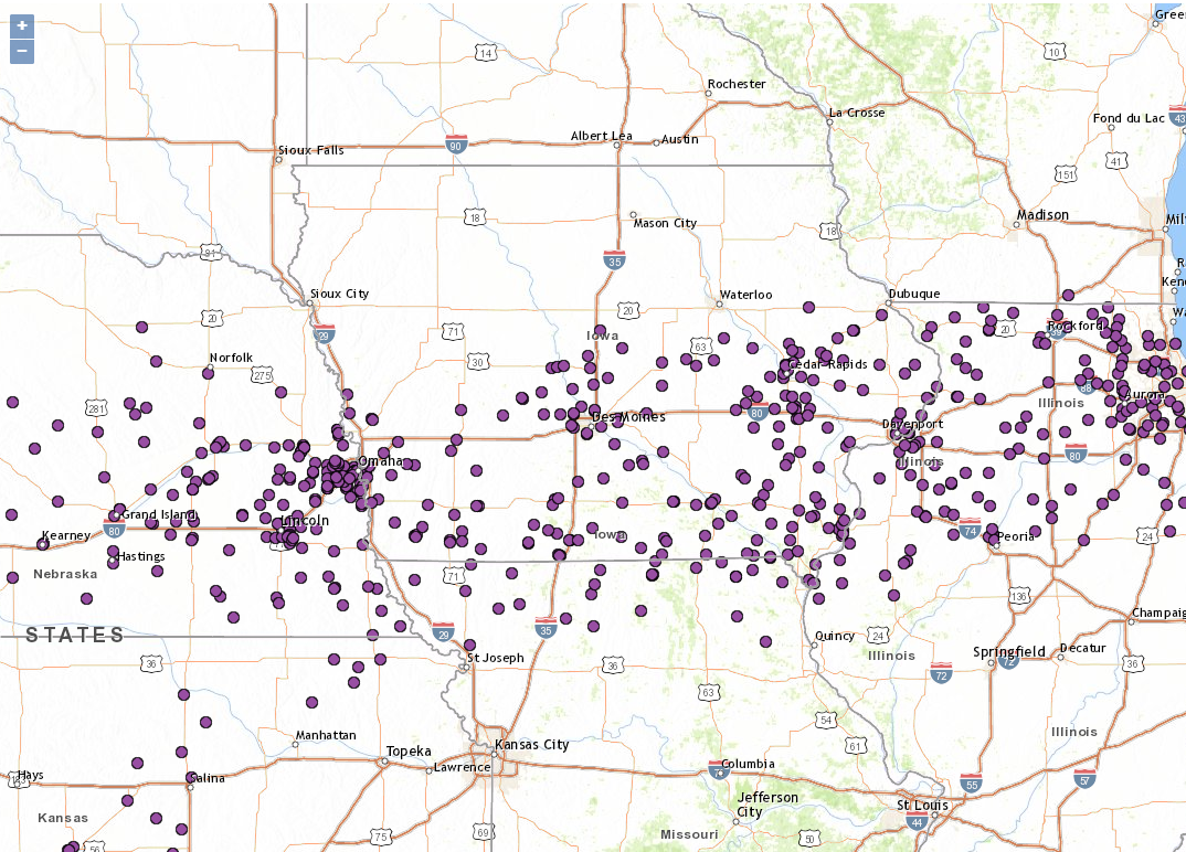
A spring snow storm (or late winter storm) brought a heavy band of wet, sticky snow to central and southern Iowa on the evening of Thursday, April 16 to the early morning of Friday, April 17, 2020. A sharp gradient of the snowfall setup and generally Interstate 80 was the cutoff of the heaviest snowfall to the snow and lighter amounts to the north. North of I-80, reports ranged from trace to around 4 inches, which 3-4 inches was common in the Des Moines Metro. Further south, especially the two rows of counties in far southern Iowa, had a band of 8-12 inches with a few isolated higher snowfall reports in Wayne, Decatur, Ringgold, and Taylor Counties. The snow stuck to trees, bushes, power lines and made for some amazing photos across central Iowa. Sunshine quickly melted off the snow later Friday morning and into the afternoon hours and all the snow except a small batch across southern Iowa had melted off by the time the sun set Friday night. |
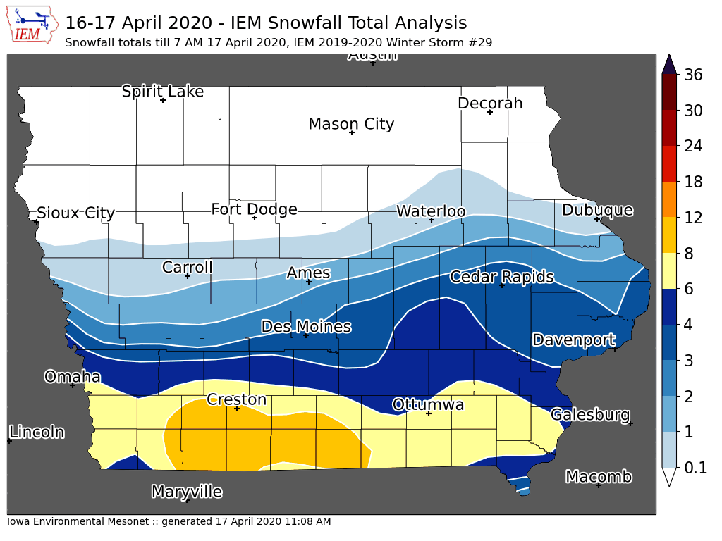 Accumulated snowfall across Central and Southern Iowa from April 16 to the morning of April 17, 2020. |
 |
.jpg) |
 |
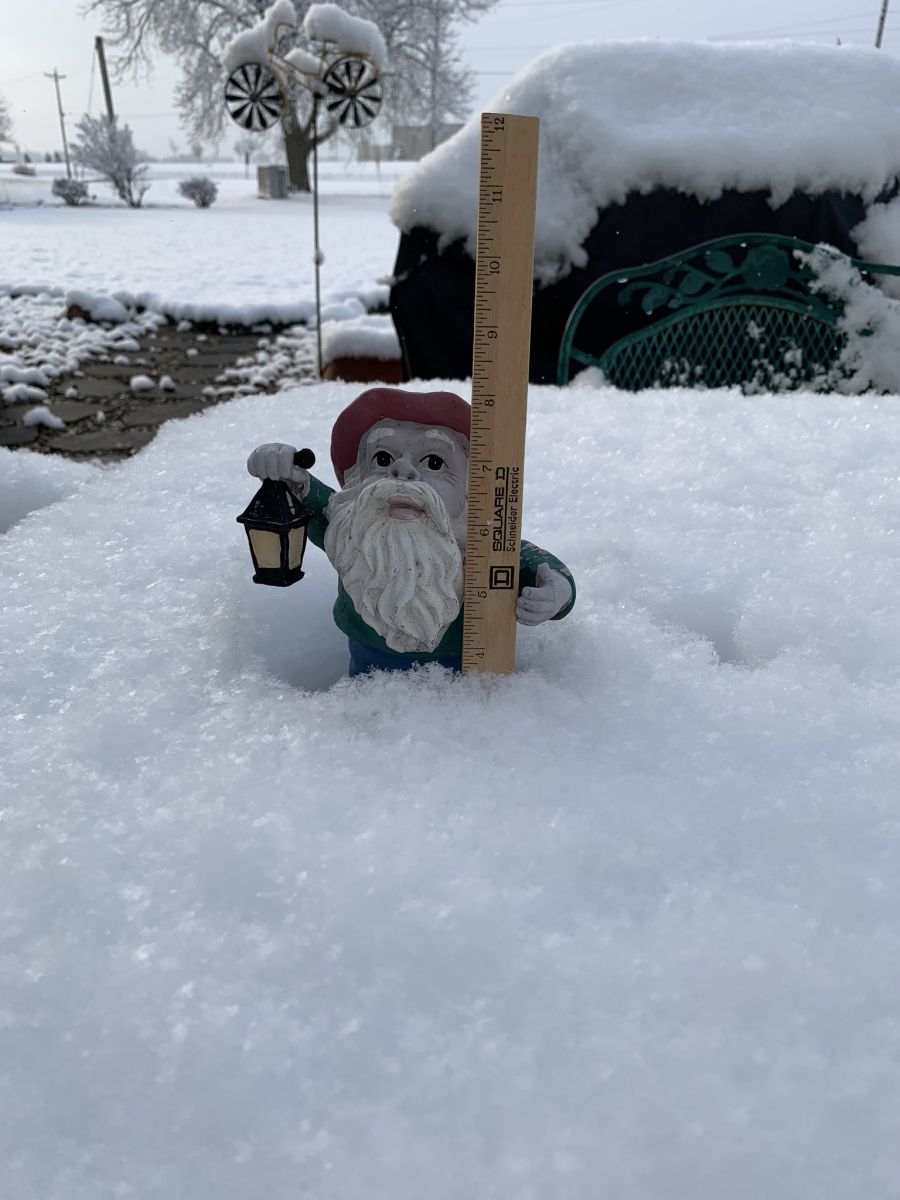
| Murray, IA. Photo courtesy of Gregory Clark | Lamoni, IA. Photo courtesy of Alex Pickman via Twitter | Chariton, IA. Photo courtesy of Greg Watsabaugh via Twitter |
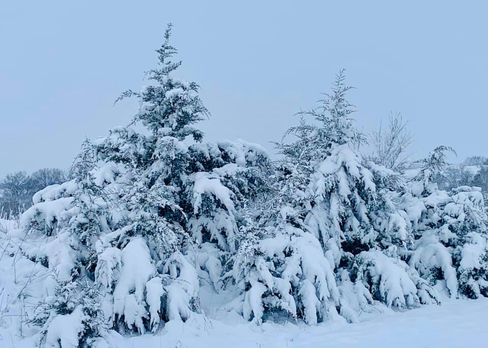
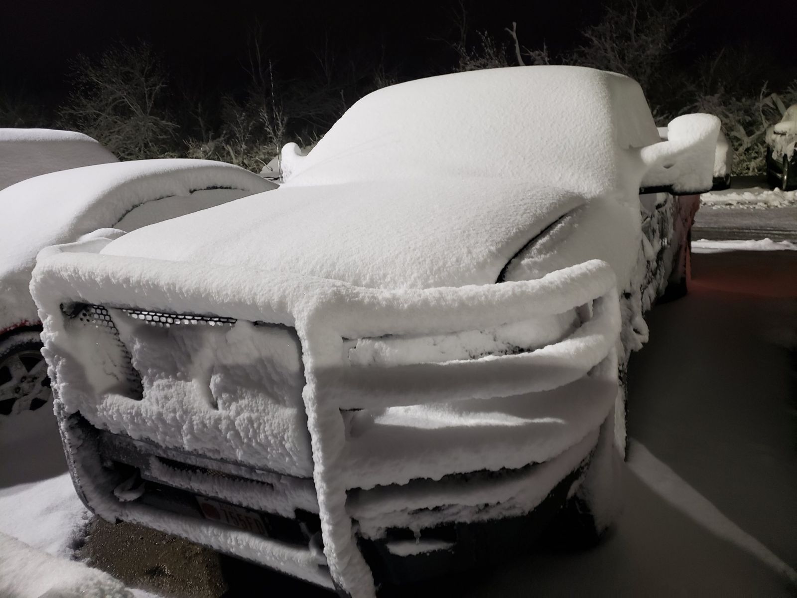
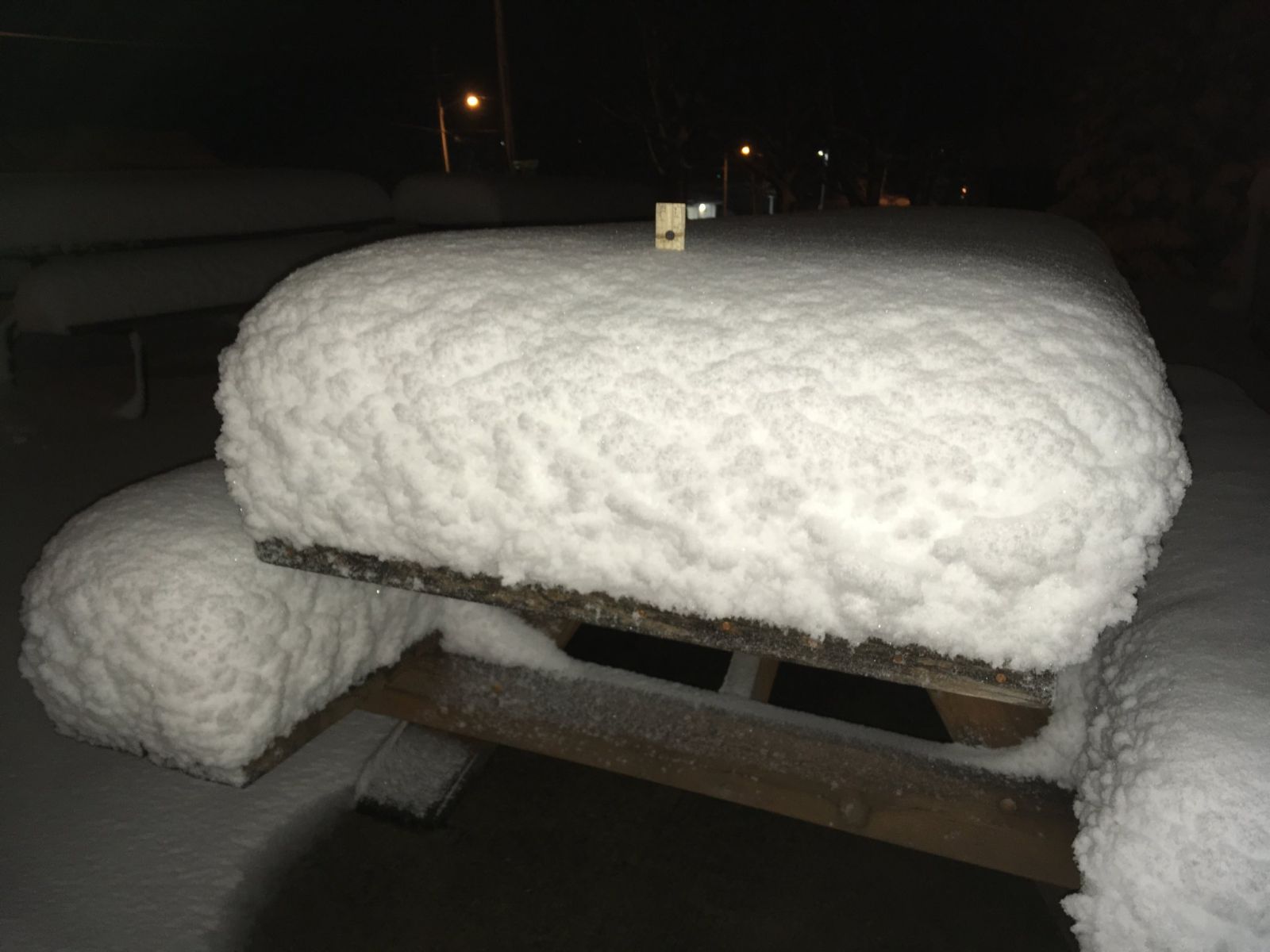
Photos & Video
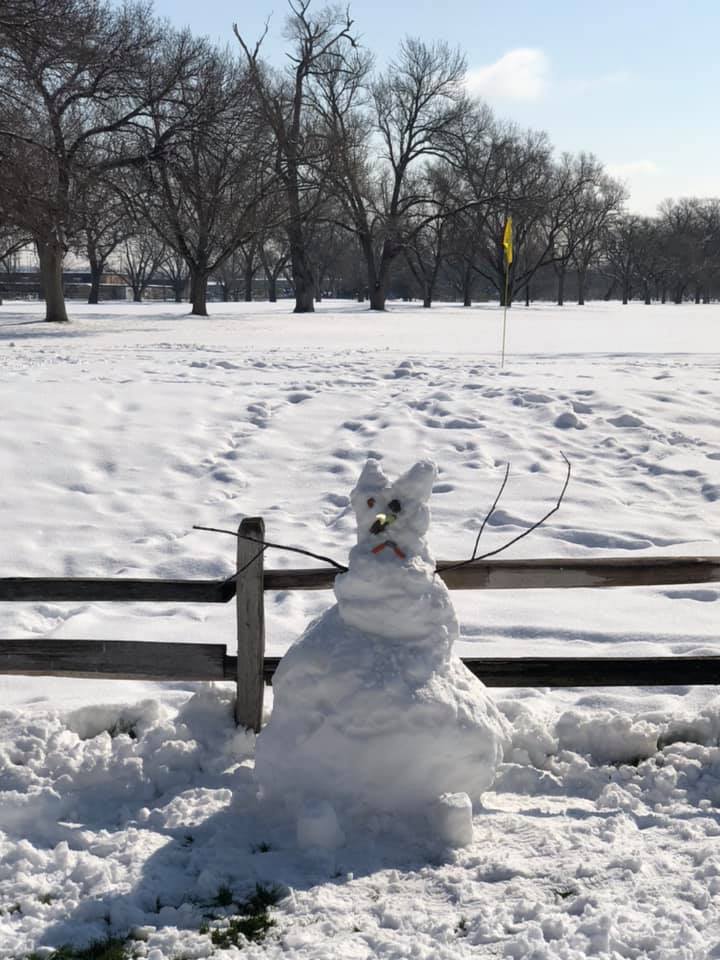
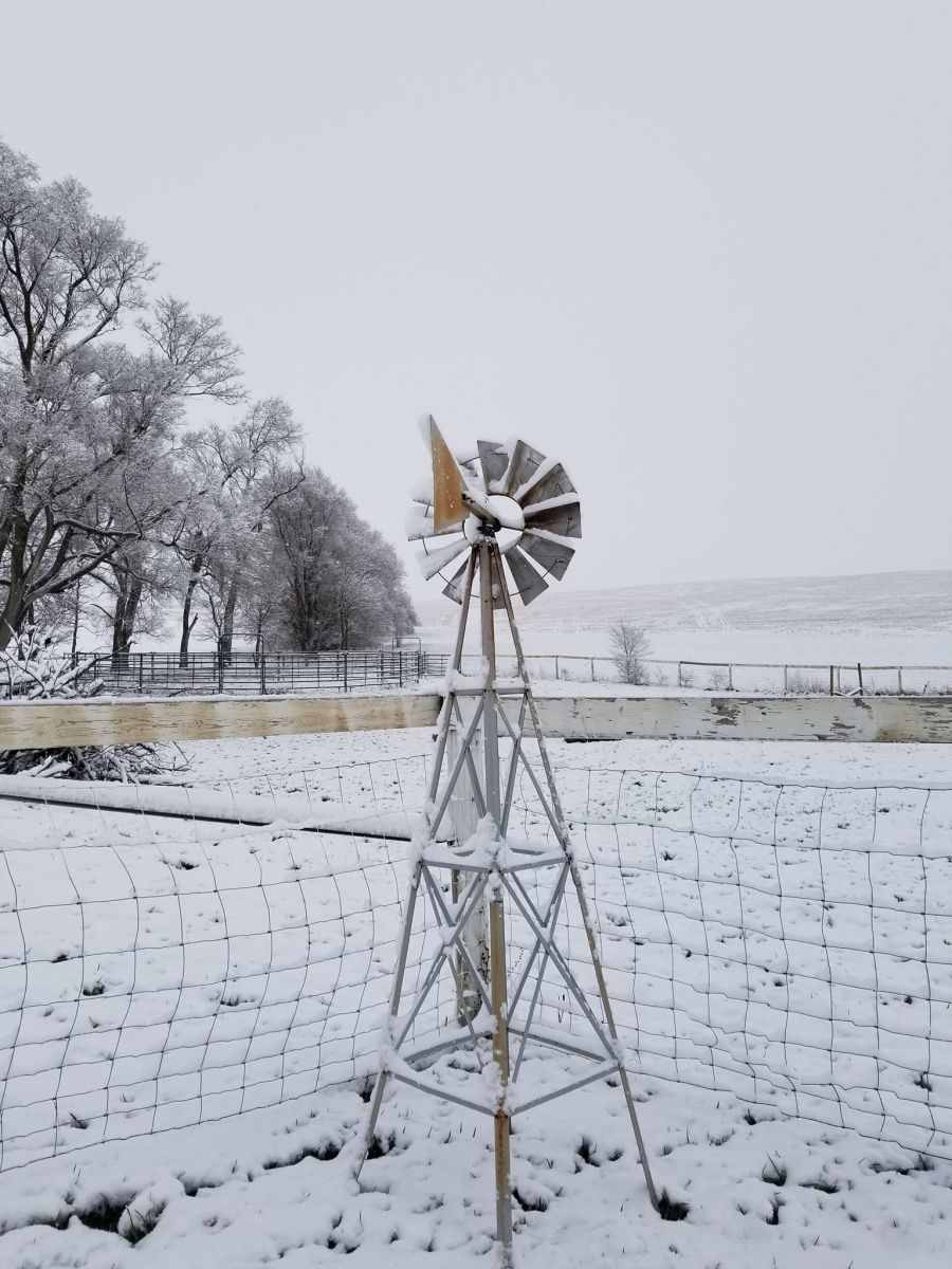
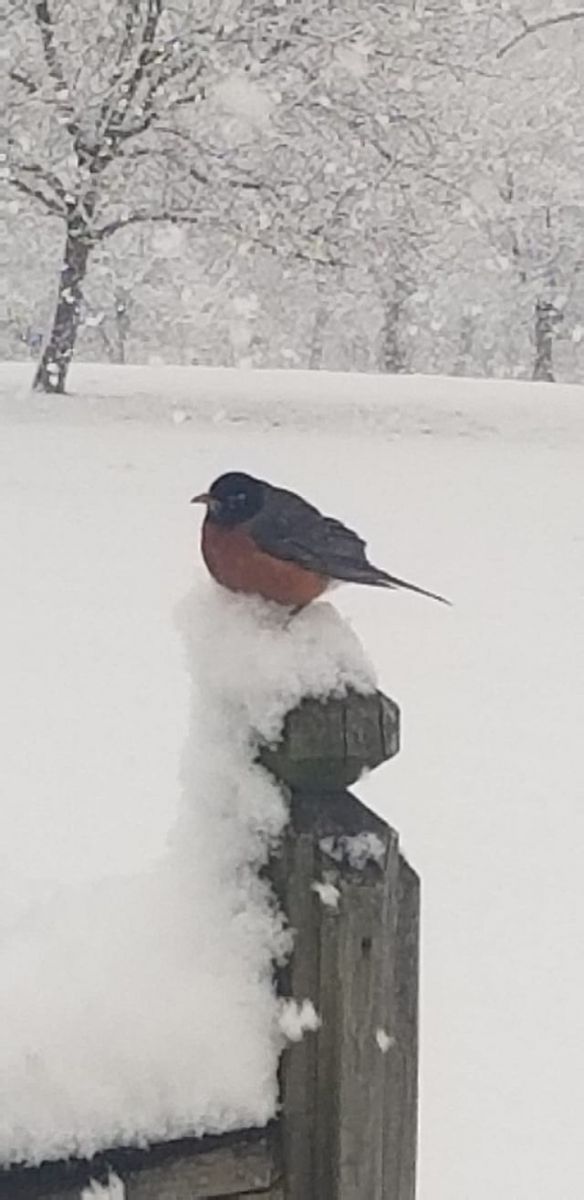
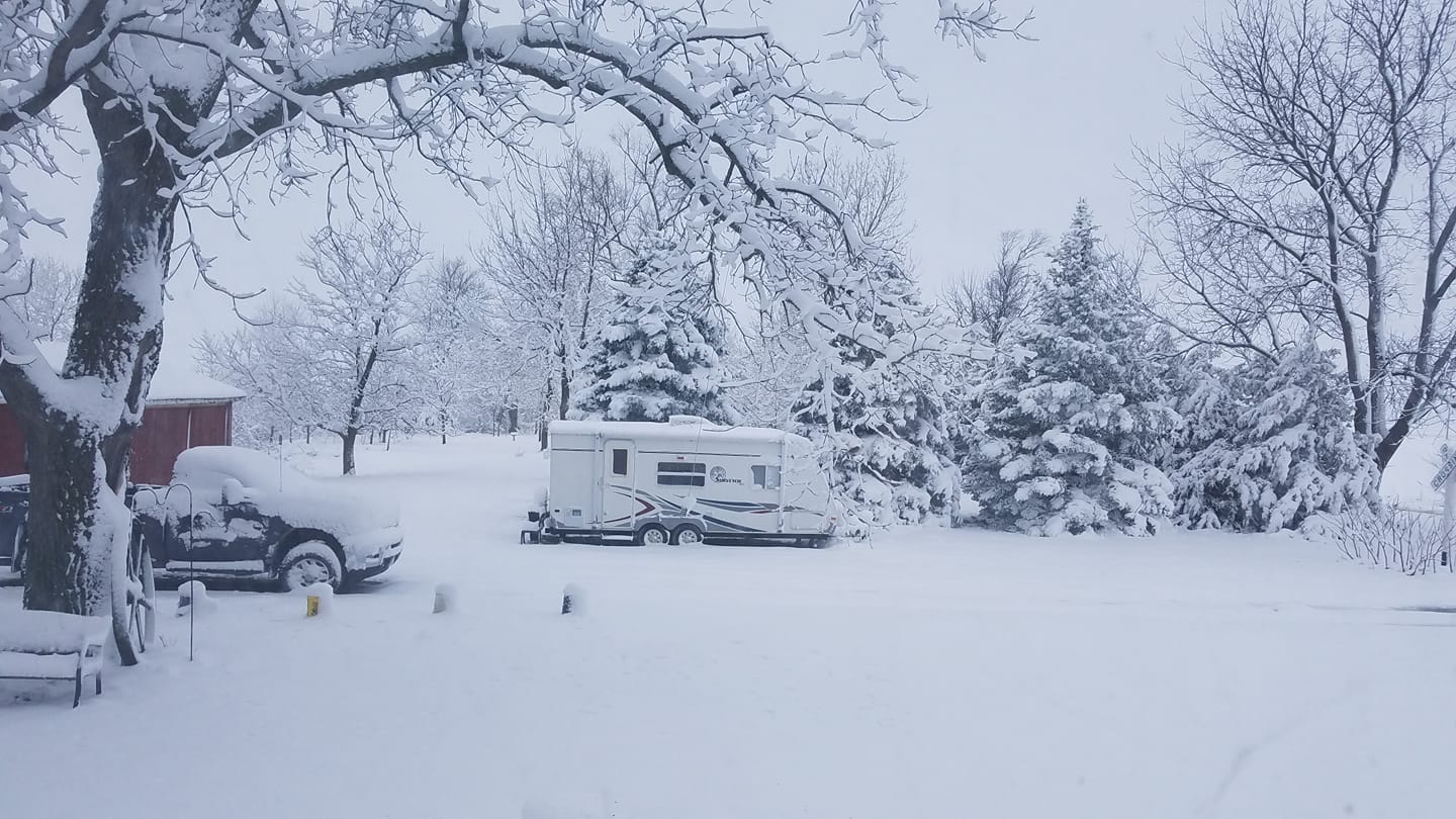
We received over 250 photos of some of the most picturesque snow that Iowa has seen in sometime. Most of these photos can be found on Facebook or Twitter. Thank you to all that provided us with these great photos!
 |
 |
.jpg) |
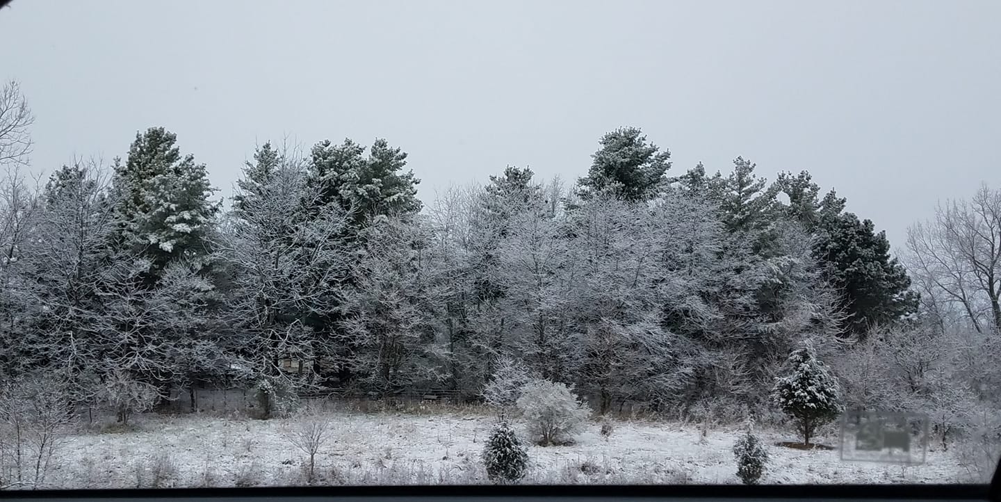 |
| Lamoni, Iowa. Photo courtesy of Basehunters Chasing via Twitter | Photo taken on the morning of April 17th at the NWS office in Johnston, Iowa | Van Horne, Iowa. Photo courtesy of Amanda Hutton | Along I-35 south of Des Moines. Photo courtesy of Amarie Crooks. |
 |
 |
 |
.jpg) |
| Council Bluffs, Iowa. Photo courtesy of Debi Derry Sell | Newton, Iowa. Photo courtesy of Corki Speck Stokka | Unknown Location. Photo courtesy of Gayle Ramaeker | Ottumwa, Iowa. Photo courtesy of Curtis Woten |
 |
 |
.jpg) |
 |
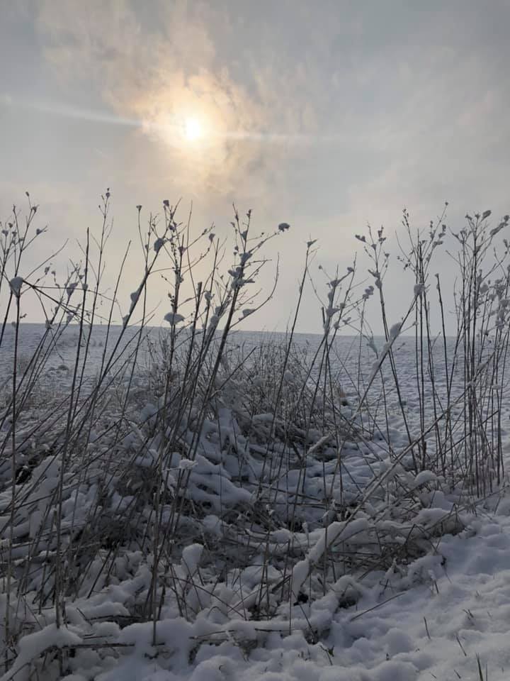
| Before and after snow melt in Anita, IA. Photo courtesy of Alissa Mixon Fountas | Earlham IA. Photo courtesy of Ashley Petersen | Leon, IA. Photo courtesy of Jennifer Watson | Photo courtesy of Sarah Summers in Marshalltown, IA. |
 |
.jpg) |
 |
.jpg) |
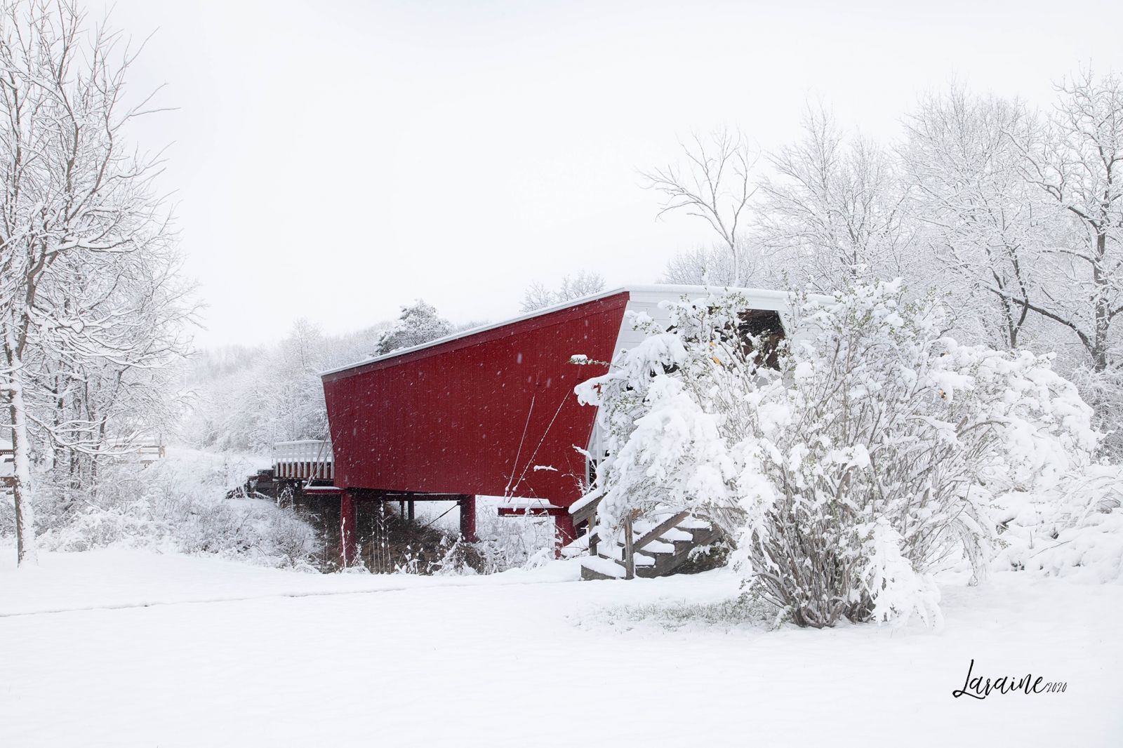
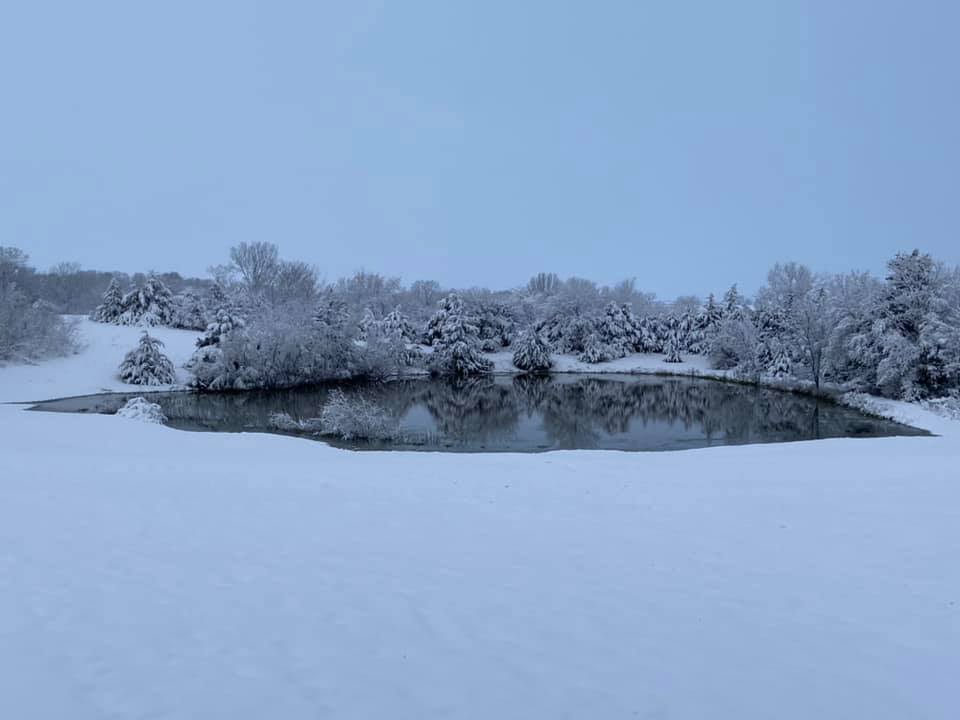
| The famous Cedar Bridge in Winterset, IA. Photo courtesy of Laraine Magee Davis | Sun Valley Lake near Thayer, IA. Photo courtesy of Lindsey Joy | North of Hedrick, IA. Photo courtesy of Lynette Chittick | Winterset, IA. Photo courtesy of Michelle Webb |
 |
 |
 |
 |
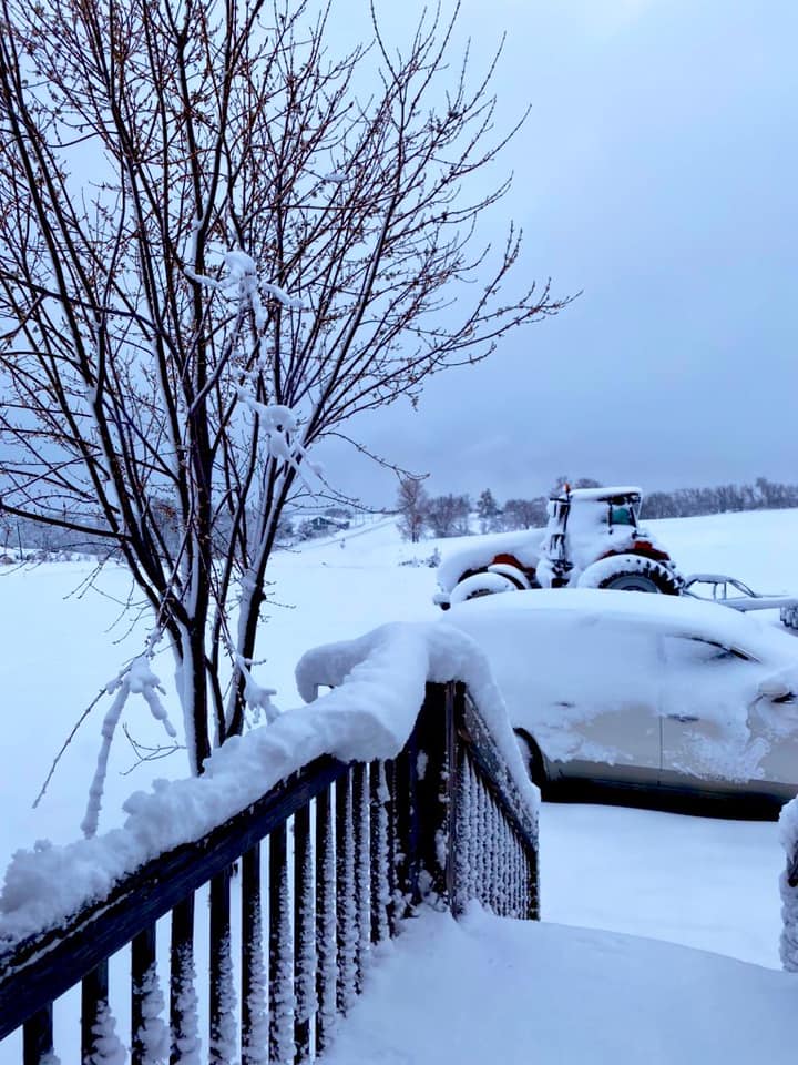
| Ankeny, IA. Photo courtesy of Erica Aleman | Promise City, IA. Photo courtesy of Shawna Hopkins | Near John Deere Plant in Ankeny. Photo courtesy of Ron Feigl | Unknown location. Photo courtesy of Brenda Howington |
.jpg) |
 |
.jpg) |
 |
| McCallsburg, IA. Photo courtesy of Rebecca Jeanne Sittig | Swedesburg, IA. Photo courtesy of Scott Deaton | Unknown location. Photo courtesy of Amy Gaumer | Ottumwa, IA. Photo courtesy of Rosanne Marie Woods |
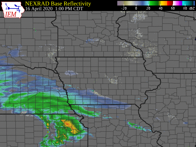
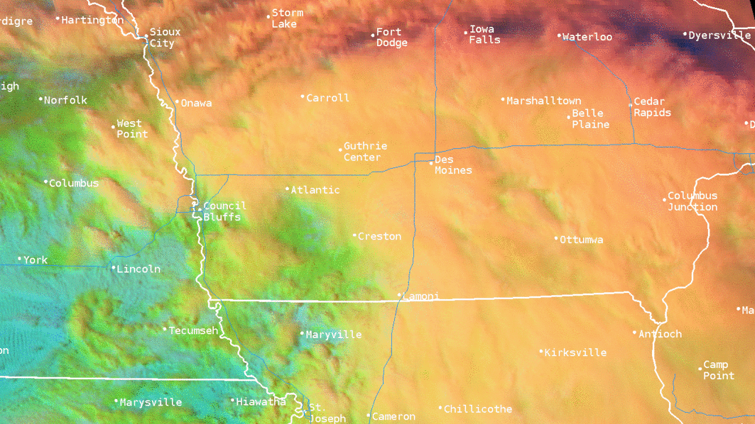
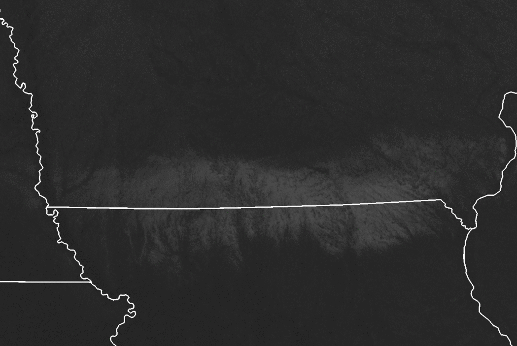
Radar and Satellite
 |
 |
 |
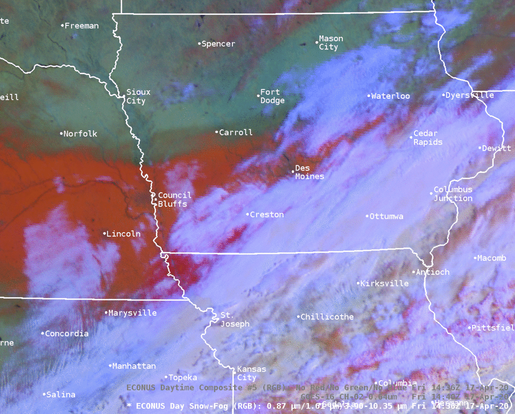 |
| Radar loop of event event starting at 1 PM on Thursday, April 16 and ending at 9 AM Friday morning, April 17. Images courtesy of IEM | The visible satellite RGB band called Day Cloud Phase Distinction via GOES-East. 1-minute data on Thursday afternoon when the snow band developed over southwest Iowa and eastern Nebraska. | Visible GOES-East Channel 2 shows the end of the snow pack melting on Saturday, April 18, 2020. | Another color curve on the GOES-East visible satellite showing the snow melting over portions of Nebraska and western Iowa. The red is the snow pack, while cloud cover is the white moving east. |
Storm Reports
There are multiple ways to view the snowfall reports gathered from the event. Click on the links below:
https://nwschat.weather.gov/lsr/#DMX/202004162330/202004171600/0100
https://nwschat.weather.gov/p.php?pid=202004171622-KDMX-NWUS53-LSRDMX
Environment
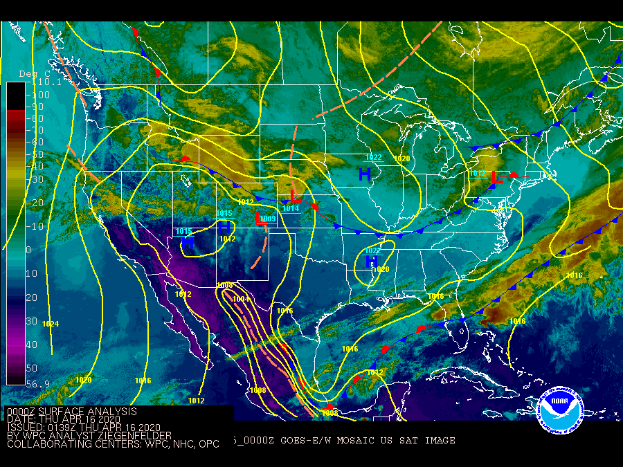
A strong low pressure system tracked across southern Nebraska/Northern Kansas into Missouri Thursday (4/16) into Friday (4/17) and placed Iowa within the colder air of the system. Abundant moisture, strong lift within the snow growth zone, and temperatures below freezing throughout the column led to a wet, sticky snow across central and southern Iowa.
.gif) |
 |
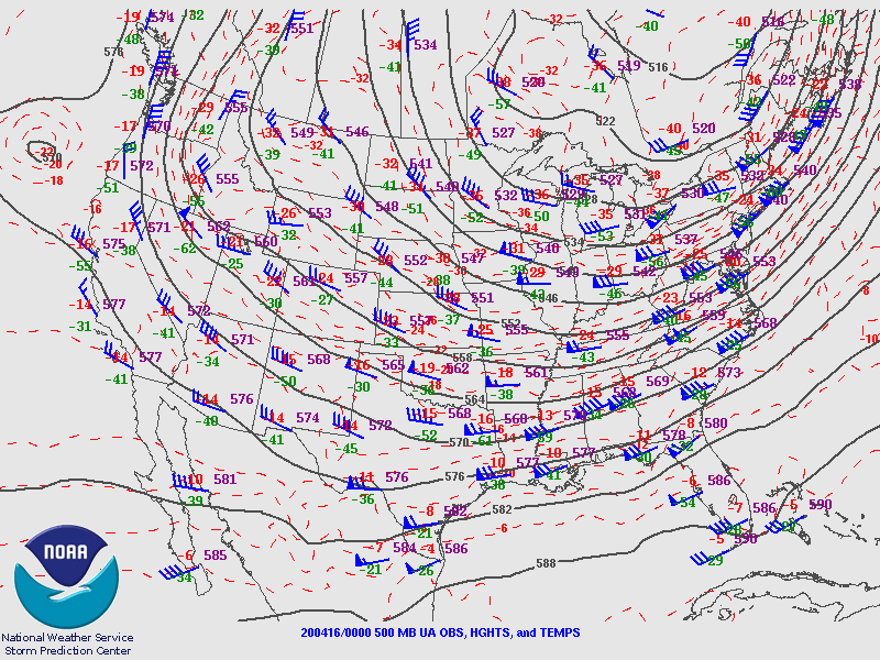 |
| Omaha observed sounding from 00z April 17 shows the deep saturation and the surface temperatures just below freezing resulting in a wet, heavy snow. | WPC surface analysis Thursday into Friday. | 500 mb upper air analysis |
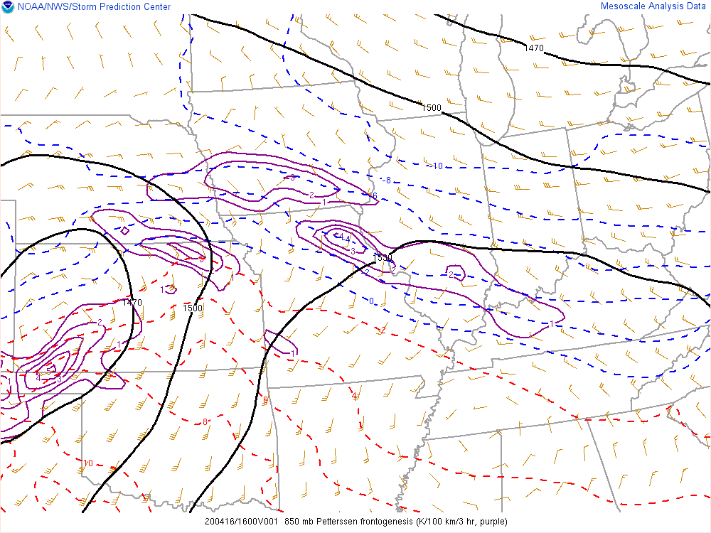
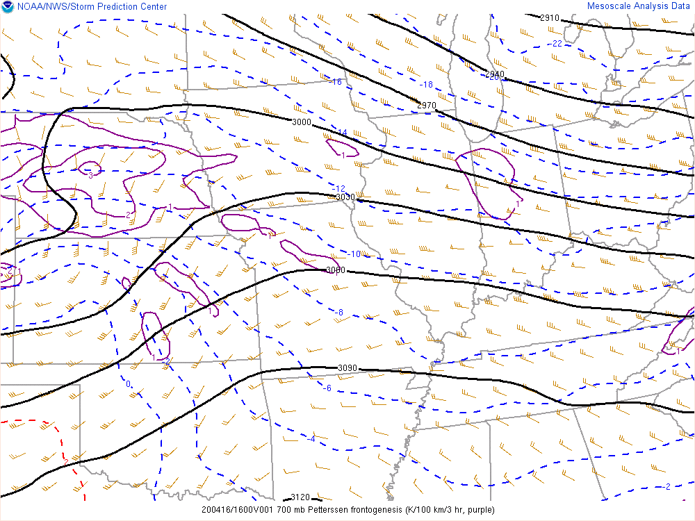
Strong frontogenetical forcing and lift within the dendritic layer, resulted in snowfall rates of 1 to 2 inches per hour across southern Iowa Thursday night, April 16th.
 |
 |
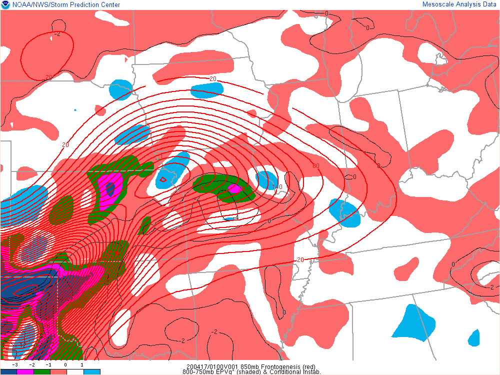 |
| 850 mb Petterssen frontogenesis shows strong frontogenetical forcing in northern Missouri and southern Iowa during the late afternoon into the evening hours Thursday. | 700 mb Petterssen frontogenesis shows strong frontogenetical forcing in northern Missouri and southern Iowa during the late afternoon into the evening hours Thursday. | 85mb Frontogenesis (red lines), 800-750 mb Equivalent Potential Vorticity (EPV - shaded) and Conditional Instability (CI-black). When negative EPV is present and thus CI, increases potential for heavy banded snow. |
Additional environmental data.
 |
 |
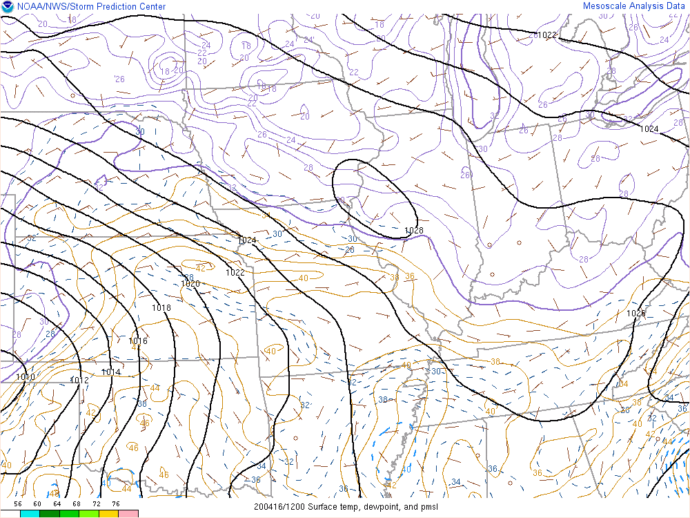 |
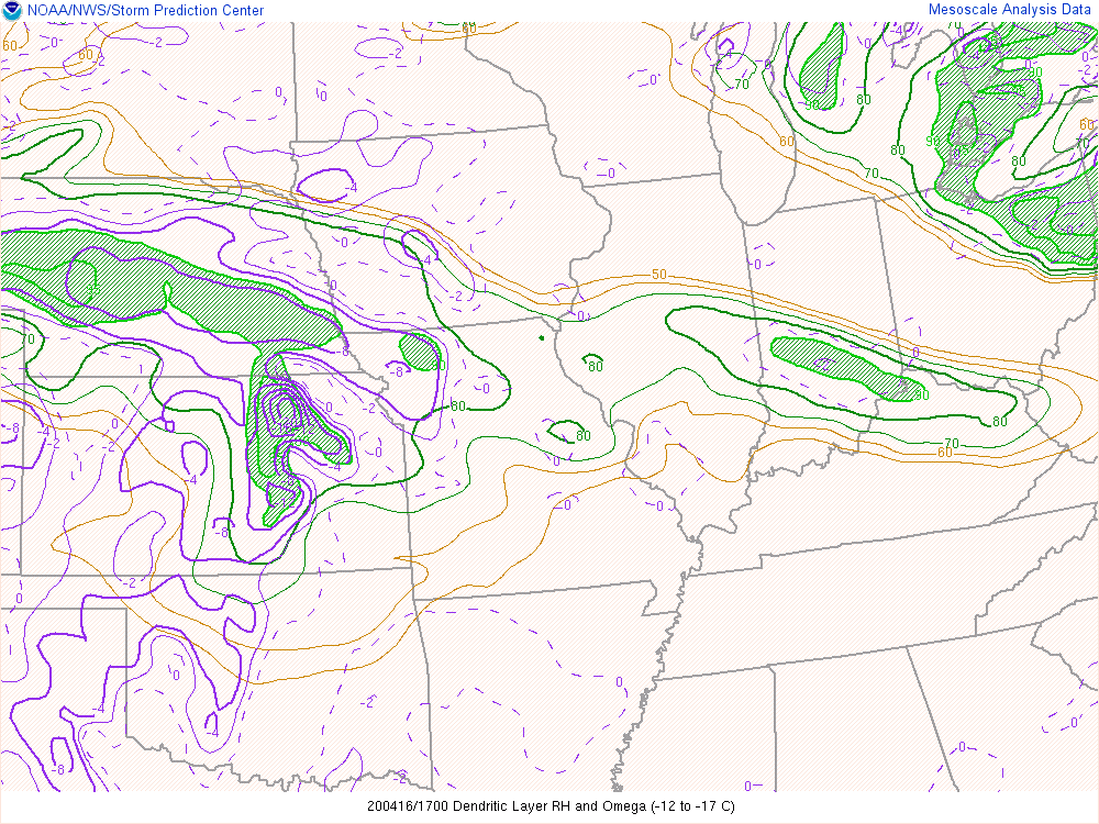
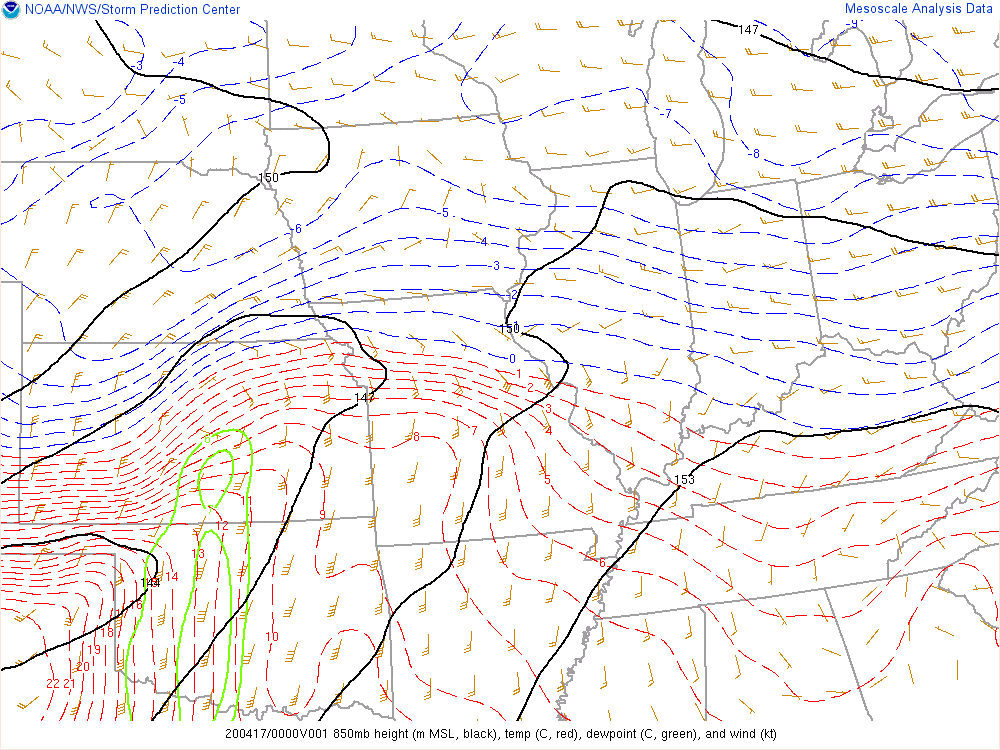
| Dendritic Layer RH and Omega shows saturation and strong lift within the dendritic (-12C to -17C) layer, which supports intense snowfall rates. | 850 mb SPC mesoanalysis at 7 p.m. CDT Thursday, April 16th when the snow band increased in intensity. | Mean sea level pressure, surface dew points and winds during the entire event |
 |
Media use of NWS Web News Stories is encouraged! Please acknowledge the NWS as the source of any news information accessed from this site. |
|

