A heat wave over the Southwest will intensify late week, peaking and expanding into the Intermountain West and northern High Plains this weekend. Severe thunderstorms and heavy rain are expected over portions of the Plains and Mississippi Valley tonight, which will shift to parts of the Upper Midwest and mid-Mississippi Valley Friday. Monsoonal showers and flooding persist in the Desert Southwest. Read More >
Overview
|
Severe storms lifted northeast across western into central Iowa late in the afternoon into the evening of Friday, April 26, 2024. Based on preliminary reports and completed storm surveys, there were at least 19 tornadoes in Iowa. Damage to trees and homes has been reported in multiple counties from Crawford to Union and Ringgold up to around Polk and Jasper Counties. Teams continue to evaluate damage. Additional tornado tracks and rating will be added in the coming days. A final tornado count will take days to a few weeks as we review radar data, examine hi-res satellite imagery, and look at videos.
For information on the storms in Nebraska and western Iowa, visit the page by NWS Omaha.
Page last updated: April 29, 2024 9:40 pm. |
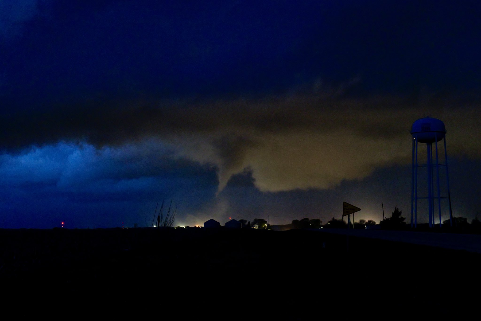
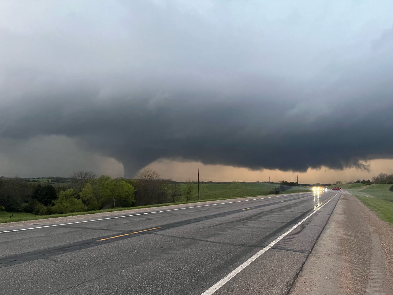 Afton, Iowa tornado captured by Dean Baron. |
|
|
|
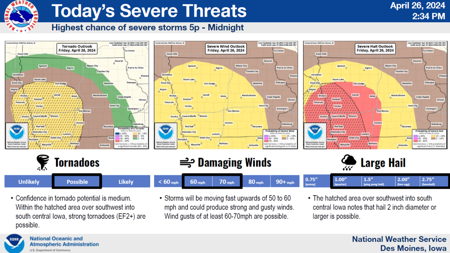
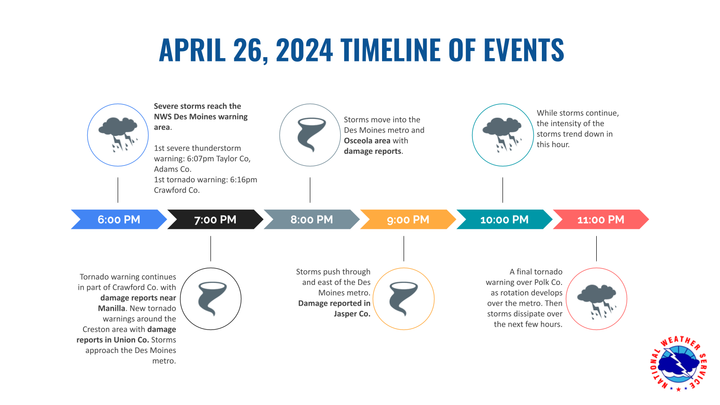
| Hazards for the Enhanced Risk on April 26th. | General timeline of the storms and tornadoes on April 26, 2024. |
Tornadoes
|
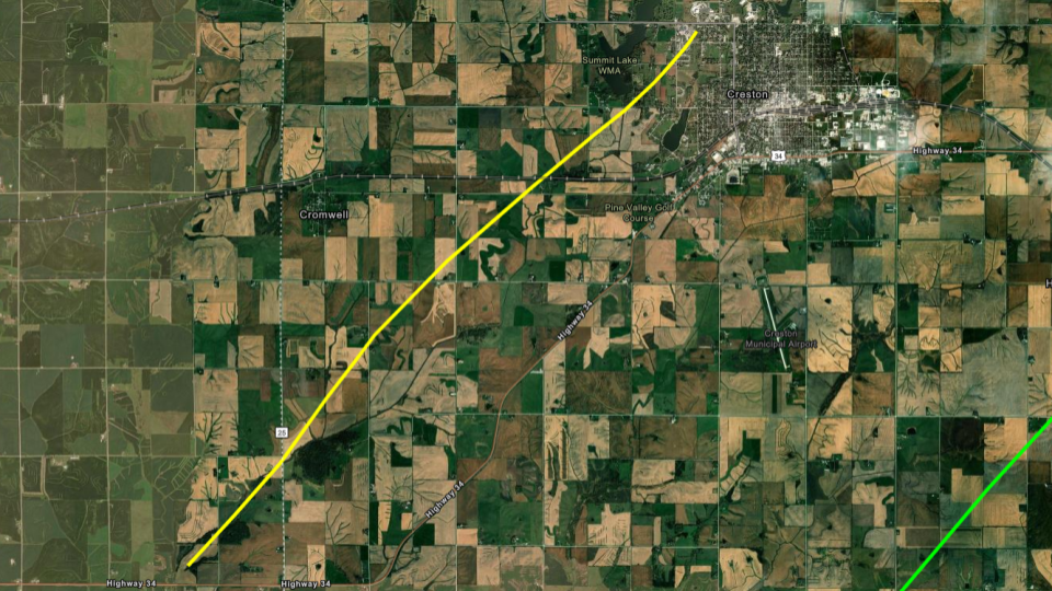
Tornado - Creston #1
|
|
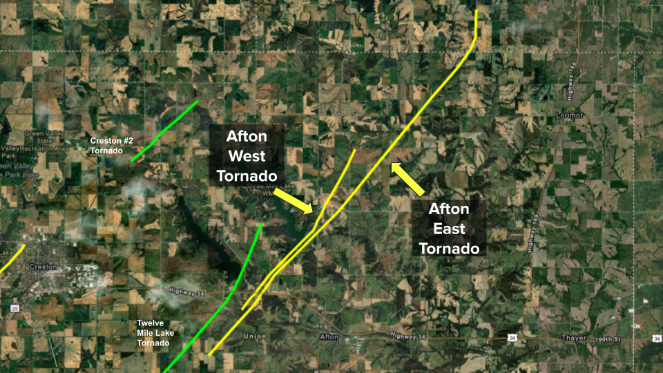
Tornado - Afton (West)
|
|
Tornado - Afton (East)
|
|
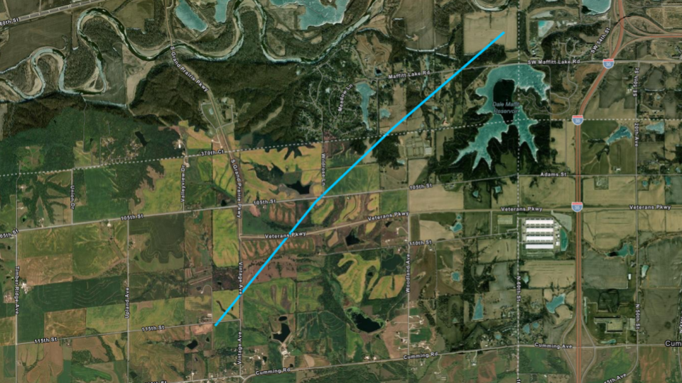
Tornado - Maffit Reservoir
|
|
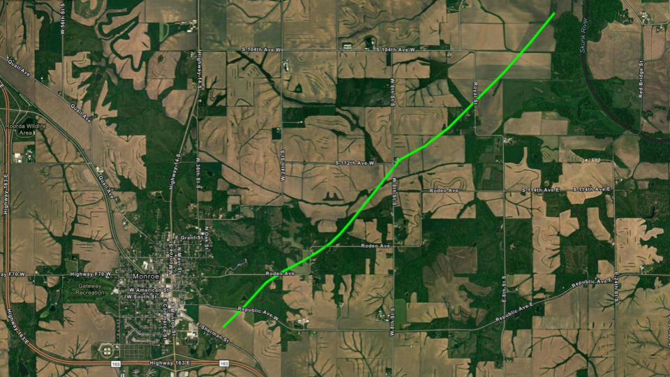
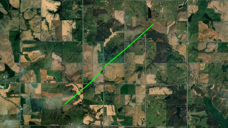
Tornado - Monroe
|
|
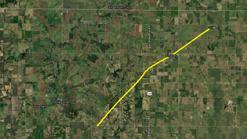
Tornado - Tingley
|
|
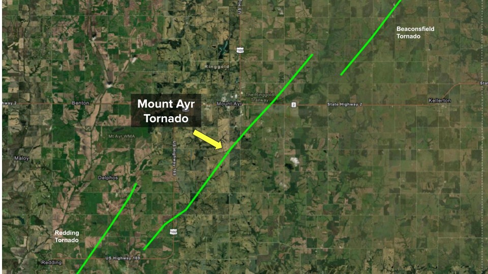
Tornado - Mount Ayr
|
|
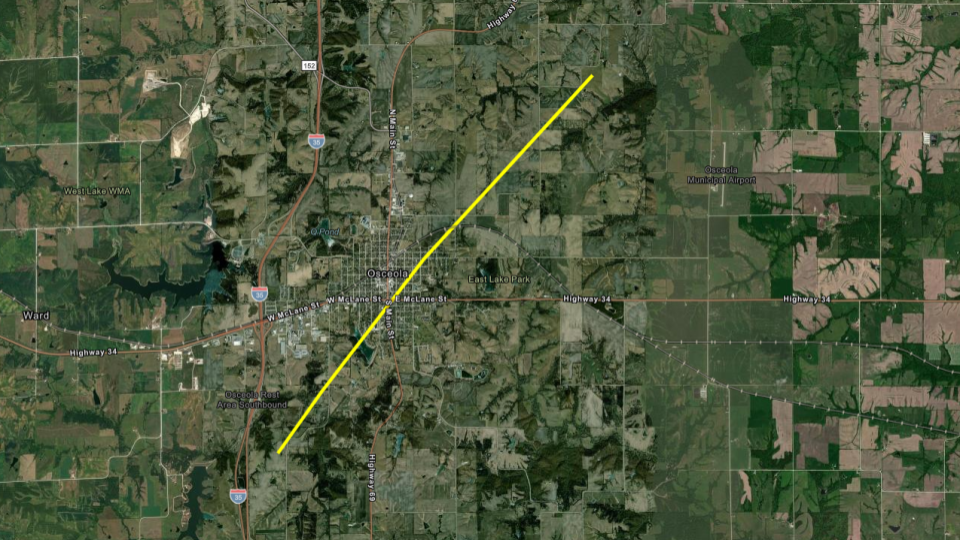
Tornado - Osceola
|
|
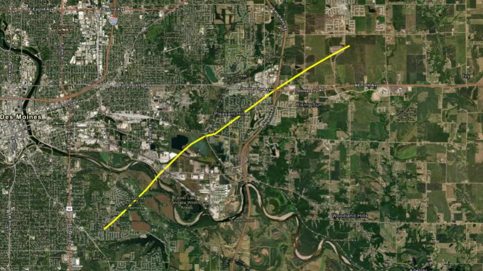
Tornado - Pleasant Hill
|
|
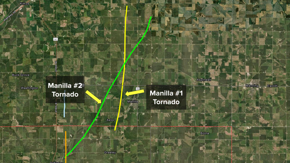
Tornado - Manilla # 1
|
|
Tornado - Manilla #2
|
|
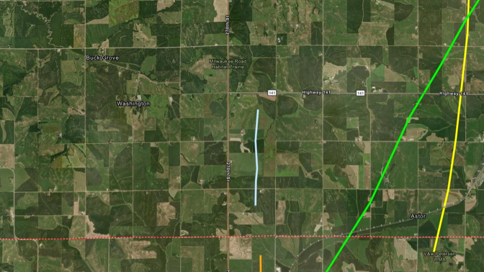
Tornado - Buck Grove
|
||||||||||||||||
|
Tornado - Creston #2
|
|
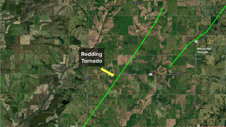
Tornado - Redding
|
|
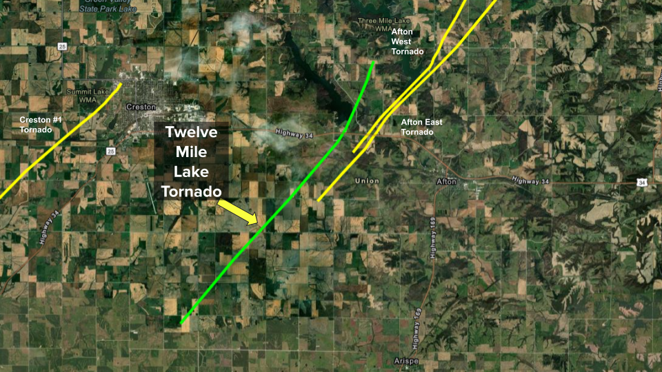
Tornado - 12 Mile Lake
|
|
Tornado - Beaconsfield
|
|
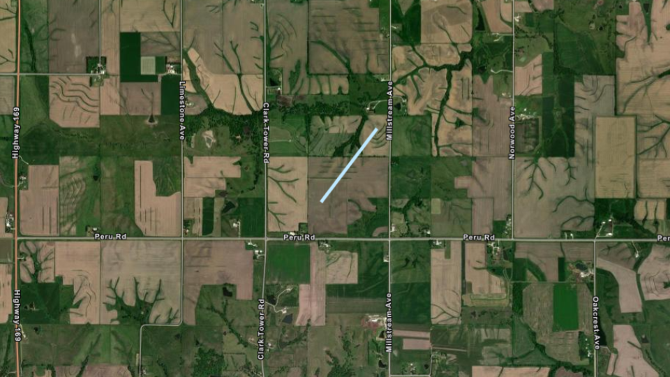
Tornado - East Peru
|
||||||||||||||||
|
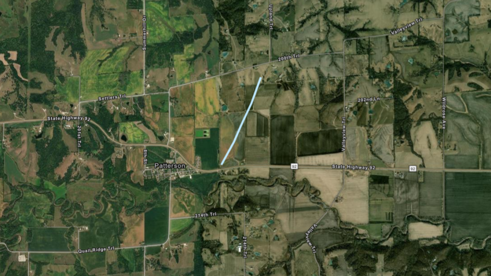
Tornado - Patterson
|
||||||||||||||||
|
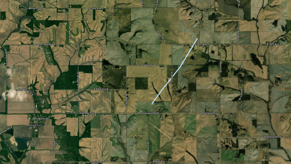
Tornado - Reasnor
|
|
Tornado - LOCATION
Track Map 
Downloadable KMZ File |
|
Tornado - LOCATION
Track Map
Downloadable KMZ File |
|
Tornado - LOCATION
Track Map
Downloadable KMZ File |
|
Tornado - LOCATION
Track Map
Downloadable KMZ File |
|
Tornado - LOCATION
Track Map
Downloadable KMZ File |
The Enhanced Fujita (EF) Scale classifies tornadoes into the following categories:
| EF0 Weak 65-85 mph |
EF1 Moderate 86-110 mph |
EF2 Significant 111-135 mph |
EF3 Severe 136-165 mph |
EF4 Extreme 166-200 mph |
EF5 Catastrophic 200+ mph |
 |
|||||
Photos & Video
Header
 |
 |
 |
|
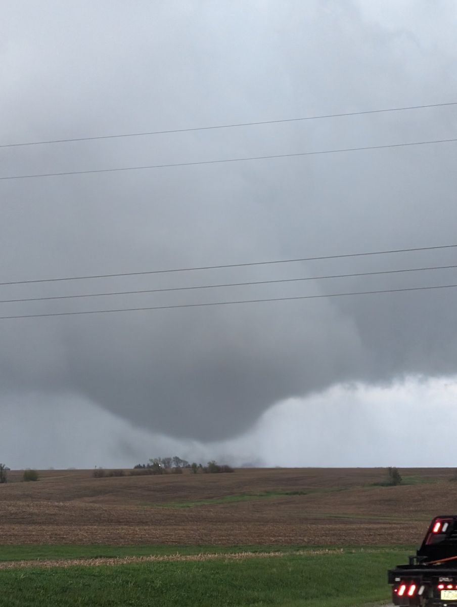
| Tornado southeast of Creston, Iowa (Photo Credit: Jesse Risley. Used with permission) |
Tornado near Osceola, Iowa (Photo Credit: Clarence Smith. Used with permission) |
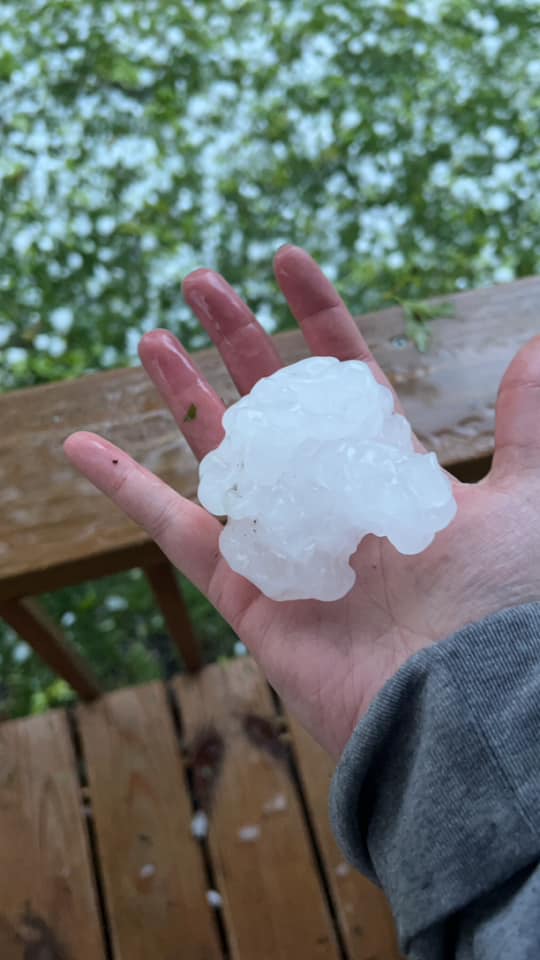
Large hail in Mount Ayr, Iowa (Photo Credit: Brittany Mastin. Used with permission) |
Caption (source) |
Radar
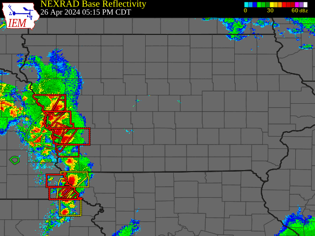 |
| Radar animation from Friday evening. Courtesy Iowa Environment Mesonet (https://mesonet.agron.iastate.edu/) |
Storm Reports
Preliminary Local Storm Report...Summary
National Weather Service Des Moines IA
1139 PM CDT Fri Apr 26 2024

..TIME...   ...EVENT...      ...CITY LOCATION...     ...LAT.LON...
..DATE...   ....MAG....      ..COUNTY LOCATION..ST.. ...SOURCE....
            ..REMARKS..

0616 PM     Hail             5 N New Market          40.80N 94.91W
04/26/2024  E1.00 Inch       Taylor             IA   Cocorahs

            Delayed report.

0658 PM     Tornado          2 W Manilla             41.89N 95.27W
04/26/2024                   Crawford           IA   Storm Chaser

            Storm chaser shared a picture of a tornado
            just west of Manilla.

0704 PM     Tornado          2 WSW Creston           41.05N 94.40W
04/26/2024                   Union              IA   Trained Spotter

            Tornado on the ground, heading northeast.

0709 PM     Tornado          Creston                 41.06N 94.36W
04/26/2024                   Union              IA   Emergency Mngr

            Tornado with debris near the hospital in
            Creston.

0710 PM     Tornado          3 NE Lenox              40.91N 94.52W
04/26/2024                   Adams              IA   Emergency Mngr

            near 205th and Highway 25.

0715 PM     Tornado          6 NE Creston            41.13N 94.29W
04/26/2024                   Union              IA   Emergency Mngr

            Tornado reported to the southwest of
            Macksburg.

0725 PM     Tornado          4 WNW Afton             41.05N 94.27W
04/26/2024                   Union              IA   Dept of Highways

            Power poles with debris on US Highway 34
            between Creston and Afton. Highway is
            closed.

0728 PM     Tornado          4 WNW Afton             41.06N 94.27W
04/26/2024                   Union              IA   Trained Spotter

            Trained spotter reported tornado on the
            ground east of Creston. Time and location
            estimated from radar.

0728 PM     Hail             2 SSW Delphos           40.64N 94.36W
04/26/2024  E1.00 Inch       Ringgold           IA   Trained Spotter


0731 PM     Tornado          2 NW Afton              41.05N 94.22W
04/26/2024                   Union              IA   Emergency Mngr


0745 PM     Hail             Mount Ayr               40.71N 94.24W
04/26/2024  M3.00 Inch       Ringgold           IA   CO-OP Observer

            Corrects previous hail report from Mount
            Ayr.

0747 PM     Tornado          1 E Mount Ayr           40.71N 94.21W
04/26/2024                   Ringgold           IA   Trained Spotter

            Delayed report. Report of tornado between Mt
            Ayr and Kellerton. Exact location estimated
            from radar.

0754 PM     Tornado          2 W Afton               41.03N 94.23W
04/26/2024                   Union              IA   Law Enforcement

            Large tornado near Afton moving northeast.
            Debris field reported with damage.

0758 PM     Tornado          5 W East Peru           41.24N 94.02W
04/26/2024                   Madison            IA   Emergency Mngr

            Tornado near Word of Life Church.

0815 PM     Tornado          2 NE Patterson          41.37N 93.85W
04/26/2024                   Madison            IA   Public

            Delayed report. Video submitted via social
            media. Briefly touched down and lifted west
            of Martensdale. Location estimated from
            radar.

0818 PM     Tornado          2 S Patterson           41.32N 93.88W
04/26/2024                   Madison            IA   Trained Spotter

            Reported to the south of Patterson.

0819 PM     Tornado          4 W Cumming             41.48N 93.84W
04/26/2024                   Madison            IA   Mesonet

            Tornadic debris signature noted on radar.

0836 PM     Tornado          Osceola                 41.03N 93.77W
04/26/2024                   Clarke             IA   Broadcast Media

            Damage reported near Osceola. Trees and
            power lines down. Time estimated from radar.

0854 PM     Tornado          4 NW Pleasant Hill      41.63N 93.56W
04/26/2024                   Polk               IA   Emergency Mngr

            Structure damage to a home with possible
            injury.

0859 PM     Tornado          Pleasant Hill           41.59N 93.51W
04/26/2024                   Polk               IA   Trained Spotter

            Power flashes reported near Pleasant Hill.
            TDS also noted on radar.

0941 PM     Tornado          Monroe                  41.52N 93.10W
04/26/2024                   Jasper             IA   Emergency Mngr

            Reports of damage in Monroe. Time estimated
            from radar.

1118 PM     Funnel Cloud     3 NNW Bondurant         41.73N 93.49W
04/26/2024                   Polk               IA   Trained Spotter

            Location estimated from radar based on time
            of report.

0740 PM     Funnel Cloud     1 W Kent                40.95N 94.47W
04/26/2024                   Union              IA   Public


0836 PM     Hail             2 NW Cumming            41.50N 93.78W
04/26/2024  E1.00 Inch       Warren             IA   Public

            Report from mPING: Quarter (1.00 in.).

0856 PM     Tornado          3 SE Des Moines         41.55N 93.57W
04/26/2024                   Polk               IA   Public

            Reported by General Public.

1103 PM     Tornado          4 S Osceola             40.97N 93.80W
04/26/2024                   Clarke             IA   Public
Environment
 |
 |
 |
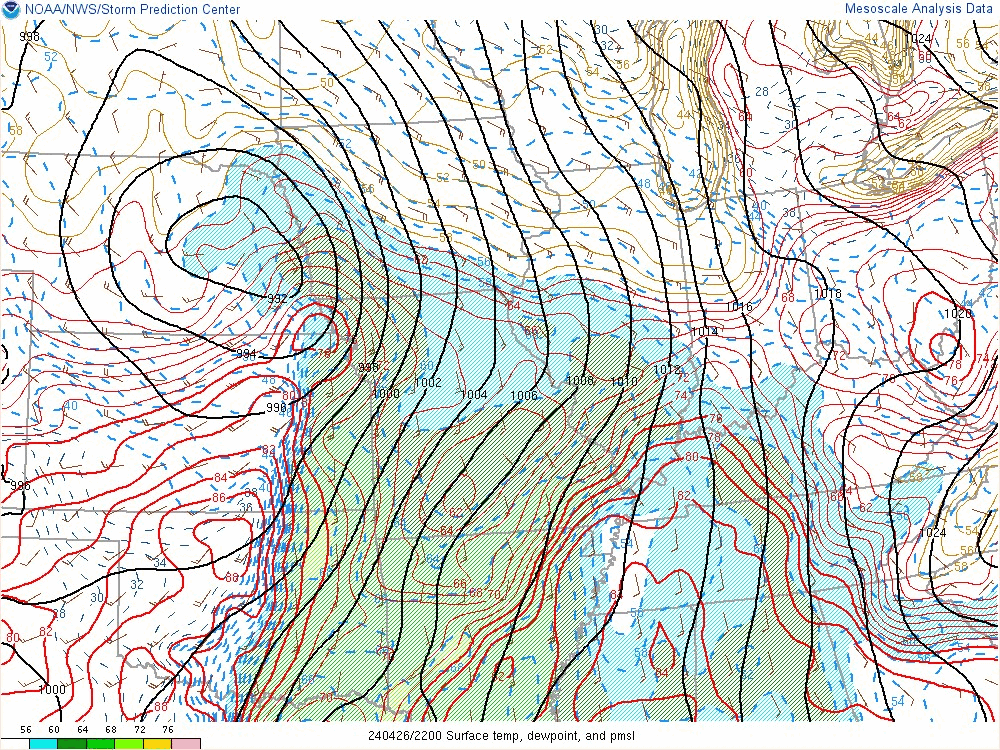
| Figure 1: Surface pressure (black lines), temperature (red dashed), dewpoints (color fill, dashed blue lines), and winds (barbs) from 5p to 10p Low pressure lifts northeast towards Sioux City with the warm front moving northeastward into central Iowa and the dryline/cold front advancing eastward into Iowa. |
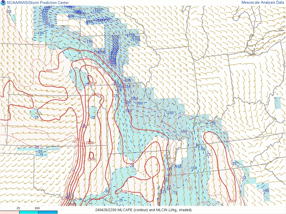
Figure 2: Mixed Layer CAPE (red lines) and CIN (color shade) 5pm to 10pm A ribbon of instability pushed into southern and central Iowa with little in the way of inhibition (CIN). |
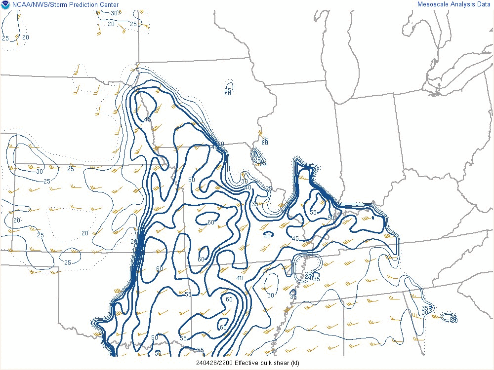
Figure 3: Effective Storm Relative Helicity (ESRH) 5pm to 10pm Detailed Definition |
 |
 |
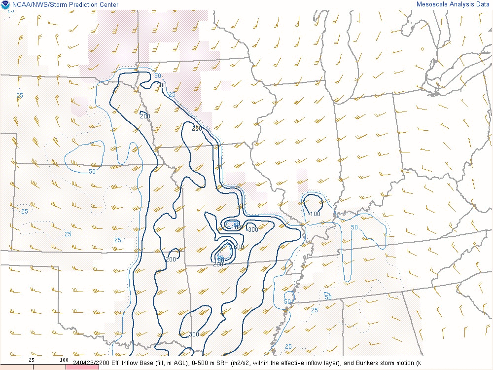
| Figure 4: 0-500m SRH 5pm to 10pm Plenty of low level SRH was available that allowed storms to rotate. |
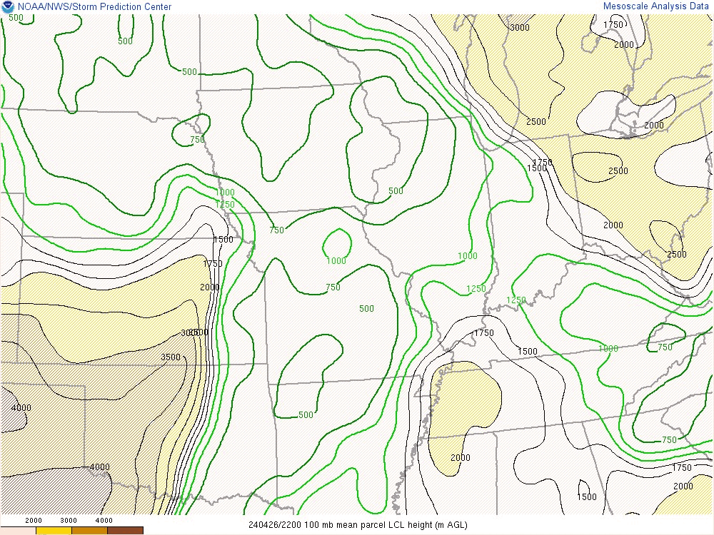
Figure 5: Lifting Condensation Level Height 5pm to 10pm This is a proxy for cloud base height. Values below 1000m favor tornadoes as cloud bases are lower to the ground. |
 |
 |
 |
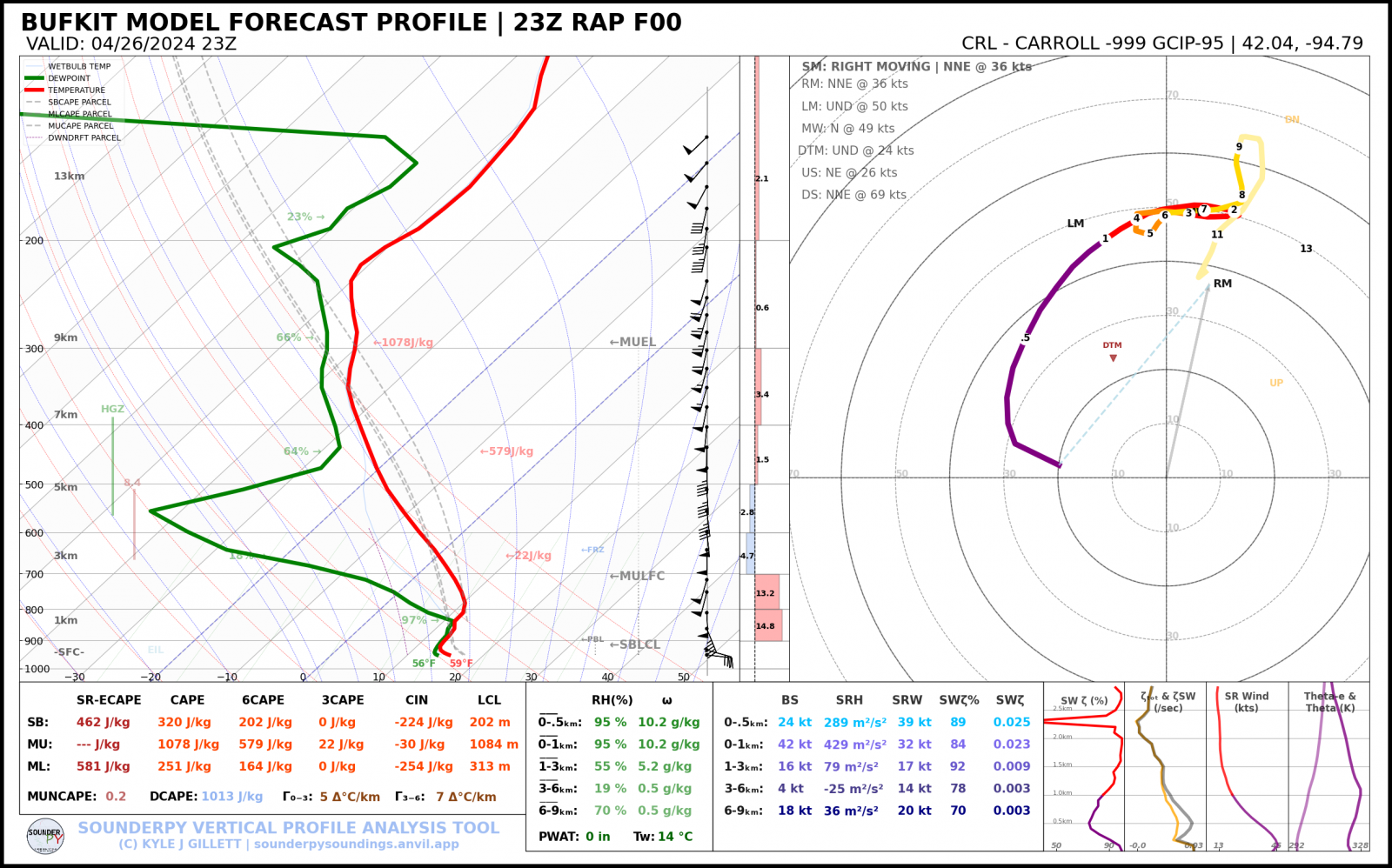
| Figure 7: 23z/6pm RAP analysis sounding at Carroll near the time storms were moving into Crawford County producing tornadoes. [full res] This sounding has good low level shear and while instability is meager and does not look surface based, this is likely not what the storms moving into Crawford County realized. |
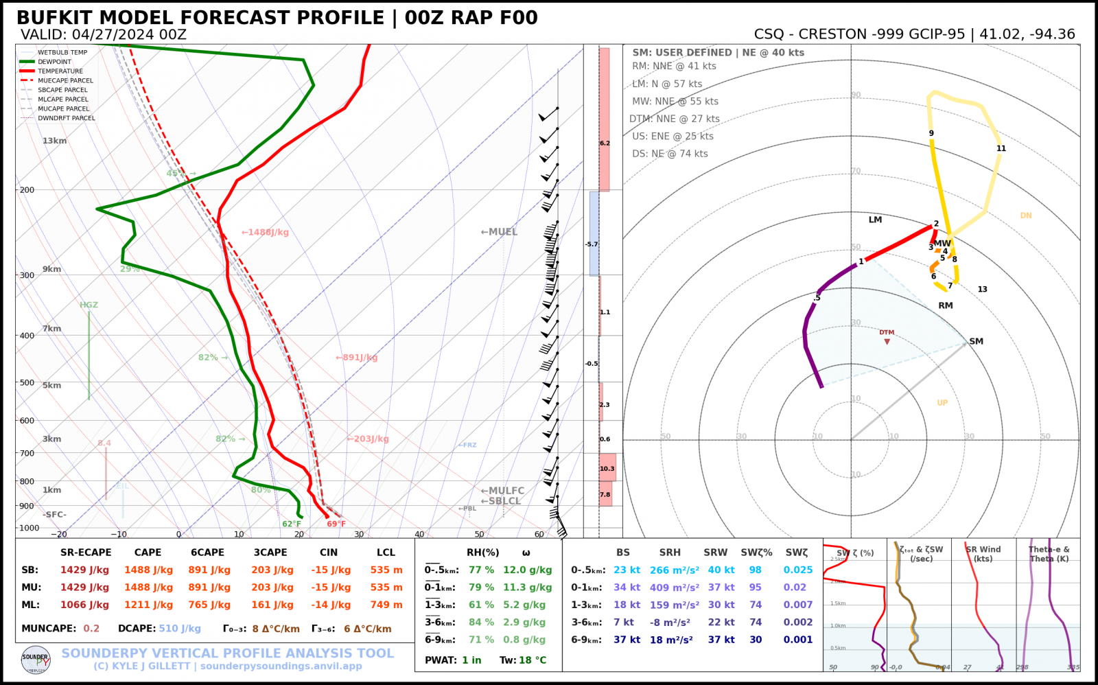
Figure 8: 00z/7pm RAP analysis sounding at Creston near the time storms were moving into Union County producing tornadoes. [full res] This sounding shows an environment favorable for tornado producing storms with plenty of instability and low level shear. |
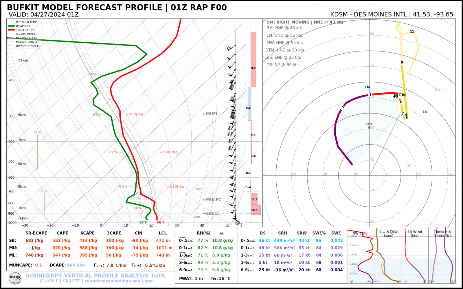
Figure 9: 01z/8pm RAP analysis sounding at Des Moines near the time storms were moving into Polk County producing tornadoes. [full res] This sounding shows an environment favorable for tornado producing storms and while the shear is not quite as good as Creston, there is still sufficient instability and low level shear. |
 |
Media use of NWS Web News Stories is encouraged! Please acknowledge the NWS as the source of any news information accessed from this site. |
|