Severe thunderstorms capable of damaging winds will be possible from the Ozark Plateau east into portions of the Southeast today. Rounds of heavy thunderstorms ahead of a slow moving front will continue locally heavy rainfall and scattered flash flooding potential from the Ozarks to the Ohio and Tennessee Valleys today. Read More >
Overview
|
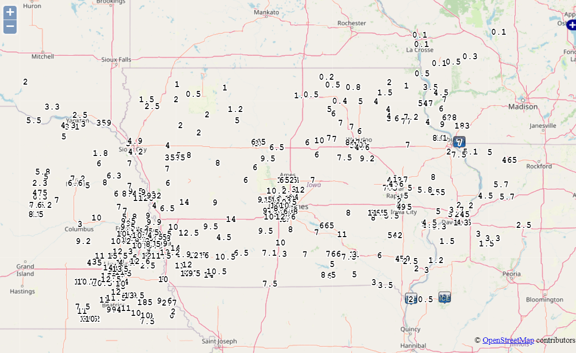
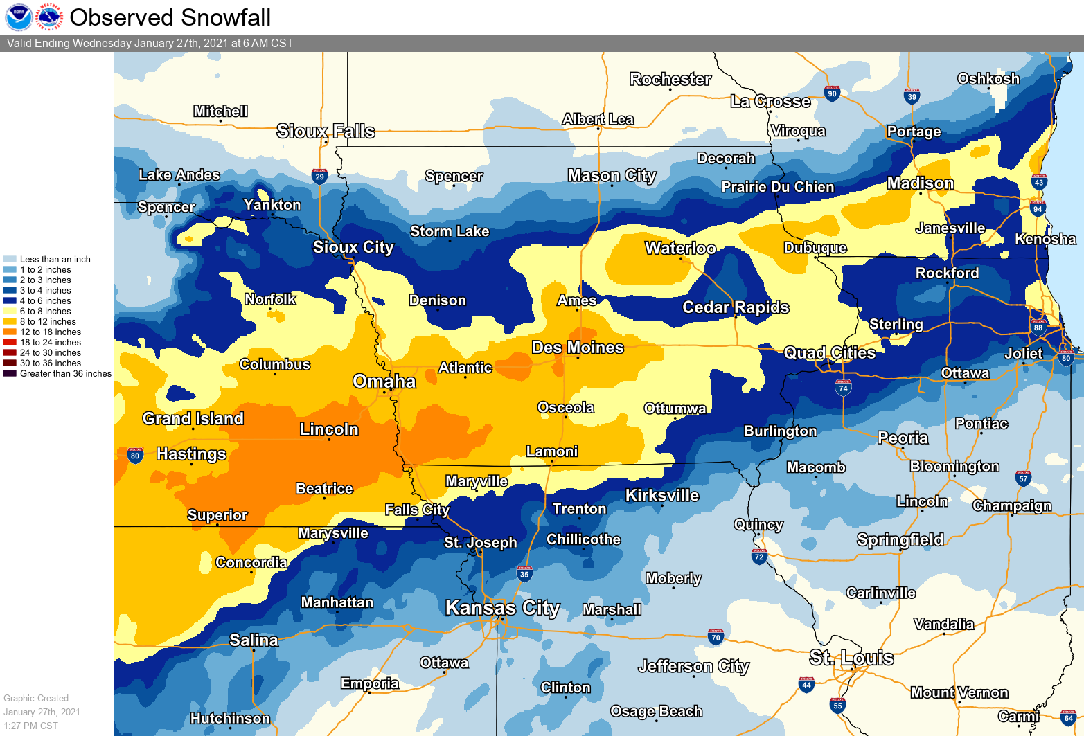
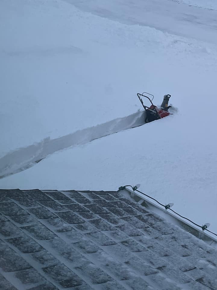
A strong low pressure system brought widespread heavy snow to much of Iowa on Monday January 25 to Tuesday January 26, 2021. Several reports of 8 to 14 inches of snow occurred over central Iowa and with the strong northeast winds causing near whiteout conditions at times led to some treacherous driving conditions and many school closing on Tuesday. |
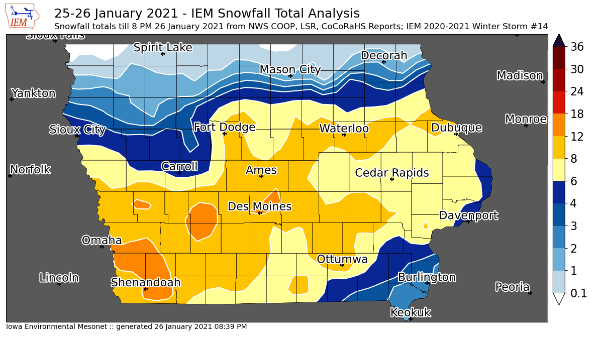 Snowfall totals from across Iowa on January 25-26, 2021 |
.jpg) |
 |
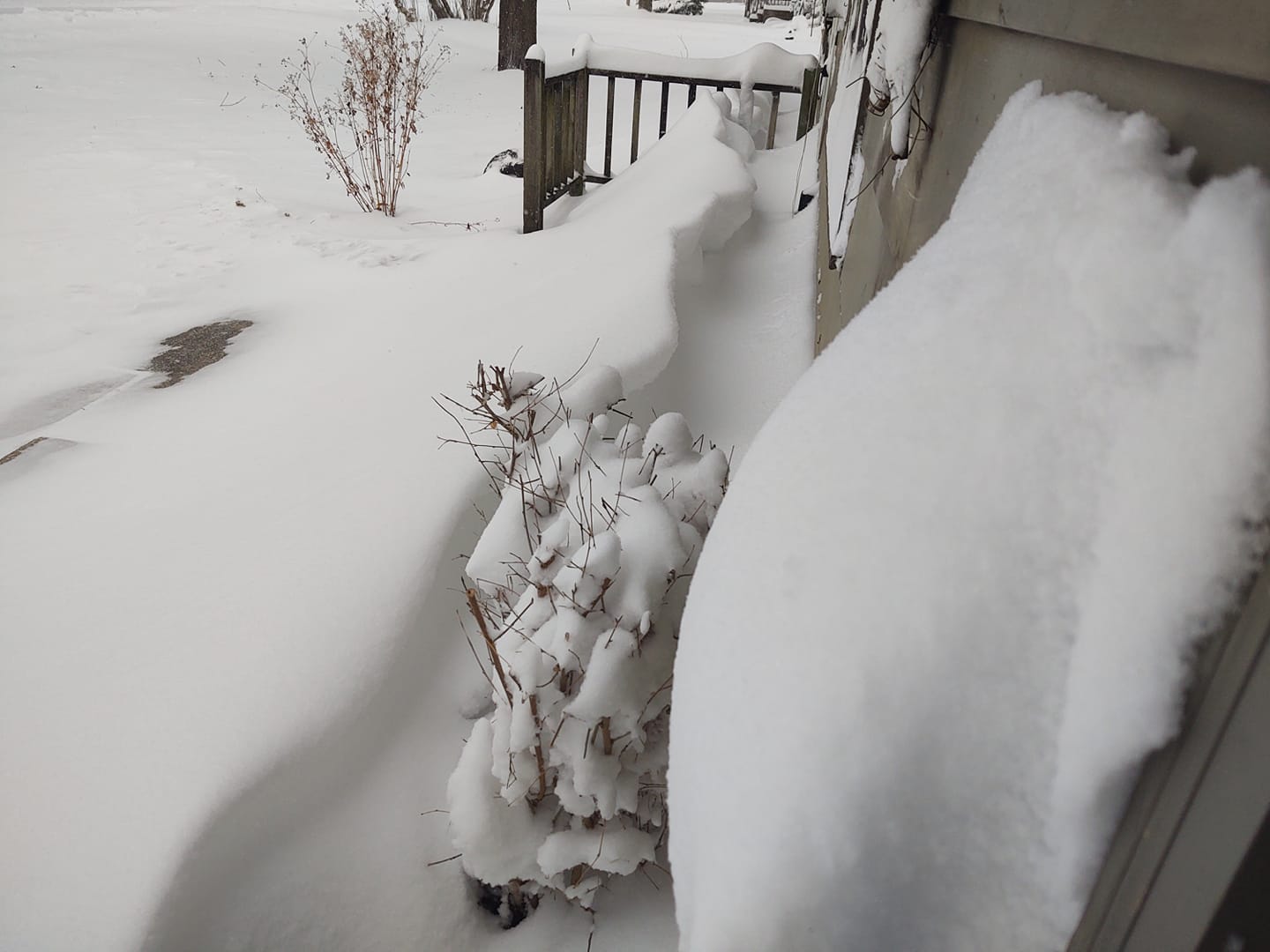 |
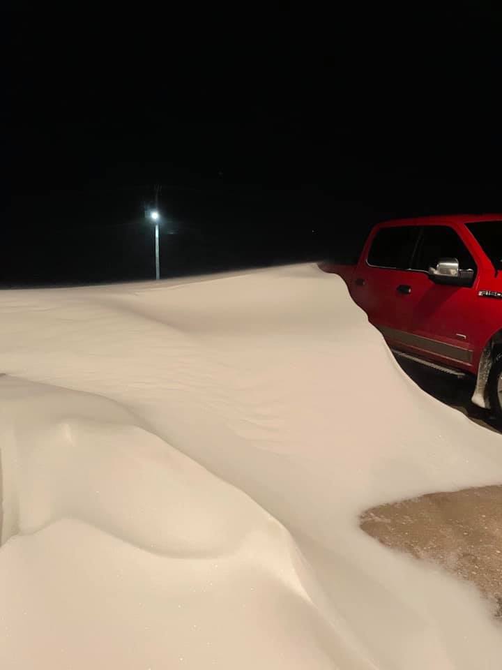
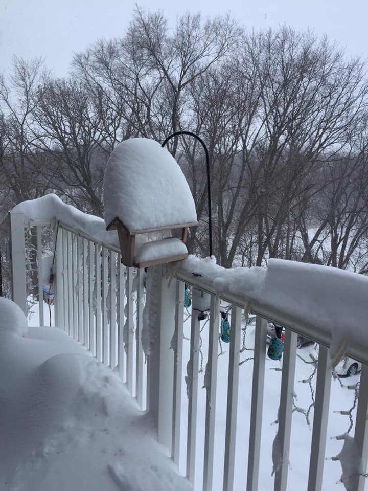
| Waterloo, Iowa. Photo courtesy of Kathy Adelmund | Cedar Falls, Iowa. Photo courtesy of Doug Rathburn | Iowa Falls, Iowa. Photo courtesy of Jim Cheaney |
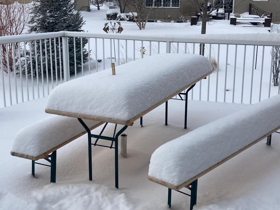
Photos & Video
 |
 |
 |
.jpg) |
| Halbur, Iowa. Photo courtesy of Dave DeYoung | Nevada, Iowa. Photo courtesy of Emma Quinn | Waukee, Iowa. Photo courtesy of Jen Christie | Grimes, Iowa. Photo courtesy of Kenny Podrazik |
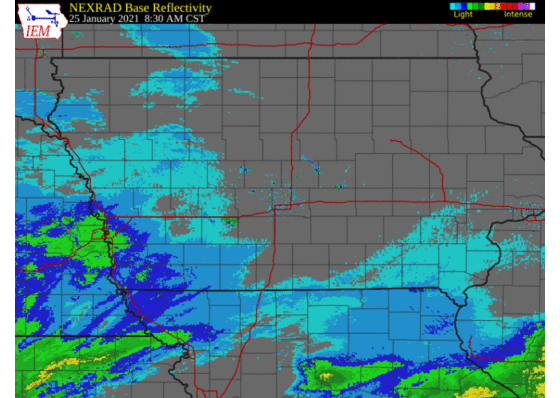
Radar
Loop of the entire event from Monday morning into Tuesday morning. The heavy snow band developed late Monday morning and continued through the afternoon and evening. The pivot point for the snow band was basically the Des Moines Metro area where many reports of over a foot occurred.
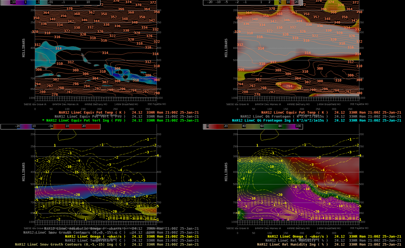
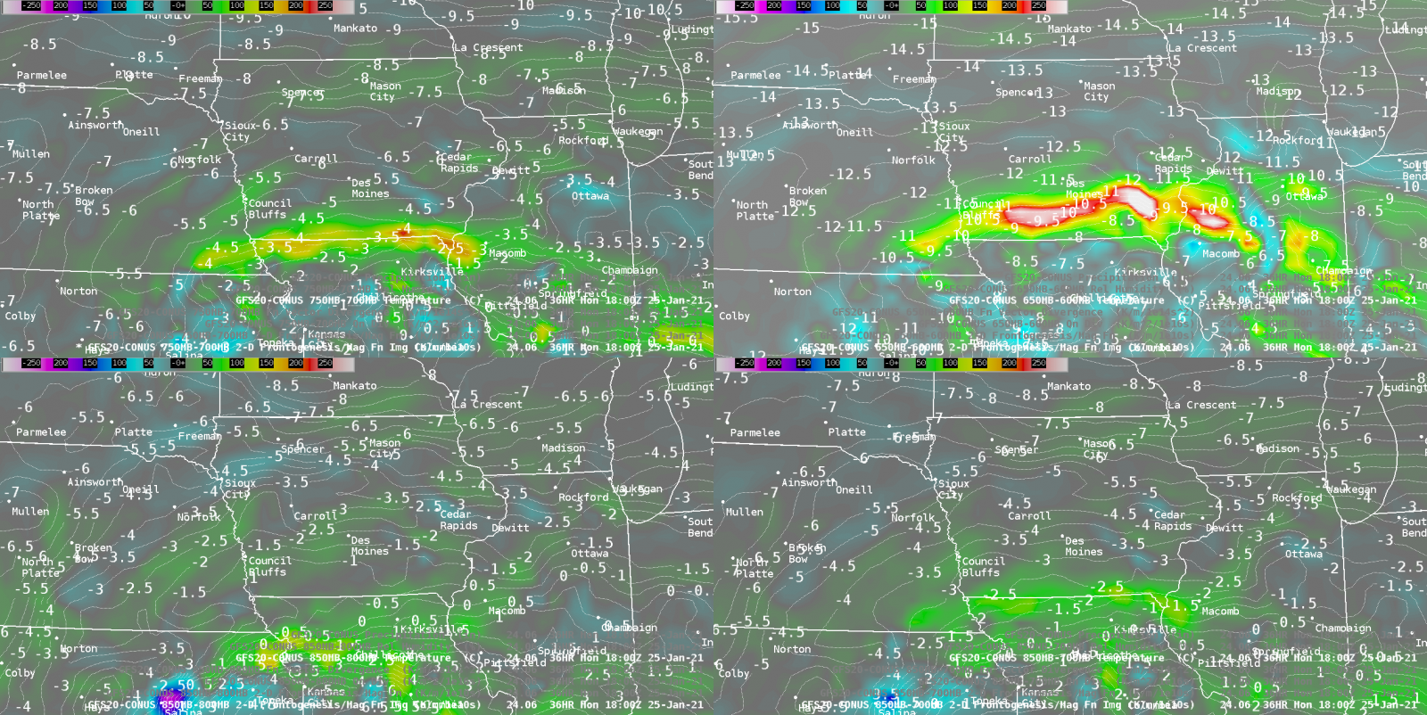
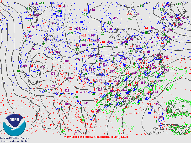
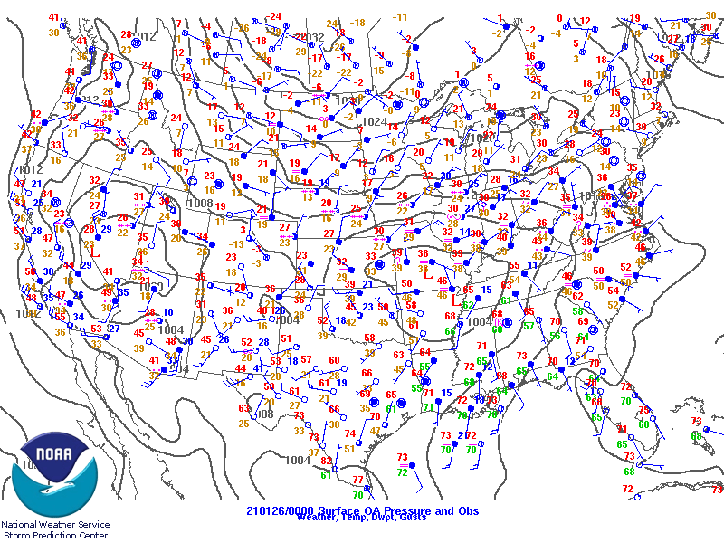
Environment
UNDER CONSTRUCTION!!!
 |
 |
 |
| Figure 1: Caption | Figure 2: Caption | Figure 3: Caption |
Near-storm environment summary.
.gif) |
.gif) |
|
| Figure 4: Caption | Figure 5: Caption | Figure 6: Caption |
Additional environmental data.
 |
 |
|
| Figure 7: Caption | Figure 8: Caption | Figure 9: Caption |
 |
Media use of NWS Web News Stories is encouraged! Please acknowledge the NWS as the source of any news information accessed from this site. |
|