
A slow moving front will produce a threat for heavy rainfall and severe weather from the southwest into the western High Plains through the weekend. Heavy rainfall and isolated flash flooding and gusty winds will be possible this weekend into early next week in portions of southern Florida. Coastal flooding impacts remain possible through the weekend along the Southeast and Mid-Atlantic coasts Read More >
Des Moines, IA
Weather Forecast Office
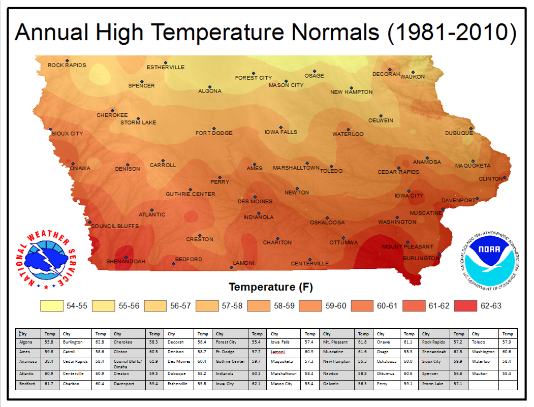
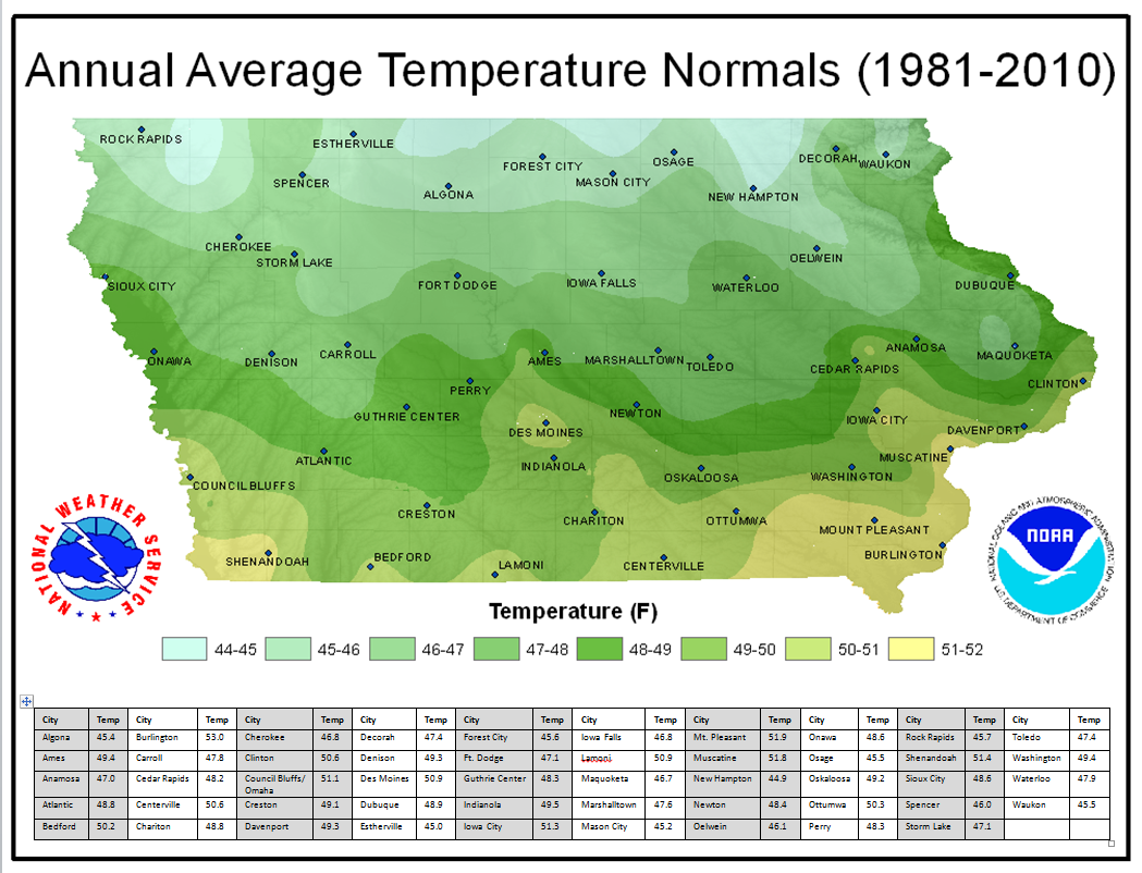
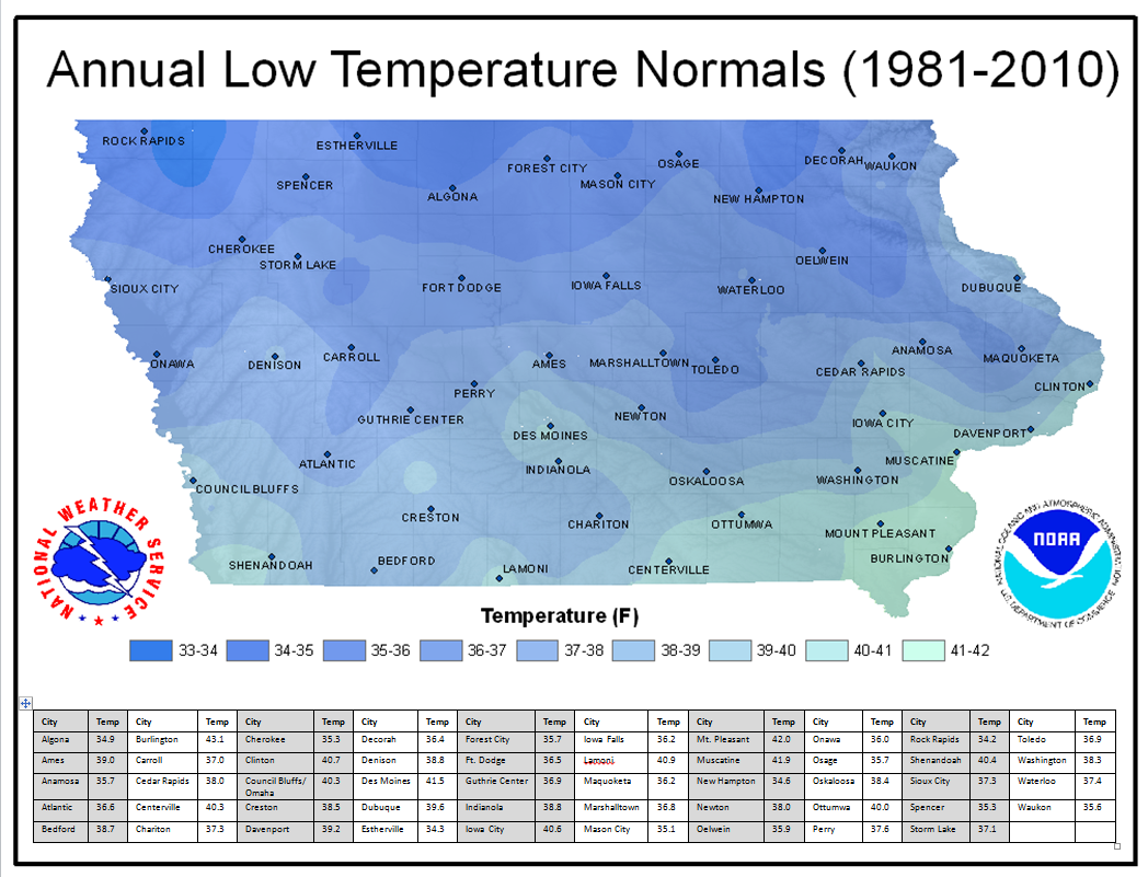
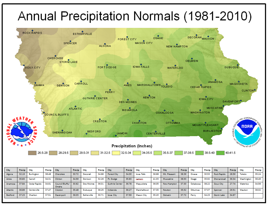
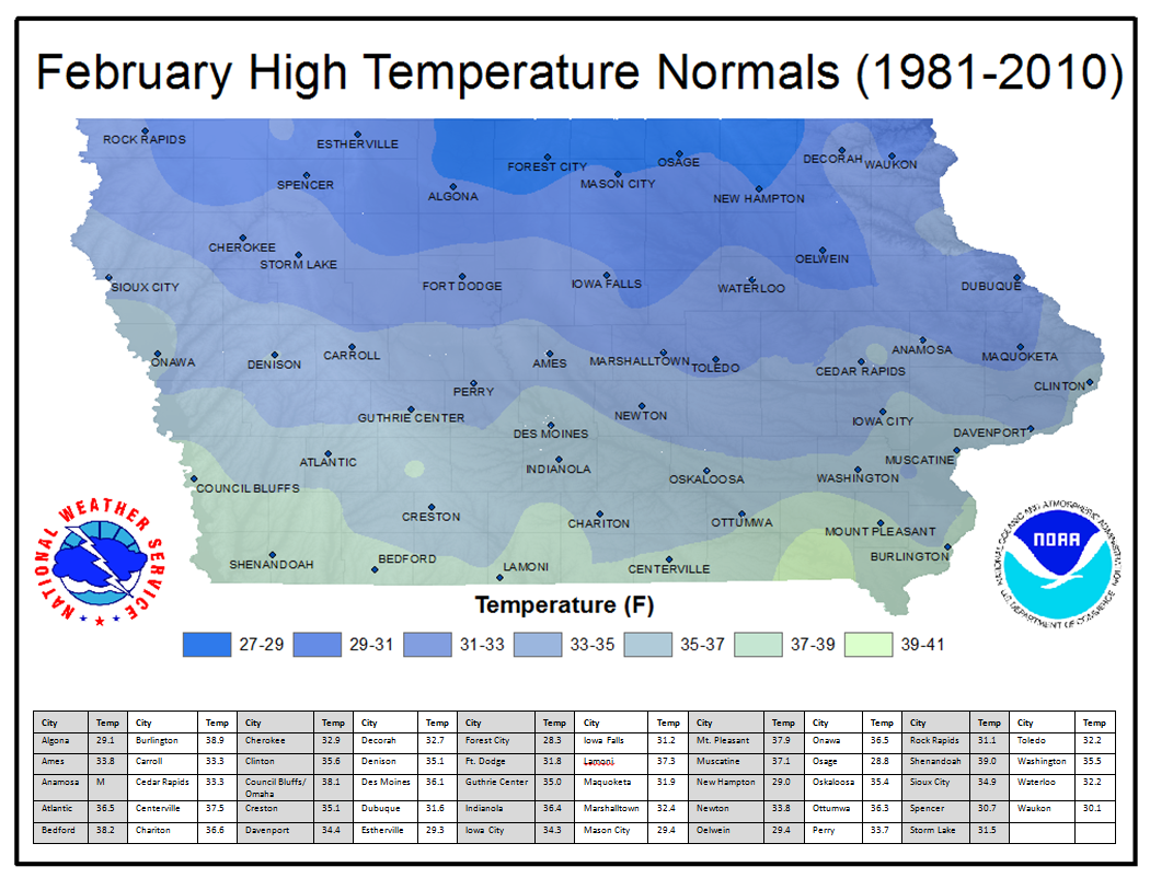
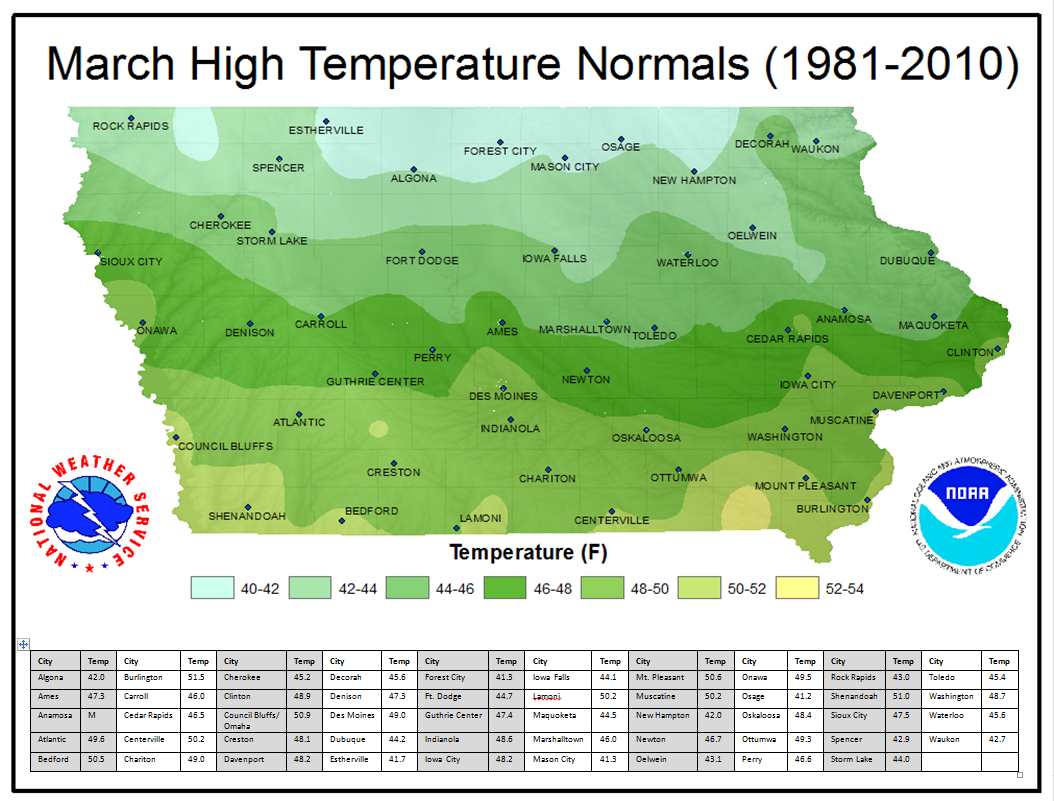
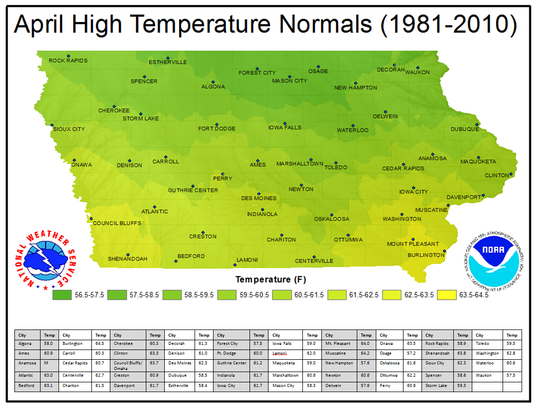
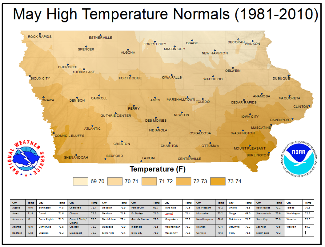
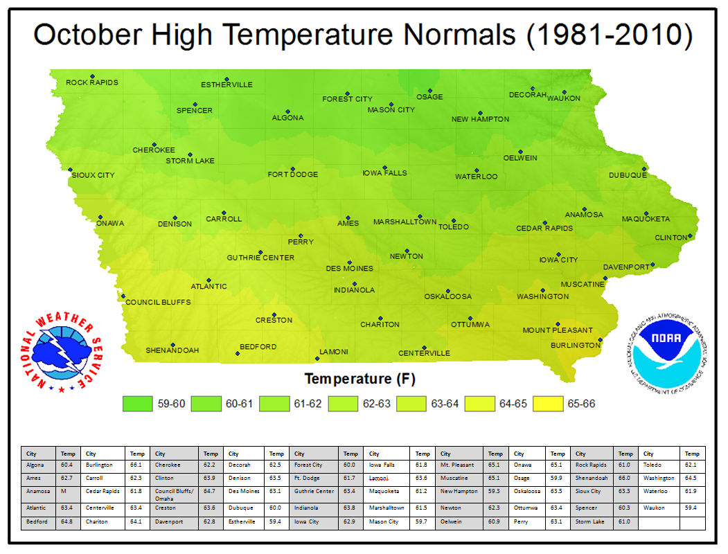
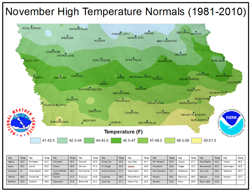
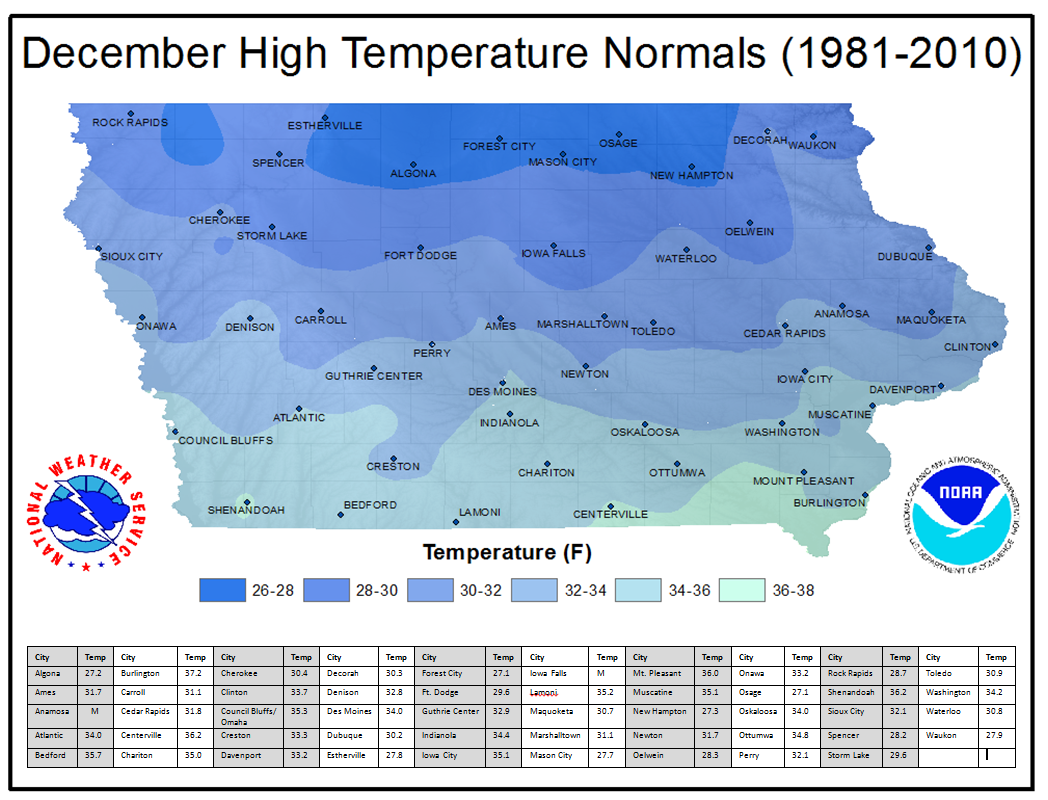
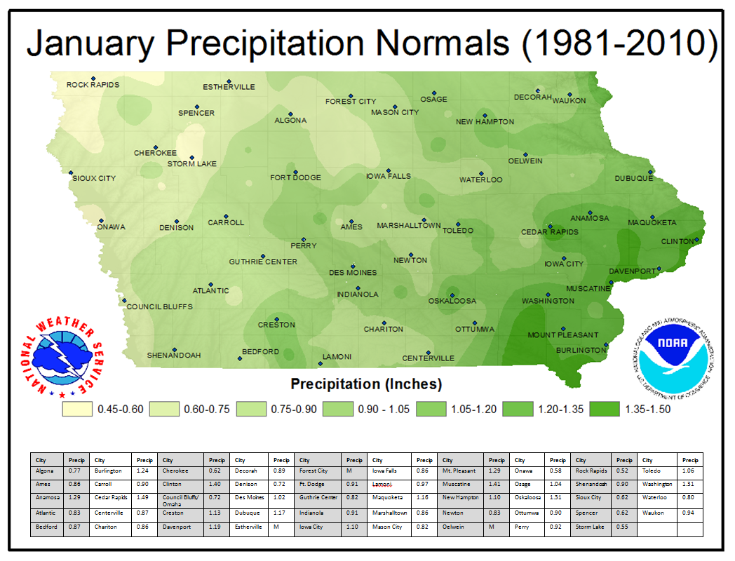
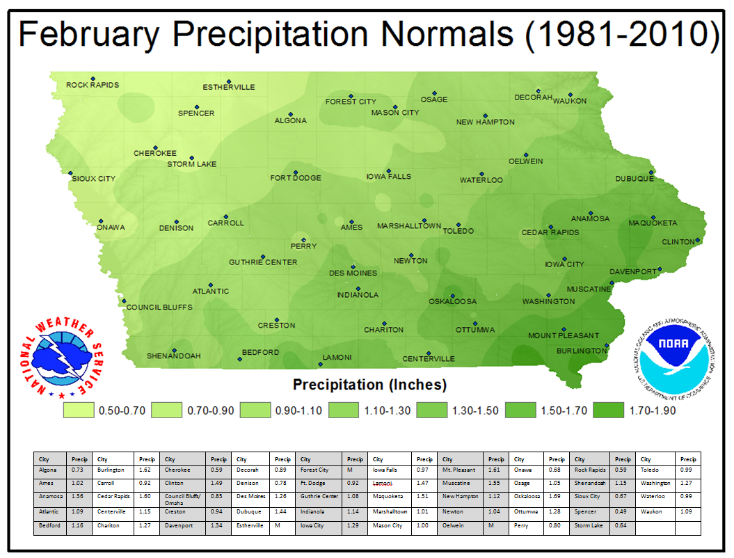
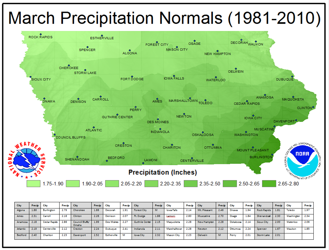
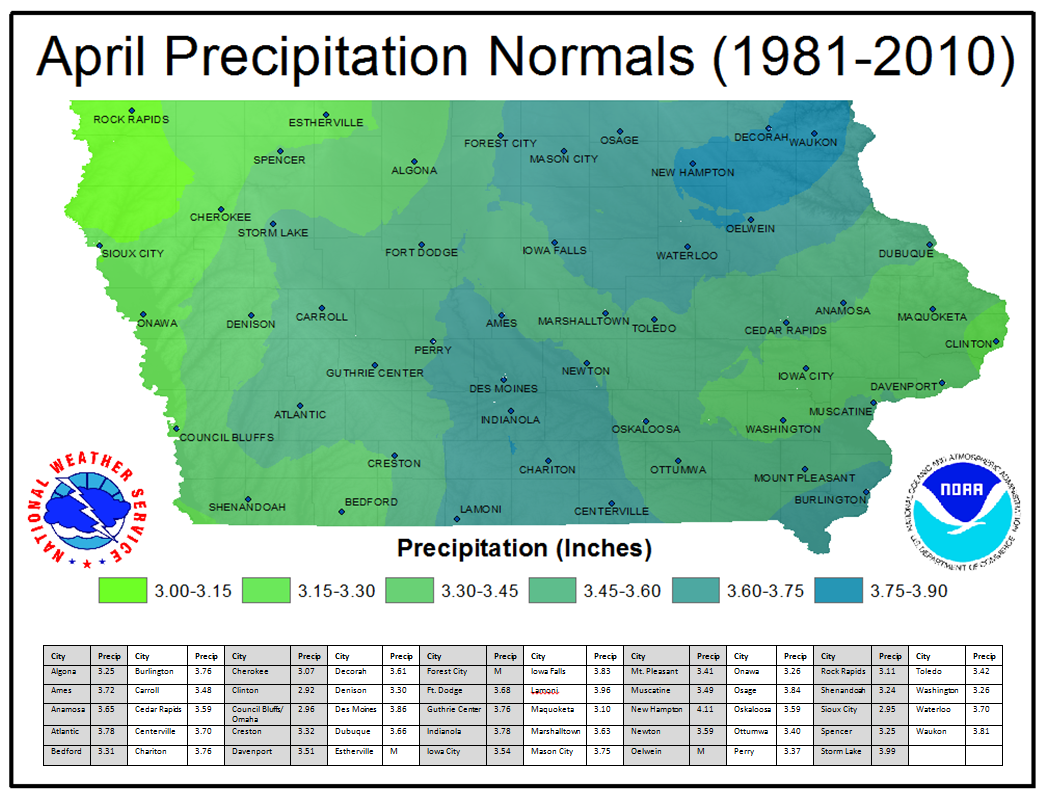
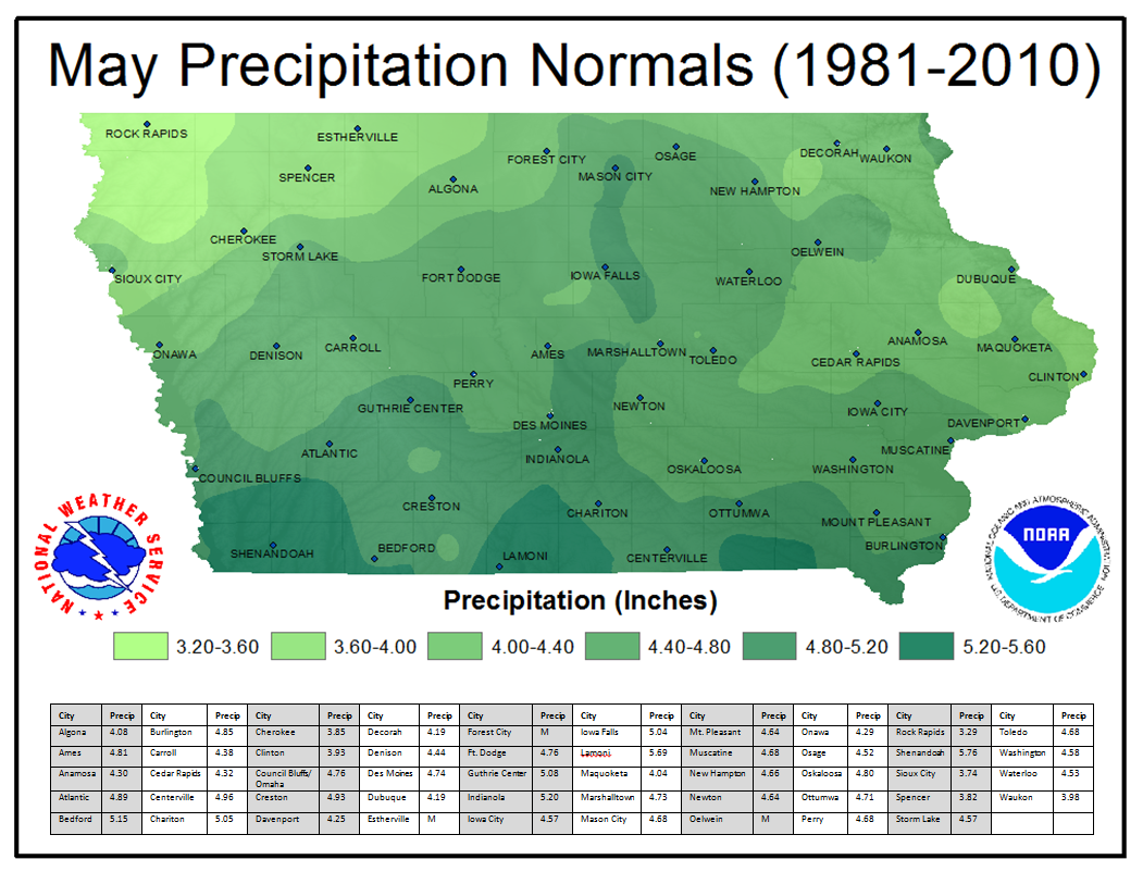
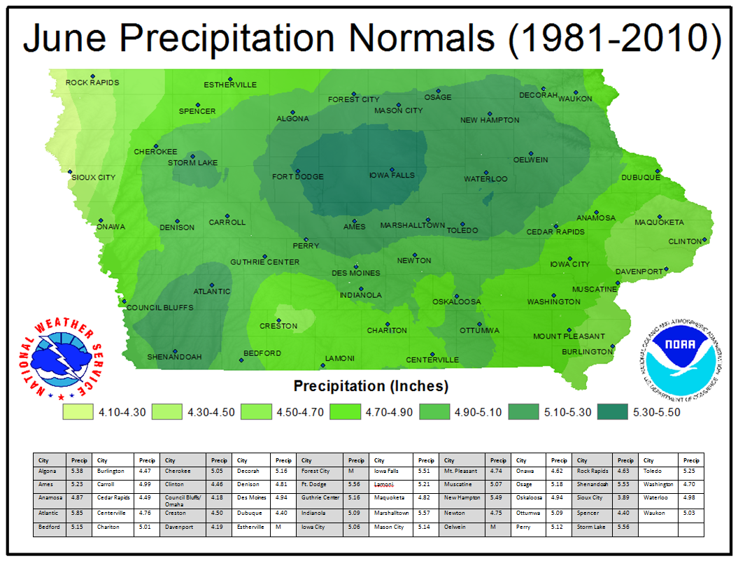
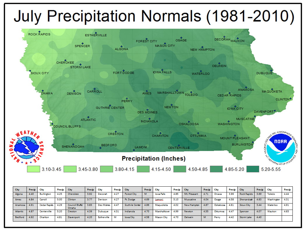
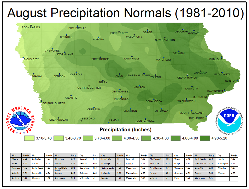
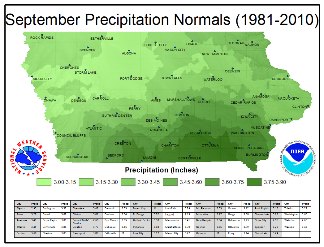
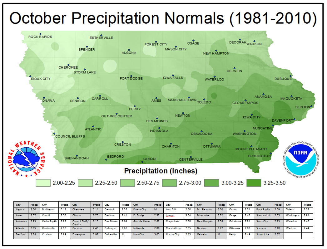
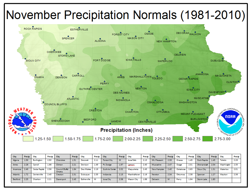
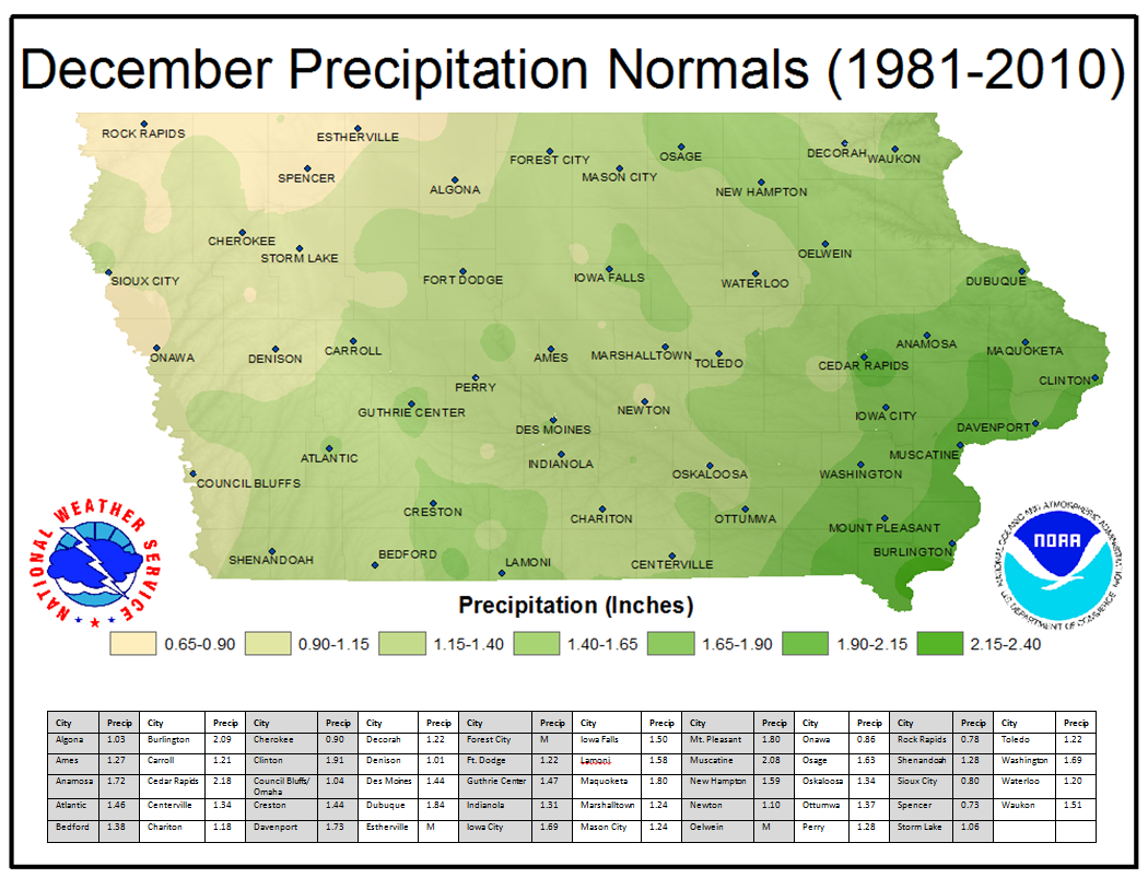
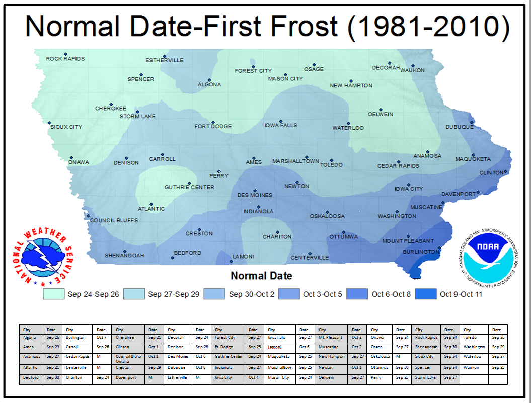
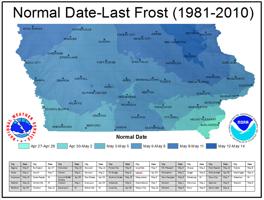
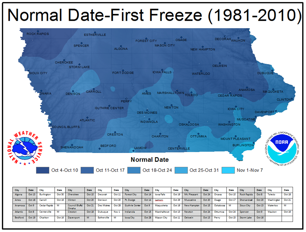
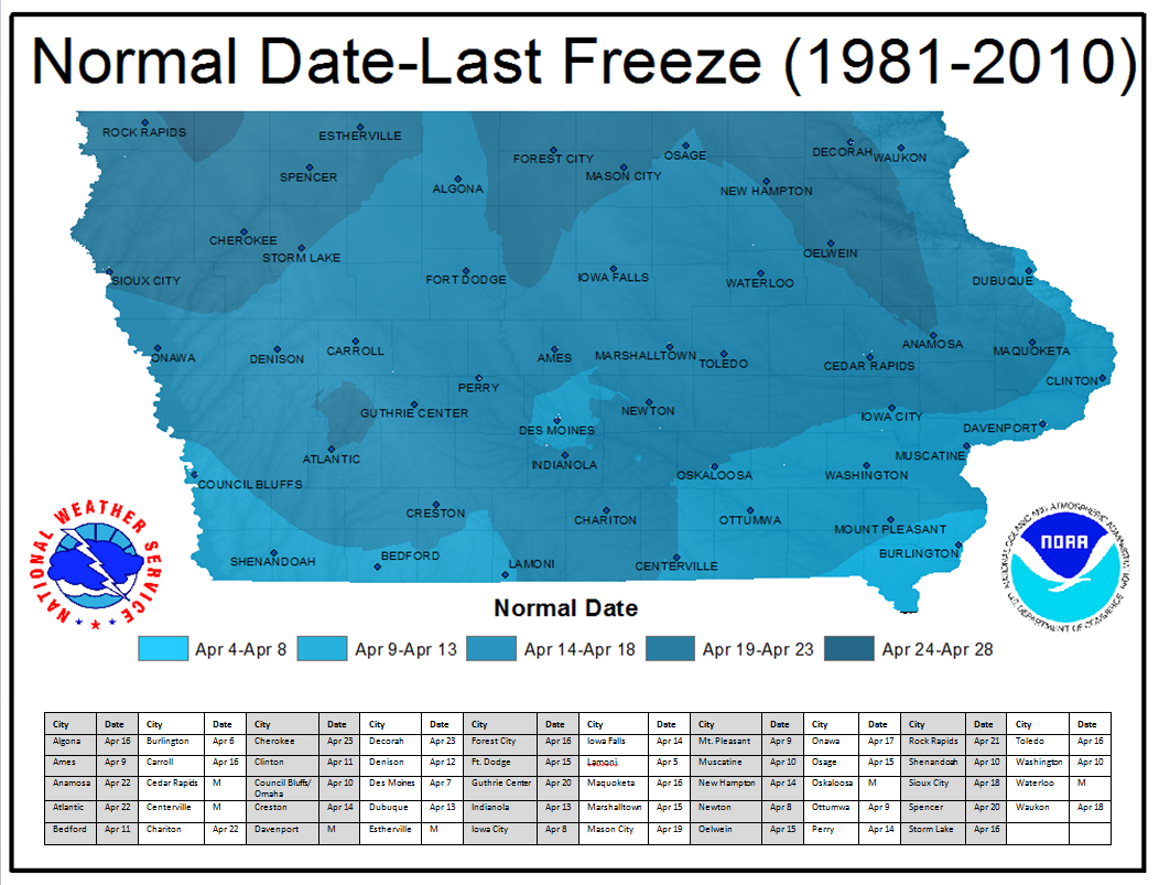
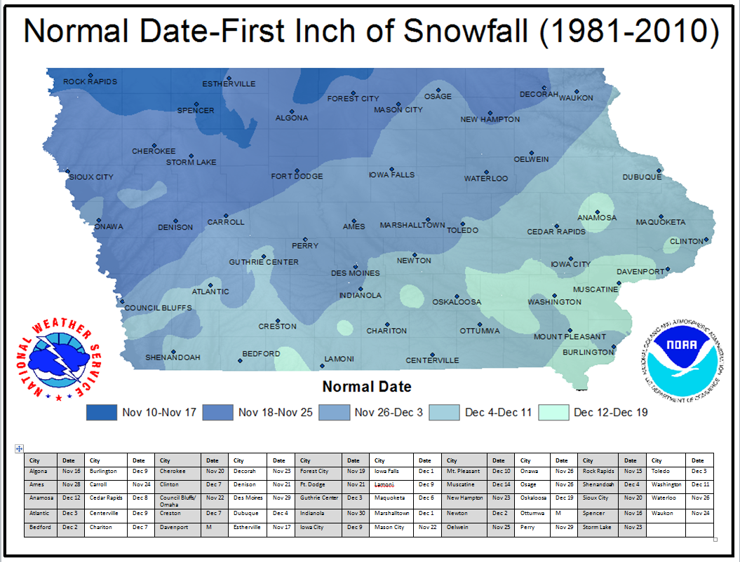
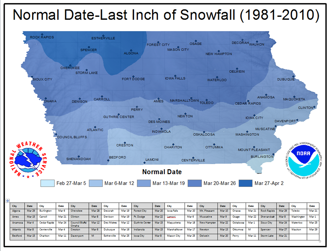
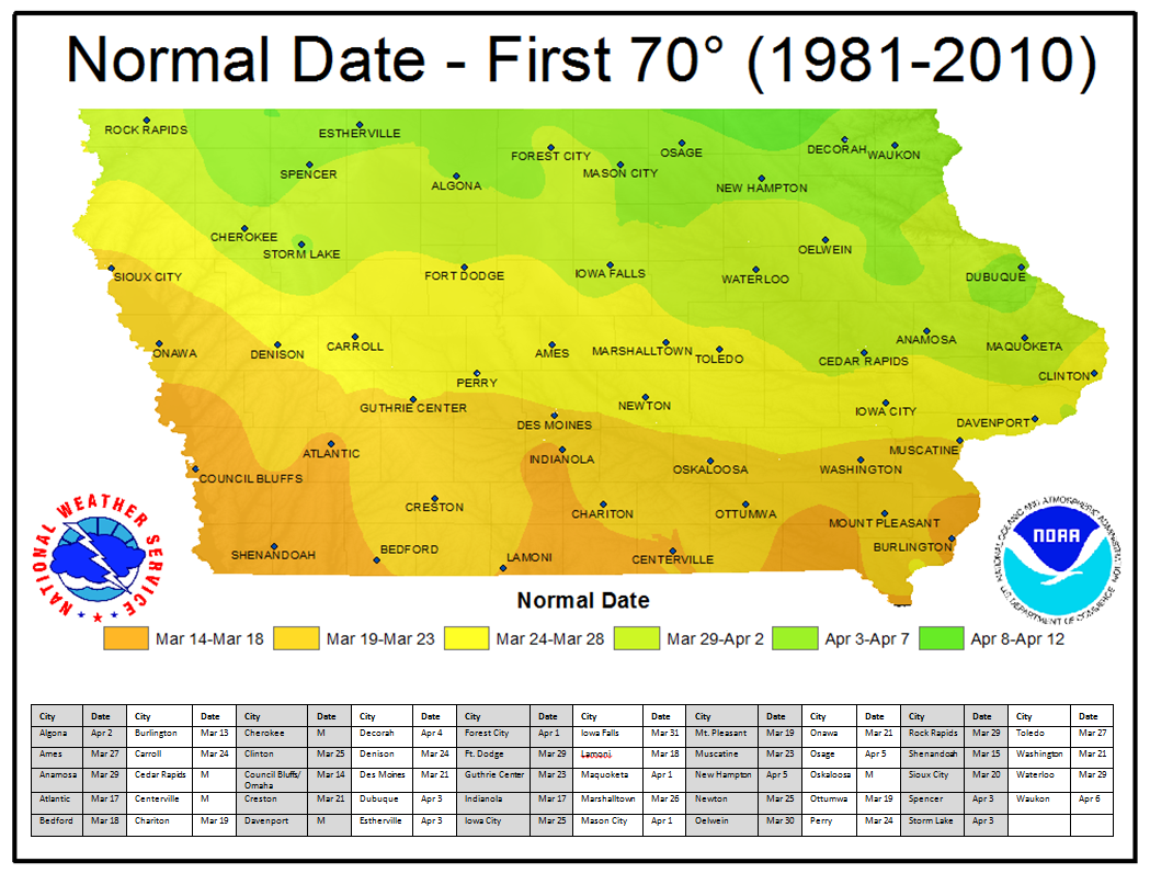
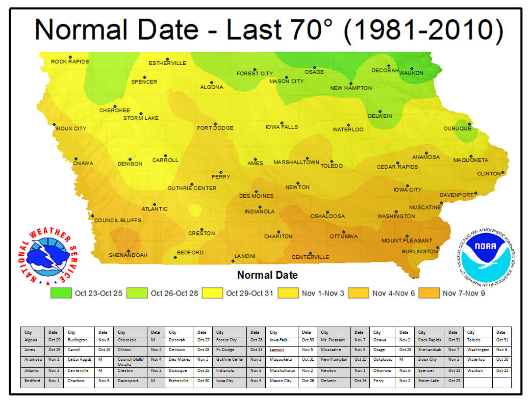
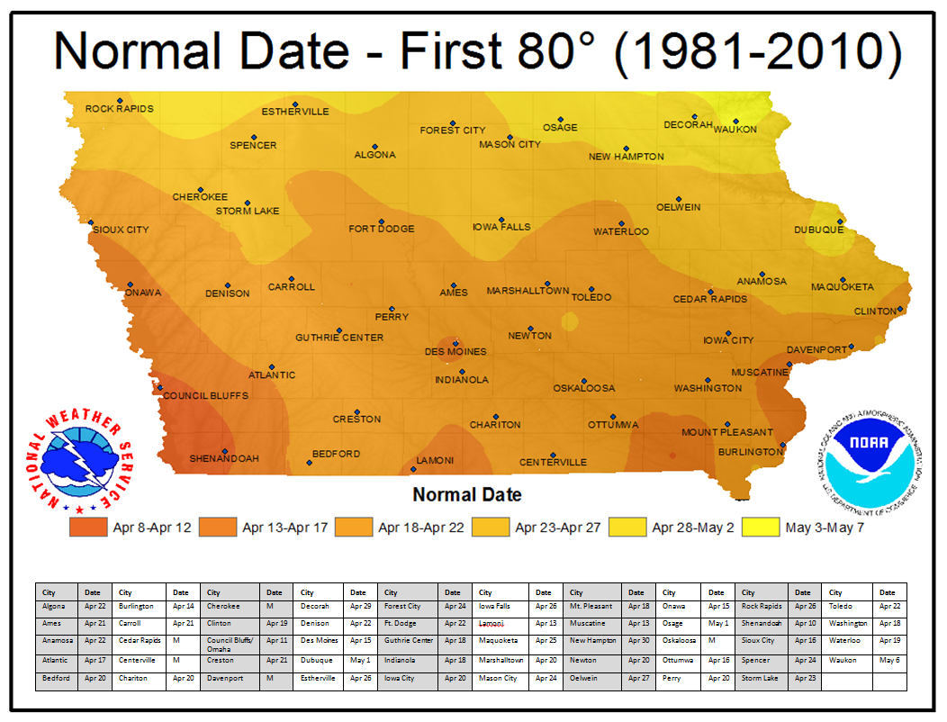
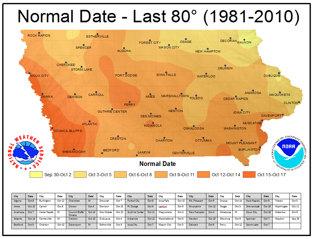
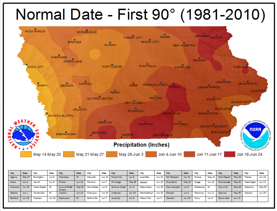
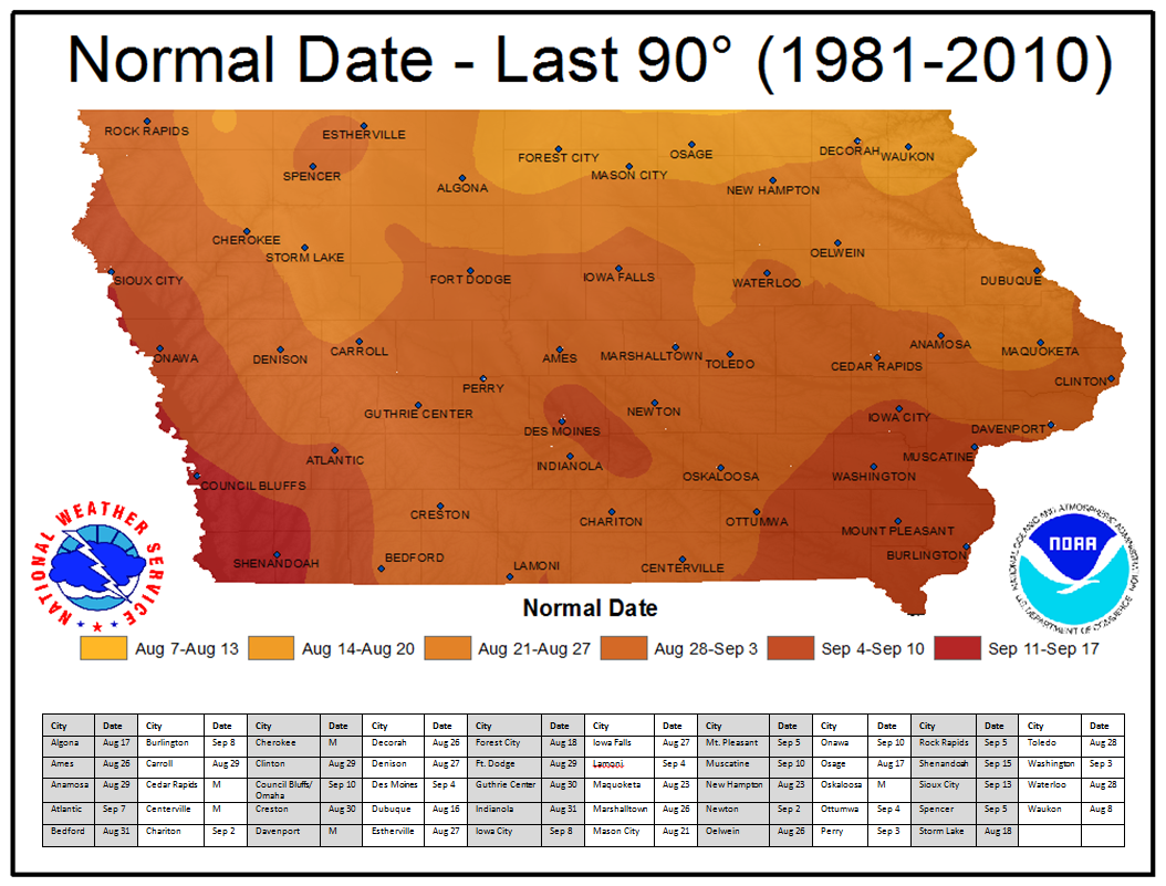
The statewide maps below are based on 30-year climate normals from 1981-2010. For your convenience, a table displaying the numerical value of each normal for select cities has been added to the bottom of each map.
*** Note: The exact values in the tables may not always match the corresponding color of the maps due to the interpolation method used and the location of the observation site relative to the city. ***
Annual Normals
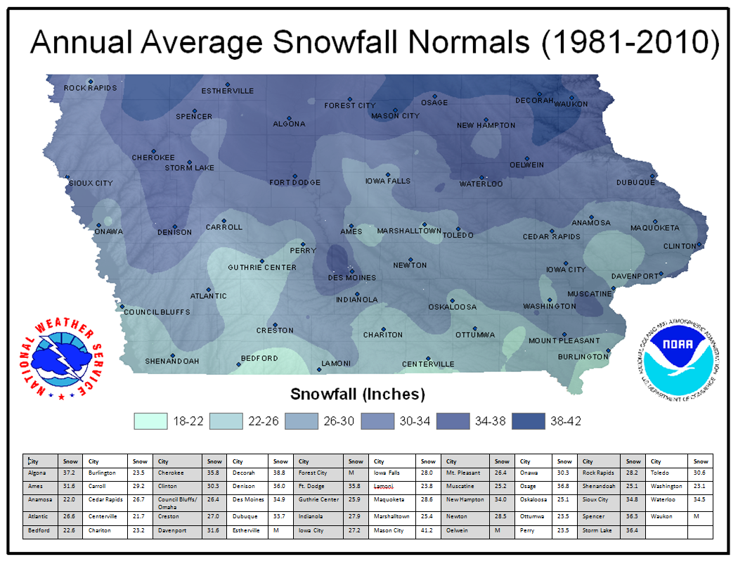
Winter (December, January, February) Normals
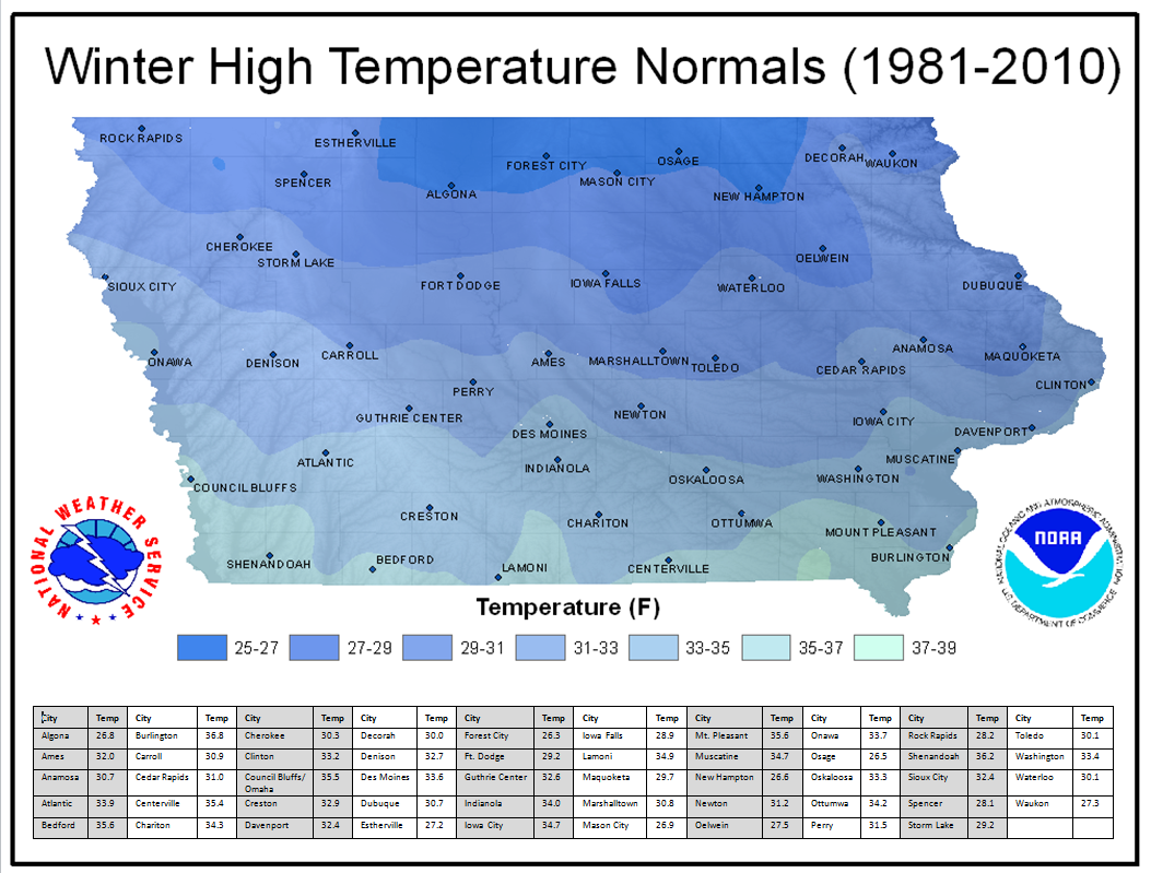
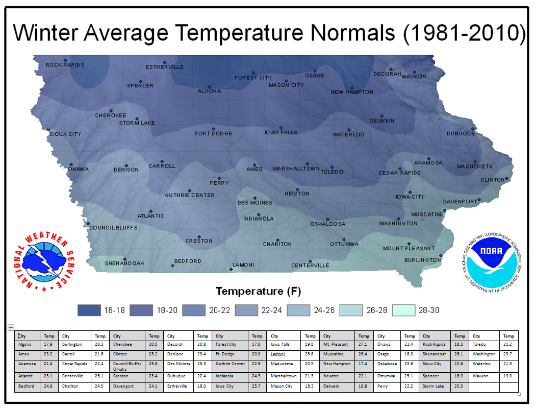
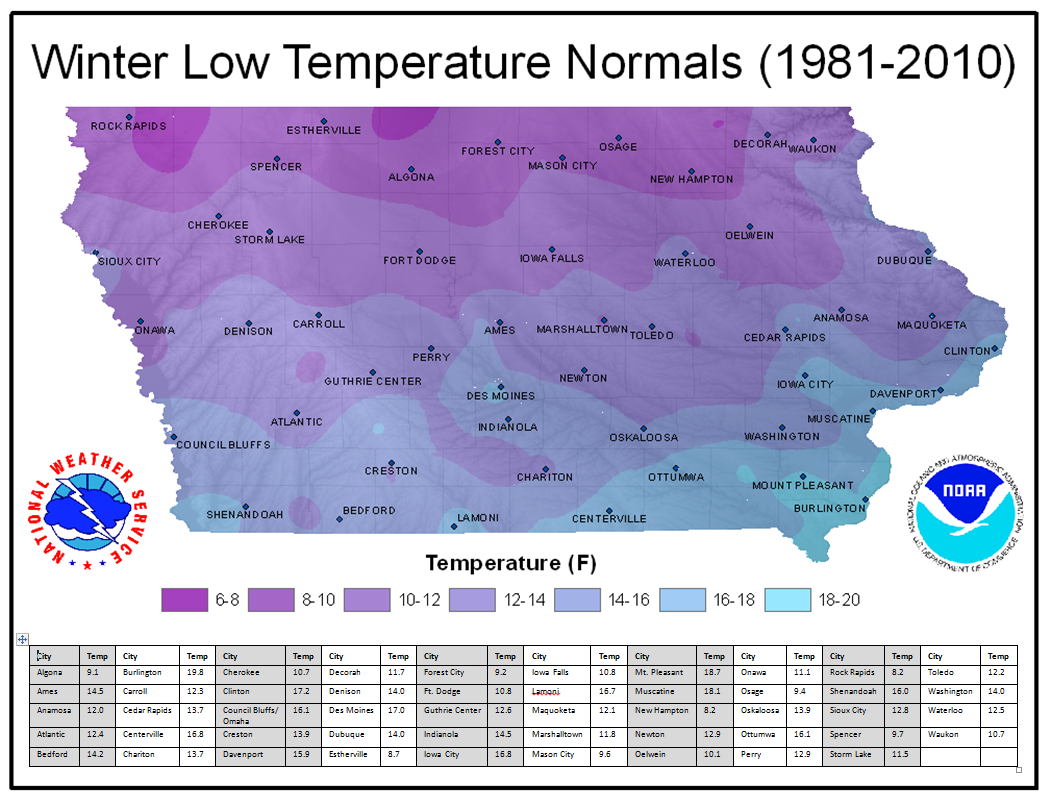
Summer (June, July, August) Normals
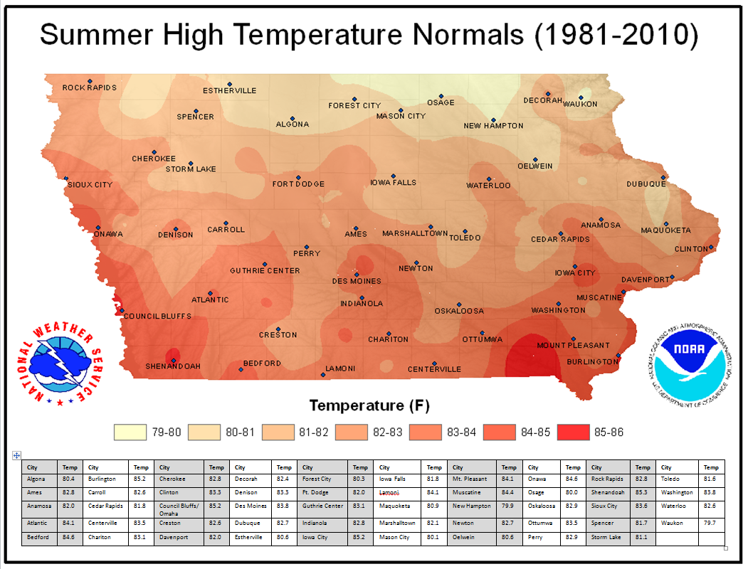
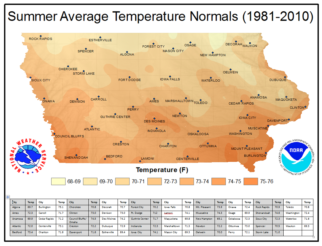
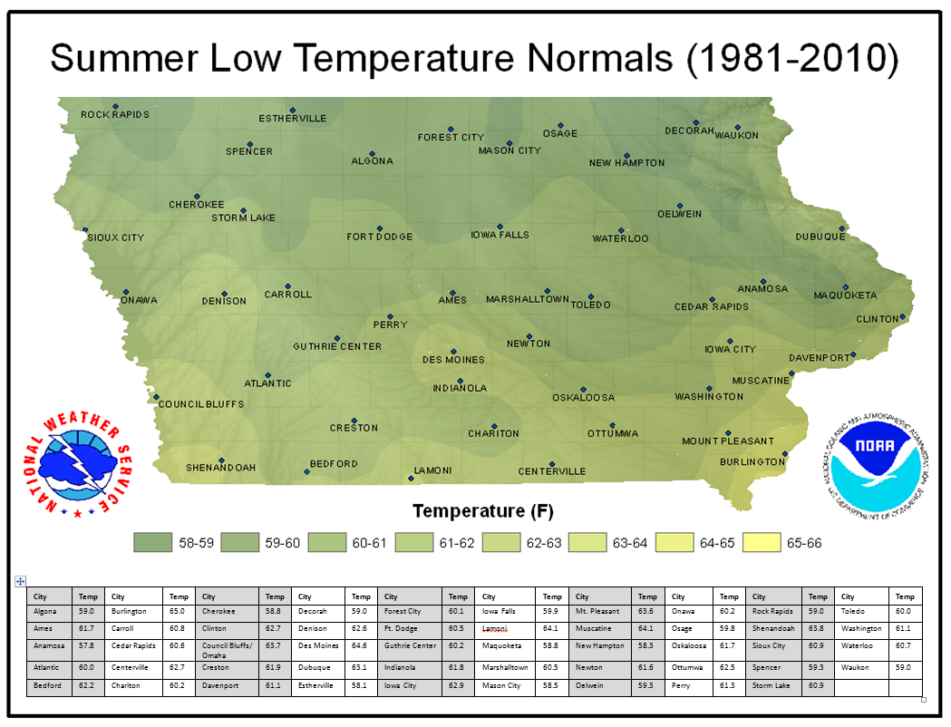
Monthly High Temperature Normals
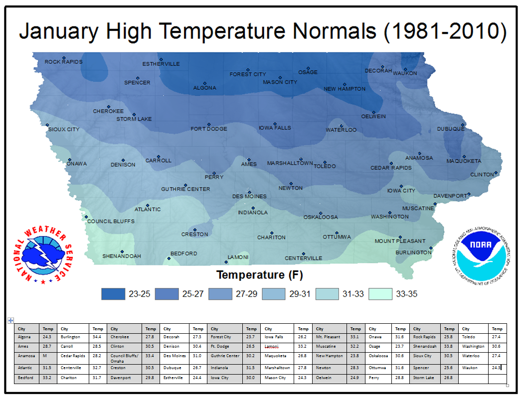
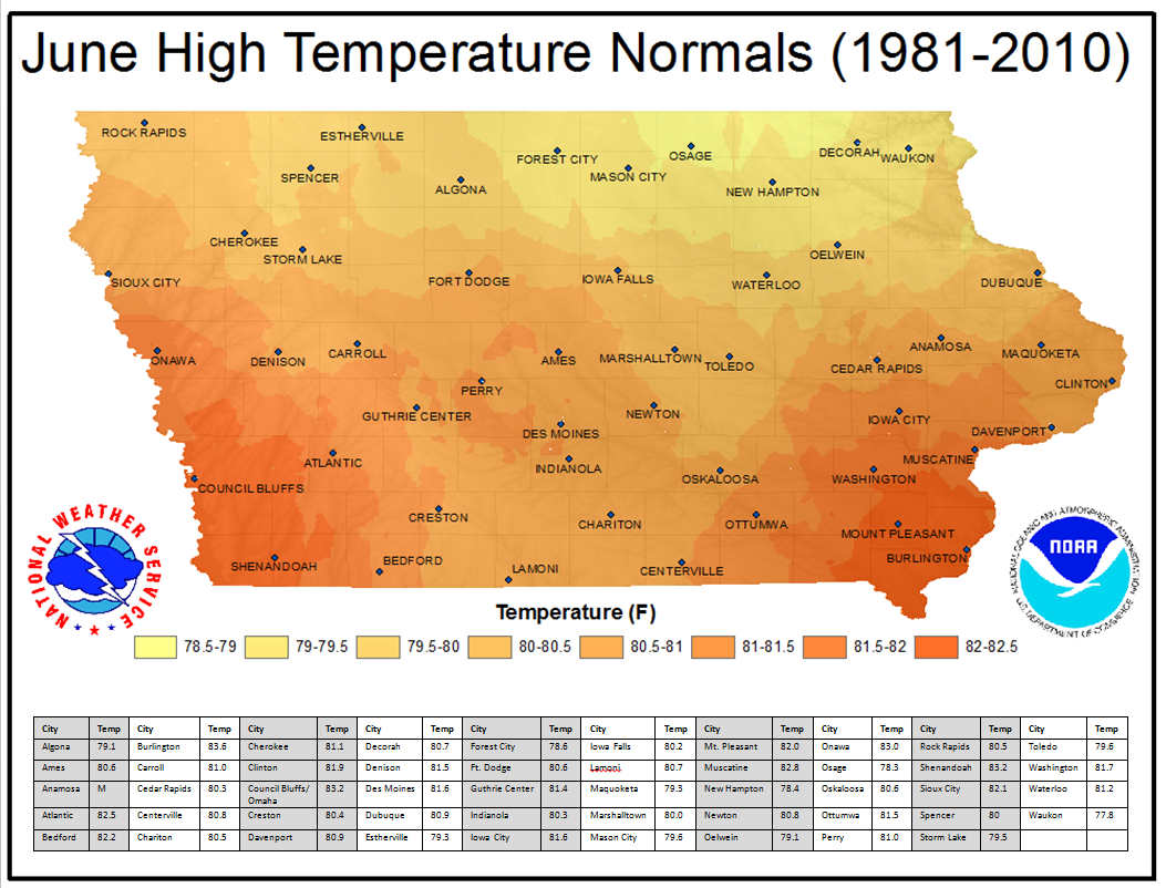
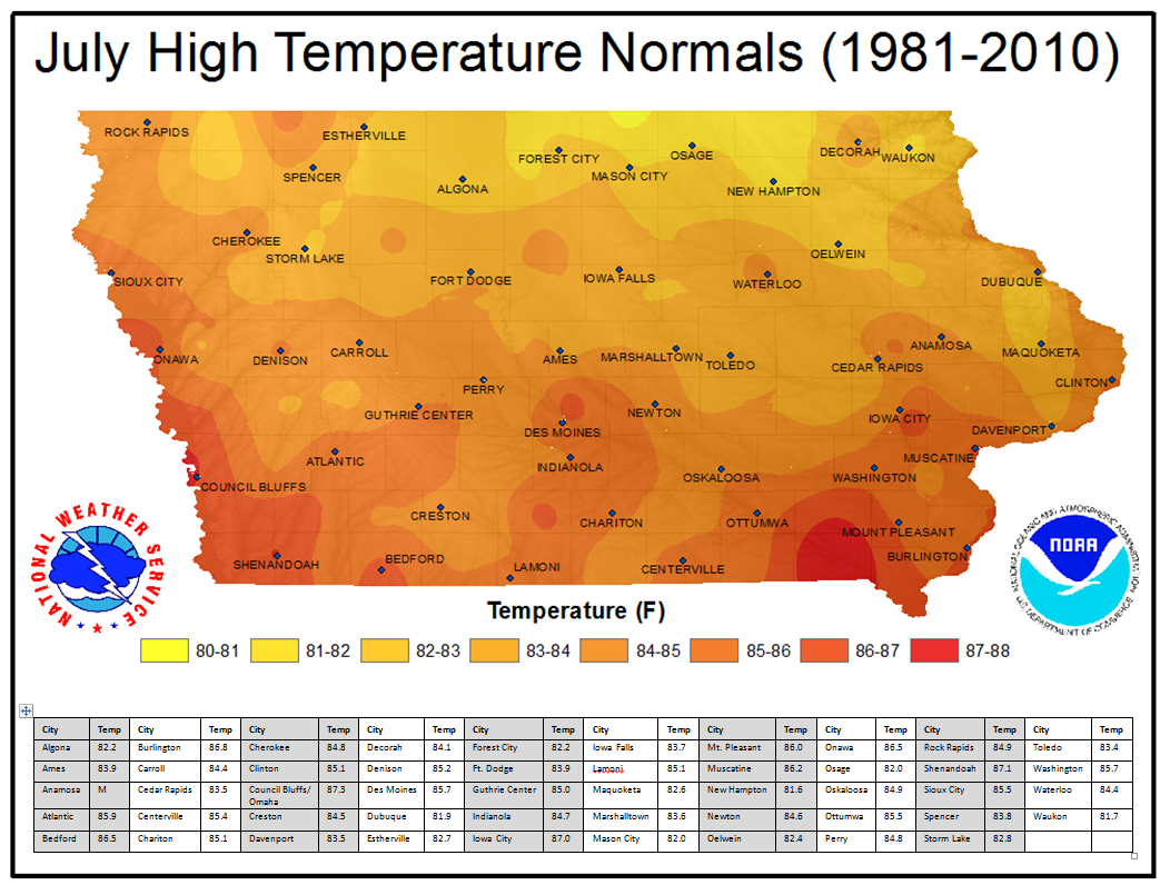
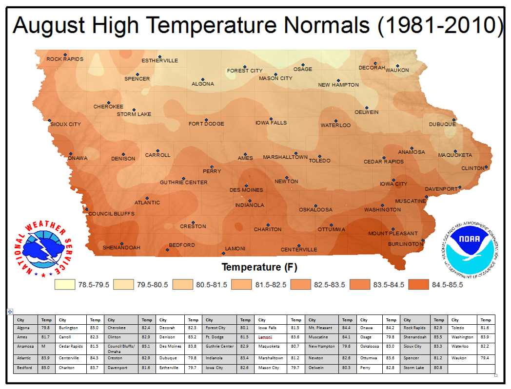
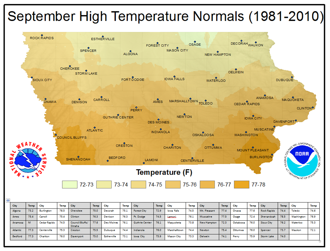
Monthly Precipitation Normals
Normal Date of First/Last Frost (Temperature <= 36°)
Normal Date of First/Last Freeze (Temperature <= 28°)
Normal Date of First/Last One Inch Snowfall
Normal Date of First/Last 70° Temperature
Normal Date of First/Last 80° Temperature
Normal Date of First/Last 90° Temperature
***A PDF document containing all of the above maps can be found here.***

US Dept of Commerce
National Oceanic and Atmospheric Administration
National Weather Service
Des Moines, IA
9607 NW Beaver Drive
Johnston, IA 50131-1908
515-270-2614
Comments? Questions? Please Contact Us.


 Follow us on X
 Follow us on Facebook
 Follow us on YouTube
 DMX RSS Feed