Record setting heat is expected over the next several days from the Intermountain West through the northern Plains. Furthermore, fire weather concerns increase with dry and breezy conditions. Meanwhile, heavy rainfall and severe thunderstorm threats for the Ohio/Tennessee Valleys, central Appalachians and Southeast today. The threat shifts to central Gulf Coast and across central Texas this week. Read More >
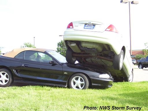
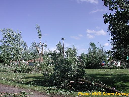
A post storm damage assessment survey team dispatched from the Quad Cities National Weather Service Office has surveyed portions of the damage caused by severe weather on the afternoon of June 1st.
A tornado developed about 1 mile south of Grandview and tracked 16 miles north-northeast through Fruitland and Muscatine.
Pictures (click for larger image)

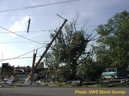
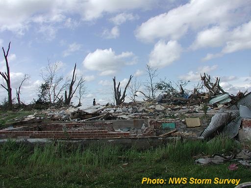
A tornado touched down approximately 3 1/2 miles south of Bellevue and moved north to county road Z15/Springbrook road. The tornado then curved northeast...crossed the Mississippi River and lifted just south of Lock and Dam 12 in Jo Daviess county IL.
LOCATION...BELLEVUE IA AND RURAL JO DAVIESS COUNTY IL
ESTIMATED TIME...220 TO 228 PM
EF-SCALE RATING...EF2
ESTIMATED WIND SPEED...125 TO 130 MPH
PATH WIDTH...35O YARDS
PATH LENGTH...4 MILES.
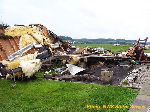
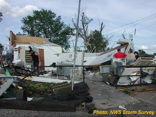
Damage specifics: one mobile home was destroyed. Numerous farms’ outbuildings were destroyed. Trees were snapped and uprooted. Five homes sustained roof and structural damage. There were no injuries reported. Click photo for larger image.