
Scattered thunderstorms with severe gusts, hail and a tornado risk are possible near a cold front from the Ohio Valley to the Mid-Atlantic tonight. Tropical Storm Bertha is expected to bring tropical storm conditions to portions of the Gulf Coast from the panhandle of Florida into Louisiana through Wednesday. Read More >
Quad Cities, IA/IL
Weather Forecast Office
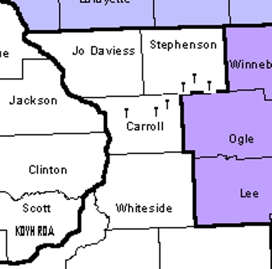
Six tornadoes and one funnel cloud were observed over northwest Illinois (Stephenson and Carroll counties) during the afternoon of June 14, 2003.
 |
|
The location of the tornadoes in northwest Illinois is denoted by a T. The NWS Quad Cities radar is located to the southwest, in the lower left corner. (photo courtesy of NWS) |
The environment on June 14, 2003 is characteristic of landspout events, where instability was moderate and shear was quite weak. A landspout is a tornado that does not arise from organized storm-scale rotation and therefore is not associated with a wall cloud (visually) or a mesocyclone (on radar). Landspouts typically are observed beneath towering cumulus clouds (often as no more than a dust whirl), and essentially are the land-based equivalents of waterspouts.
The landspouts appeared to form with these storms on the lake enhanced boundary, which provided the focus for convective initiation of showers and weak thunderstorms. The slow moving, short-lived tornadoes produced no damage (F0), though they were highly visible to the public since they occured on a Saturday afternoon when many people were outdoors.
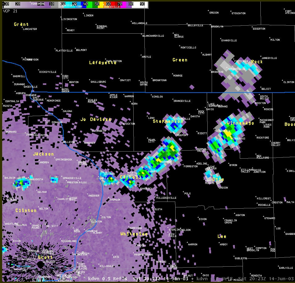 |
| Reflectivity image from NWS Quad Cities, IA/IL at 2023Z showing storms over Stephenson and Carroll counties. (photo courtesy of NWS) |
Hazardous Weather
Watches, Warnings, & Advisories
Briefing
Hazards Page
View Local Storm Reports
Submit Report
Road Reports
Text Products
Forecasts
Fire Weather
Briefing
Hourly Forecast Graphs
Forecast Discussion
User-Defined Area
Activity Planner
Local Forecasts
Space Weather
Text Products
River Graphs
Airport Forecasts
Snow and Ice Probabilities
Winter Storm Severity Index (WSSI)
Current Conditions
Observations
Drought Monitor
Radar
Satellite
Text Products
Rivers and Lakes
River Graphs
Sunrise/Sunset Tables
Seasons (Equinoxes/Solstices)
Road Reports
Past Weather
Recent Observation History
Climate Summaries
Past Events
Climate Normals/Averages
Climate Records
Climate/Almanac Data
Holiday Climatology
Climate Maps
Monthly Climate Stats
Annual Climate Stats
Observation Site History
Sunrise/Sunset Tables
US Dept of Commerce
National Oceanic and Atmospheric Administration
National Weather Service
Quad Cities, IA/IL
9040 N Harrison Street
Davenport Municipal Airport
Davenport, IA 52806-7326
563-386-3976
Comments? Questions? Please Contact Us.

