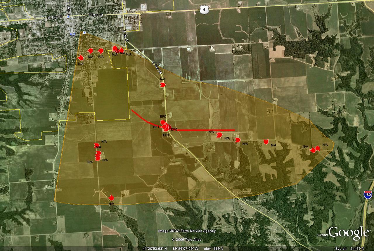
A team from the National Weather Service in the Quad Cities conducted a storm damage survey in Princeton, Illinois on July 26, 2009 to investigate damage from a line of thunderstorms that moved through northwest Illinois on the 24th. It was determined that the majority of the damage was caused by straight line winds, however evidence of a brief tornado was found near Highway 26.
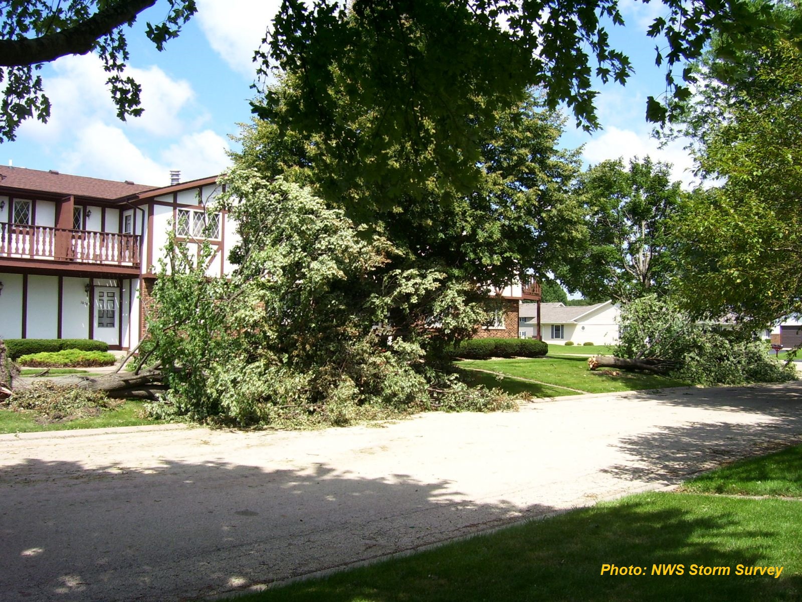
The line of thunderstorms produced damaging winds, with embedded stronger downbursts, with wind speeds between 80 and 95 mph. The wind gusts resulted in widespread tree damage, especially along Thompson Street in the southeast part of town. South of town, on Euclid Avenue, crops were flattened and a barn was blown over, in addition to tree damage. Farther southeast of town more crops were flattened, trees were taken down, and two silos were blown down.
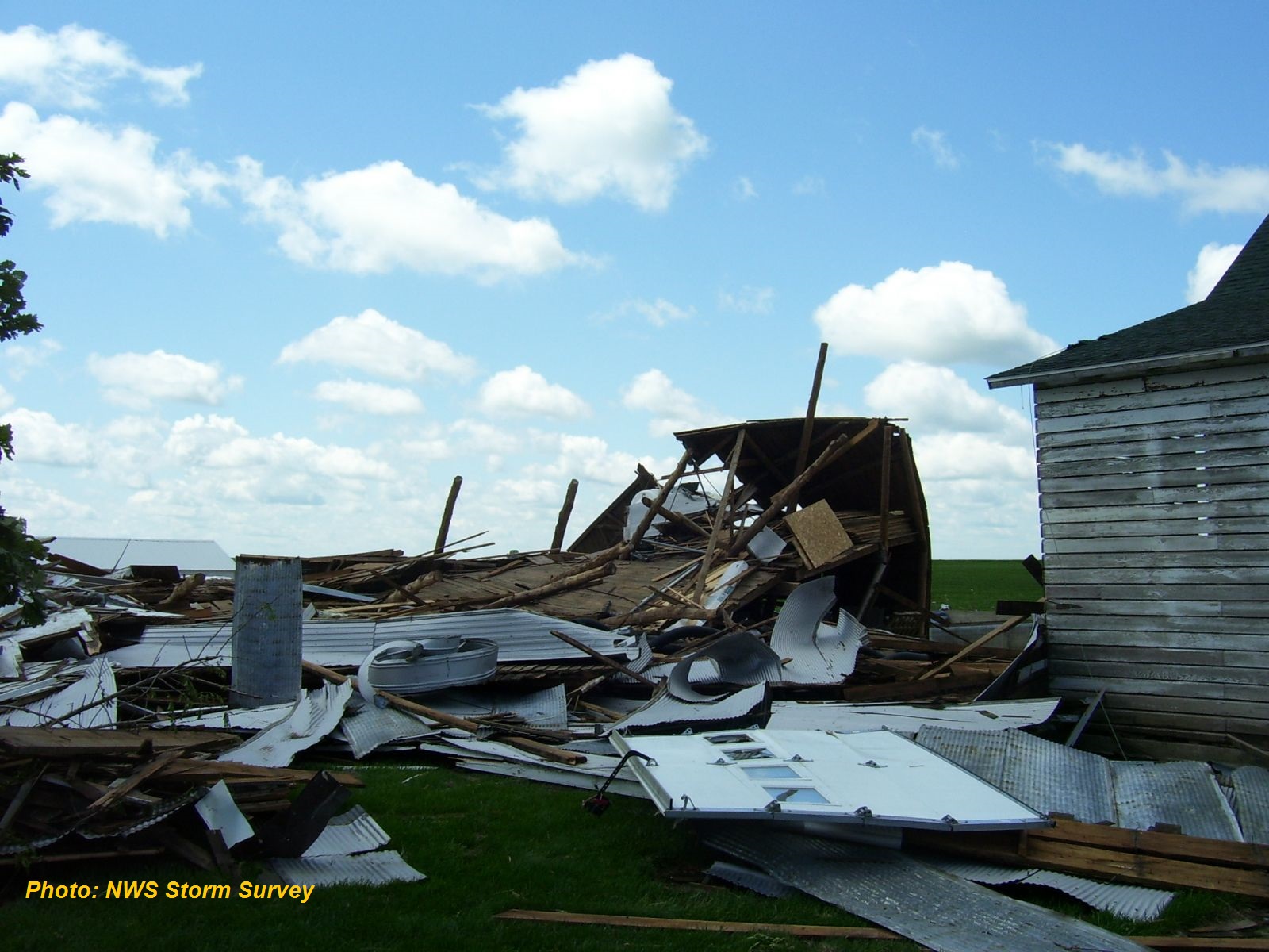
Within the swath of damaging straight line winds, the tornado touched down in a field about 2 miles south southeast of town. Near Highway 26 the tornado damaged a single farmstead. A barn was destroyed, and winds carried the debris in the direction of the house, which sustained damage due to the impact. Vehicles, windows, and the siding of the house were damaged by flying debris, and a two by six board was driven into the side of the garage. Debris was found in an adjacent bean field to the northeast of where the barn stood. A grain bin on the north side of the house, was also destroyed and lofted southeast across Highway 26, taking out powerpoles as it went. A number of trees on the property were also snapped and uprooted. Damage was rated as EF1* (wind estimated at 105 mph) along the damage path. The tornado dissipated 3 miles southeast of town, where a witness sighted a funnel cloud more than halfway to the ground, as it was illuminated by lightning, before it disappeared.
*ENHANCED FUJITA /EF/ SCALE INFORMATION...
PLEASE NOTE THE NUMBERS BELOW ARE APPROXIMATE WIND SPEEDS FOR DAMAGE
CATEGORIES.
EF0... 65 - 85 MPH
EF1... 86 - 110 MPH
EF2... 111 - 135 MPH
EF3... 136 - 165 MPH
EF4... 166 - 200 MPH
EF5... 201 MPH OR GREATER
Tornado path and location of damage. (Tornado path is the red line, straight line wind is in orange. Red arrows indicate the direction of damage at that spot.)
Tree damage on Thompson Street (facing south)
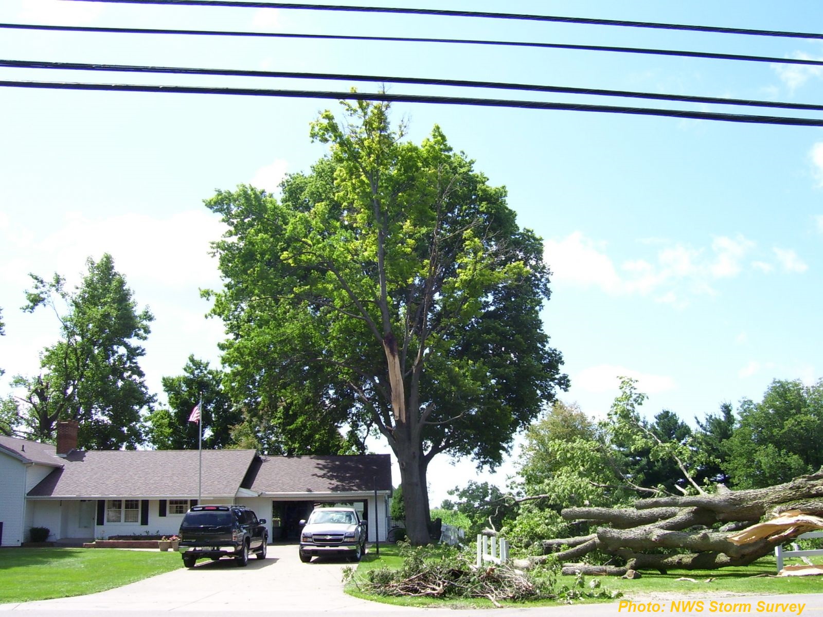
Tree damage on Thompson Street (facing northwest)
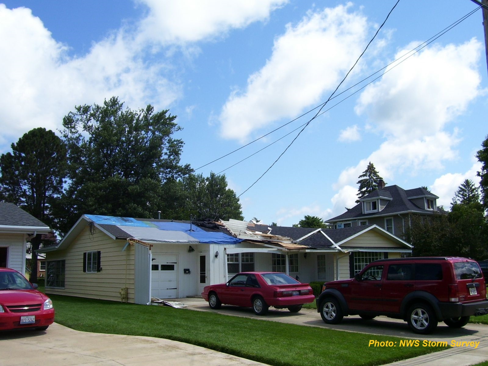
Roof damage on Thompson Street (facing northeast).
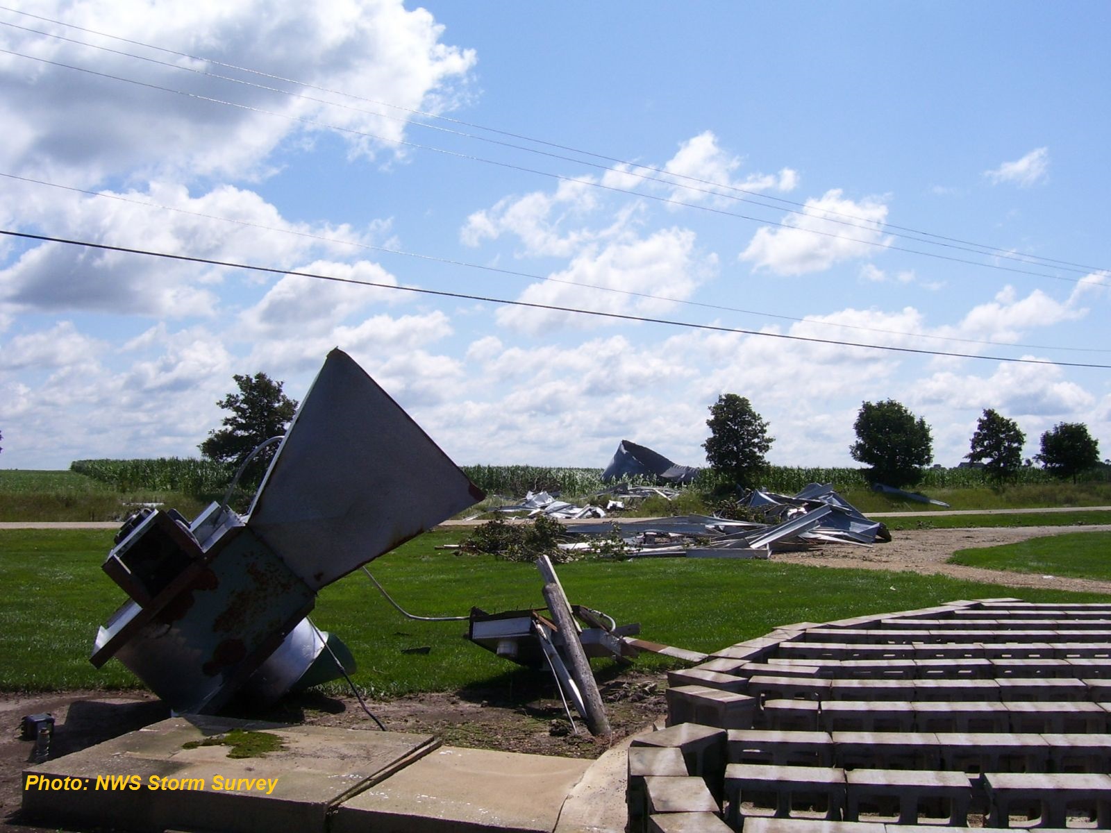
Damage to grain bin at farmstead 2 SE of Princeton (viewed from the original location looking across Highway 26 to the southeast)
Board driven through garage wall (facing northeast)
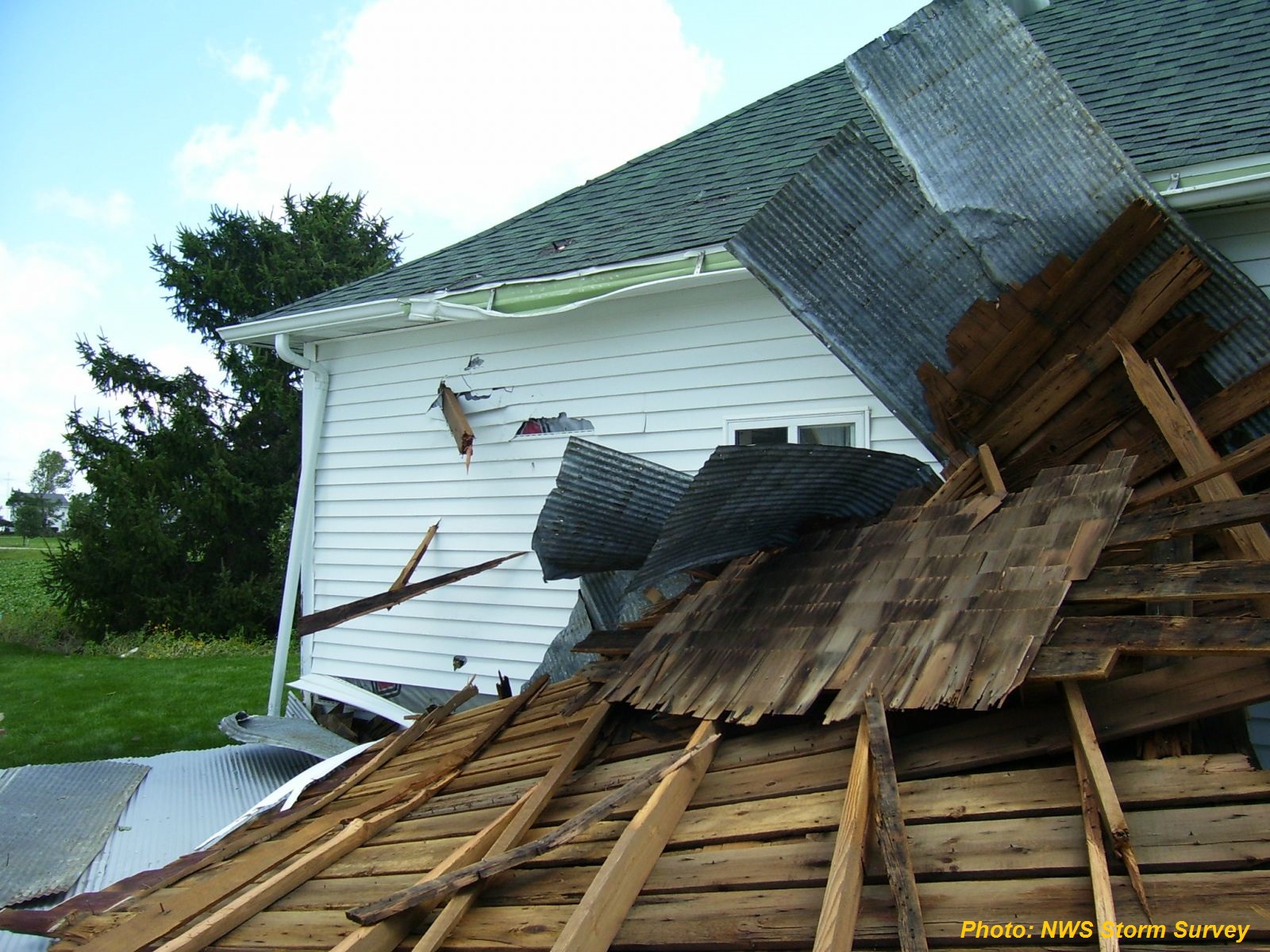
Damage to barn (facing southwest)