This Spring Flood and Water Resources Outlook is for the Quad Cities Hydrologic Service Area (HSA), which covers portions of eastern Iowa, northwest and west central Illinois, and extreme northeast Missouri. This includes the Mississippi River from above Dubuque, Iowa to below Gregory Landing, Missouri and its tributaries. The primary tributary river basins include the Maquoketa, Wapsipinicon, Cedar, Iowa, Skunk, and Des Moines Rivers in Iowa, the Fox River in Missouri, and the Pecatonica, Rock, Green, and La Moine Rivers in Illinois.
Probabalistic Hydrologic Outlook
Use the links below to find the Graphical Probabilities and the Numerical Probabilities respectively.
|
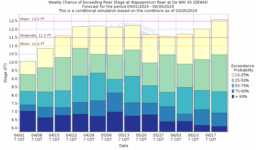
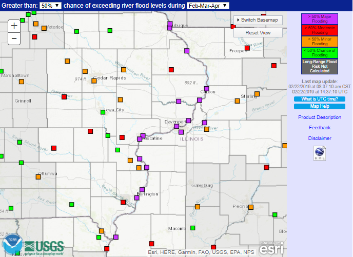
Graphical Hydrologic Outlooks Images below are examples which link to the Wapsipinicon River near DeWitt. Find all other locations in the Quad Cities Hydrologic Service Area in the drop down menu below. |
Statistical Hydrologic Outlook | ||
|
 |
Flood Outlook Overview
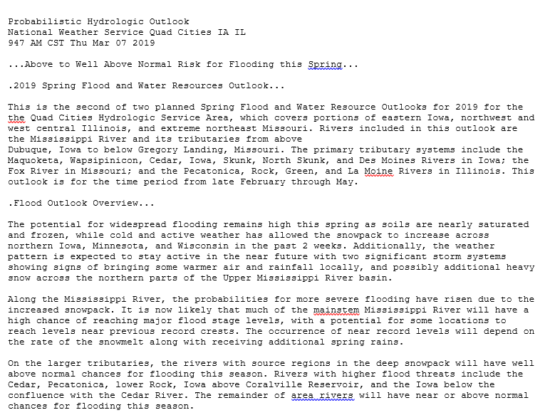
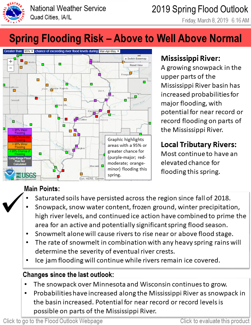
The potential for widespread flooding remains high this spring as soils are nearly saturated and frozen, while cold and active weather has allowed the snowpack to increase across northern Iowa, Minnesota, and Wisconsin in since February 21st. Additionally, the weather pattern is expected to stay active through the middle of March with 2 significant storm systems showing signs of bringing some warmer air and rainfall locally, and possibly additional heavy snow across the northern parts of the Upper Mississippi River basin.
Along the Mississippi river, the probabilities for more severe flooding have risen due to the increased snowpack. It is now likely that much of the mainstem Mississippi River will have a high chance of reaching major flood stage levels, with a potential for some locations to reach levels near previous record crests. The occurrence of near record levels will depend on the rate of the snowmelt, along with receiving additional spring rains.
On the larger tributaries, the rivers with source regions in the deep snowpack will have well above normal chances for flooding this season. Rivers with higher flood threats include the Cedar, Pecatonica, lower Rock, Iowa above Coralville Reservoir, and the Iowa below the confluence with the Cedar River. The remainder of area rivers will have near or above normal chances for flooding this season.
To note: even a gradual snowmelt with little rainfall this spring still assures at least minor flooding for many rivers across the area.
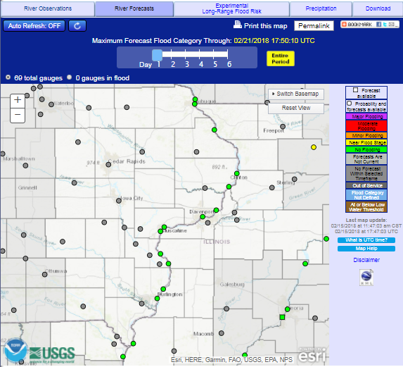
Main Points:Current and Forecast River Conditions - Advanced Hydrologic Prediction Service (AHPS)
 |
 |
|
| Observed Conditions | Forecast Conditions | Long-Range Outlooks |
Flood Category definitions:
Many factors are considered when determining the overall flood risk for the season, with the combination of these influences factoring into the final determination. These factors are discussed in detail below.
Seasonal Precipitation
The winter season ended with total precipitation amounts being above to well above normal across the local area as well as across the entire Upper Mississsippi River basin. A large area from central Iowa into southern Minnesota through northeast Wisconsin had observed total amounts upwards of 200 percent of normal.
Some of the winter precipitation has been rain, but overall, the entire region has also observed above normal snowfall for the season. Portions of the region have received 20 to near 40 inches above normal.
The wet conditions this winter followed a wet autumn season. So overall, conditions across the region have been wetter than normal for much of the past 6 months.
 |
 |
 |
 |
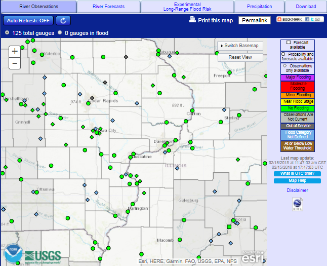
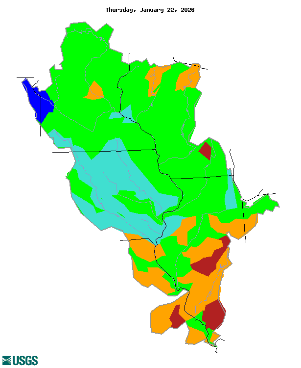
River Conditions
River levels are generally running above normal for this time of year. They have remained at elevated levels since September. The continuation of cold temperatures across the mid-west has kept ice on many area rivers. Ice action has had an impact on river levels and has caused flooding on some rivers through the winter months, helping to keep levels above normal.
|
|
|
 |
 |
 |
| Iowa | Illinois | Missouri |
| Images courtesy of the USGS |
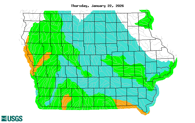
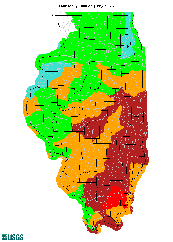
Soil Conditions
Little changes have occurred in soil conditions since late February. Soils across all of Iowa into southern Minnesota, Wisconsin, and northern Illinois are nearly saturated, ranking in the 90th to 99th percentile of soil moisture rankings. The areal extent of the saturated soils is concerning as it would imply excessive amounts of runoff from snowmelt, rainfall, or a combination of the two will impact most rivers in the area, leading to an enhanced threat for flooding.
|
|
| Image courtesy of the NWS Climate Prediction Center |
Snow Cover and Liquid Water Content
The snowpack is extensive across the region, with complete coverage extending from southwest Iowa to southeast Wisconsin and all areas north of that line. Snow depths range from a few inches on the southern edge of the snowpack and quickly increase going north, with the majority of the region measuring amounts in excess of one foot. The deepest snow is currently being observed over northern Wisconsin with amounts over 30 inches. These depths are anywhere from 2 to 24 inches above normal for early March.
The water equivalent in the snowpack is quite impressive, with widepread amounts of 2 to 6 inches of liquid in the snowpack. There are even some locations in the region that exceed 6 inches. Along the southern periphery of the snowpack, liquid water content is generally 1 to 3 inches.
The rate that this snowpack melts will be a primary determination of the severity of flooding that occurs.
|
|
||
|
||
| Images courtesy of the National Operational Hydrologic Remote Sensing Center (NOHRSC) |
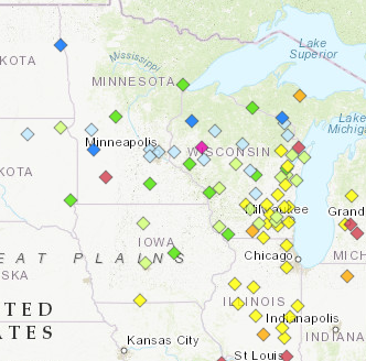
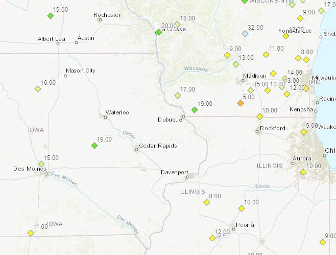
Frost Depth
Frost depths range from 6 to 12 inches from southern Iowa into northeast Illinois, to 3 feet in parts of Minnesota and Wisconsin. The frozen ground across the northern parts of the Upper Mississippi River basin will likely cause high snowmelt and rainfall runoff amounts into the Mississippi River system this spring.
Locally, the frozen ground will play a part to increase runoff and the threat for flooding into tributary rivers and smaller creeks and streams through March.
| Frost Depths - North Central River Forecast Center | |||
|
Ice Jam Flooding
Where rivers are still ice covered, high amounts of runoff from either snowmelt or moderate to heavy rain could cause ice to break-up and form ice jams. Any ice jams will have the potential to cause flooding. This will remain a threat until all area rivers are ice free.
Drought
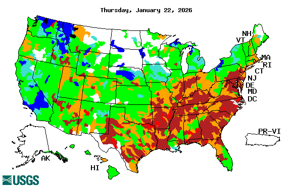
According to the U.S. Drought Monitor, there are no areas in the Midwest under drought conditions.
|
|
| Image courtesy of the US Drought Monitor |
Looking Ahead:
Active weather is expected through the middle of March with the potential for several large storm systems to impact the region with both rain and snow. This could further build up the snowpack in some areas, could promote melting across the southern fringe of the snowpack, and if soils are able to thaw, will further saturate the ground. Looking to the second half of March, a drier weather pattern is favored, with below normal temperatures looking to continue through the remainder of March. Of note, average temperatures rise considerably through the month of March. By the end of the month, normal temperatures for most areas are above freezing. Therefore, a forecast of near normal temperatures will be promoting snowmelt.
The longer into the spring that the snow remains, the higher the potential for a rapid snowmelt. A faster snowmelt will promote an increased chance for a higher degree of flooding.
| 8 to 14 day Temperature Outlook | 8 to 14 day Precipitation Outlook |
 |
 |
|
March Temperature Outlook |
March Precipitation Outlook |
 |
 |
Additional Information can be found here:
River and streamflow information:
Flood safety and flood insurance information:
Precipitation, temperature, and soil moisture information:
Questions or Comments
If you have questions or comments about this spring flood and water resource outlook please contact:
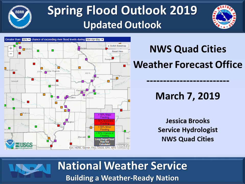
Jessica Brooks
Service Hydrologist
National Weather Service
9050 Harrison St
Davenport, IA 52806
563-391-7094 ext 493
Email: jessica.brooks@noaa.gov


.png)
.png)