A widespread heat wave will peak over the South and East today, with several dozen temperature records expected along the East Coast. Heat should begin to ease this weekend in the Northeast, while hazardous heat continues over the South. Severe thunderstorms capable of damaging winds are possible across parts of the Appalachians, Mid Atlantic, and Northeast this afternoon and evening. Read More >
| Climate/Almanac Data - JUN Normals - JUN Records | ||||||||||||||||||||||||||||||||||||||||||||||||||||||
| JUNE | ||||||||||||||||||||||||||||||||||||||||||||||||||||||
| *(Values Now Compared With New Climate Normals (1991-2020))* | ||||||||||||||||||||||||||||||||||||||||||||||||||||||
|
||||||||||||||||||||||||||||||||||||||||||||||||||||||
| The ranking is listed in parentheses (__) when within the "Top 10". | ||||||||||||||||||||||||||||||||||||||||||||||||||||||
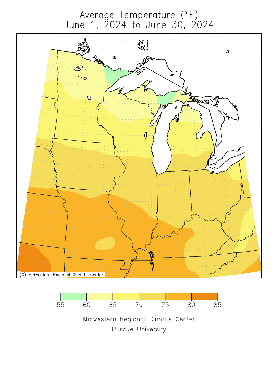
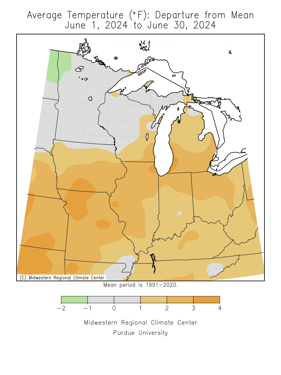
| June 2024 was about 2 to 3 degrees above normal. | ||||||||||||||||||||||||||||||||||||||||||||||||||||||
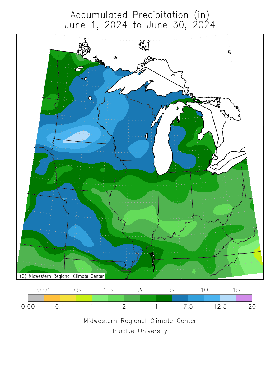
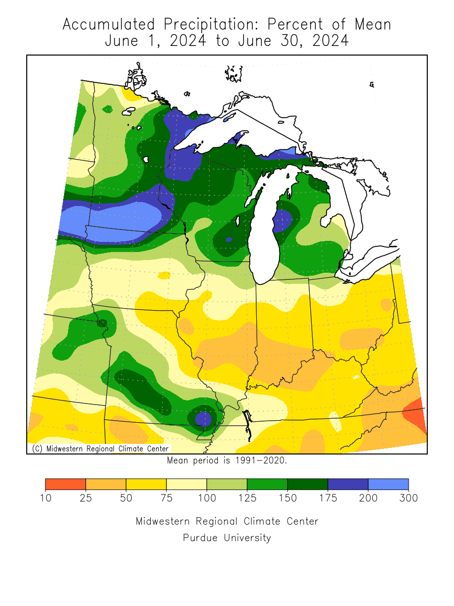
| Precipitation totals were mainly 1 to 2 inches below normal. Precipitation was above normal at Dubuque. | ||||||||||||||||||||||||||||||||||||||||||||||||||||||
| Please see JUN Records for monthly record information. | ||||||||||||||||||||||||||||||||||||||||||||||||||||||
| The climate maps below are courtesy of the Midwest Regional Climate Center. | ||||||||||||||||||||||||||||||||||||||||||||||||||||||
| These maps become available around 10am on the first of the month. | ||||||||||||||||||||||||||||||||||||||||||||||||||||||
|
||||||||||||||||||||||||||||||||||||||||||||||||||||||
| A LOOK AHEAD | ||||||||||||||||||||||||||||||||||||||||||||||||||||||
| Climate Prediction Center | ||||||||||||||||||||||||||||||||||||||||||||||||||||||
|
||||||||||||||||||||||||||||||||||||||||||||||||||||||