Widespread life-threatening flash and urban flooding continues in south-central Texas, with considerable flooding impacts possible across central Texas. Wildfire smoke is impacting air quality across much of the Great Lakes region into southern New England and the Mid-Atlantic. Monsoonal thunderstorms may produce isolated to scattered flash flooding across the Southwest into the Great Basin. Read More >
Overview
|
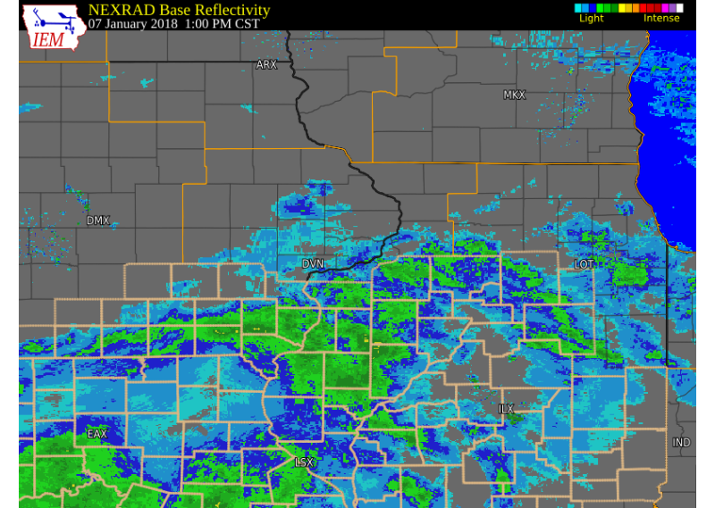
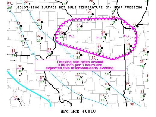
An upper level storm system tracked east across the Great Plains and Midwest Sunday morning, bringing precipitation to much of Missouri, southeast Iowa, west central and northwest Illinois. Freezing rain was the dominant precipitation type, with many areas south of I-80 seeing at least a glaze of ice on area roads and sidewalks. Many accidents were reported to the Iowa and Illinois Department of Transportation and travel was not advised late Sunday morning and early afternoon. Southeast Iowa and west central Illinois saw even higher freezing rain amounts, with ice thicknesses around a tenth of an inch. |
Storm Reports
| Interactive Storm Report Map |
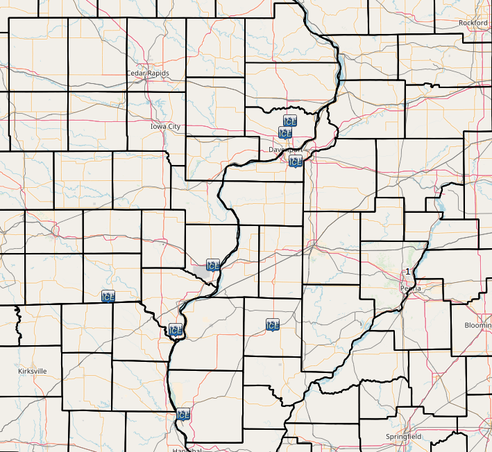 |
PRELIMINARY LOCAL STORM REPORT...SUMMARY
NATIONAL WEATHER SERVICE QUAD CITIES IA IL
915 PM CST SUN JAN 07 2018

..TIME...   ...EVENT...      ...CITY LOCATION...     ...LAT.LON...
..DATE...   ....MAG....      ..COUNTY LOCATION..ST.. ...SOURCE....
            ..REMARKS..

1008 AM     FREEZING RAIN    MACOMB                  40.47N 90.68W
01/07/2018  E0.01 INCH       MCDONOUGH          IL   LAW ENFORCEMENT

            LIGHT ICE GLAZE ON ROADS.

1206 PM     FREEZING RAIN    2 NW BURLINGTON         40.83N 91.15W
01/07/2018  E0.08 INCH       DES MOINES         IA   TRAINED SPOTTER

            ICE THICKNESS OF .08 OF AN INCH ON THE PATIO. LIGHT
            FREEZING RAIN CONTINUES.

1234 PM     FREEZING RAIN    MOLINE QUAD-CITY AIRPOR 41.45N 90.50W
01/07/2018  E0.02 INCH       ROCK ISLAND        IL   OFFICIAL NWS OBS

            GLAZE OF ICE ON MOST SURFACES.

1242 PM     FREEZING RAIN    3 NW KEOKUK             40.44N 91.45W
01/07/2018  E0.02 INCH       LEE                IA   TRAINED SPOTTER

            LIGHT FREEZING RAIN WITH A GLAZE OF ICE ON SIDEWALKS AND
            ROADS.

0339 PM     FREEZING RAIN    5 E CANTRIL             40.64N 91.98W
01/07/2018  E0.10 INCH       VAN BUREN          IA   TRAINED SPOTTER

            A TENTH OF AN INCH OF ICE ACCUMULATION ON EXPOSED
            SURFACES. TEMPERATURES WAS 33 DEGREES WITH SOME FREEZING
            DRIZZLE.

0500 PM     FREEZING RAIN    PARK VIEW               41.69N 90.54W
01/07/2018  E0.00 INCH       SCOTT              IA   NWS EMPLOYEE

            COATING OF ICE ON UNTREATED SURFACES.

0530 PM     FREEZING RAIN    3 NW KEOKUK             40.44N 91.45W
01/07/2018  E0.20 INCH       LEE                IA   TRAINED SPOTTER

            TWO TENTHS OF AN INCH OF ICE ON UNTREATED SURFACES.
            FREEZING RAIN HAS CHANGEED OVER TO A MIX OF SLEET AND
            SNOW. TRANSMISSTION OF THE REPORT WAS DELAYED.
Rain Reports
 |
 |
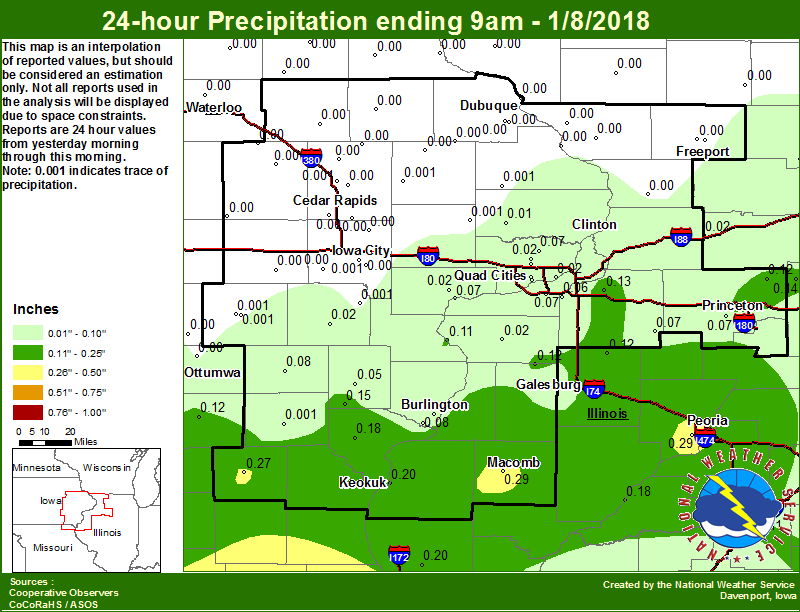
| Figure 1: Local 24-hr Rainfall |
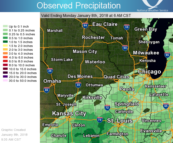
Figure 2: Regional 24-hr Rainfall |
Environment
 |
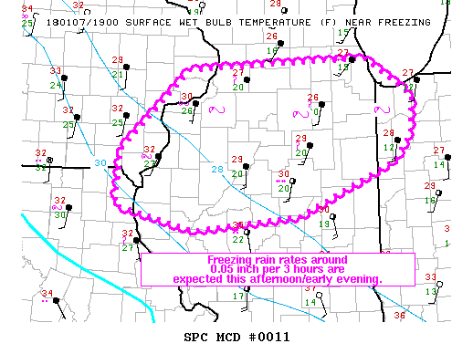 |
| Figure 1: Mesoscale Precipitation Discussion #10 | Figure 2: Mesoscale Precipitaiton Discussion #11 |
 |
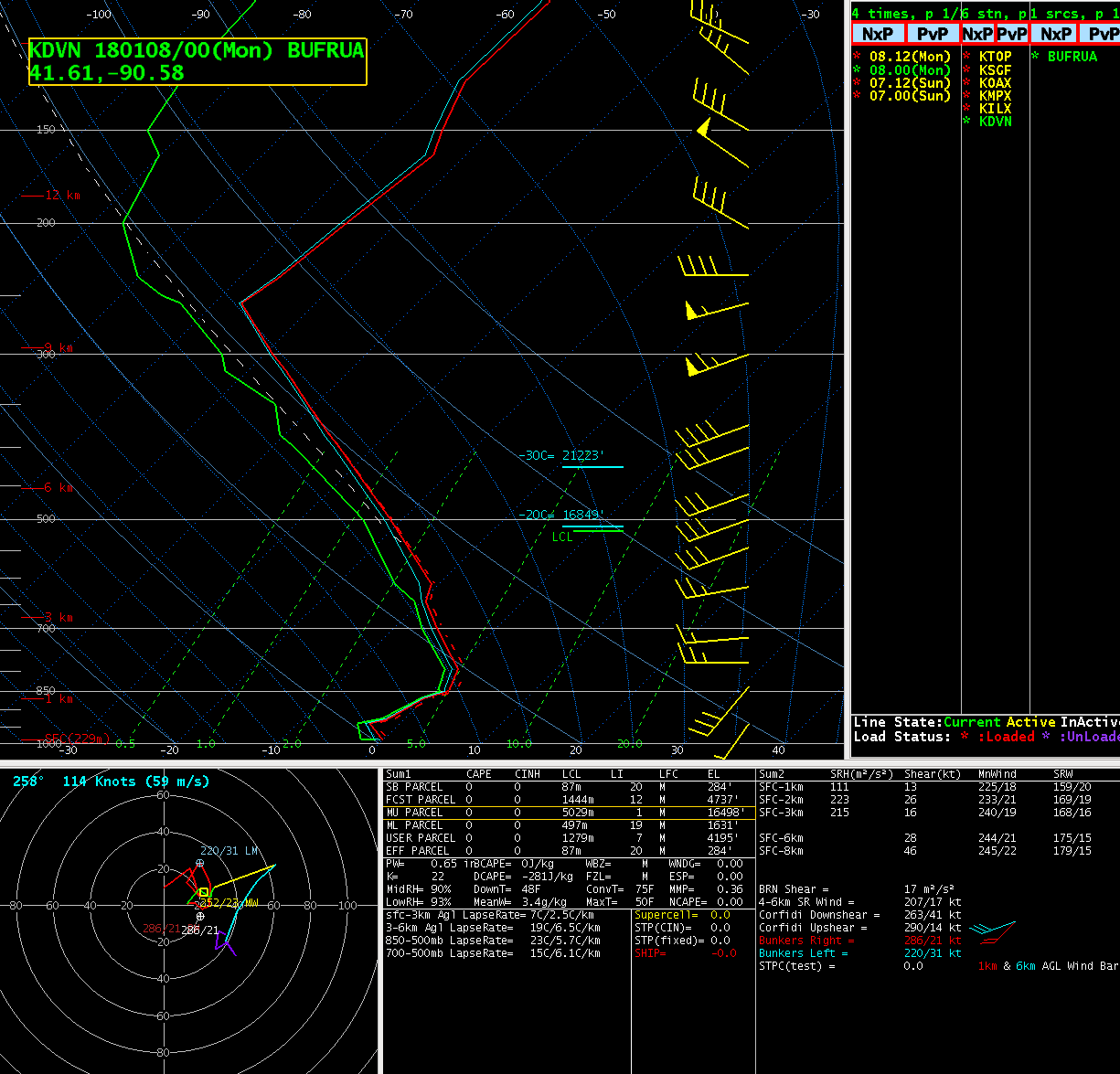 |
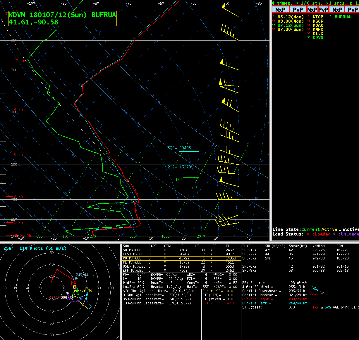
| Figure 3: 12z 1/7/18 DVN Sounding | Figure 4: 00z 1/8/18 DVN Sounding |
 |
Media use of NWS Web News Stories is encouraged! Please acknowledge the NWS as the source of any news information accessed from this site. |
|