Dangerous and extreme heat will remain across portions of the central U.S. this week, persisting across the mid to lower Mississippi Valley, Gulf Coast, southern Plains and portions of Texas. A heat wave over the Southwest U.S. will peak this weekend. Heavy to excessive rainfall may produce flash flooding from the Delmarva Peninsula north into the Hudson Valley today and tonight. Read More >
Overview
|
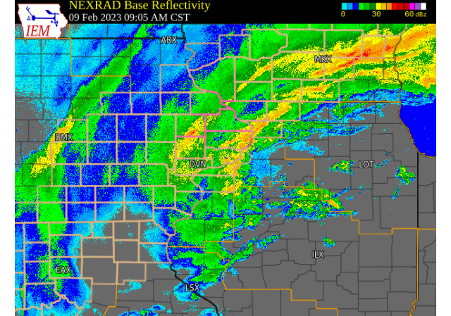
A large low pressure system lifted northeast into northern Illinois Thursday, February 9th bringing some widespread rain of 1 to 2 inches to much of the area and a swath of snow of 1 to 4 inches from north central Missouri into southwest Wisconsin. Higher totals of 5 to 10 inches of snow were seen near Dubuque into southwest Wisconsin. NWS Official Totals
|
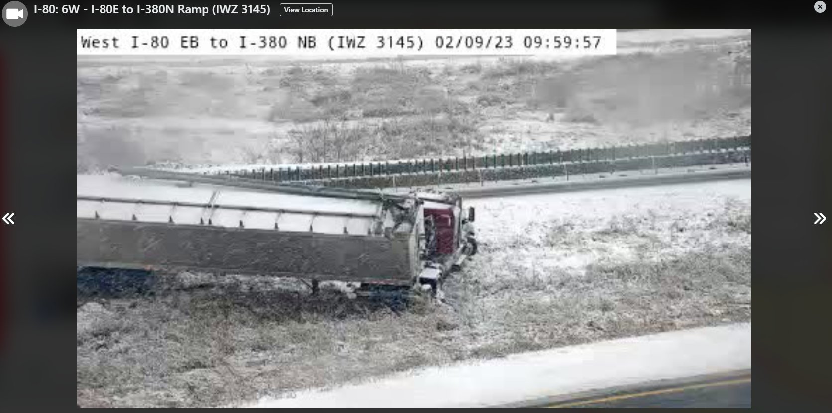 10 AM 2/9/23 - West I-80 EB to I-380 NB - IA DOT |
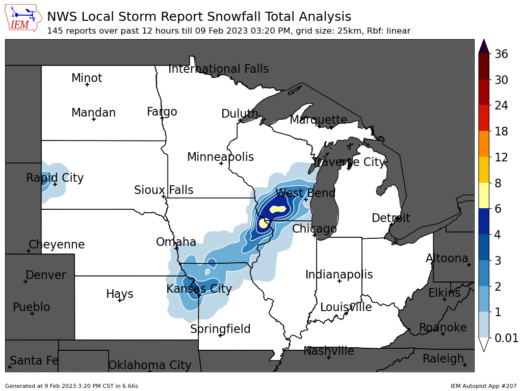
Snow and Rain Maps
| Regional Snow Map (courtesy IEM) |
Rain Map 24 hrs from 8am 2/8 to 8am 2/9 |
|
 |
 |
|
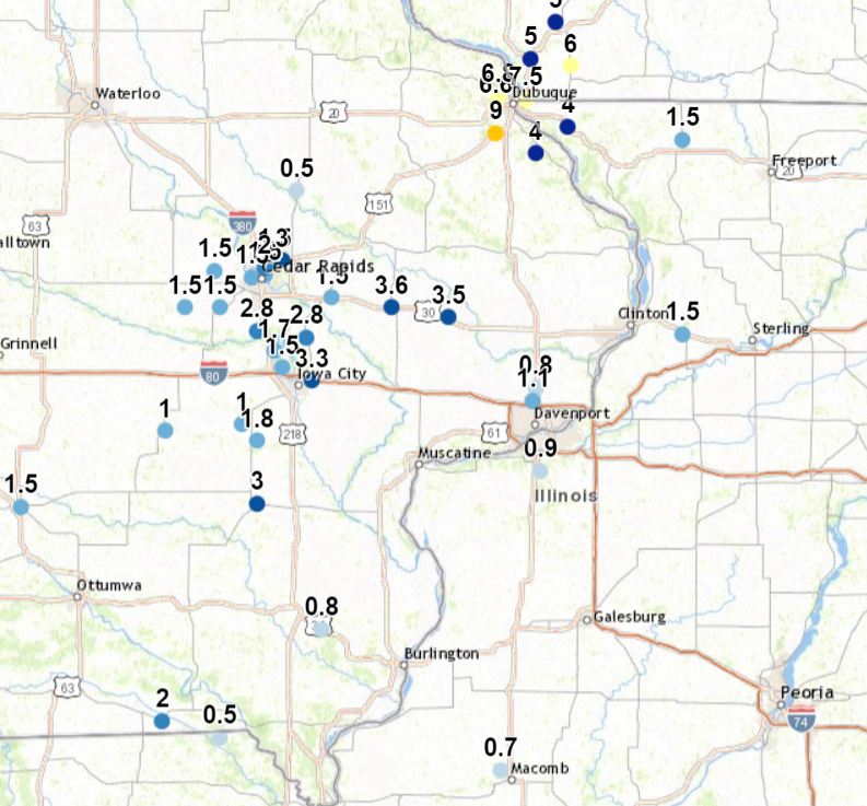
Storm Reports
| Storm Reports Map Courtesy IEM |
|
|
|
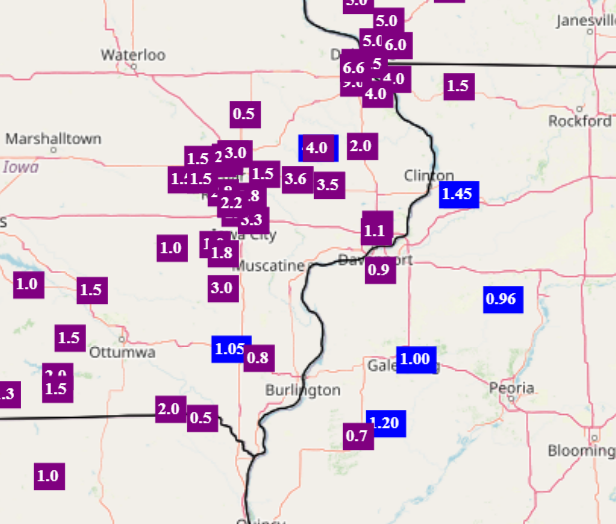 |
THE REPORTS BELOW ARE SEPARATED INTO SNOW...AND ICE AND SLEET CATEGORIES...THEN BY AMOUNT...AND ARE NOT NECESSARILY THE FINAL AMOUNT FOR EACH LOCATION. SNOW REPORTS LISTED BY AMOUNT INCHES LOCATION ST COUNTY TIME ------ ----------------------- -- -------------- ------- 9.4 1 NW DUBUQUE REGIONAL A IA DUBUQUE 0600 PM 7.5 2 ENE EAST DUBUQUE IL JO DAVIESS 0130 PM 7.5 1 WNW DUBUQUE IA DUBUQUE 0330 PM 6.8 2 WNW DUBUQUE IA DUBUQUE 0100 PM 6.6 1 NW CENTER GROVE IA DUBUQUE 0237 PM 4.0 1 NW GALENA IL JO DAVIESS 0140 PM 4.0 2 SW SAINT DONATUS IA JACKSON 0245 PM 4.0 WYOMING IA JONES 0325 PM 3.6 STANWOOD IA CEDAR 1253 PM 3.6 3 SSW CENTER JUNCTION IA JONES 0350 PM 3.5 LOWDEN IA CEDAR 1215 PM 3.3 4 ENE IOWA CITY IA JOHNSON 0235 PM 3.0 WASHINGTON IA WASHINGTON 1113 AM 3.0 MARION IA LINN 1219 PM 2.8 1 WNW COU FALLS IA JOHNSON 1004 AM 2.8 SOLON IA JOHNSON 1213 PM 2.8 LISBON IA LINN 0155 PM 2.5 3 N STOCKTON IL JO DAVIESS 0530 PM 2.4 1 WNW COU FALLS IA JOHNSON 0307 PM 2.4 2 SE GALENA TERRITORY IL JO DAVIESS 0435 PM 2.3 1 ENE MOUNT VERNON IA LINN 0713 PM 2.2 2 NNW NORTH LIBERTY IA JOHNSON 0315 PM 2.0 3 NNE CEDAR RAPIDS IA LINN 1015 AM 2.0 CANTRIL IA VAN BUREN 1100 AM 2.0 1 NW MAQUOKETA IA JACKSON 0312 PM 2.0 2 SSE SCHAPVILLE IL JO DAVIESS 0400 PM 1.8 KALONA IA WASHINGTON 1150 AM 1.5 ATKINS IA BENTON 1001 AM 1.5 WALFORD IA BENTON 1008 AM 1.5 3 NNE STOCKTON IL JO DAVIESS 1134 AM 1.2 DAVENPORT AIRPORT IA SCOTT 0600 PM 1.1 3 SW QUAD CITY AIRPORT IL ROCK ISLAND 0600 PM 1.0 3 ENE CHARLIE HEATH MEM MO CLARK 0800 PM 0.7 2 NW MACOMB IL MCDONOUGH 1043 AM 0.3 1 SSW COAL VALLEY IL ROCK ISLAND 0439 PM |
|
 |
Media use of NWS Web News Stories is encouraged! Please acknowledge the NWS as the source of any news information accessed from this site. |
|