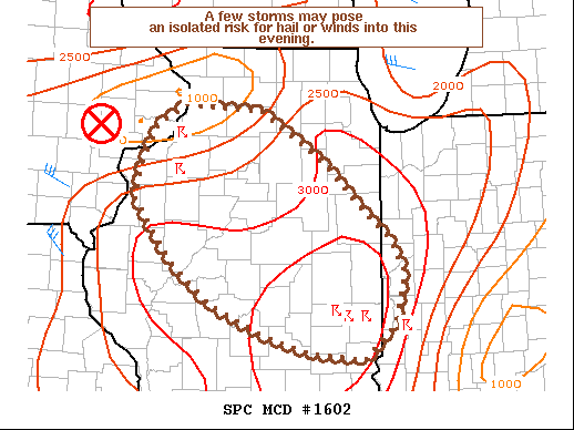
Scattered thunderstorms with severe gusts, hail and a tornado risk are possible near a cold front from the Ohio Valley to the Mid-Atlantic tonight. Tropical Storm Bertha is expected to bring tropical storm conditions to portions of the Gulf Coast from the panhandle of Florida into Louisiana through Wednesday. Read More >
Overview
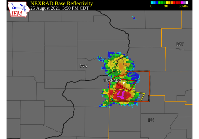
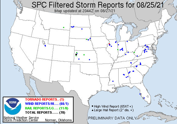
A few severe thunderstorms developed during the mid afternoon hours of August 25. A landspout was witnessed by law enforcement briefly touching down in a field southwest of Geneseo, IL around 3:40 PM CDT. Further to the south, a severe thunderstorm produced large hail and damaging winds. Hail at least golf ball sized was reported and severe wind gusts around 60 MPH resulted in damage to tree limbs, power lines, and shingles.Tornadoes:
|
Tornado - 4 ENE MORRISTOWN, IL
Track Map 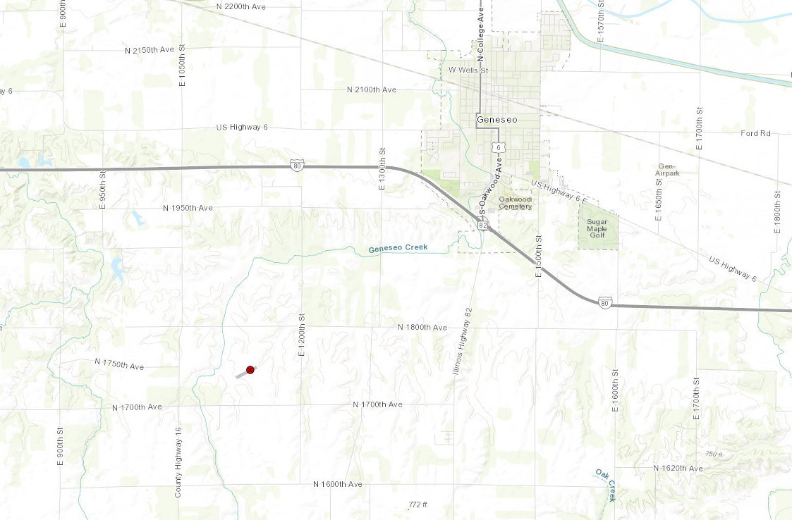 
|
||||||||||||||||
The Enhanced Fujita (EF) Scale classifies tornadoes into the following categories:
| EF0 Weak 65-85 mph |
EF1 Moderate 86-110 mph |
EF2 Significant 111-135 mph |
EF3 Severe 136-165 mph |
EF4 Extreme 166-200 mph |
EF5 Catastrophic 200+ mph |
 |
|||||
 |
|
PRELIMINARY LOCAL STORM REPORT...SUMMARY ..TIME... ...EVENT... ...CITY LOCATION... ...LAT.LON... 0340 PM TORNADO 4 ENE MORRISTOWN 41.41N 90.23W CORRECTS PREVIOUS TORNADO REPORT FROM 4 ENE 0412 PM HAIL 3 W GALVA 41.16N 90.09W
0415 PM TSTM WND DMG BISHOP HILL 41.20N 90.12W EM REPORTS NUMEROUS TREE LIMBS DOWN ACROSS 0428 PM TSTM WND GST 1 NNE NEKOMA 41.18N 90.18W ESTIMATED 60 MPH WIND GUST JUST NORTH OF |
Rain Reports
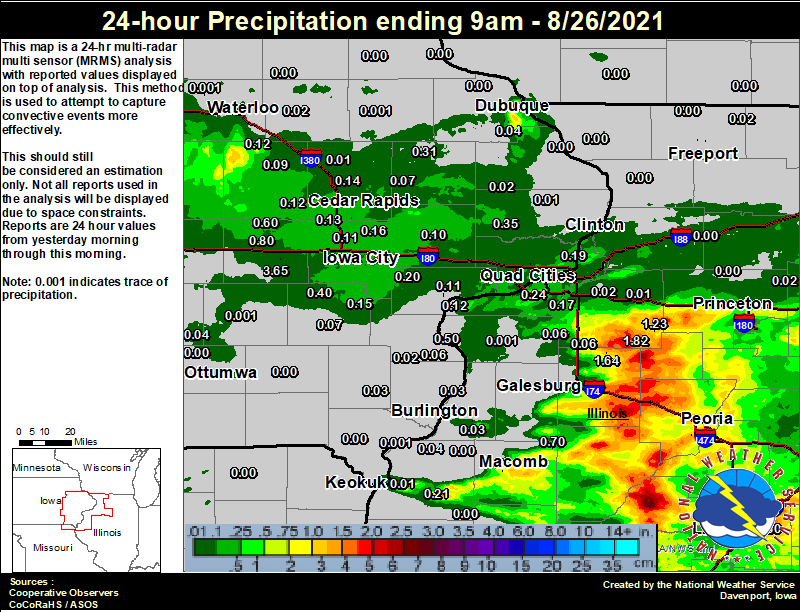 |
24 hour precipitation reports (in Inches),
for eastern Iowa, northwest and west central Illinois, and northeast Missouri. Reported between Midnight and 9 AM, Thursday August 26, 2021. ....IOWA.... Toledo 3 N 0.93 Marengo 2.6 SSW 0.80 Marengo 0.69 Marengo 3.6 N 0.60 Wellman 4.0 E 0.40 Calamus 2.0 NE 0.35 Monticello 1 E 0.31 West Liberty 0.7 NNW 0.20 Ely 0.5 SE 0.19 Le Claire 1.8 NNE 0.19 Rathbun Reservoir 2 N 0.18 Iowa City 0.18 Solon 0.3 ESE 0.16 Centerville 0 NE 0.15 Ainsworth 7.4 N 0.15 Muscatine 1.4 N 0.15 Marion 1.7 NNW 0.14 Davenport 0.9 WNW 0.13 Cedar Rapids Arpt 0.13 Williamsburg 0.13 Marshalltown ASOS 4 N 0.13 Fairfax 4.0 NW 0.12 Beaconsfield 1 NNE 0.12 Muscatine 2.1 N 0.12 Mount Auburn 2.2 NNW 0.12 Muscatine 2N 0.11 Iowa City Arpt 0.11 North Liberty 0.7 SSW 0.11 Center Point 0.6 NNW 0.10 Tipton 0.7 N 0.10 Vinton 0.09 Oskaloosa 1 NNW 0.09 Anamosa 3 SSW 0.07 Washington 0.07 Pella AWOS 2 WSW 0.07 Wapello 5.4 SE 0.06 Marshalltown 1 NW 0.05 Oskaloosa AWOS 9 ESE 0.04 Dubuque Arpt 0.04 New London 1.5 SW 0.03 Davenport Arpt 0.03 Maquoketa 0.02 Camanche 1.2 W 0.02 Independence 0.9 WNW 0.02 Pella 4 N 0.02 Morning Sun 1.7 E 0.02 Burlington Arpt 0.02 Grinnell AWOS 2 SSW 0.02 Central City 6.7 W 0.01 Asbury 0.4 SW 0.01 Charlotte 1.9 WNW 0.01 Keokuk LD19 0.01 Dubuque #3 7 SW 0.01 Manchester 0.00 NWS Johnston* 5 NNW 0.00 Fort Madison 0.9 NE 0.00 Waterloo ASOS 5 NW 0.00 Sigourney 0.00 Bellevue LD12 0.00 Mason City ASOS 6 W 0.00 Dubuque LD11 0.00 Mason City 1 NNE 0.00 Rickardsville 0.2 W 0.00 Elkader 6SSW 0.00 Le Claire LD14 0.00 Ottumwa ASOS 6 NNW 0.00 Oelwein AWOS 0.00 Boone 1 SSW 0.00 Donnellson 0.00 Fayette 1 NW 0.00 Perry 0 W 0.00 Hampton 1 N 0.00 Guttenberg Dam 10 0.00 Fairfield 0.00 ....ILLINOIS.... Galva 2.7 NE 1.82 Altona 1.64 Peoria ASOS 1.36 Kewanee 1 E 1.23 Joliet 0.94 Streator 3 SE 0.92 St Anne 0.81 Prairie City 2S 0.70 Lincoln NWS 0.60 New Boston LD17 0.50 Romeoville 0.40 Princeton 1.1 SE 0.37 Princeton 0.37 Ottawa 4 SW 0.35 Colchester 3.5 NE 0.33 Tuscola 0.33 Moline 0.7 NNE 0.28 Minonk 0.25 Quad City Arpt 0.24 Bentley 0.21 Bloomington Airport 0.20 Coal Valley 1.9 SE 0.17 Windsor 0.12 Ill. City LD16 3 WNW 0.12 Decatur Airport 0.09 Jacksonville 2E 0.08 Coal Valley 2.6 E 0.07 New Windsor 2.0 N 0.06 Woodhull 0.3 ESE 0.06 Alpha 2.3 N 0.05 Dallas City 3.0 SSE 0.04 Gladstone LD18 0.03 Ogden 0.03 Stronghurst 0.4 SSW 0.03 Geneseo 2.0 NW 0.02 Davis 0.5 N 0.02 Paw Paw 1 E 0.02 Mendota 2 SE 0.02 Atkinson 2.6 NNE 0.01 Jacksonville AWOS 0.01 Aledo 0.00 Steward 0.00 Rockford ASOS 0.00 Mundelein 0.00 Mount Carroll 0.00 La Harpe 0.00 Rock Falls 0.00 Galesburg 0.00 Rochelle AWOS 0.00 Fulton LD13 0.00 Augusta 0.00 Freeport 0.00 Freeport 1.7 NW 0.00 Quincy ASOS 0.00 Elizabeth 0.00 Winslow 4.3 ESE 0.00 Walnut 5.3 ENE 0.00 ....MISSOURI.... Chillicothe 2 NW 0.16 Columbia 0.00 Memphis 0.00 Kirksville ASOS 0.00 ....WISCONSIN.... Prairie du Chien AWOS 0.00 Delavan-1 W-WWTP 1 W 0.00 Sullivan-NWS 2 SE 0.00 Brodhead 1 SW 0.00 Watertown-AWOS 0.00 Madison-ASOS 0.00 Beloit-College 0.00 Viroqua 0.00 Steuben 4SE 3 NE 0.00 La Crosse WFO 0.00 Darlington 0.00 Whitewater 0.00 ....MINNESOTA.... Preston 0.00 |
 |
Media use of NWS Web News Stories is encouraged! Please acknowledge the NWS as the source of any news information accessed from this site. |
|