Event Summary: November 10, 2020
|
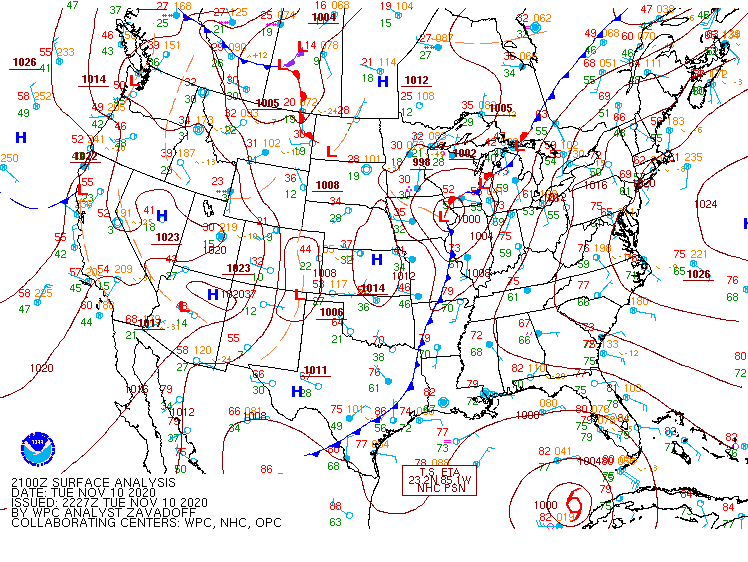
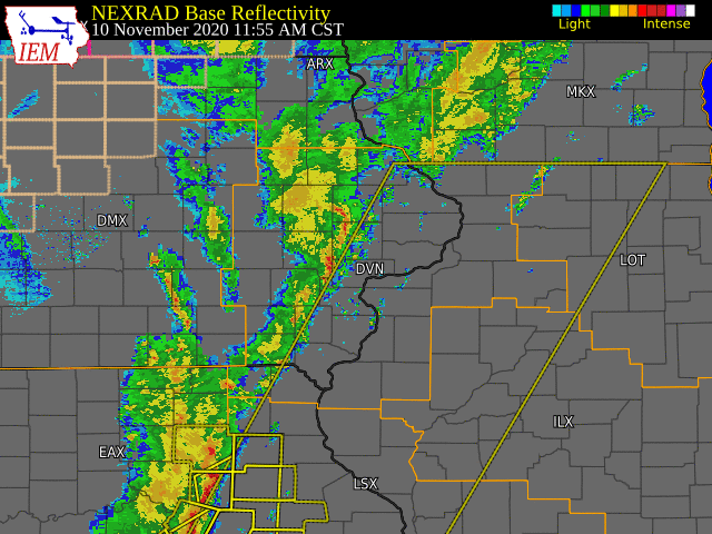
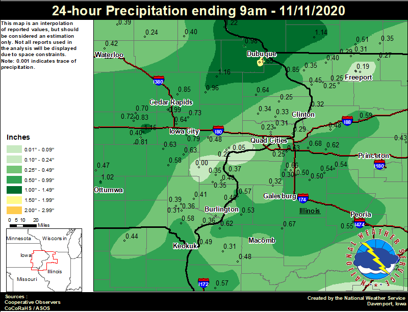
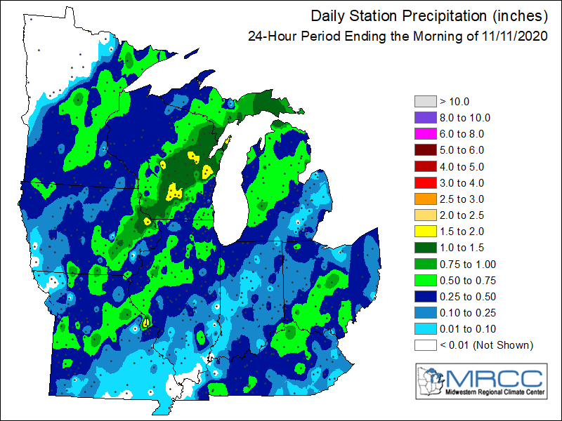
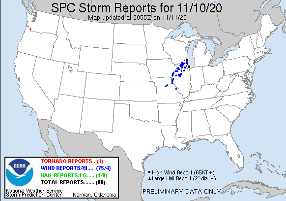
On November 10, 2020, a strong and quick moving cold front made its way through the Midwest. The environment ahead of the cold front was unseasonably warm, with temperatures in the upper 60s and temperatures in the 40s not far behind the front. This lead to strong baroclinicty along the front, and subsequent convection with just the right amount of instability. This is considered a high shear low CAPE (HSLC) event, where organized severe thunderstorms are favored in this environment. Potential hazards are damaging winds, large hail, and tornadoes. Two tornadoes have been confirmed at this time with surveys continuing, several wind reports were received (ranging between 50-60 mph, with a few gusts >60 mph). Damage reports ranged from structural damage to tree damage. Many residents were left without power in parts of northwestern IL, leading to some schools canceling class on the 11th. Besides the strong winds, a few severe hail reports were received. In addition, heavy rain occurred with some of the stronger storms, leading to rainfall totals over an inch. For how dry it has been, flash flooding was not much of a concern. While the environment was very moist and favorable for heavy rainfall, the fast storm motions led to little accumulation through much of our forecast area. |
|
Tornadoes:
|
Tornado 1 - 2 SW Joy, Illinois
Track Map 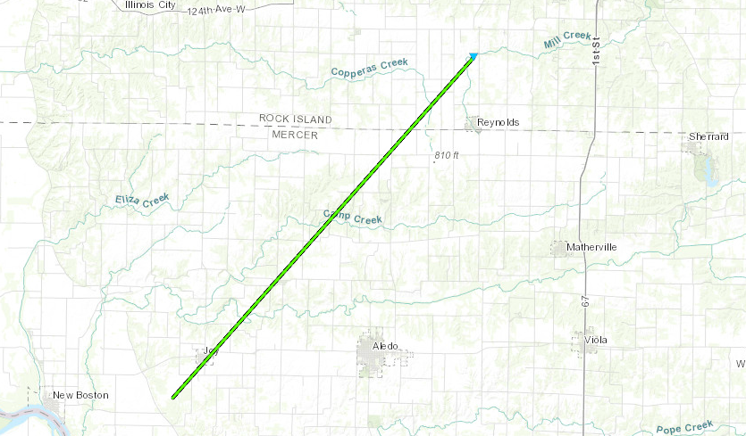  |
||||||||||||||||
|
Tornado 2 - 2 W Burgess, Illinois
Track Map 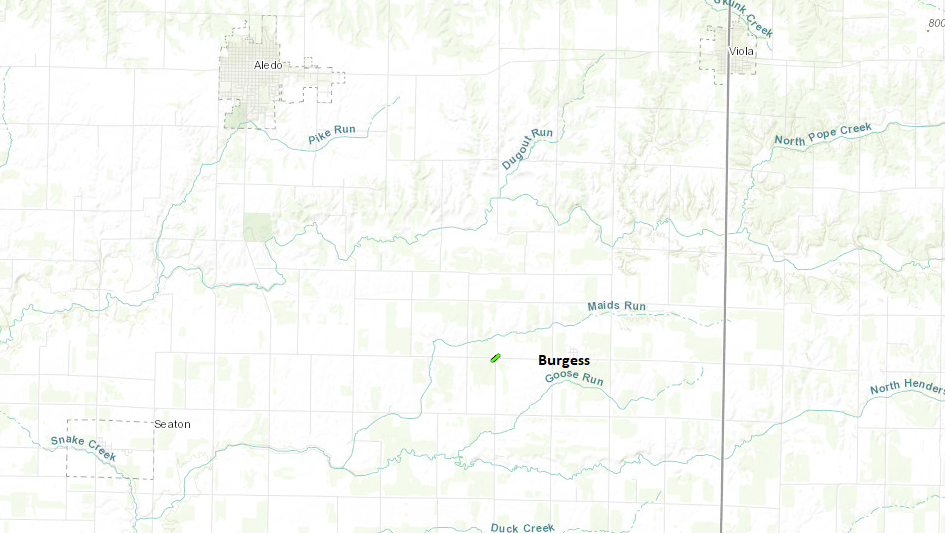 |
||||||||||||||||
|
Tornado 3 - 2 SSE Albany, Illinois
Track Map 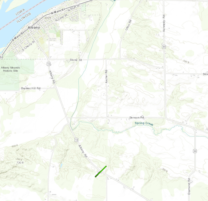 |
||||||||||||||||
|
Tornado 4 - 2 W Malvern, Illinois
Track Map 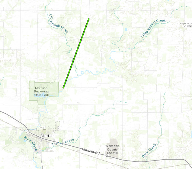 |
||||||||||||||||
|
Tornado 5 - 2 E Round Grove, Illinois
Track Map 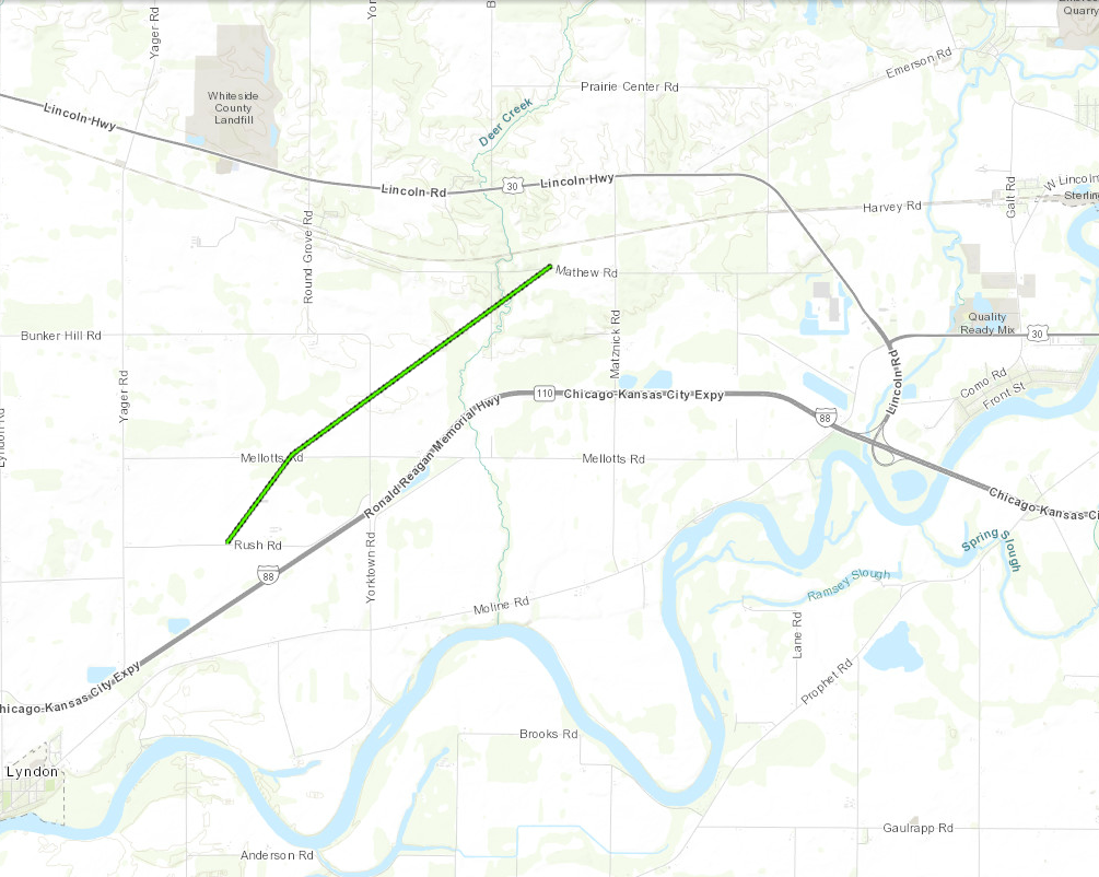 |
||||||||||||||||
|
Tornado 6 - 2 WSW Atkinson, Illinois
Track Map 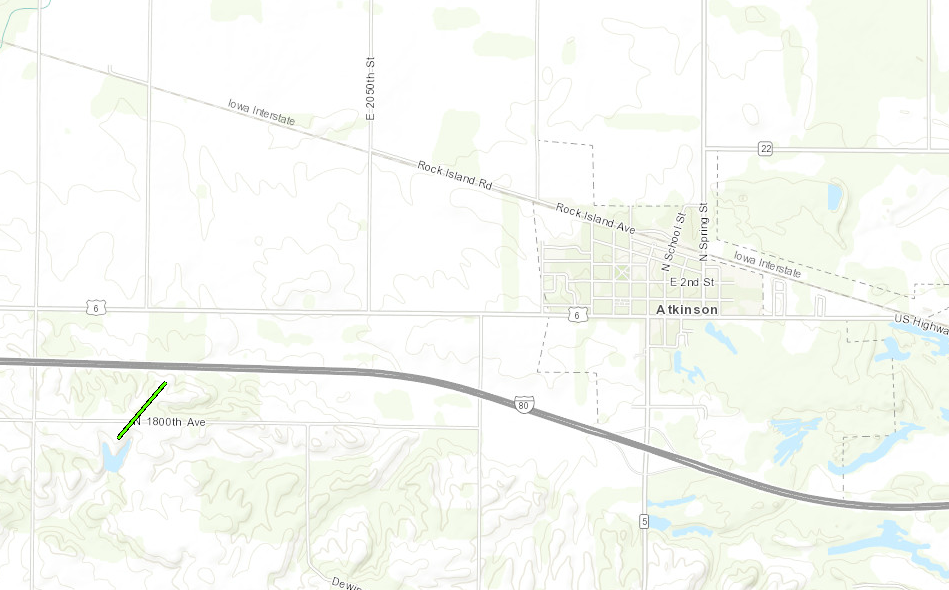 |
||||||||||||||||
The Enhanced Fujita (EF) Scale classifies tornadoes into the following categories:
| EF0 Weak 65-85 mph |
EF1 Moderate 86-110 mph |
EF2 Significant 111-135 mph |
EF3 Severe 136-165 mph |
EF4 Extreme 166-200 mph |
EF5 Catastrophic 200+ mph |
 |
|||||
Photos
EmfQqGaW8AEsbUy(1).jpg) |
 |
 |
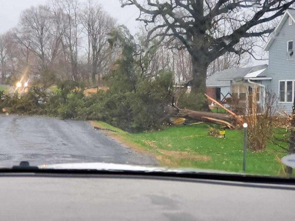 |
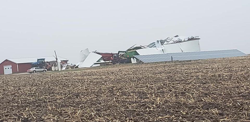
| Roof Blown Off Outbuilding South of Cathage, IL (Photo credit to Doug Campbell) | Cattle Shed Blown Off By the Strong Winds near Lyndon, IL (Photo credit to Ian Frank) | Machine Shed Flattened North of Lyndon, IL (Photo credit to Beau Wetzell) | Tree Blown Down North of Lyndon, IL (Photo credit to Ian Frank) |
Storm Reports
| SPC Storm Reports | |
 |
|
|
Area Rainfall Amounts
|
24-hr Local Rainfall Map |
24-hr Regional Rainfall Map |
24 hour precipitation reports (in Inches), for eastern Iowa, northwest and west central Illinois, and northeast Missouri. Reported between Midnight and 9 AM, Wednesday November 11, 2020. ....IOWA.... Dubuque Arpt 1.65 Dubuque LD11 1.40 Guttenberg Dam 10 1.22 Monticello 1 E 1.16 Williamsburg 1.15 Ottumwa ASOS 1.02 Asbury 0.4 SW 1.00 Cedar Rapids Arpt 0.99 Rickardsville 0.2 W 0.98 Anamosa 3 SSW 0.96 Bellevue LD12 0.85 Marion 1.7 NNW 0.85 Marengo 0.83 Centerville 0 NE 0.82 North English 0.81 Iowa City 0.79 Iowa City Arpt 0.77 Coralville 1.4 S 0.74 Solon 0.3 ESE 0.73 Oskaloosa 1 NNW 0.72 Marengo 2.6 SSW 0.72 Marengo 3.6 N 0.70 Maquoketa 0.64 North Liberty 0.7 SSW 0.64 Ainsworth 7.4 N 0.63 Wellman 4.0 E 0.63 Washington 0.58 Pella 4 N 0.58 Donnellson 0.58 Marshalltown ASOS 0.55 Marshalltown 1 NW 0.54 Newton 1 NE 0.54 Riverdale 0.5 N 0.51 Keokuk LD19 0.49 West Liberty 0.7 NNW 0.48 Oskaloosa AWOS 0.47 Waukon 3N 0.46 Waterloo ASOS 0.42 New London 1.5 SW 0.41 Grinnell AWOS 0.40 Wapello 5.4 SE 0.40 Fayette 1 NW 0.40 Parnell 0.1 SSW 0.40 Strawberry Point 0.40 Salem 3.1 ESE 0.39 Tripoli 0 N 0.39 West Point 7.5 NW 0.36 Fort Madison 0.9 NE 0.36 Burlington 6.5 SSW 0.35 Wapello 0.2 S 0.35 Morning Sun 1.7 E 0.35 Calamus 2.0 NE 0.34 Davenport 2.9 W 0.33 Davenport 0.9 WNW 0.33 De Witt 0.33 NWS Johnston* 5 NNW 0.32 Burlington Arpt 0.32 Salem 1S 0.31 Park View 0.2 WSW 0.31 Le Claire 1.8 NNE 0.29 Perry 0 W 0.29 Camanche 1.2 W 0.28 Mason City ASOS 0.28 Boone 1 SSW 0.28 Muscatine 2N 0.26 Charlotte 1.9 WNW 0.25 Davenport Arpt 0.24 Oelwein AWOS 0.24 Eldridge 0.7 SSW 0.23 Muscatine 2.1 N 0.22 Hampton 1 N 0.20 Pella AWOS 0.05 Columbus Jct 2 SSW 0.00 ....ILLINOIS.... Geneseo 2.0 NW 0.68 Prairie City 2S 0.67 New Windsor 2.0 N 0.66 Galesburg 0.65 Coal Valley 1.9 SE 0.63 Atkinson 2.6 NNE 0.62 Dallas City 3.0 SSE 0.62 Rock Falls 0.59 Galesburg Arpt 0.57 Oquawka 0.5 N 0.57 Quincy ASOS 0.57 Peoria ASOS 0.55 Galva 2.7 NE 0.54 Kewanee 1 E 0.54 Mundelein 0.53 Ottawa 4 SW 0.53 Romeoville 0.53 Stronghurst 0.4 SSW 0.53 Joliet 0.51 Colchester 3.5 NE 0.50 Woodhull 0.3 ESE 0.50 Altona 0.50 Minonk 0.49 Prophetstown 0.2 SW 0.48 Augusta 0.48 Rockford ASOS 0.45 Savanna 4.6 N 0.45 Mendota 2 SE 0.43 Bloomington Airport 0.43 Macomb 0.42 Steward 0.41 Gladstone LD18 0.40 Stockton 3.4 NNE 0.40 Princeton 0.39 St Anne 0.39 Princeton 1.1 SE 0.39 Rochelle AWOS 0.38 New Boston LD17 0.37 Elizabeth 0.35 Jacksonville AWOS 0.33 Fulton LD13 0.32 Alexis 1 SW 0.32 Lincoln NWS 0.32 Bentley 0.31 Orangeville 2.8 NW 0.31 Alpha 2.3 N 0.30 Winslow 4.3 ESE 0.29 Davis 0.5 N 0.27 Quad City Arpt 0.25 Mount Carroll 6.8 NNW 0.25 Lanark 5.3 N 0.25 Freeport 1.7 NW 0.22 Decatur Airport 0.21 Freeport 2.0 NW 0.19 Tuscola 0.18 Ogden 0.17 Freeport 0.13 Windsor 0.09 Ill. City LD16 3 WNW 0.05 Jacksonville 2E 0.04 ....MISSOURI.... Chillicothe 2 NW 0.68 Columbia 0.58 Kirksville ASOS 0.55 Memphis 0.44 ....WISCONSIN.... Darlington 1.14 Steuben 4SE 3 NE 0.95 Madison-ASOS 0.83 Allenton-WWTP .6 NW 0.72 Watertown-AWOS 0.71 La Crosse WFO 0.70 Viroqua 0.65 Monroe 1 W 0.51 Brodhead 1 SW 0.35 Whitewater 0.31 Beloit-College 0.23 ....MINNESOTA.... Preston 0.20 |
|
Environmental Analysis / Other Information
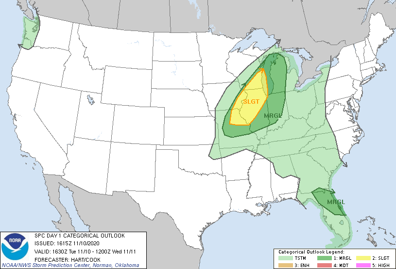
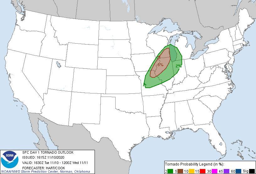
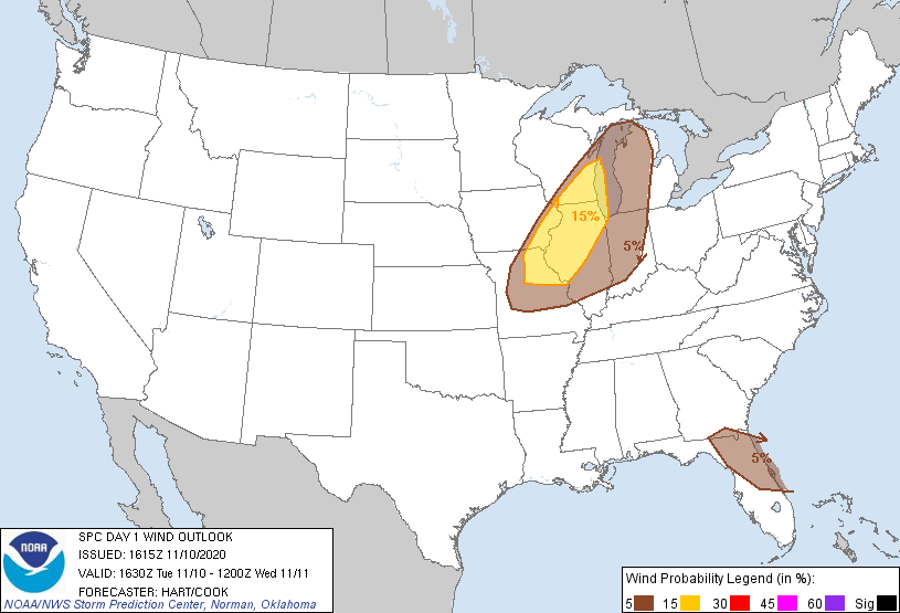
SPC Convective Outlooks
 |
 |
 |
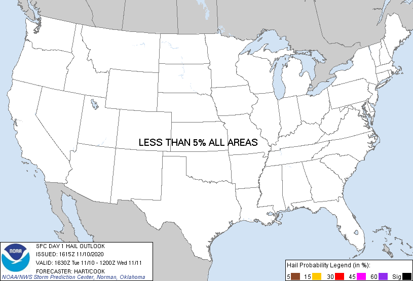 |
| SPC Day 1 Outlook (163z0) | SPC Day 1 Tornado Outlook (1630z) | SPC Day 1 Wind Outlook (1630z) | SPC Day 1 Hail Outlook (1630z) |
Local Sounding Analysis
 |
 |
|
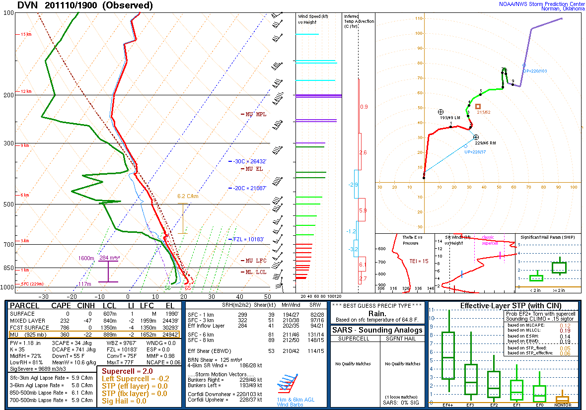
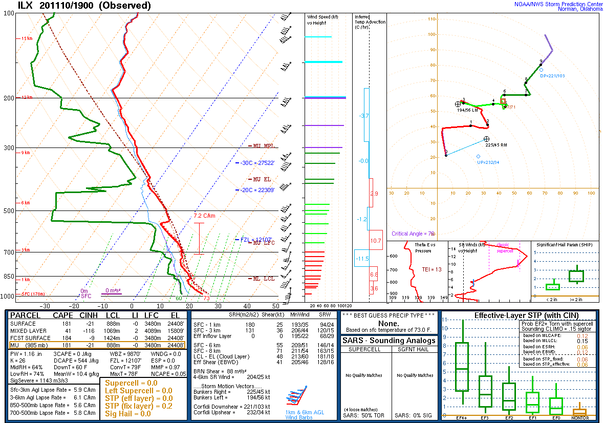
| DVN Sounding 11/10/2020 19z | ILX Sounding 11/10/2020 19z |
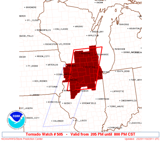
SPC Watches Issued For Our Area
 |
 |
|
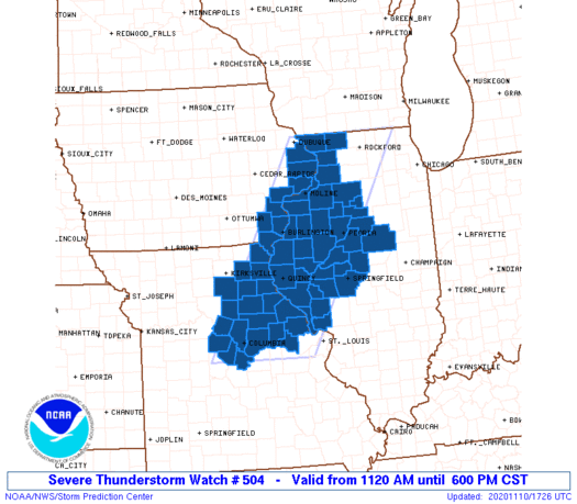
| SPC Severe Thunderstorm Watch #504 (see link for more details) |
SPC Tornado Watch #505 (see link for more details) |
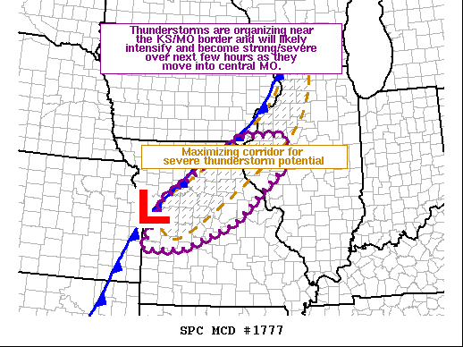
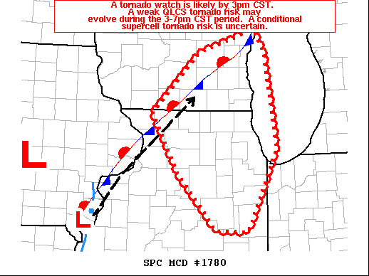
SPC Mesoscale Discussions Issued For Our Area
 |
 |
||
| SPC Mesoscale Discussion #1777(see link for more details) | SPC Mesoscale Discussion #1780(see link for more details) |
 |
Media use of NWS Web News Stories is encouraged! Please acknowledge the NWS as the source of any news information accessed from this site. |
|