Widespread life-threatening flash and urban flooding continues in south-central Texas, with considerable flooding impacts possible across central Texas. Wildfire smoke is impacting air quality across much of the Great Lakes region into southern New England and the Mid-Atlantic. Monsoonal thunderstorms may produce isolated to scattered flash flooding across the Southwest into the Great Basin. Read More >
Overview
|
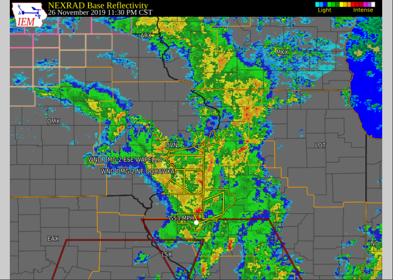
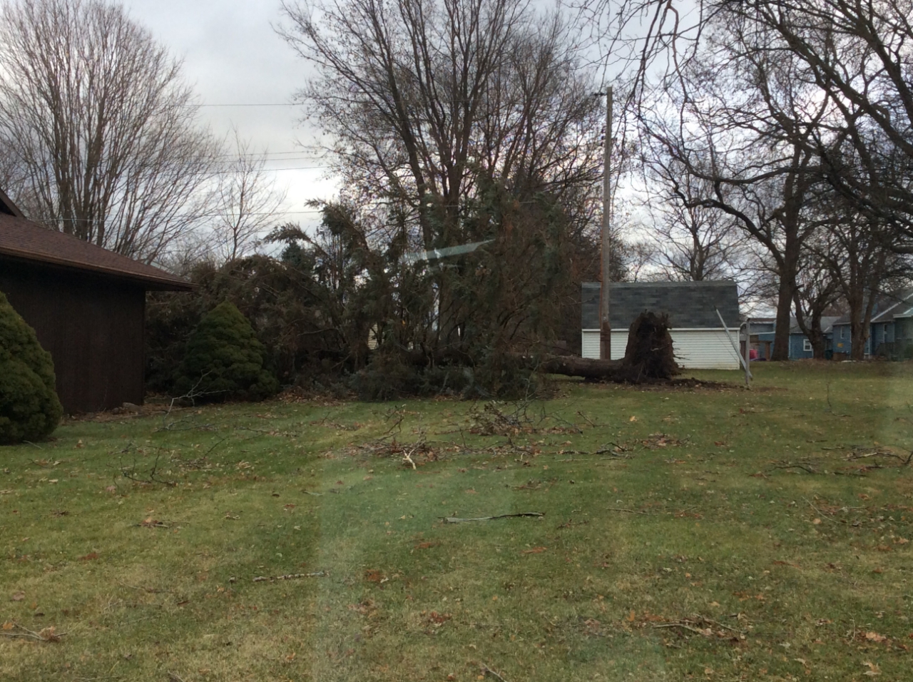
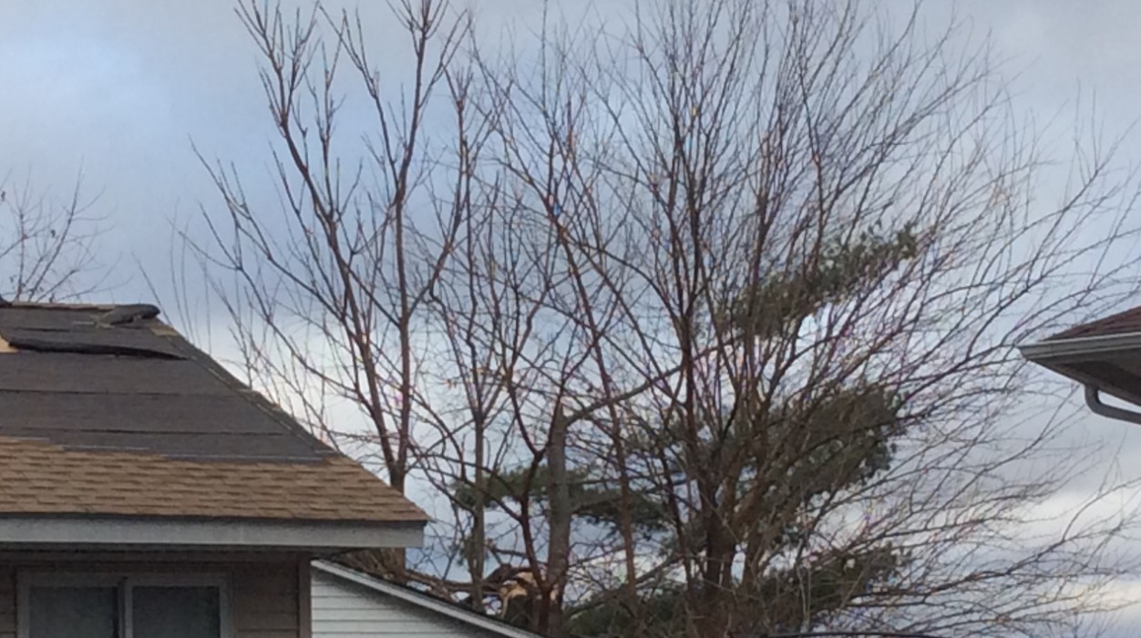
A strong storm system developed across the eastern Great Plains and Midwest during the afternoon of November 26, and brought a strong cold front across the area during the evening and overnight. Several rounds of showers and strong thunderstorms developed along this front, some of which produced severe wind gusts. Damage was limited mainly to trees, and mainly occurred over southeast Iowa and west central Illinois. An NWS Storm Survey determined that straight-line thunderstorms wind caused extensive damage in Granville, IL this morning at approximately 1240 AM CST. The maximum estimated wind speed is between 90 and 100 MPH. The winds snapped power poles, uprooted and snapped trees, and caused roof damage at several homes and businesses. The damage path is approximately 1 mile long and half of a mile wide. |
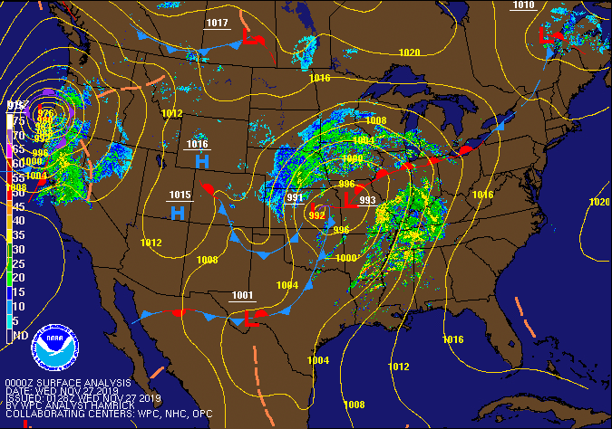 WPC Surface Fronts and Pressure |
Photos Granville, IL from NWS Survey Team
 |
 |
 |
 |
| Uprooted Tree |
Roof Damage |
Roof Damage | Roof Damage and Trees Snaped |
Storm Reports
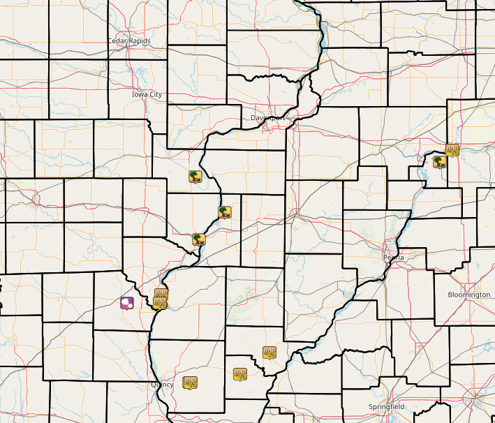 |
| Interactive Storm Report Map Courtesy Iowa Environment Mesonet |
PRELIMINARY LOCAL STORM REPORT...SUMMARY
NATIONAL WEATHER SERVICE QUAD CITIES IA IL
412 PM CST WED NOV 27 2019

..TIME...   ...EVENT...      ...CITY LOCATION...     ...LAT.LON...
..DATE...   ....MAG....      ..COUNTY LOCATION..ST.. ...SOURCE....
            ..REMARKS..

1023 PM     HAIL             CLARK CITY              40.42N 91.69W
11/26/2019  E0.25 INCH       CLARK              MO   TRAINED SPOTTER


1248 AM     TSTM WND DMG     GRANVILLE               41.26N 89.23W
11/27/2019                   PUTNAM             IL   EMERGENCY MNGR

            EM REPORTS SOME TREES AND POWERLINES DOWN IN
            GRANVILLE.

1240 AM     TSTM WND DMG     GRANVILLE               41.26N 89.23W
11/27/2019                   PUTNAM             IL   NWS STORM SURVEY

            AN NWS STORM SURVEY DETERMINED THAT
            STRAIGHT-LINE THUNDERSTORM WINDS CAUSED
            EXTENSIVE DAMAGE IN GRANVILLLE, IL EARLY
            THIS MORNING. MAXIMUM WINDS WERE ESTIMATED
            BETWEEN 90 AND 100 MPH. THE WINDS SNAPPED
            POWER POLES, UPROOTED AND SNAPPED TREES, AND
            CAUSED ROOF DAMAGE AT SEVERAL HOMES AND
            BUSINESSES. THE DAMAGE PATH IS APPROXIMATELY
            1 MILE LONG AND A HALF OF A MILE WIDE.

1115 PM     TSTM WND DMG     2 NE OQUAWKA            40.96N 90.92W
11/26/2019                   HENDERSON          IL   LAW ENFORCEMENT

            DELAYED REPORT. TREE DOWN NORTHEAST OF
            OQUAWKA. TIME ESTIMATED FROM RADAR.

1115 PM     TSTM WND DMG     2 ESE WAPELLO           41.17N 91.15W
11/26/2019                   LOUISA             IA   LAW ENFORCEMENT

            LARGE TREE DOWN NEAR THE INTERSECTION OF
            77TH ST AND HIGHWAY 99. TIME ESTIMATED FROM
            RADAR.

1035 PM     TSTM WND GST     1 E KEOKUK AIRPORT      40.47N 91.42W
11/26/2019  M58 MPH          LEE                IA   AWOS

            AWOS STATION KEOK KEOKUK ARPT.

1035 PM     TSTM WND GST     1 WNW KEOKUK            40.42N 91.43W
11/26/2019  E60 MPH          LEE                IA   TRAINED SPOTTER

            RELAYED BY DES MOINES CO EMA. SPOTTER
            ESTIMATED 55 TO 65 MPH WINDS ALONG HIGHWAY
            61 BYPASS NEAR KEOKUK. TIME ESTIMATED.

1100 PM     TSTM WND DMG     BURLINGTON              40.80N 91.12W
11/26/2019                   DES MOINES         IA   PUBLIC

            PUBLIC REPORTED A PART OF THEIR SUNROOM WALL
            BLOWN IN FROM THE WIND. TIME ESTIMATED FROM
            RADAR.
 |
Media use of NWS Web News Stories is encouraged! Please acknowledge the NWS as the source of any news information accessed from this site. |
|