Overview
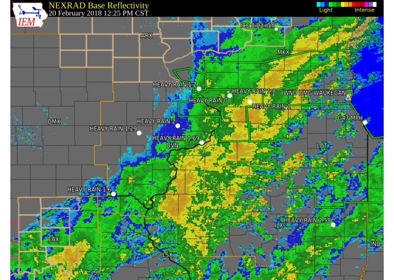
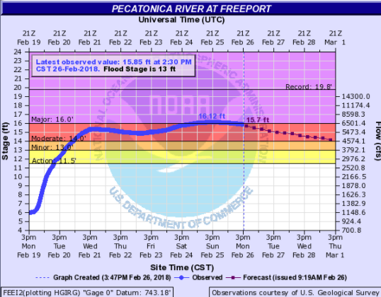
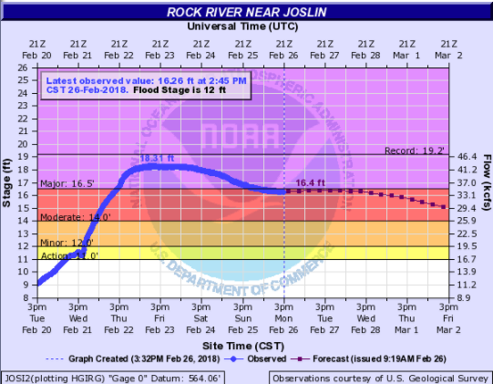
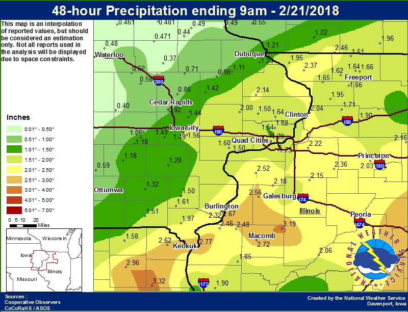
| Widespread rainfall between 1 and 2 inches fell over frozen and saturated ground during the 19th and 20th of February. Much of the rain became runoff and went into area streams and rivers. Melting snow from the 2nd week of February and ice jams, also contributed to the rises. The Rock and Pecatonica rivers in IL were hardest hit, with both reaching major flood stage. | 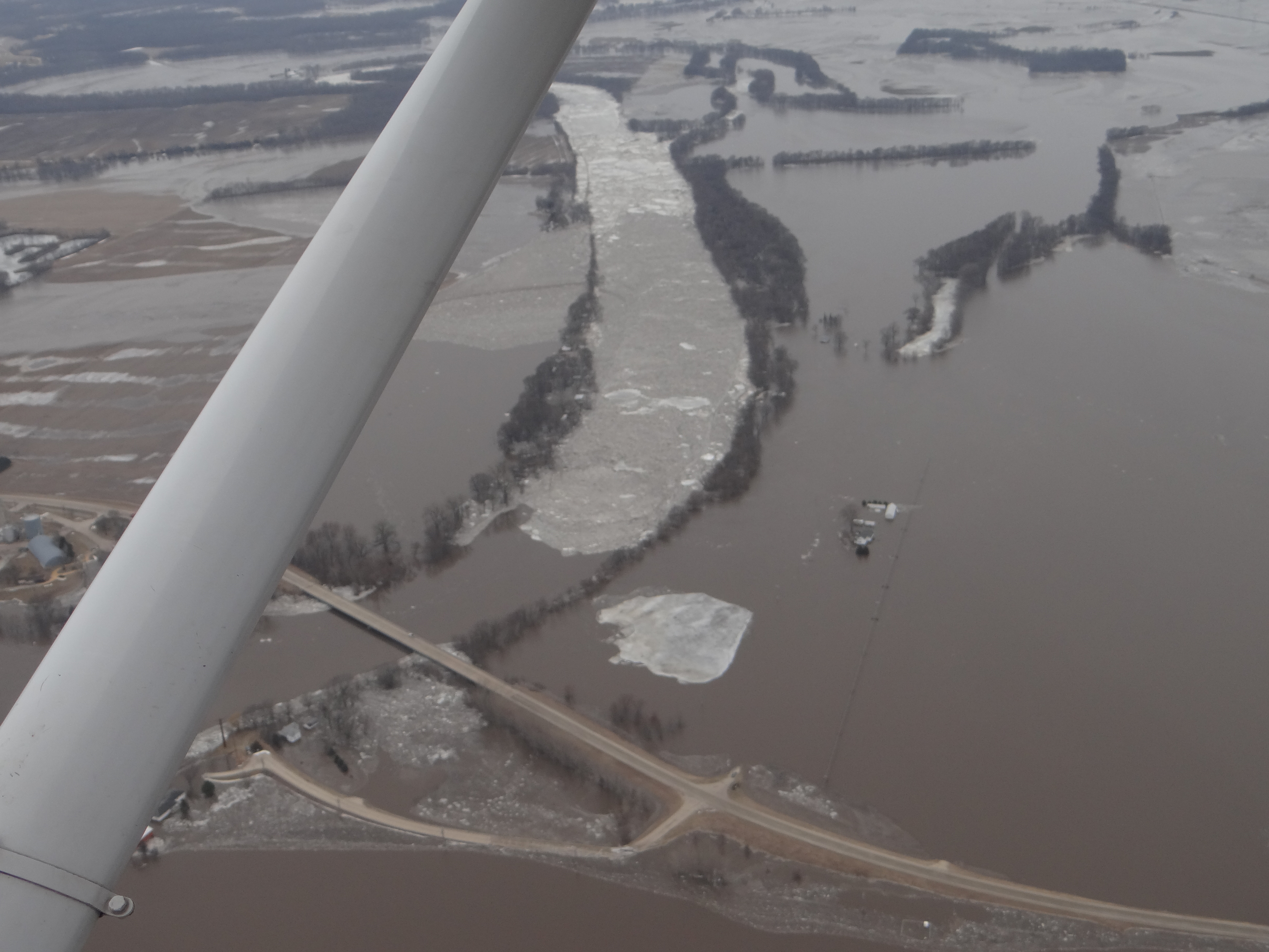 Rock River Flooding : Courtesy Whiteside County Emergency Management |
Flooding
The Rock river and Pecatonica rivers in northwest Illinois experienced the brunt of the flooding with both rivers seeing major flooding and remaining in flood for a prolonged period of time. The English, Maquoketa, and Iowa rivers in Iowa saw minor to moderate flooding, but for a shorter period of time.
Hydrographs
| MAJOR FLOODING | |||
 |
 |
 |
|
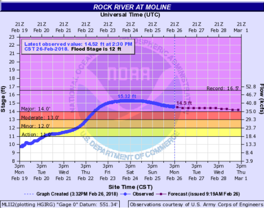
| Pecatonica River - Freeport, IL | Rock River - Joslin, IL | Rock River - Moline, IL | |
| MODERATE FLOODING | |||
 |
 |
||
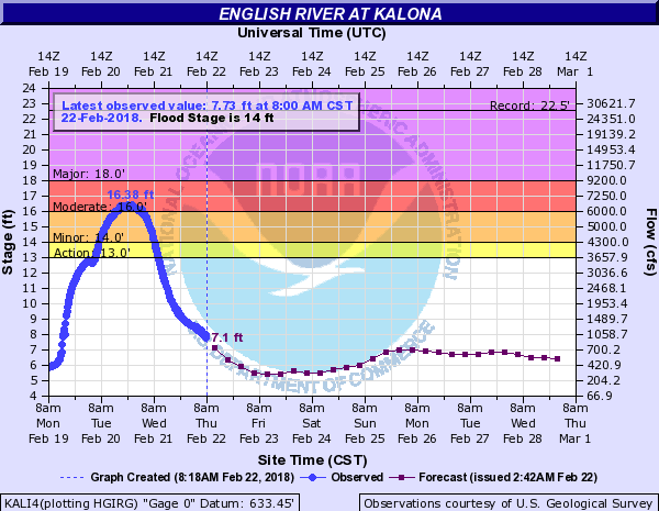
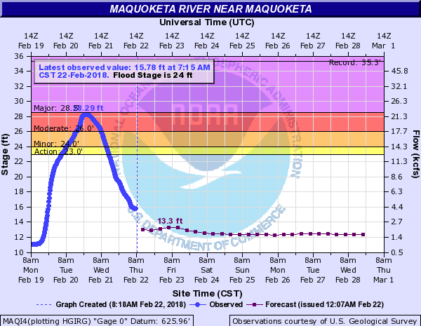
| English River - Kalona, IA | Maquoketa River - Maquoketa, IA | ||
| MINOR FLOODING | |||
 |
 |
 |
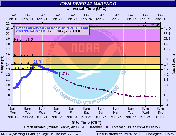 |
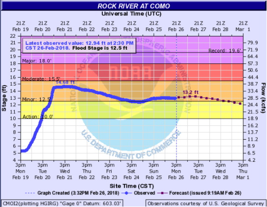
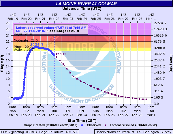
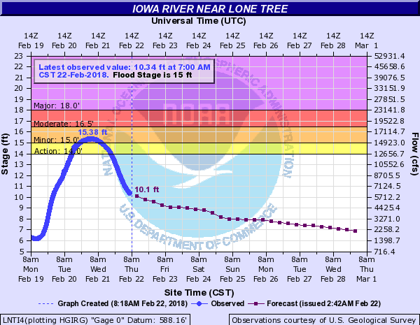
| Rock River - Como, IL | La Moine River - Colmar, IL | Iowa River - Lone Tree, IA | Iowa River - Marengo, IA |
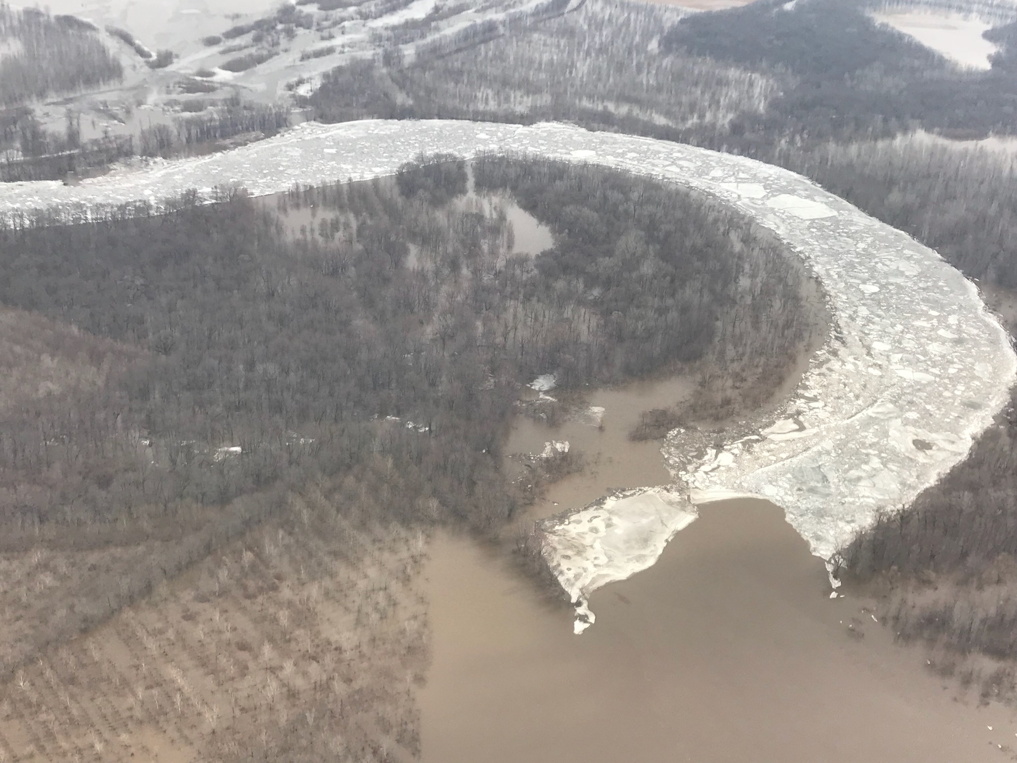
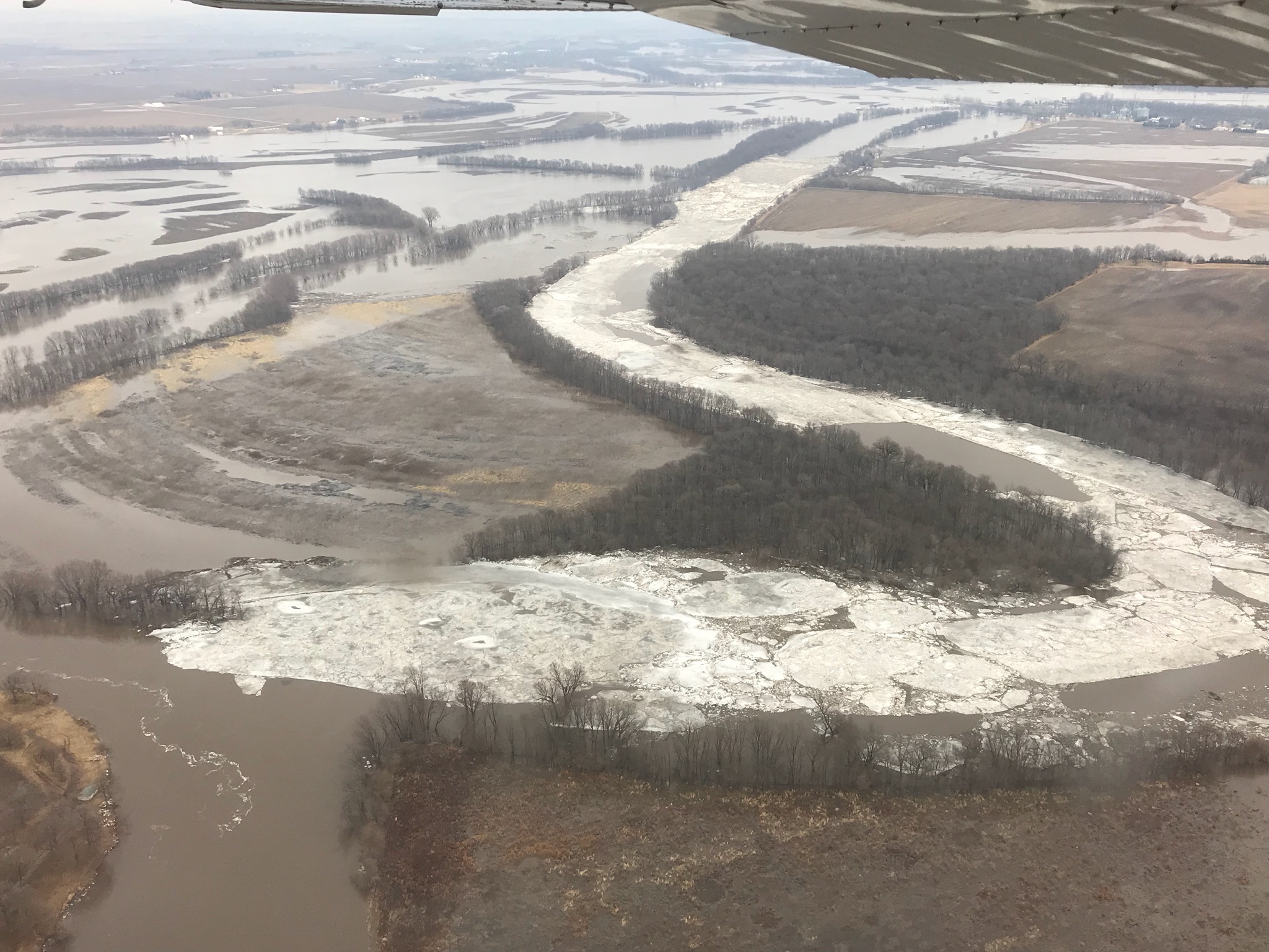
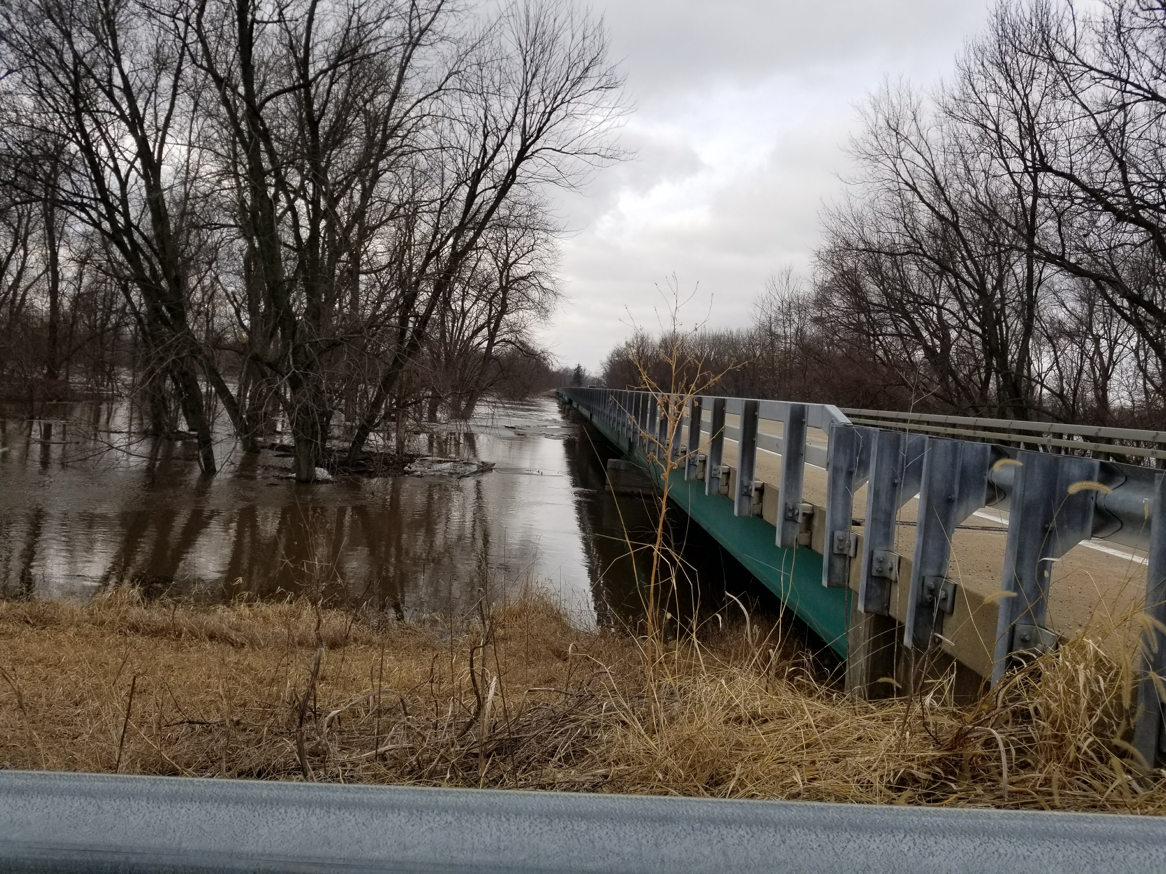
Photos/Survey
 |
 |
 |
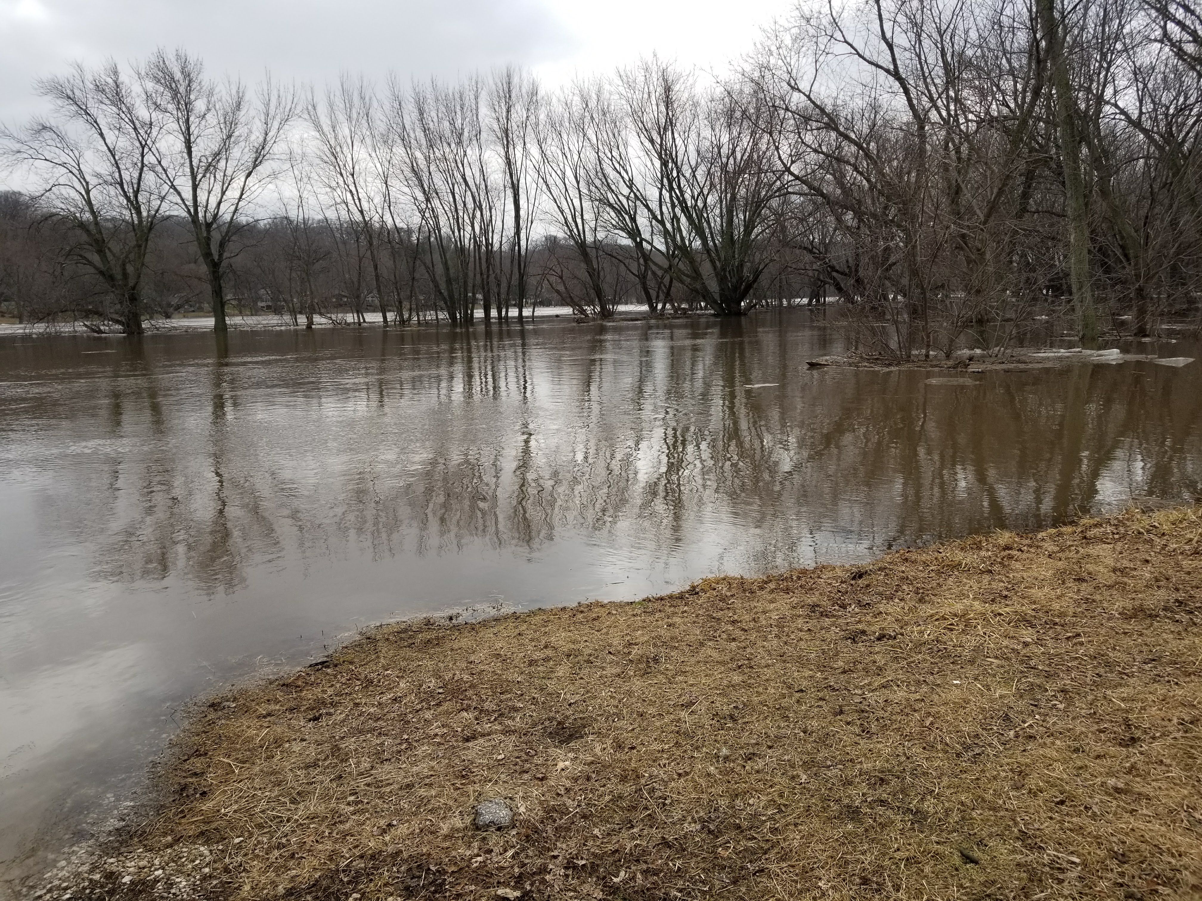 |
| Ice Jam just upstream of Erie, IL (Whiteside County Emergency Management) |
Ice Jame downstream from Rt 78 near Prophetstown, IL (Whiteside County Emergency Management) |
Bridge at Joslin, IL (NWS Survey) |
Near Joslin, IL (NWS Survey) |
Storm Reports
 |
| Interactive Map Link |
..TIME... ...EVENT... ...CITY LOCATION... ...LAT.LON...
..DATE... ....MAG.... ..COUNTY LOCATION..ST.. ...SOURCE....
..REMARKS..
0944 PM Freezing Rain HENNEPIN 41.26N 89.32W
02/20/2018 E0.12 inch Putnam IL CO-OP Observer
ACCUMULATED ON ELEVATED SURFACES AND A
LITTLE ON GROUND...STILL FALLING LIGHTLY.
0459 PM Heavy Rain 4 ENE FREEPORT 42.32N 89.57W
02/20/2018 M1.85 inch Stephenson IL Trained Spotter
STORM TOTAL.
0303 PM Heavy Rain 1 WNW MORRISON 41.81N 89.98W
02/20/2018 M1.80 inch Whiteside IL Trained Spotter
STILL RAINING LIGHTLY.
0300 PM Heavy Rain 7 NW MOUNT CARROLL 42.17N 90.07W
02/20/2018 M1.66 inch Carroll IL Cocorahs
RAIN HAS STOPPED. .80 IN PAST 8 HOURS.
0257 PM Heavy Rain 5 E CANTRIL 40.64N 91.98W
02/20/2018 M1.90 inch Van Buren IA Trained Spotter
RAIN HAS ENDED. .70 SINCE THIS MORNING.
0104 PM Heavy Rain LOWDEN 41.86N 90.92W
02/20/2018 M2.00 inch Cedar IA CO-OP Observer
30 HOUR STORM TOTAL OF 2.0 INCHES.
0104 PM Heavy Rain W CANTRIL 40.64N 92.07W
02/20/2018 M1.60 inch Van Buren IA Trained Spotter
1.6 INCHES STORM TOTAL THROUGH 30 HOURS.
0102 PM Heavy Rain 1 W BETTENDORF 41.56N 90.49W
02/20/2018 E1.69 inch Scott IA Trained Spotter
STORM TOTAL.
1229 PM Flood MC CONNELL 42.43N 89.73W
02/20/2018 Stephenson IL Trained Spotter
SPOTTER REPORTS THAT CREEKS ARE OUT OF THEIR
BANKS, CROSSING THE ROADS AND FLOODING
FIELDS IN THIS AREA.
1229 PM Heavy Rain 1 SSW NORTH LIBERTY 41.73N 91.61W
02/20/2018 M1.29 inch Johnson IA Trained Spotter
1158 AM Heavy Rain 3 NNE STOCKTON 42.40N 89.99W
02/20/2018 M1.80 inch Jo Daviess IL Trained Spotter
1.80 INCHES IN THE PAST 24 HOURS.
1158 AM Heavy Rain 3 NNE STOCKTON 42.40N 89.99W
02/20/2018 M0.00 inch Jo Daviess IL Trained Spotter
1.80 INCHES IN THE PAST 24 HOURS.
1134 AM Heavy Rain FREEPORT 42.29N 89.63W
02/20/2018 M1.00 inch Stephenson IL Emergency Mngr
1115 AM Flood 2 N SAVANNA 42.12N 90.14W
02/20/2018 Carroll IL Trained Spotter
FLOWING WATER 3 TO 4 INCHES DEEP ON IL-84
NORTH OF SAVANNA.
0840 AM Heavy Rain 5 NW MACOMB 40.52N 90.75W
02/20/2018 E3.40 inch McDonough IL Public
VIA BROADCAST MEDIA.
0830 AM Heavy Rain 2 SSE SCHAPVILLE 42.37N 90.18W
02/20/2018 M1.84 inch Jo Daviess IL Trained Spotter
RAINFALL IN THE PAST 24 HOURS.
0817 AM Heavy Rain NW BUSHNELL 40.56N 90.51W
02/20/2018 M1.60 inch McDonough IL Trained Spotter
0814 AM Heavy Rain 3 ENE ROCK FALLS 41.80N 89.64W
02/20/2018 M1.25 inch Whiteside IL Trained Spotter
EVENT TOTAL UP TO 7 AM.
0808 AM Heavy Rain 1 W BETTENDORF 41.56N 90.49W
02/20/2018 M1.07 inch Scott IA Trained Spotter
STORM TOTAL. 0.75 FELL SINCE MIDNIGHT.
0804 AM Heavy Rain 1 WNW MORRISON 41.81N 89.98W
02/20/2018 M1.00 inch Whiteside IL Trained Spotter
Rainfall
 |
 |
 |
 |
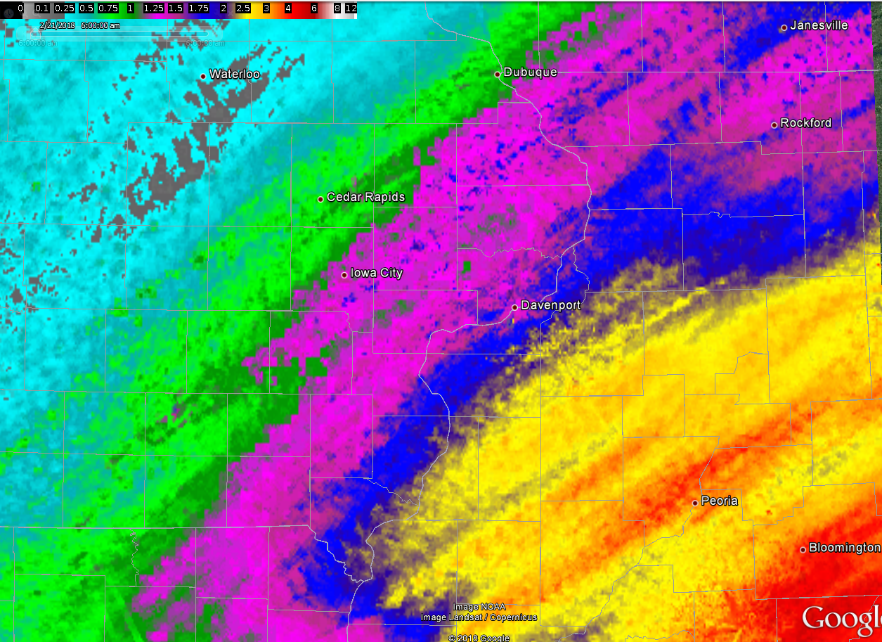
| Figure 1: Local 48-hr Rainfall Ending 2/21/18 |
Figure 2: Multiple-Radar/ Multiple-Sensor 72hr-Rainfall Ending 2/22/18 |
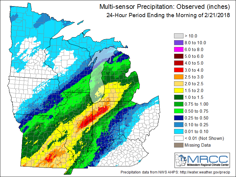
Figure 3: Regional 24-hr Rainfall 02/21/18 |
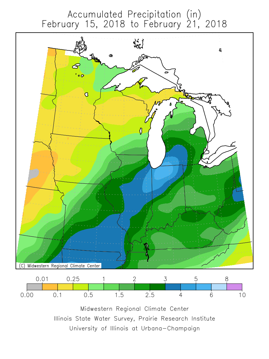
Figure 4: 6 day Regional Rainfall 2/15/18 - 2/21/18 |
Additional Information
The Forecast
 |
 |
 |
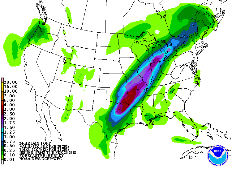 |
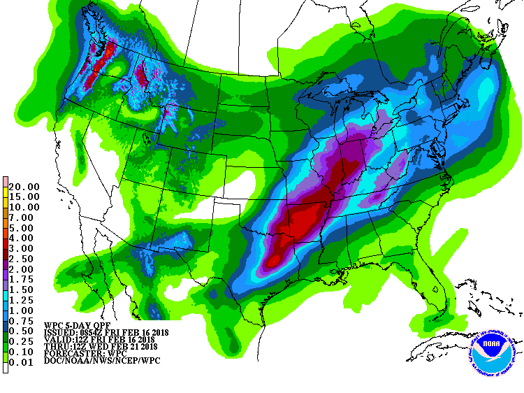
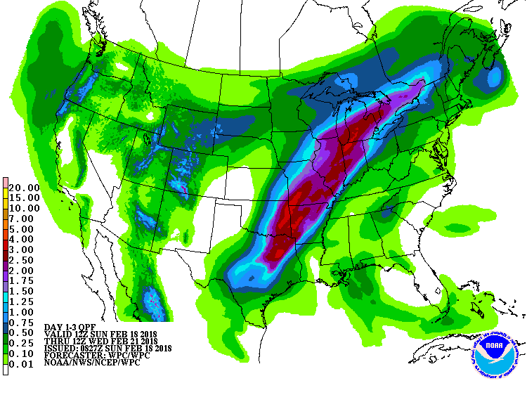
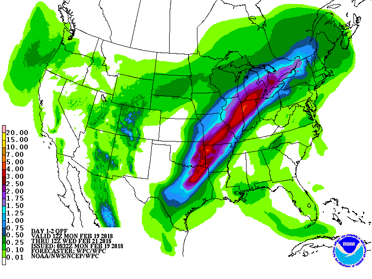
| WPC 5 Day QPF | WPC 3 Day QPF | WPC 2 Day QPF | WPC 1 Day QPF |
 |
 |
 |
|
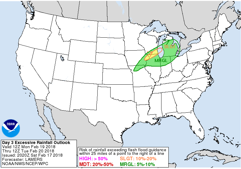
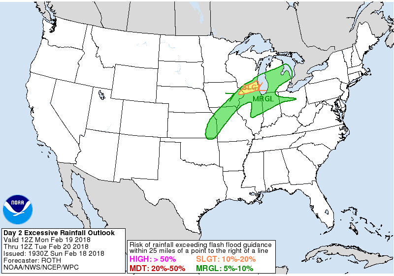
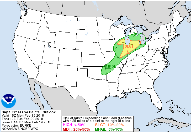
| WPC Day 3 Excessive Rainfall Outlook | WPC Day 2 Excessive Rainfall Outlook | WPC Day 1 Excessive Rainfall Outlook |
Summaries from other NWS Offices
 |
Media use of NWS Web News Stories is encouraged! Please acknowledge the NWS as the source of any news information accessed from this site. |
|