There are no watches, warnings, or advisories at this time.
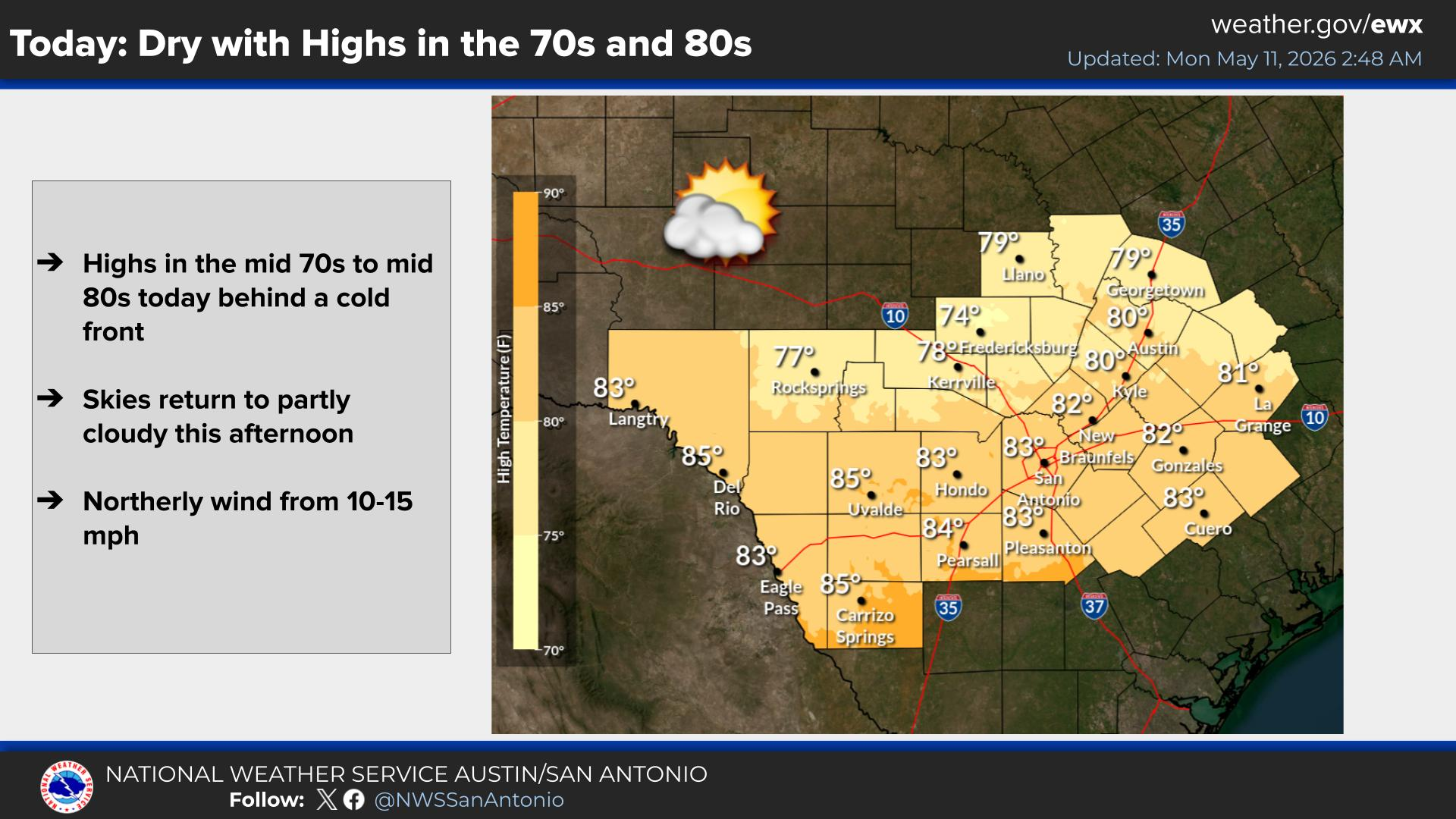
Today
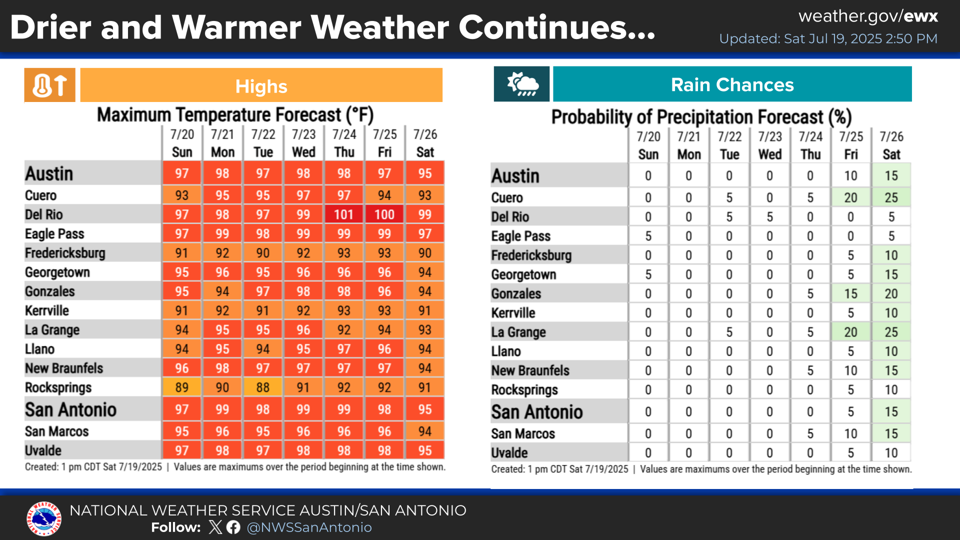
Weekly Outlook
Uvalde NWR Outage
Seasonable heat persists today across the region with afternoon highs forecast between 90°F and 98°F. Skies will be partly cloudy, and rain chances today are lower than yesterday, with only a stray to isolated afternoon shower or storm possible (10–20% chance). While the vast majority of the area will remain entirely rain-free, humidity will still push afternoon heat indices up to 100°F to 105°F along and east of the I-35 corridor into the coastal plains.
Seasonable heat continues through the week ahead with highs consistently in the 90s, followed by a minor cooling trend by the weekend. The main weather story features a distinct period of midweek drying on Wednesday and Thursday, accompanied by a light plume of Saharan dust moving through the area. This dry spell breaks quickly as rain and storm chances increase this weekend, with rain chances jumping up to 20% to 45% on Saturday and Sunday.
The Uvalde National Weather Radio transmitter remains off the air due to an equipment issue. If you receive typically receive warnings from Uvalde (162.425 MHz), consider temporarily switching to the D'Hanis transmitter at 162.525 MHz.


 Austin/San Antonio Radar
 Weather Map
 Satellite Imagery
 Del Rio Radar
 Digital Forecast Map
 Tropical Outlook
 Drought Status
 Air Quality
 Fire Weather Forecasts
 Observed Rainfall
 Observed Temperatures
 Daily Climate Graphs