Today will start of warmer than normal with high humidity. A cold front will arrive into the northernmost counties by around 9 AM and slowly work south across the region. Showers and thunderstorms will be expected near and behind the front, but rain chances in the midday hours are expected to be lower than for the northern counties. Later in the day when the front moves south of San Antonio, rain chances could increase again with southern counties seeing good chances of rain to continue into the nighttime hours. Only sporadic rainfall amounts of 1/4 to 1/2 inches are expected in the more populated areas of Austin, San Antonio, and Del Rio, but some isolated amounts over an inch will be possible north and east of a line from Fredericskburg to Austin to Cuero.
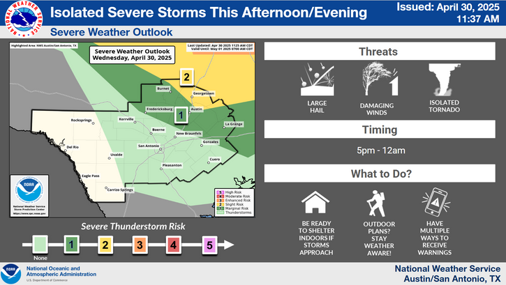
A weak cold front will bring a chance of showers and storms to the area Today. There is a good chance of rain and storms in the morning hours across the Hill Country and areas north of Austin metro, but the stronger thunderstorms are not expected to develop until mid afternoon when most of the activity is south of Austin and Kerrville. There is a level 1 out of 5 risk for isolated severe storms. Damaging wind is the main threat, but an isolated potential for severe hail and heavy rainfall is also possible.
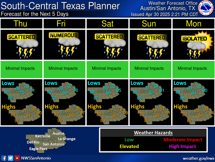
A weak cold front moves across the area on today bringing scattered showers and storms to the area. After this frontal passage, temperatures fall slightly closer to seasonal values for the rest of the week and into early next week.


 Austin/San Antonio Radar
 Weather Map
 Satellite Imagery
 Del Rio Radar
 Digital Forecast Map
 Tropical Outlook
 Drought Status
 Air Quality
 Fire Weather Forecasts
 Observed Rainfall
 Observed Temperatures
 Daily Climate Graphs