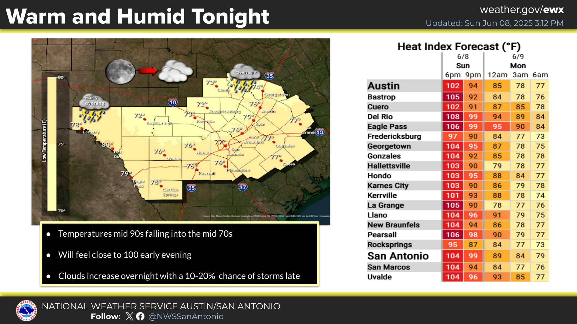
Increasing clouds through the period. There is a low chance for storms to develop over the southern Edwards Plateau late tonight. Could be strong to severe. Large hail and damaging wind gusts.
Rain chances continue mid week into the weekend and even into early next week. Forecast highs in the 70s and 80s for the most part with lows in the 60s and 70s.
May is an active month across South-Central Texas characterized by muggy conditions and frequent late-afternoon thunderstorms. While highs are typically in the 80s and 90s, triple digits often emerge along the Rio Grande. For May 2026, the local forecast leans toward a wetter-than-normal month with no strong signal for temperatures to deviate from seasonal averages.
The Climate Prediction Center outlook for May 2026 outlines expected conditions across the U.S. The Precipitation Outlook indicates a 33–50% chance for above-normal rainfall across most of Texas. Meanwhile, the Temperature Outlook places South-Central Texas in an Equal Chances zone, meaning there is no specific lean toward a cooler or warmer month compared to the norm.


 Austin/San Antonio Radar
 Weather Map
 Satellite Imagery
 Del Rio Radar
 Digital Forecast Map
 Tropical Outlook
 Drought Status
 Air Quality
 Fire Weather Forecasts
 Observed Rainfall
 Observed Temperatures
 Daily Climate Graphs