Tropical Storm Zeta Crosses North Georgia
October 29, 2020
Hurricane Zeta made landfall late in the afternoon on October 28, 2020 along the eastern Louisiana coast, bringing widespread damage to that portion of the coast. After landfall, Zeta rapidly moved northeastward, bringing damaging winds and rainfall to portions of west central and northern Georgia in the early morning hours of October 29, 2020. Sustained winds of 20 to 35 mph were felt across the area with widespread gusts of 40 to 60 mph and isolated gusts over 60 mph. The heaviest of the rainfall fell across portions of northern Georgia where areas received between 1.5 to 4 inches with some locally higher amounts across the northeast. Due to the strong winds and rainfall overnight, numerous trees and power lines were downed across most of north and portions of central Georgia, leading to widespread property damage and power outages.
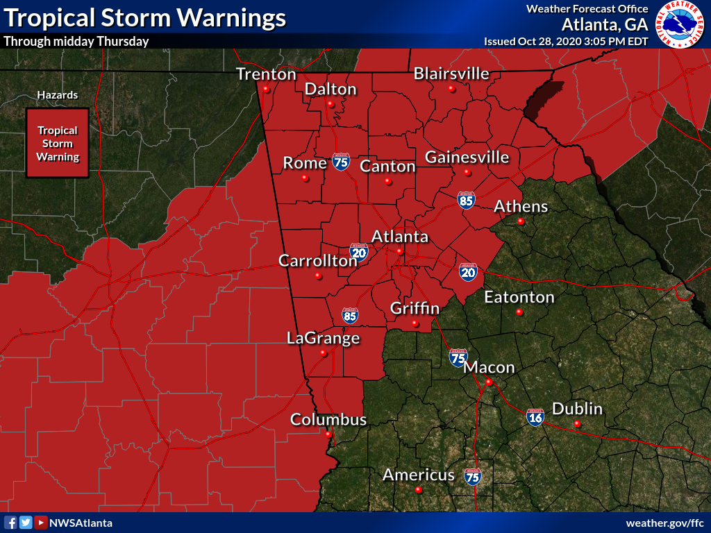
Tropical Storm Warnings
A Tropical Storm Warning was issued across north Georgia ahead of Zeta's arrival as tropical storm force wind gusts were forecast.
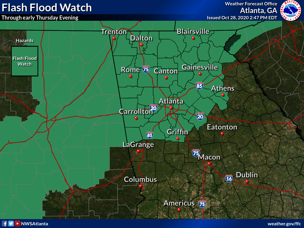
Flash Flood Watch:
A Flash Flood Watch was issued in anticipation of the potential for heavy rainfall. Fortunately, due to Zeta's extremely fast forward movement, only isolated flooding issues occurred in portions of north Georgia.
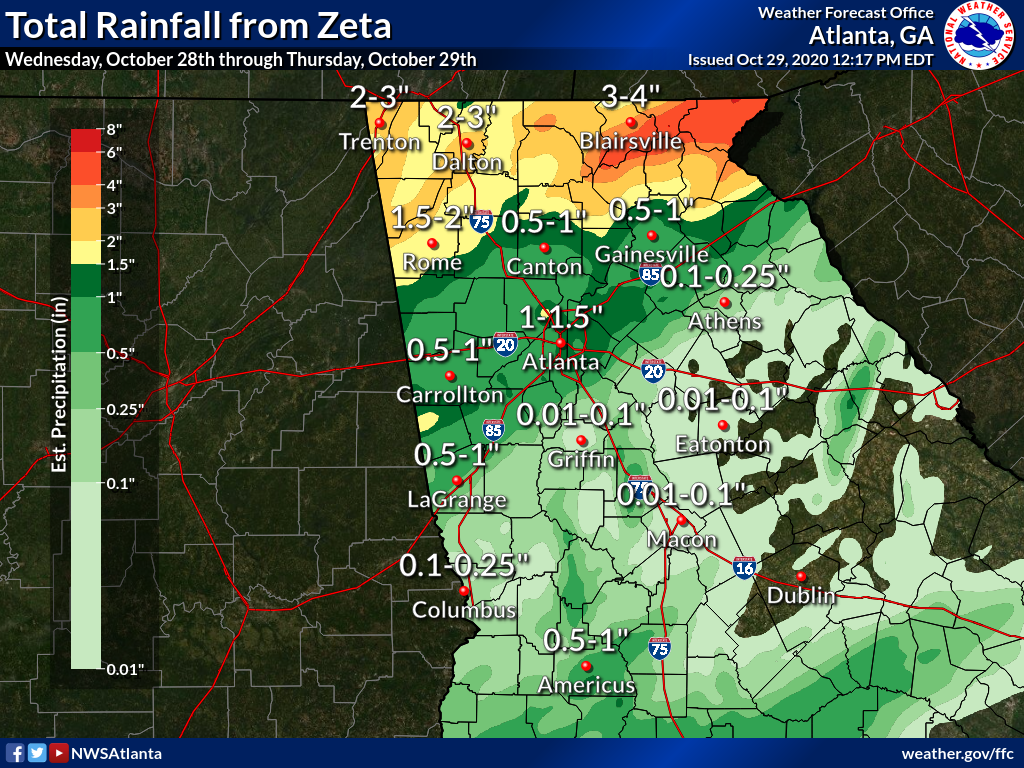
Map of Total Rainfall From Zeta
Total rainfall from Zeta was fairly limited with the heaviest occurring in far north Georgia. Isolated flooding and flash flooding issued occurred in these areas where 2-4" of rain fell.
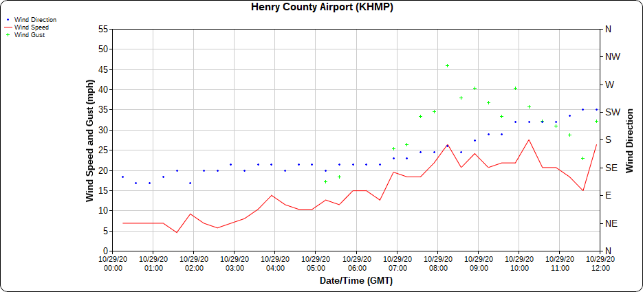
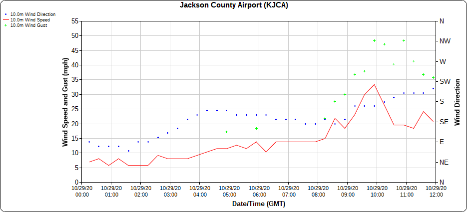
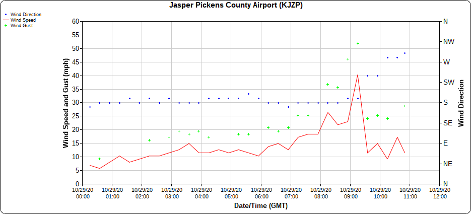
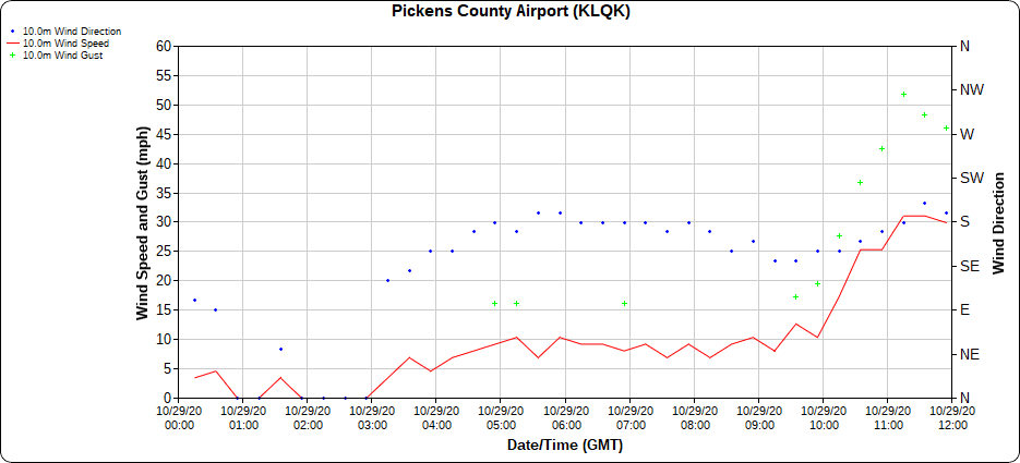
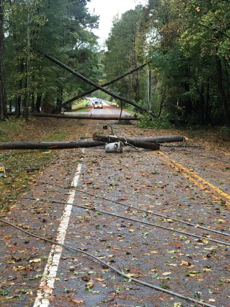
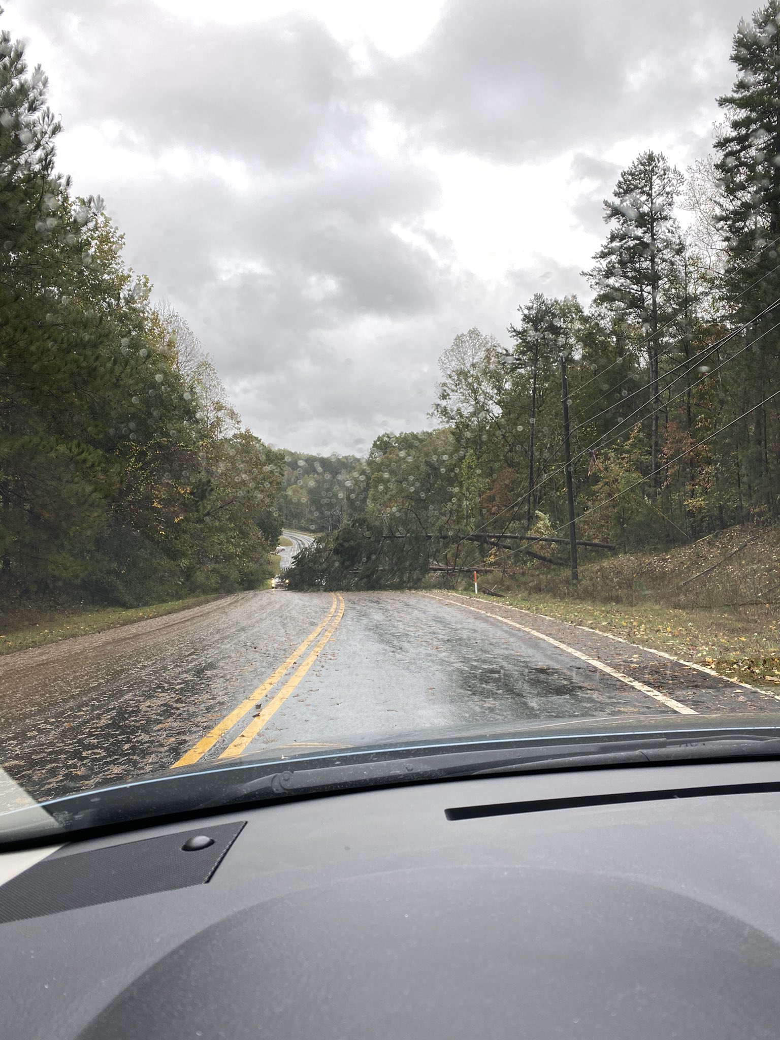
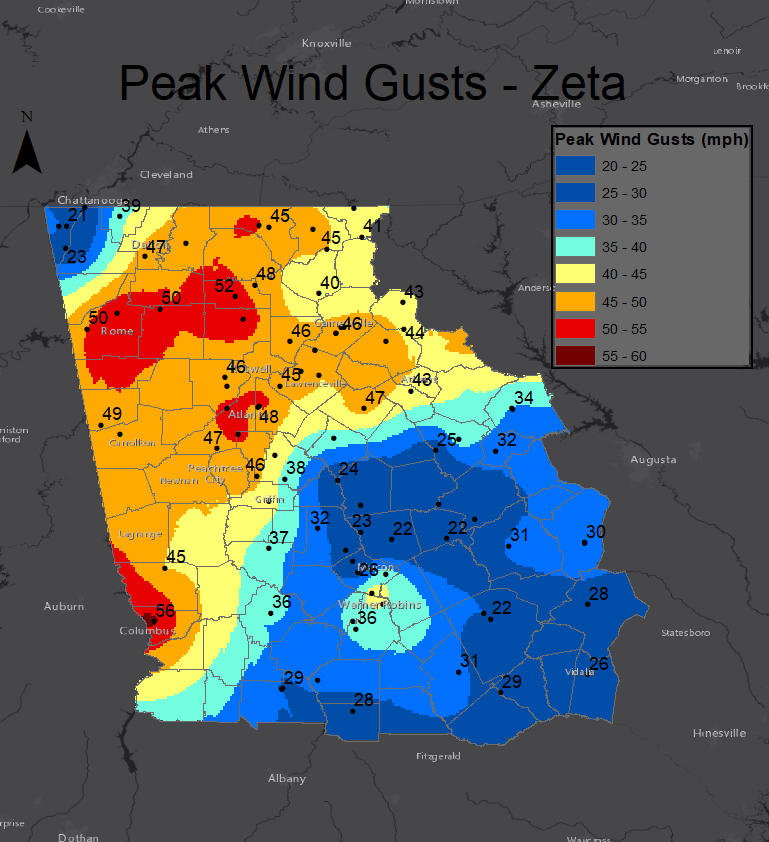
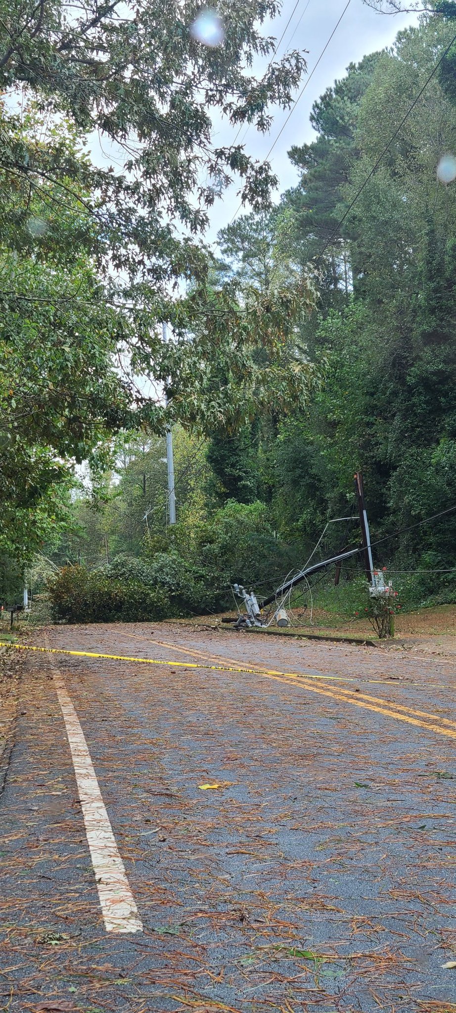
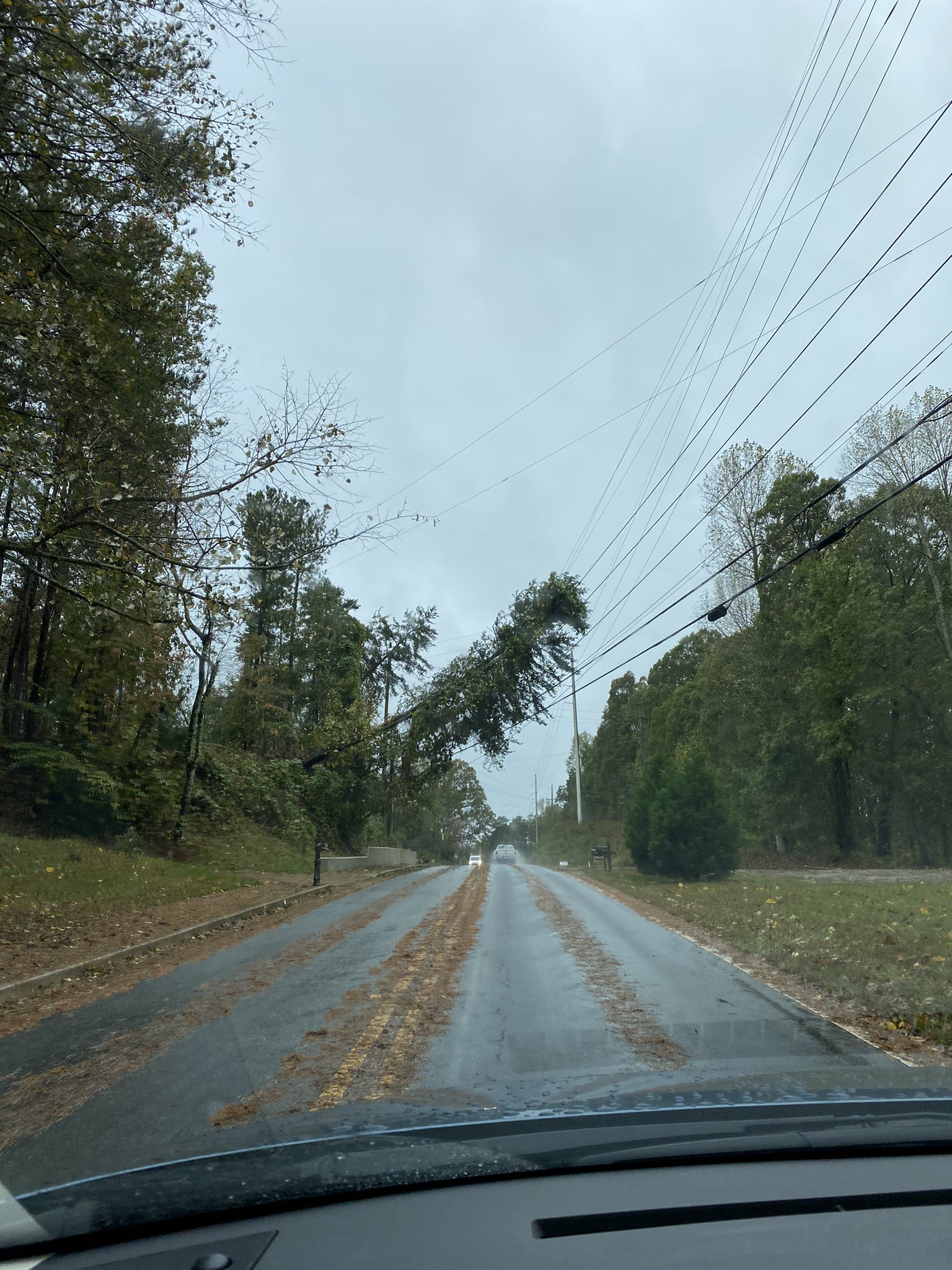
Tropical Storm Zeta brought sustained winds around 20 to 35 mph across the area with widespread gusts from 40 to 60 mph and isolated gusts over 60 mph. These strong wind gusts downed numerous trees and power lines across most of north Georgia as well as portions of central Georgia. Many trees fell onto homes and businesses, leading to widespread property damage. Sadly, 3 people in north Georgia were killed by falling trees. Over 1 million electrical customers in Georgia were without electricity at the peak of the outages on the morning of October 29th, and many were left without power for several days.
Map of Maximum Recorded Wind Gusts
Numerous gusts in the 45-55 mph range were recorded. Isolated gusts over 60 mph also occurred.
|
|
 |
| This large tree was blown down onto power lines on the campus of Georgia Tech in Atlanta. (courtesy GA Tech Police) | This large tree fell across Northside Drive in Atlanta. This scene was repeated countless times across the area. (courtesy CBS46) |
|
|
 |
| Many trees fell across power lines, snapping numerous utility poles and causing widespread power outages. (courtesy Georgia EMC) |
This tree and power line damage occurred in Roswell. (courtesy @gatorhead1013) |
|
|
 |
|
These trees were downed in Sugar Hill. (courtesy @emjay0329) |
Another picture of many instances of tree and power line damage in the Sugar Hill area. (courtesy @emjay0329) |
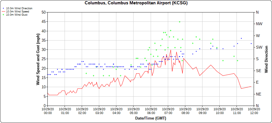
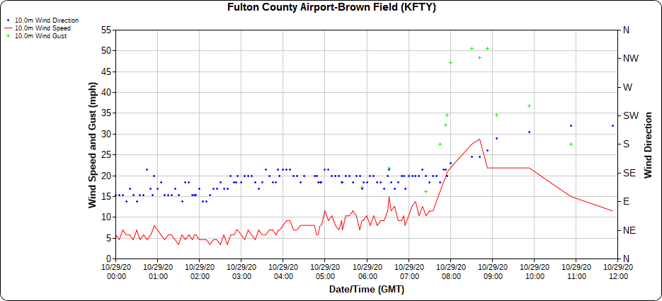
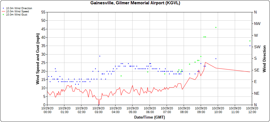
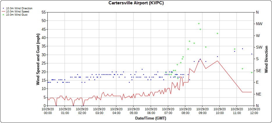
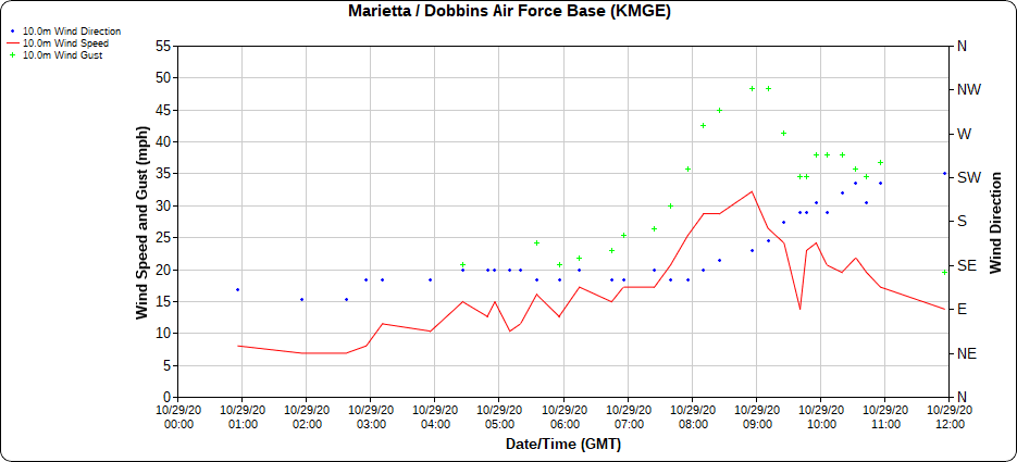
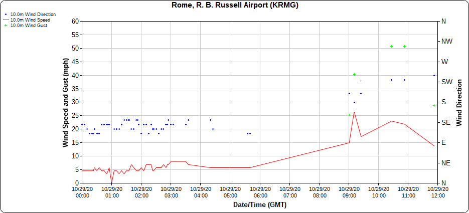
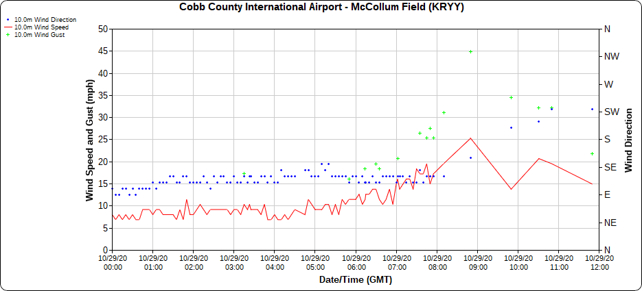
The graphs below show the progression of the strong winds through the early morning hours on October 29th as Tropical Storm Zeta raced across the area. Notice the period of gusts between 45-55 mph at many sites during the early morning hours.
(Click the image to enlarge and use the arrow keys to progress between images.)