Atlanta/Peachtree City, GA
Weather Forecast Office
 |
WEST AREA |
CENTRAL AREA |
GULF AREA |
SOUTH AREA |
EAST AREA |
NORTH AREA |
|
Lo Sectors Hi Sectors UH Sectors TRACONs Icing: Lo Sectors Hi Sectors UH Sectors TRACONs CIG/VIS: METARs By Sector TRACONs PIREPs: |
|
Plotted Pireps are updated every 5 minutes, for all flight levels and include Pireps from 2 hours previous.
Click on the PIREP icons to get more information.
The map is displaying PIREPs using the following icons:
|
|
|
|
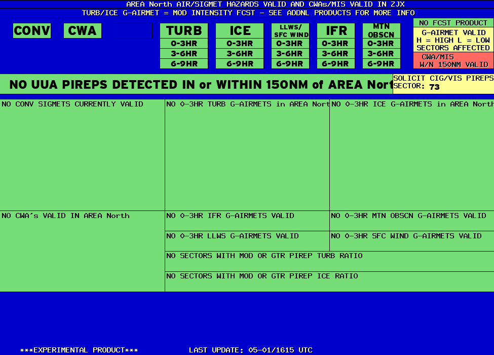
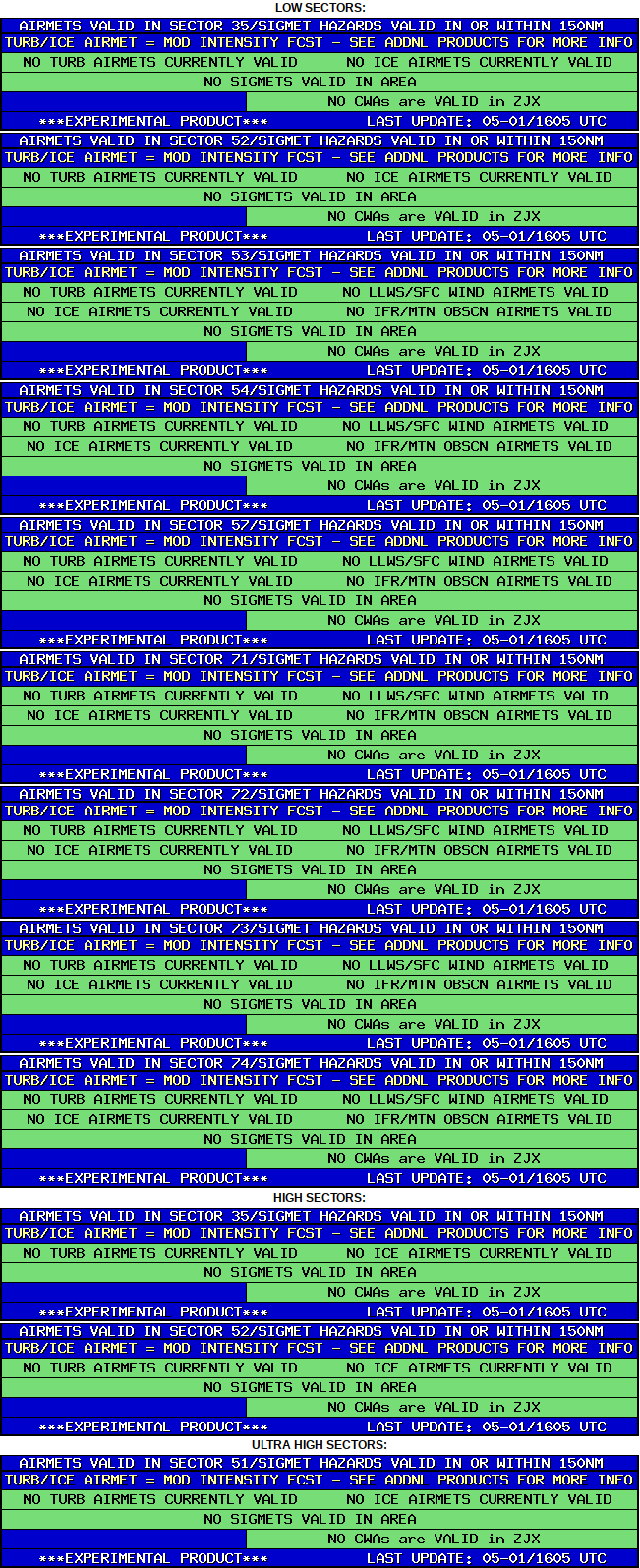
NORTH AREA HAZARDS BY SECTOR |
BASED ON SIGMETS/CWAS VALID WITHIN 150NM of SECTOR and LEGACY AIRMETS VALID WITHIN SECTOR |
 |
Current Hazards
Local
Submit Storm Report
Outlooks
Georgia Road Conditions
Nationwide
Local Storm Reports
Forecasts
Aviation Weather
Activity Planner
Recreational Forecast
Fire Weather
Forecast Discussion
Incident Support
Tropical Weather
Local
Computer Models
Graphical
Current Weather
Maps
Rivers/Lakes
Satellite Images
Observations
Radar Imagery
Warner Robins
Peachtree City
Regional Loop
Nationwide
US Dept of Commerce
National Oceanic and Atmospheric Administration
National Weather Service
Atlanta/Peachtree City, GA
4 Falcon Drive
Peachtree City, GA 30269
770.486.1133
Comments? Questions? Please Contact Us.


