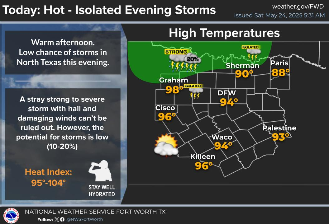
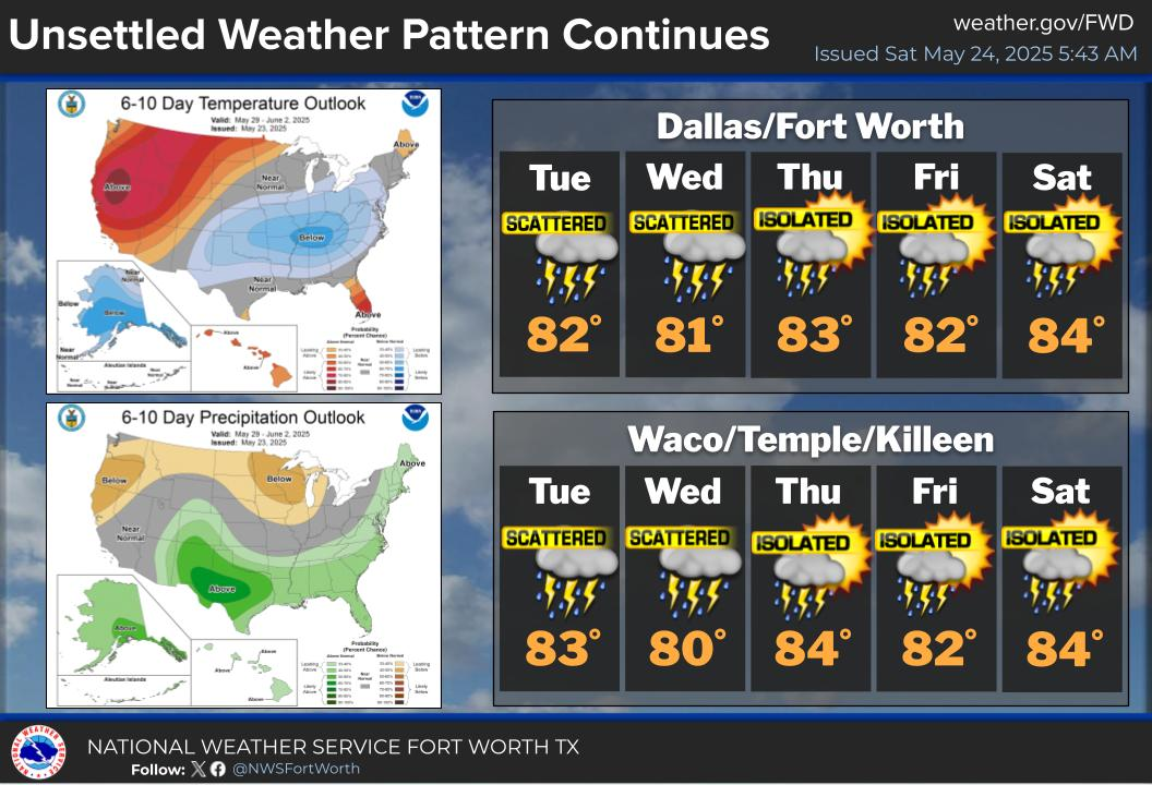
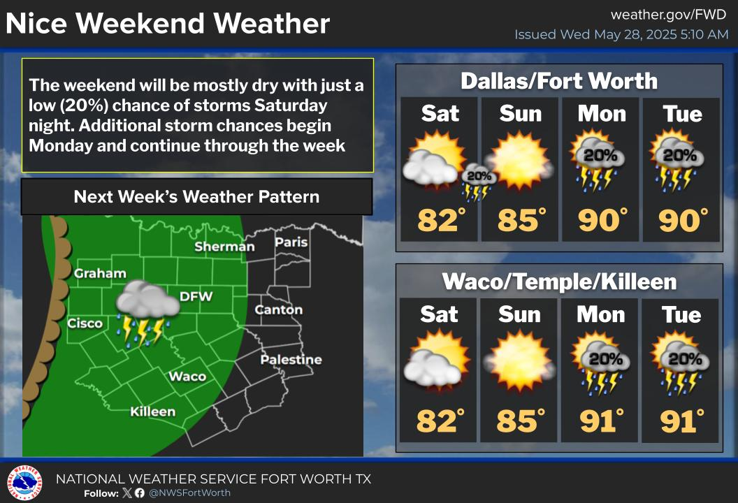
National Weather Service United States Department of Commerce

Heavy to Excessive Rainfall in the Southeast U.S.; Critical Fire Weather in the Northern Plains and Upper Midwest

A slow-moving storm system will continue to produce widespread heavy showers and thunderstorms which may bring excessive rainfall and flooding as it tracks across the Southeast and Mid-Atlantic regions today into Wednesday. Gusty winds and dry fuels under potential record setting temperatures will support widespread critical fire weather in the northern Plains and Upper Midwest today. Read More >

Click a location below for detailed forecast.

Last Map Update: Mon, May 12, 2025 at 9:46:29 am CDT

Unseasonably hot weather is expected on Wednesday with DFW and Waco both likely to beat their record high temperatures for the date. Remember to stay hydrated and take frequent breaks in the shade or A/C!
Temperatures will begin to climb this week with highs in the mid 80s today, which is near normal for this time of year. A quick warmup is expected into Tuesday with highs in the mid/upper 90s. Record breaking heat is expected by Wednesday across the region.
Warm weather continues through the end of the week, with low storm chances expected Friday through this the weekend.

Text Product Selector (Selected product opens in current window)
Latest Text Products Issued (Experimental)
Safe Rooms Icon Cooperatirve Rainfall (CoCoRaHs) icon Storm Ready Icon AirNow Icon