National Weather Service United States Department of Commerce

Thunderstorms Over the Southeast U.S. and Northern Rockies; Critical Fire Weather Conditions in the Plains

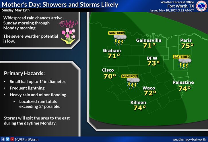
Isolated severe thunderstorms and showers will bring a flash flood threat across the Southeast. Scattered severe wind gusts are expected across the northern Rockies into the Plains. Elevated to Critical fire weather conditions are expected across the north/central Plains and Upper Midwest. Read More >

Click a location below for detailed forecast.

Last Map Update: Mon, May 12, 2025 at 12:04:29 am CDT

Record heat will arrive on Tuesday and worsen Wednesday with triple digit highs expected across much of North and Central Texas. Stay hydrated and take frequent breaks in the shade or A/C!
Monday will be warmer with highs in the upper 70s to upper 80s. North winds around 5 mph will shift to the southeast late in the afternoon.
Warm conditions continue through the end of the week with low storm chances returning Friday through the weekend.

Text Product Selector (Selected product opens in current window)
Latest Text Products Issued (Experimental)
Safe Rooms Icon Cooperatirve Rainfall (CoCoRaHs) icon Storm Ready Icon AirNow Icon