National Weather Service United States Department of Commerce

Wet High-elevation Snow and High Winds in the West; Severe Weather in the Central/Southern Plains

Higher elevation snow across the Great Basin and the Pacific Northwest into the northern Rockies will expand eastward into the central Rockies and will also bring quite a bit of wind. Windy and dry conditions in the Desert Southwest will cause Critical fire conditions. Severe thunderstorms and heavy rains are expected to develop across parts of the southern/central Plains on Monday. Read More >

Click a location below for detailed forecast.

Last Map Update: Mon, May. 6, 2024 at 6:02:37 am CDT

National Weather Service Amarillo, TXNational Weather Service Norman, OKNational Weather Service Tulsa, OK
National Weather Service San Angelo, TXZoom
Out

National Weather Service Shreveport, LA
National Weather Service Austin/San Antonio, TXNational Weather Service Houston/Galveston, TXNational Weather Service Lake Charles, LA

We'll be watching a dryline to our west this afternoon and evening as thunderstorms are expected to develop along it and move east. Most of the activity will remain across Oklahoma, but a few storms may clip our northern counties mainly north of I-20. Very large hail and damaging winds would be the main threats with any storms that develop, with a non-zero tornado threat.
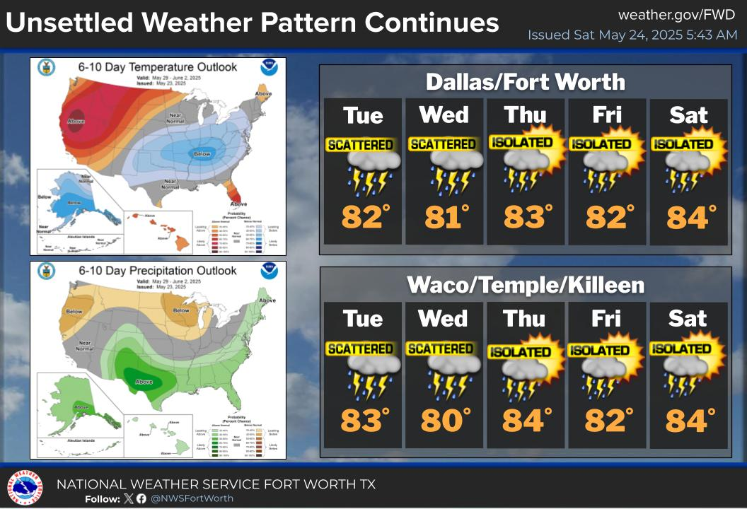
The unsettled pattern continues mid-week with additional storm chances Wednesday and Thursday associated with an approaching dryline and passing cold front. Strong to severe thunderstorms and heavy rainfall will be possible at times. Large hail and damaging wind gusts are the main threats. Localized heavy rainfall may lead to flash flooding, especially over areas that are saturated from recent rainfall.

Text Product Selector (Selected product opens in current window)
Latest Text Products Issued (Experimental)
Safe Rooms Icon Cooperatirve Rainfall (CoCoRaHs) icon Storm Ready Icon AirNow Icon