A cold front will arrive on Memorial Day, increasing storm chances along the front. Morning strong storms will give way to strong and severe storms in the afternoon. Although there will be a threat for large hail, the main concern will be from damaging wind gusts.
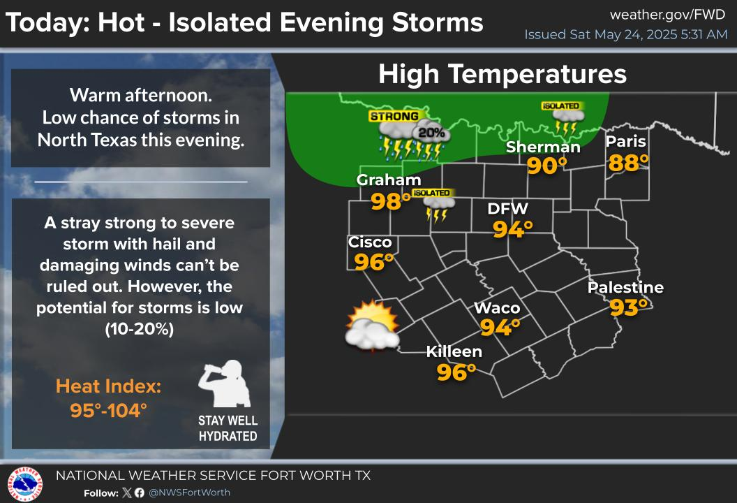
Another mostly quiet day is ahead with temperatures rising into the mid to upper 90s. Heat index values will exceed 100 degrees in a few locations. This evening, a few storms cannot be ruled outa long the Red River. Small hail and gusty winds will be possible with any storm.
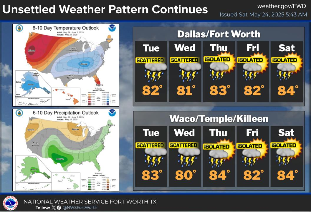
A stalled front will bring daily storm chances to the region next week. Cooler temperatures are expected throughout the week, with afternoon highs in the 80s and morning lows in the 60s.


 Local Radar
 Weather Map
 Drought Monitor