National Weather Service United States Department of Commerce

Severe Thunderstorms and Heavy Rainfall in the Central and Southern Plains

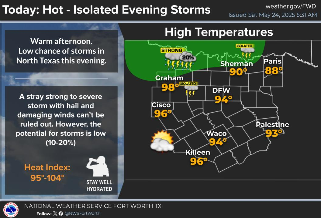
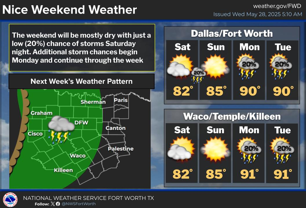
Severe thunderstorms capable of very large hail, damaging wind gusts, and a few tornadoes are possible today across parts of the central and southern Plains. Heavy rain will pose a threat for flash flooding across portions of central and coastal Texas. Thunderstorms may also cause isolated wind damage across the Southeast. Read More >

Scattered strong to severe storms will develop this afternoon and evening, with the greatest chances west of I-35 and south of I-20. Large hail and damaging winds are the primary threats, with a low (non-zero) tornado threat. The main storm timing is between 3 PM and 10 PM.
A Severe Thunderstorm Watch is in effect until 10 PM for western Central Texas. Hail to 2.5 inches in diameter and damaging wind gusts to 70 MPH are possible in and near the watch area. A tornado or two also cannot be ruled out.
Shower and storms will continue Thursday night across much of North and Central Texas. An isolated severe storm cannot be ruled out across Central Texas. The storm potential will continue into Friday, mainly along and south of the stalled front.
A low chance of storms will arrive Saturday night, otherwise, a relatively quiet weekend is in store. Storm chances return Monday afternoon and persist through the week.

Text Product Selector (Selected product opens in current window)
Latest Text Products Issued (Experimental)
Safe Rooms Icon Cooperatirve Rainfall (CoCoRaHs) icon Storm Ready Icon AirNow Icon