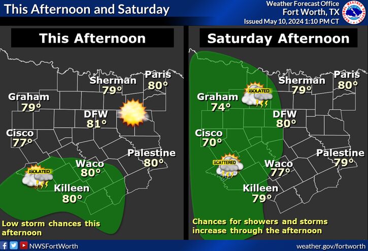
Expect a dry and calm afternoon today as highs peak in the 70s and 80s and cloud cover continues to scatter out. While an isolated storm cannot be ruled out today, chances remain at 10% or less.
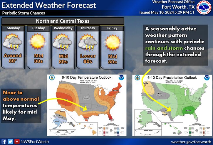
The unsettled pattern continues through the end of the week with the potential for isolated to scattered showers and storms both Thursday and Friday. Lightning and brief heavy rain are the main concerns. Severe weather is not anticipated. Afternoon temperatures will be in the 70s to low 80s each afternoon.
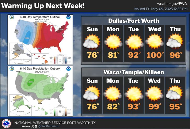
After a relatively cool and rainy start to the month, conditions will finally turn drier and warmer beginning this weekend and continuing through the middle of next week. Temperatures will climb into the 80s to low 90s by Tuesday.


 Local Radar
 Weather Map
 Drought Monitor