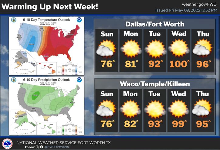
Record heat will arrive on Tuesday and worsen Wednesday with triple digit highs expected across much of North and Central Texas. Stay hydrated and take frequent breaks in the shade or A/C!
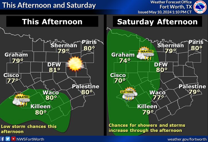
Scattered showers will continue today across East Texas thanks to a pesky slow moving upper disturbance. Coverage of showers should be around 20%. Temperatures will be in the upper 60s to upper 70s today with north winds around 10 mph.


 Local Radar
 Weather Map
 Drought Monitor