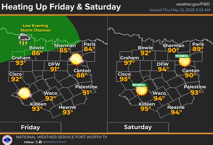
Isolated showers will continue today and Sunday across the region thanks to a pesky slow moving upper disturbance. Coverage of showers should be less than 20%. Outside of any areas that see rain, partly cloudy skies will prevail with temperatures in the 70s.
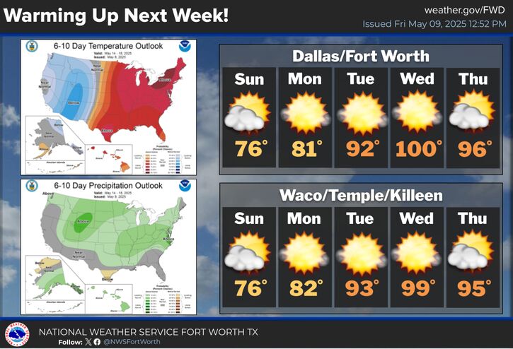
A taste of summer will arrive on Wednesday when highs in the 90s to triple digits can be expected. DFW and Waco have a good chance of breaking their May 14 high temperature records!
Much warmer weather is on the way next week with triple digits arriving across much of the region on Wednesday! Storm chances do return on Friday and continue through next weekend.


 Local Radar
 Weather Map
 Drought Monitor