
Severe thunderstorms capable of large hail and damaging wind gusts appear possible over the central and southern High Plains and eastern Kansas into Missouri Friday afternoon and evening. Rounds of storms Friday ahead of a slow moving frontal boundary will bring locally heavy rainfall and scattered flash flooding potential to the Mid-Mississippi, Ohio, and Tennessee Valleys, and the Appalachians. Read More >
Our Top Picks - Memorable Weather Events of 2016
|
As we close out 2016, it's time to take a look back and review some of the significant weather events which occurred across south central Nebraska and north central Kansas. The events that made our top picks include varying weather extremes from winter weather to severe weather to flooding. The severe weather season began early with large hail and tornadoes observed in April and early May. Fortunately, the tornado near Superior on April 24th was more of a "photo-op" than a damage producer. On May 9, a small tornado skipped across Sandy Creek Schools east of Fairfield, NE around 5:00 PM. Again, damage was minor and most of the students and staff were gone for the day. The rest of the spring and summer was relatively quiet with regards to severe weather. Late fall thunderstorms brought a rare occurrence as multiple tornadoes were reported on the Sunday following Thanksgiving. As if the post-Thanksgiving tornadoes weren't rare enough, another round of thunderstorms moved through the area on Christmas Day, producing damaging straight-line winds and at least 4 tornadoes! In addition, the area saw extreme weather in terms of climate with summer temperatures topping the century mark and low temperatures plummeting well below zero. Precipitation amounts ranged from only a few hundredths for an entire month to over seven inches in a 24-hour period. Though there was rain to be had, the year closed with an significant increase in abnormally dry, moderate drought or even severe drought (Kearney County, NE) conditions across about half of the area, especially west of U.S. Highway 281. This was a marked change from one year ago when no part of south central Nebraska and north central was considered even abnormally dry. |
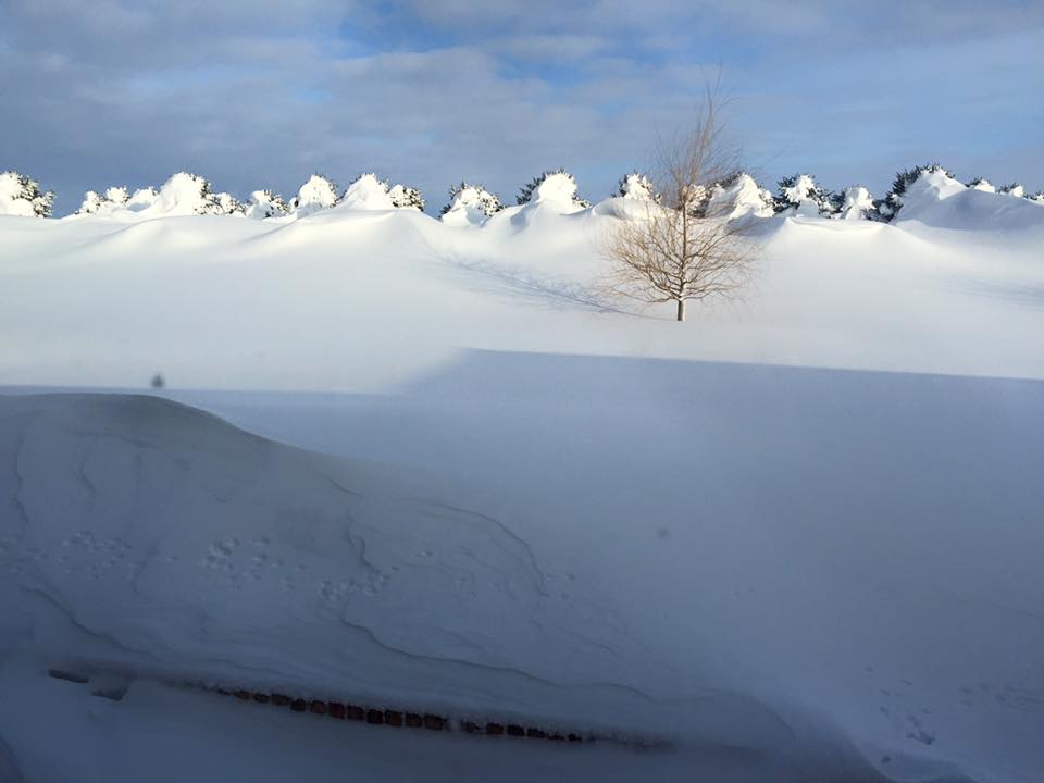
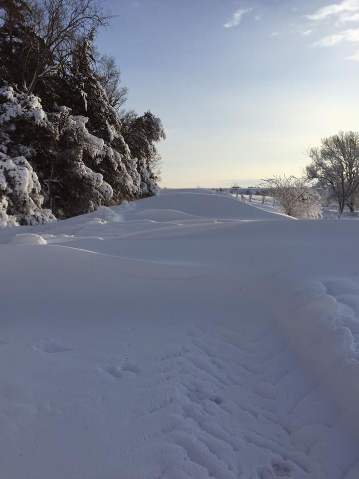
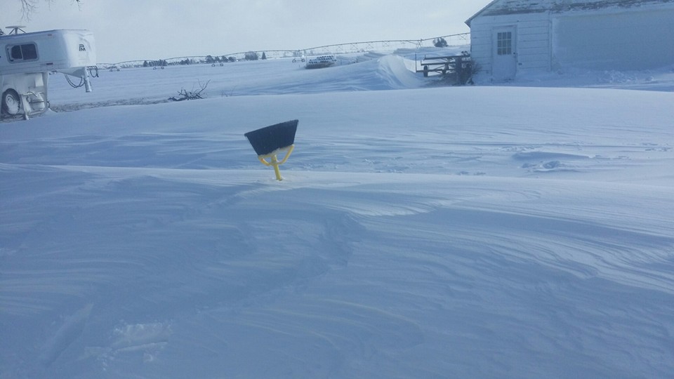
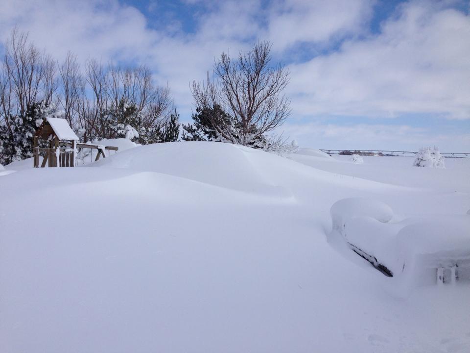 February 2nd blizzard. Photo by Danny Bruntz (6N of Hastings, NE) |
Blizzard! - February 2nd (Groundhog Day)
Winter arrived in full force on February 2nd as a potent upper low pressure system emerged onto the Central Plains, bringing one of the most significant winter storms to our area. Blizzard conditions developed during the predawn hours on February 2nd as snow combined with intense north winds of 30 to 40 mph and gusts of 50 mph to reduce visibility to zero or near zero. The snow and wind persisted through the day with the blizzard conditions continuing. The snow finally tapered off during the evening after dropping widespread snow amounts around 12 inches (a foot!) with even higher amounts in the 15 to 18 inch range for some areas. The snow event shattered records for both snowfall and liquid (melted snow) precipitation. Cleanup of the snow lasted several days and many schools or businesses were closed for several days.
Snow Records Set:
Grand Island: Snowfall of 17 inches on February 2nd shattered the previous record of 4.4 inches set back in 1990.
Precipitation (melted snow) amount of 1.64 inches broke the previous record of 0.68 inches set in 1943.
The 17.0 inches of snow on February 2nd was the highest snowfall ever recorded in February, and was the second highest on record on a single day ever, finishing behind 17.8 inches which fell on March 20, 2006.
Hastings: Snowfall of 14.3 inches on February 2nd shattered the previous snow record of 8.0 inches set in 1940.
Precipitation (melted snow) amount of 1.41 inches broke the previous record of 0.70 inches set in 1919.
The 14.3 inches of snow on February 2nd was the second highest daily snowfall total, finishing behind a 17.4 inch snow event on March 20, 2006.
 |
 |
 |
 |
| South of Hendley Photo by Darla McGahan |
Hastings Photo by Cindy Mau Gottsch |
Southeast of Campbell Photo by Todd & Beck Bartels |
3 miles west of Wood River Photo by James Haley |
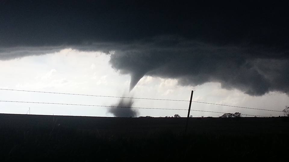
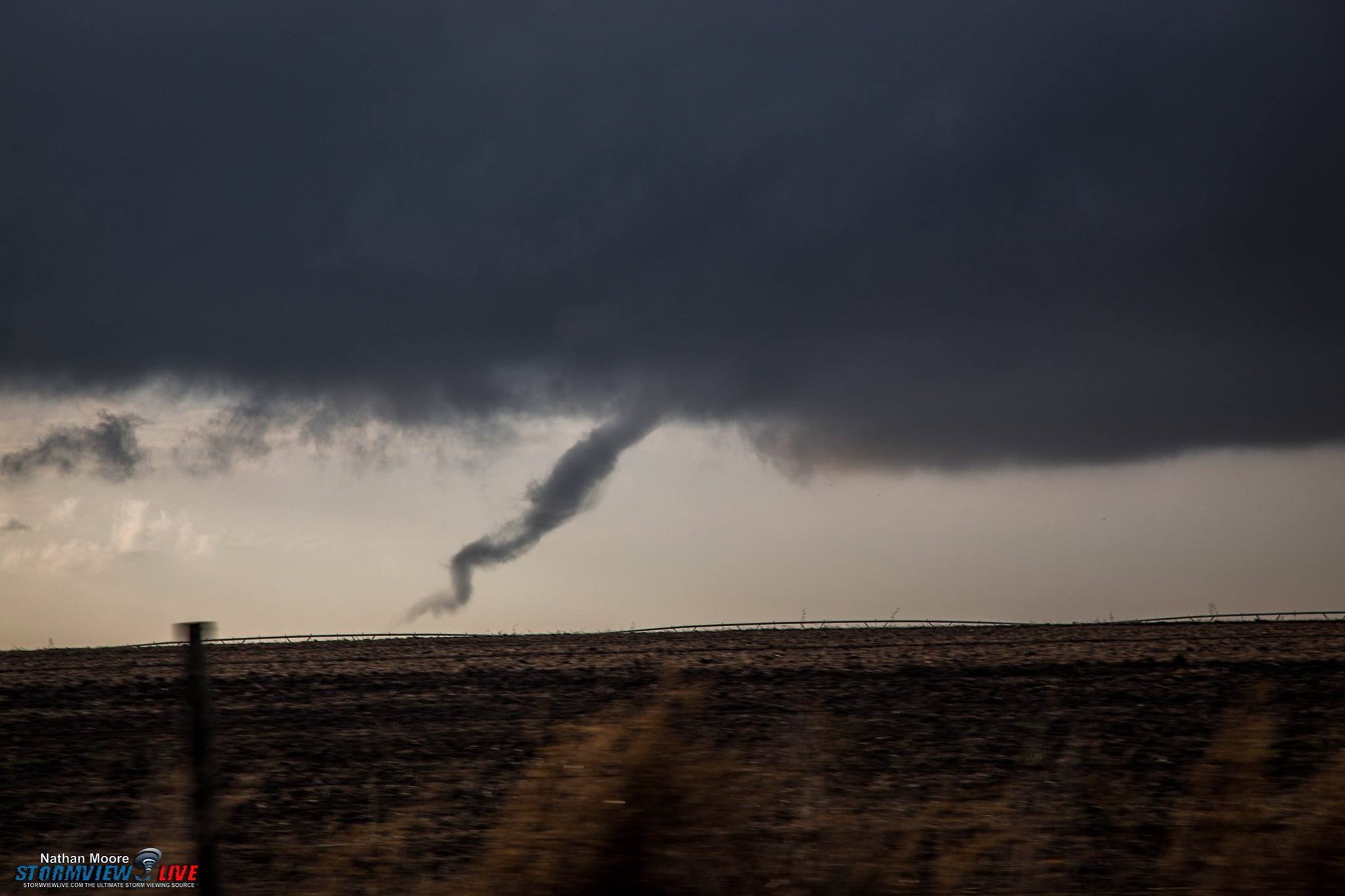
Tornadoes and Severe Weather - April 24th and May 8th-9th
April 24th. An upper level disturbance and a cold front crossing our region set the stage for a round of spring severe weather for locations along and east of Highway 281 on April 24th. The strongest storms impacted Jewell and Mitchell Counties in north central Kansas as well as Nuckolls and Thayer Counties in south central Nebraska. The first tornado of the season touched down near Highway 136 northwest of Superior, NE and remained on the ground for 2.8 miles. The tornado was rated an EF1 and mainly damaged power poles.
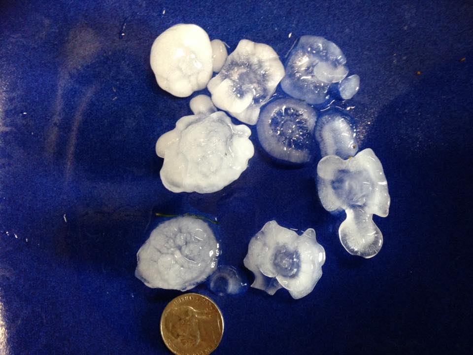
May 8th and 9th. A strong low pressure system and frontal boundaries combined to produce large hail and tornadoes May 8th and 9th. Intense thunderstorms produced large hail to 2 inches in diameter eight miles northeast of Natoma, KS. In Nebraska, hail the size of ping pong balls and wind gusts near 55 mph were common across Sherman, Dawson, and Gosper Counties. In Red Cloud, thunderstorm wind speeds were estimated at 75 mph and several trees were uprooted or damaged at the golf course. Another round of severe thunderstorms developed May 9th, producing hail of 1 to 2 inches in diameter and an isolated tornado. The largest (2" diameter) hail fell in Strang, with additional large hail of quarter to golf ball size occurring in the Holdrege and Clay Center, NE areas, and in the vicinity of Mankato, KS. A tornado developed east of Fairfield, NE and skipped along a 2.7 mile path to the east, damaging a pivot before striking the Sandy Creek school. The tornado damaged the front walkway overhang, the concessions stand, and blew windows out of vehicles in the school parking lot. The tornado crossed Highway 14 and damaged trees and a fence before lifting a couple of miles east of the highway.
 |
 |
 |
 |
| Tornado near Superior April 24 Photo by Britni Oakman |
Large Hail southeast of Red Cloud April 24 Photo by Linda Brinda |
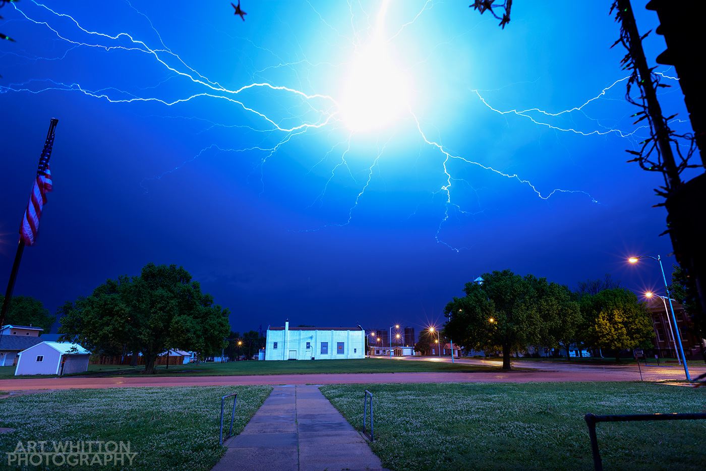
Lightning over Chester May 8th Photo by Art Whitton |
Tornado Damage at Sandy Creek School on May 9th Photo by NWS Staff |
Flooding - April 26th (Deshler) and September 4th (North Central Kansas)
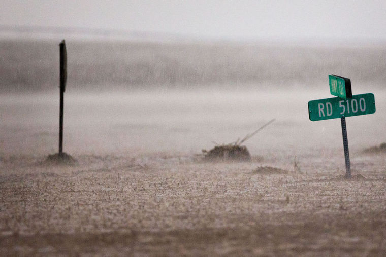
April 26th. Rounds of heavy rain produced significant rainfall totals as high as 5.10 inches in Ruskin, NE. The heavy rainfall resulted in flash flooding, especially over far eastern Nuckolls County into western Thayer County. A portion of Highway 136 between Ruskin and Deshler was closed due to water running over the road. In the town of Deshler, roads were covered in water due to flooding of the Spring and Snake Creeks, and residents of an assisted living facility were evacuated. One water rescue occurred when a person went outside to board up their home and became surrounded by water.
Heavy rainfall also affected portions of Buffalo and Phelps Counties. A portion of Highway 30 was closed near Elm Creek due to water running over the road. Flooding was reported in low-lying areas in the Amherst and Odessa areas and affected several county roads. Lowland flooding also impacted the underpass on the east side of Holdrege.
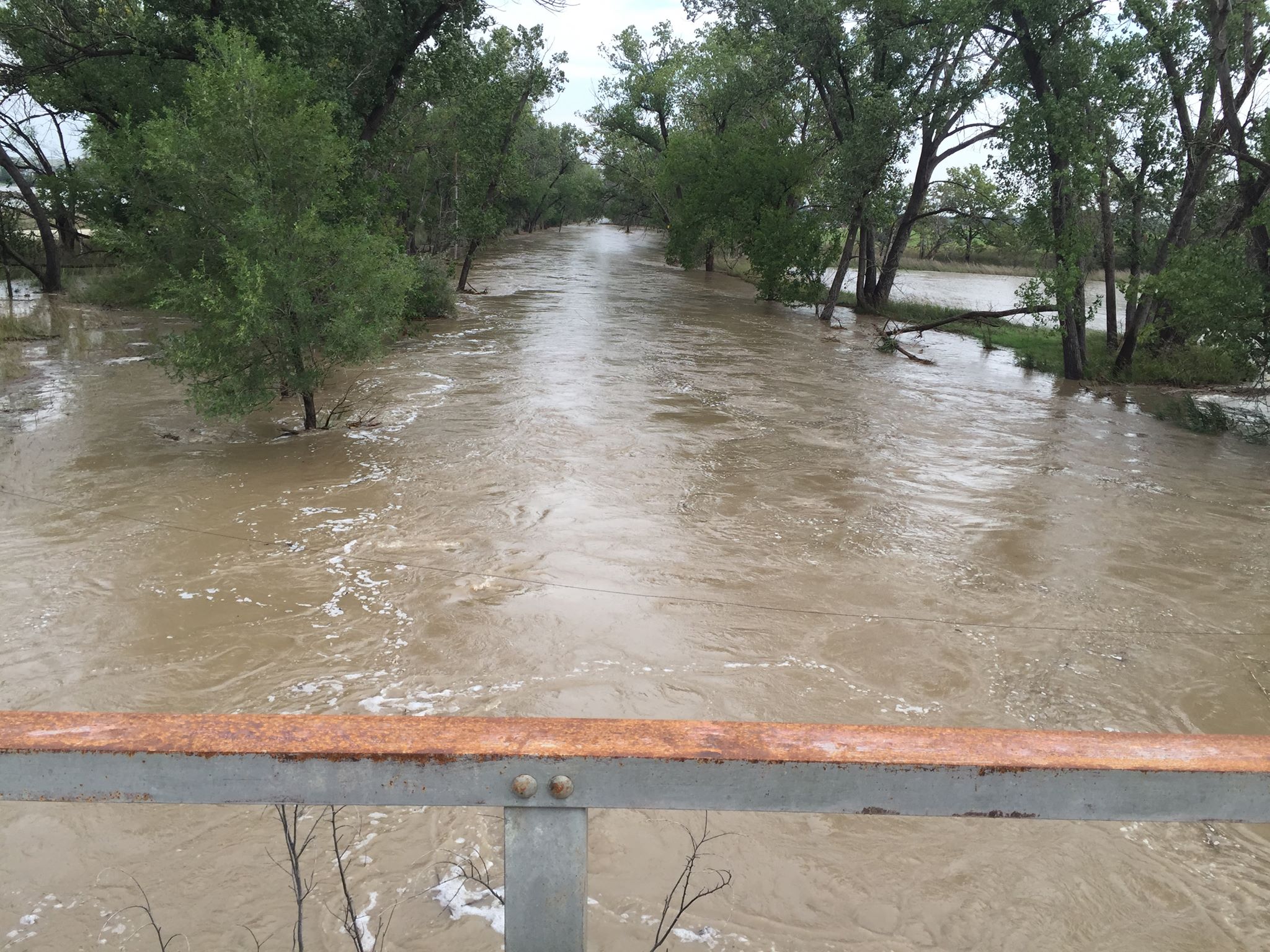
September 4th. Widespread heavy rainfall fell the evening of September 3rd through the overnight hours on September 4th. Copious rain amounts of 3 to 6 inches were common and the city of Plainville, KS had measured rain gauge amounts of 6 to 6.5 inches. Runoff from the heavy rainfall produced significant flooding of lowlands, rural roads, bridges and rivers. Numerous county roads were closed and several culverts were washed out. The North Fork of the Solomon River, the South Fork of the Solomon River, Deer Creek, Elm Creek and Bow Creek, among others, experienced river rises and flooding. Of note, the North Fork of the Solomon River near Glade, KS reached its all-time record stage of 18.65 feet on September 5th.
 |
 |
 |
 |
| Video of Flooding over Highway 136 near Deshler (April 26, 2016) Video by Trevor Tetley |
Flooding over Highway 136 and Road 5100 near Deshler (April 26, 2016) Photo courtesy of the Omaha World Herald |
Elm Creek flooding 7 miles north of Plainville, KS (September 4, 2016) Photo by Elizabeth Stamper |
Spillway St. at Plainville, KS Lake (September 4, 2016) Photo by Butch Post |
Rare Tornadoes November 27th
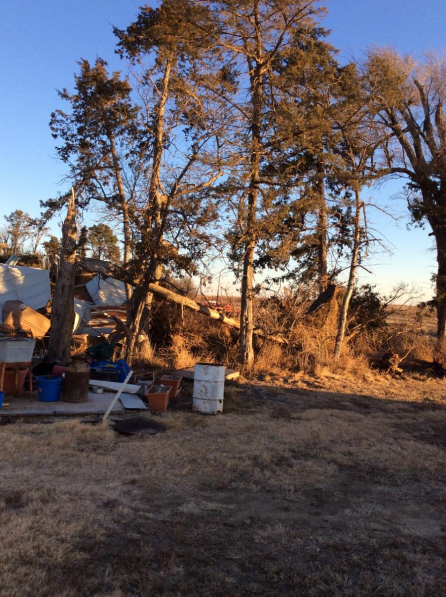
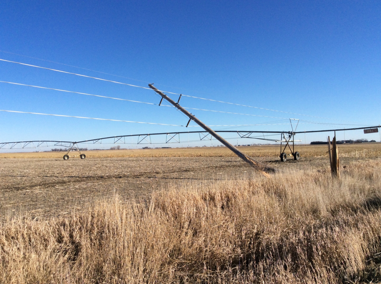
A warm, moist November air mass and an upper level low pressure system crossing the Central Plains, provided the necessary ingredients for a few tornadoes to develop on Sunday, November 27th. Three tornadoes touched down, the first tornado occurred 2.6 miles southwest of Upland and this tornado was very brief and was rated EF0. The second tornado set down east of Red Cloud, NE, and traveled 3.92 miles. This EF1 tornado uprooted trees, destroyed an outbuilding, upset irrigation pivots, and caused other minor damage along its path. The third tornado briefly touched down east of Lawrence, NE and was rated EF0, with only very minor damage occurring on its 3.67 mile path.
November tornadoes are rare! The tornadoes on November 27th marked the second latest day of the calendar year that tornadoes occurred in the state of Nebraska (excluding this year's Christmas tornadoes). The latest calendar date for tornadoes was on December 13, 1975 when tornadoes touched down in Thayer and Pawnee Counties (again, excluding this year's Christmas tornadoes). This was the fourth time since 2000 that a tornado occurred in November in Nebraska.
 |
 |
 |
 |
| Tornado East of Red Cloud Photo by Red Cloud/Guide Rock Fire Department |
Tree Damage east of Red Cloud Photo by NWS Hastings Staff |
Tornado East of Lawrence Photo by Nick Kliewer |
Tornado near Upland, NE Photo by Nathan Moore |
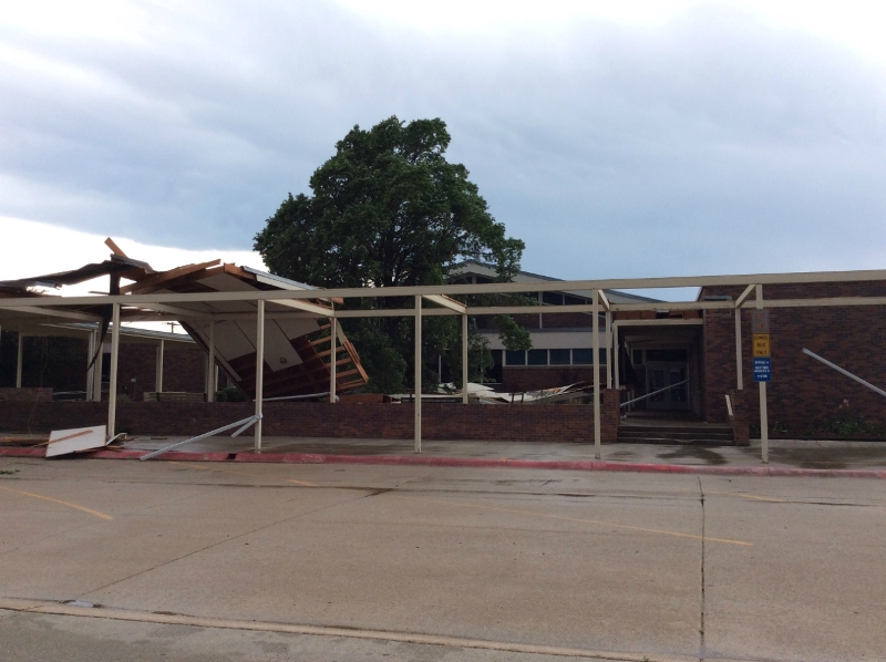
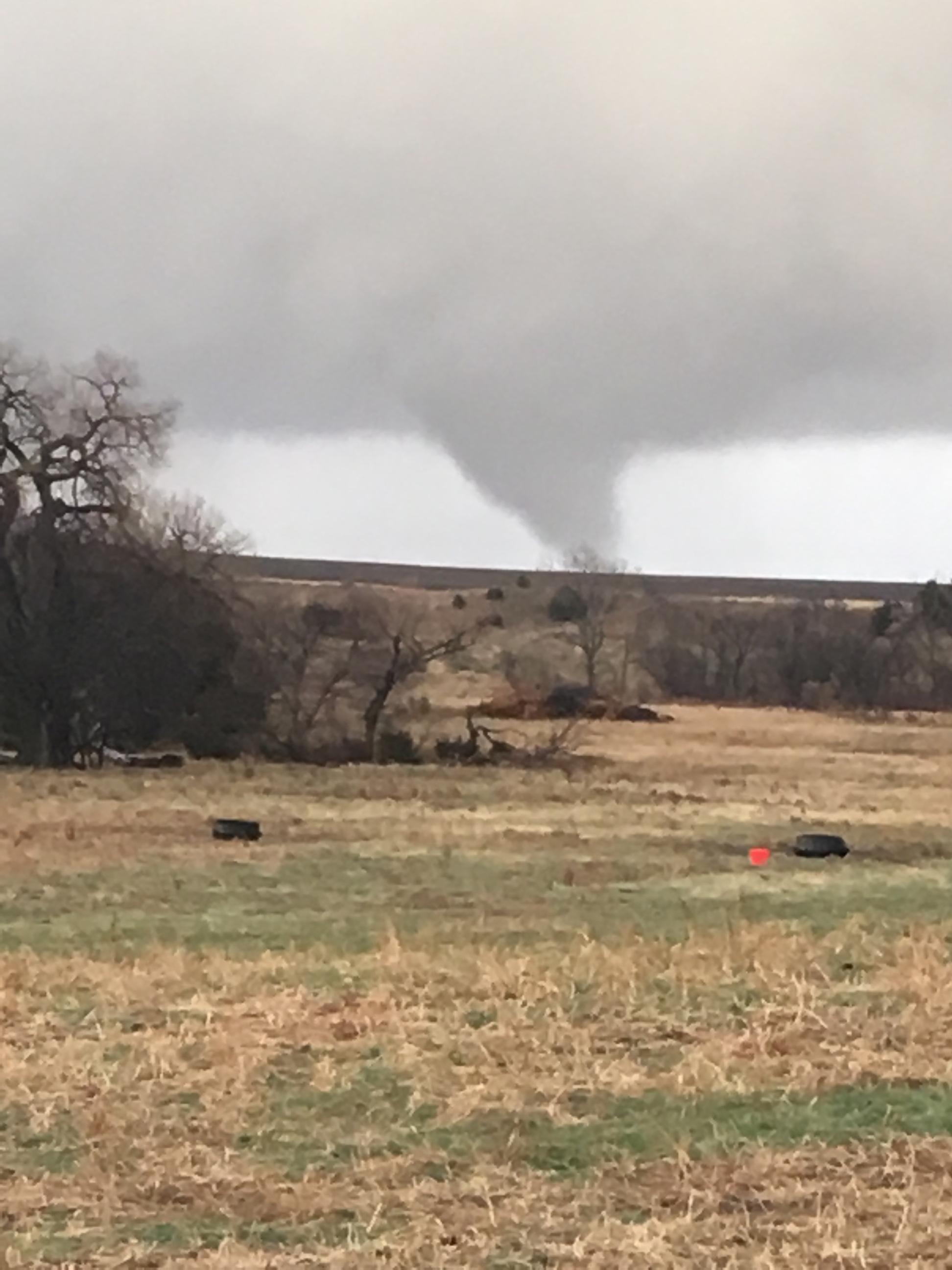
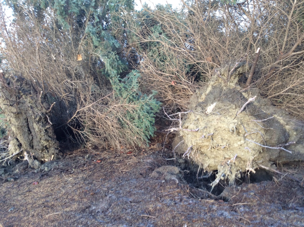
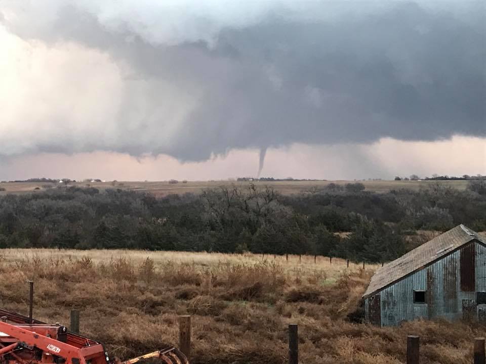
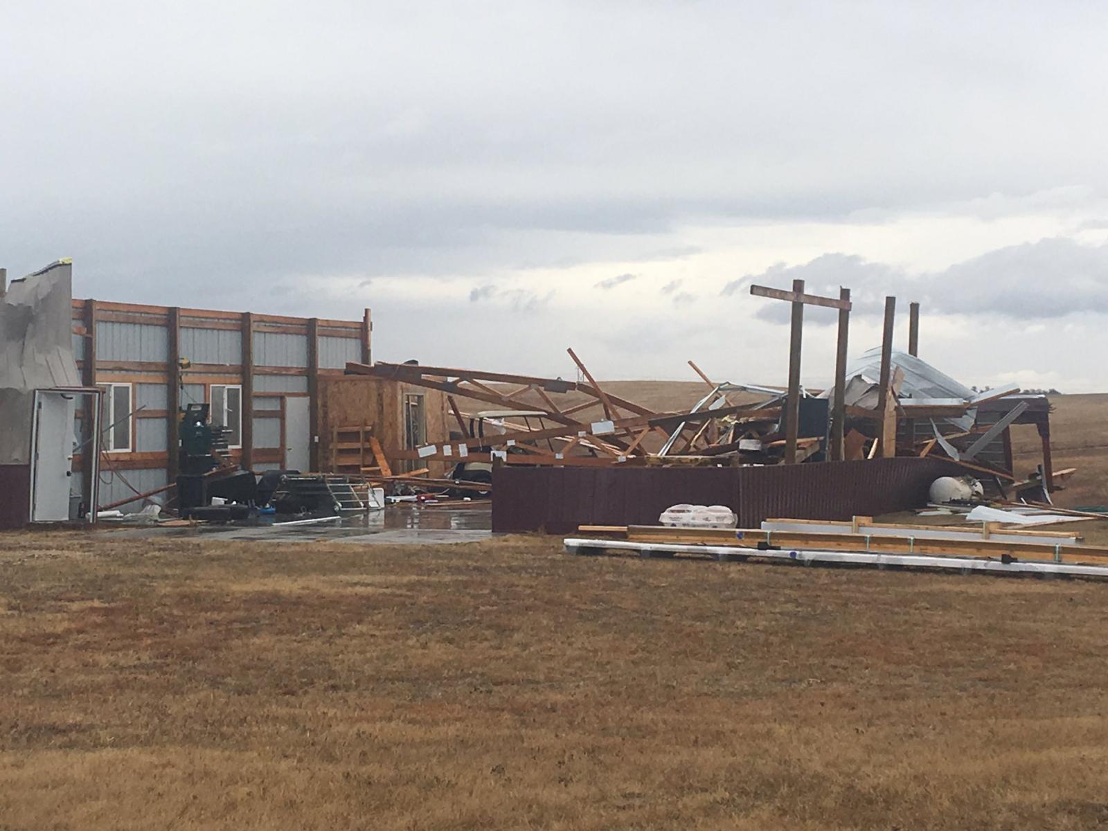
Christmas Thunderstorms/Hurricane Force Wind Gusts and Historic Tornadoes
The weather on Christmas Day was historic in many ways, from the occurrence of thunderstorms which produced tornadoes and damaging winds, to another round of extreme weather during the evening when widespread wind gusts to hurricane force buffeted the area. An intense low pressure system moving out of the Rockies lifted northeast across the Central Plains, and brought the unique weather to our region for Christmas, including a lead cold front generating thunderstorms from late morning into early afternoon. Rare, historic tornadoes occurred on the leading edge of the storms both in Nebraska and Kansas. The tornadoes were confirmed: northwest of Alton, KS; near Funk, NE; southeast of Minden, NE; and northwest of Gibbon, NE.
The Nebraska tornado northwest of Gibbon is the 'latest calendar year' tornado in Nebraska since 1950 and this is the first day with December tornadoes since December 13, 1975. In 1975, a tornado tracked eight miles between Chester and Gilead in Thayer County and a brief tornado occurred near Steinauer in Pawnee County.
In Kansas, prior to 2016, it appears at least eight tornadoes occurred in Kansas in December since 1950. The most recent December tornado was an EF-0 in Harper County on December 14, 2014. Prior to that, two tornadoes occurred in Cherokee County on December 18, 2002. The latest 'calendar year' tornado was on December 26, 1959 when an F2 tornado occurred west of Talmage in Dickinson County.
During the evening on Christmas Day, generally between 5 PM and 9 PM, intense wind gusts of 60 to 80 mph blasted much of Nebraska and western Kansas. The duration and strength of the extreme winds created another historic event on Christmas. Sustained wind speeds averaged 35 to 45 mph and even reached over 50 mph in a few locations and wind gusts of 60 to 80 mph were common. The intense winds caused another round of damage to trees, power lines, roofs and buildings and traffic accidents occurred with overturned semis. Several areas also experienced power outages due to downed power lines.
"I've worked for the National Weather Service for 18 years, and never have I seen such strong wind for such a long period. We had quite a few locations with a sustained wind of at least 40 mph with wind gusts of 60-80 mph for 2-4 hours on Christmas evening."---Merl Heinlein, Jr., Meteorologist at NWS Hastings, NE.
Wind Gusts of 70 mph or greater Include:
 |
.jpg) |
 |
 |
| A tornado damaged a building near Gibbon, NE Photo by Heather Riggleman |
Shingles off a roof on the west side of Kearney, NE |
A tornado damaged a shed and trees northwest of Alton, KS Photo by NWS Hastings |
A tornado damaged power lines near Funk, NE Photo by NWS Hastings staff |
2016 Climate Extremes
Hottest temperatures of 2016
Coldest temperatures of 2016
Highest 24 hour rain totals
Highest 24 hour snowfall totals
Nebraska Tri-Cities Extremes (Grand Island, Hastings, Kearney)
Of interest:
 |
Media use of NWS Web News Stories is encouraged! Please acknowledge the NWS as the source of any news information accessed from this site. |
|

