
Scattered severe thunderstorms capable of large to very large hail, damaging winds with potentially significant gusts, and perhaps a couple of tornadoes are expected Friday afternoon into night across portions of the central Plains into upper Great Lakes. Thunderstorms with heavy to excessive rainfall may produce flooding over a part of the Midwest Friday. Read More >
Overview
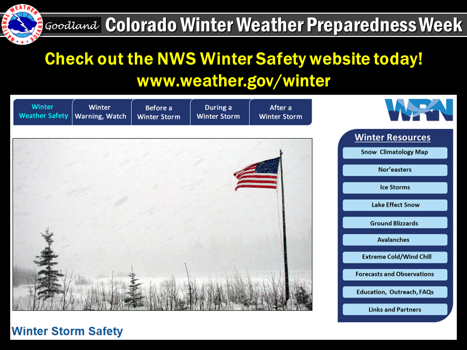
As declared by Colorado Governor John Hickenlooper, the week of October 16th through the October 22nd is Colorado Winter Weather Preparedness Week. This page has been created in support of that week, raising winter weather awareness for the state of Colorado. This page will also serve to provide winter weather information to all citizens across the High Plains. Winter is fast approaching for the High Plains...stay aware and please prepare!
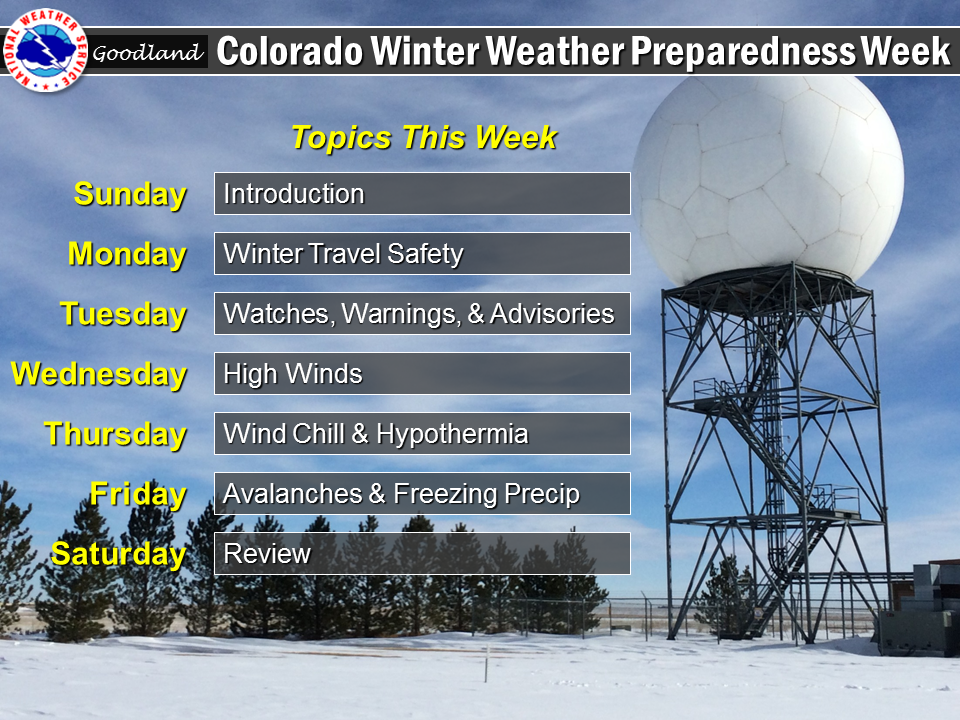
Sunday:
…Winter Weather Preparedness Week in Colorado...
Governor John Hickenlooper has proclaimed the week of October 16th through October 22nd as Winter Weather Preparedness Week in Colorado. This is an excellent time for all individuals, families, businesses, schools, and media outlets to review their winter storm preparedness plans. It is especially important for all new arrivals to the state to become familiar with the National Weather Service watch and warning definitions, as well as winter safety procedures.
Snow in Colorado is important to the farmers, the ski areas, and for filling up reservoirs. However, winter storms often bring heavy snow, bitter cold air, high winds, low visibilities, and slick roads. This can lead to dangerous travel conditions and other life threatening situations such as avalanches and very frigid wind chill temperatures.
To help you prepare for these hazards this coming winter, the National Weather Service will issue statements throughout the week to discuss:
Monday: Winter Travel Safety
Tuesday: Watches, Warnings, and Advisories
Wednesday: High Winds
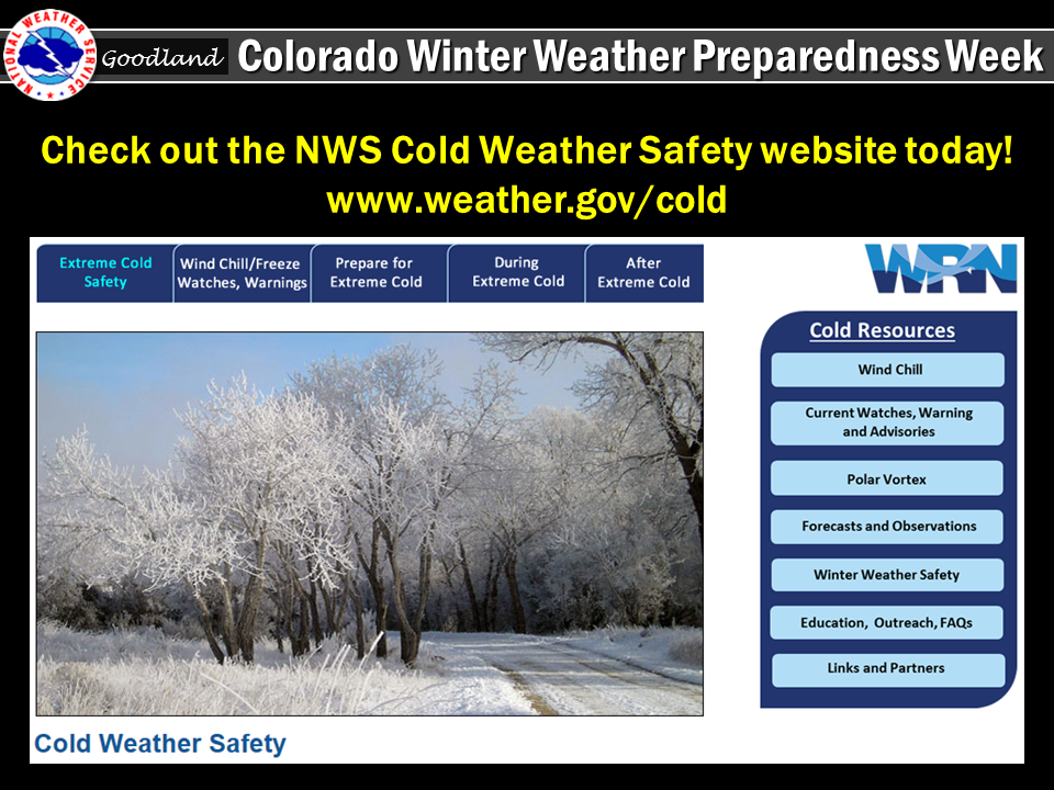
Thursday: Wind Chill Temperatures and Hypothermia
Friday: Avalanches and Freezing Precipitation
Saturday: Winter Weather Preparedness Week in Review
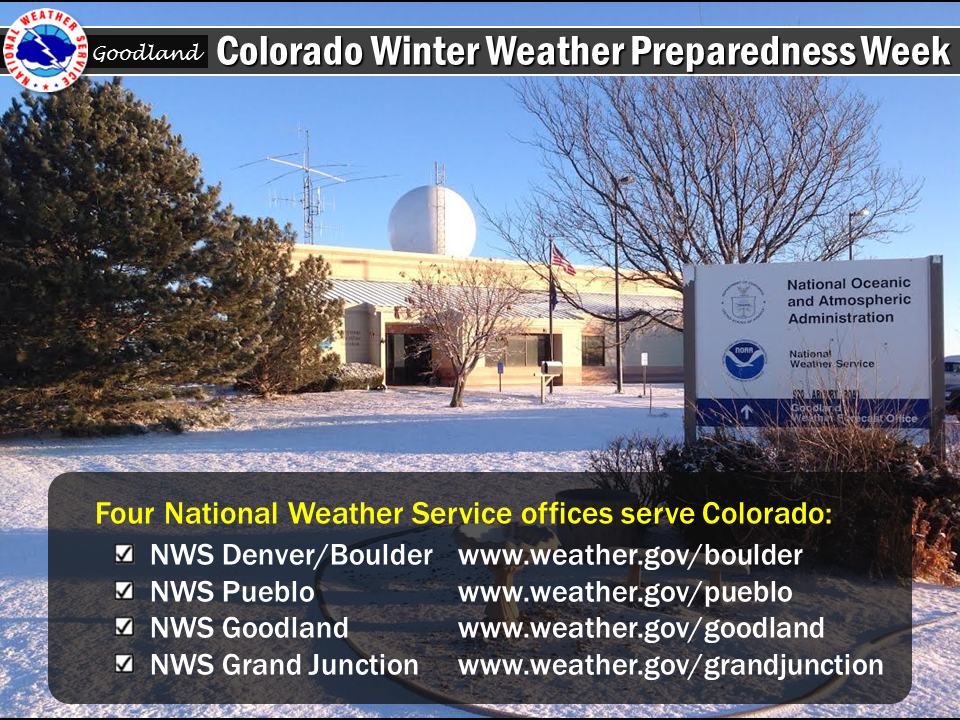
Anyone who needs information on winter storms in Colorado should contact their nearest National Weather Service office.
Denver/Boulder:
Grand Junction:
Pueblo:
Goodland Kansas:
Sunday's Social Media Posts
 |
 |
 |
Monday:
...Winter travel safety...
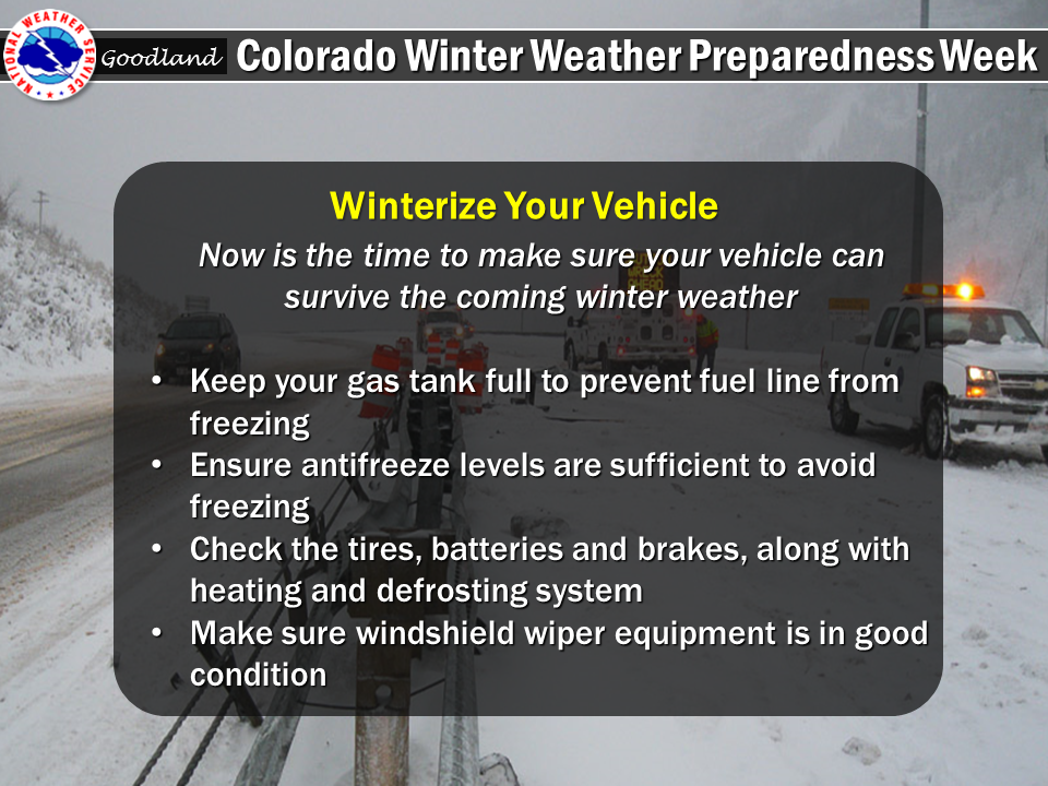
Colorado Winter Weather Preparedness Week continues through Saturday, October 22nd, as proclaimed by Governor Hickenlooper. Preparedness is a big part of this campaign. Before winter weather arrives in earnest, it is highly recommended that you prepare your car or truck for winter travel.
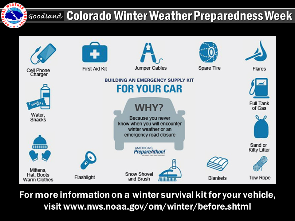
A well-equipped vehicle has adequate tires, tire chains, tow rope, sand or cat litter for traction, shovel, tool kit, windshield scraper and brush, battery cables, first aid kit, flashlight, extra batteries, blankets and/or sleeping bags, extra clothing, candles, water‑proof matches, jug of water, high calorie packaged food for quick energy, and an empty can to melt snow for drinking.
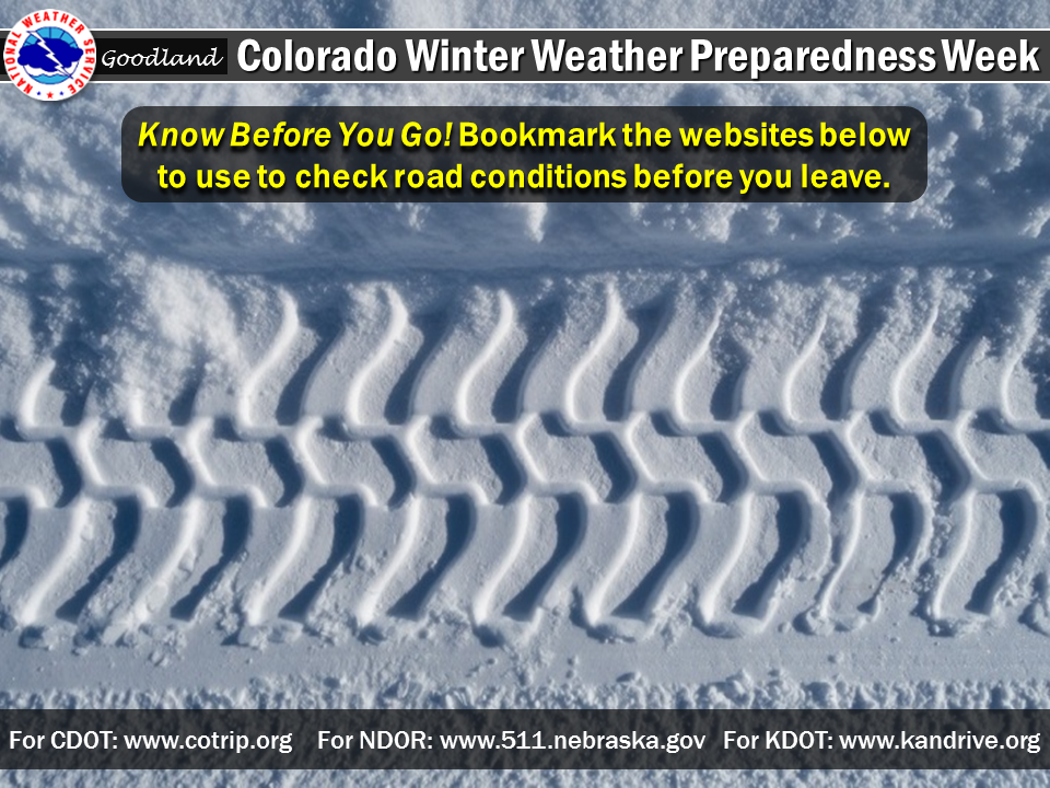
The best way to prevent treacherous winter travel is to avoid it. This can be done by staying informed about the current weather and road conditions as well as the latest weather forecasts. Information on road conditions in Colorado is available on the web at www.cotrip.org or from the toll free number 1-877-315-7623. When calling from anywhere in Colorado, dialing 511 will also access the Colorado road reports. Additionally, a free smartphone application, CDOT mobile, is available.
If you should become stranded during a winter storm, stay with your vehicle and do not panic. If accompanied by others, take turns sleeping. Run the motor every hour for about ten minutes to maintain warmth, but keep windows open a little to prevent the buildup of carbon monoxide. Make sure the exhaust pipe is not blocked. Keep the car visible with brightly colored cloths tied to the side view mirrors, door handles, or external antenna. At night, turn on the dome light when running the engine. Exercise periodically by vigorously moving arms, legs, toes and fingers.
In the mountains, avalanches become a possibility in the winter, especially below steep slopes. Avalanches occasionally come down across roads, with little or no warning. However, avalanche control work is performed on many avalanche prone roads in Colorado, making the roads safer to travel. Caution is advised when traveling along avalanche prone roads, especially during and shortly after a heavy snowstorm or during periods of rapid snowmelt.
Very strong downslope winds occur at times mainly along the Front Range of Colorado. These chinook and bora winds can have gusts exceeding 100 mph. Persons traveling in light weight or high profile vehicles should avoid travel during these strong wind events especially on north‑south oriented roads.
Roads which appear to be clear in the winter may actually be coated with a thin layer of ice, commonly known as black ice. This nearly invisible ice layer can cause you to rapidly lose control of your vehicle. Black ice is most common during the nighttime hours. If you detect black ice, you should reduce your speed.
Please follow these winter travel safety recommendations which could save your life.
Monday's Social Media Posts
 |
 |
 |
Tuesday
...What Does that Warning Mean...
When a warning is issued during the winter season, will you know what it means and will you know how to respond? During this Colorado Winter Weather Preparedness Week, please become familiar with our list of potentially life-saving winter weather products.
Today’s statement contains warning and advisory criteria for eastern Colorado.
Outlooks
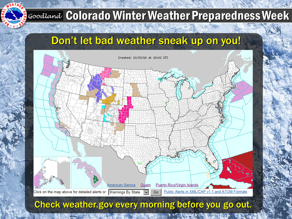
A Hazardous Weather Outlook is issued daily by each National Weather Service office serving Colorado. The outlook provides information on potentially hazardous weather out to 7 days into the future. Also, the weather story, a graphic of expected hazardous weather, is posted daily on National Weather Service web sites serving Colorado.
Watches and Warnings
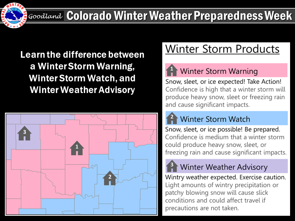
A Winter Storm Watch is issued when hazardous winter storm conditions are possible within the next 2 to 4 days...but the timing... intensity...or occurrence may still be uncertain.
In contrast, a Winter Storm Warning is issued for potentially life-threatening winter storm conditions, such as heavy snowfall or a combination of snowfall, sleet and ice, which are likely to occur within the next 1 to 2 days.
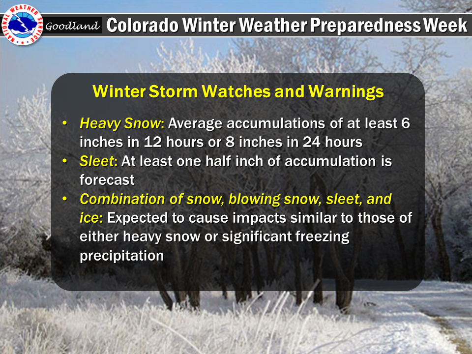
Warning criteria for heavy snow, sleet and ice is defined by the following amounts.
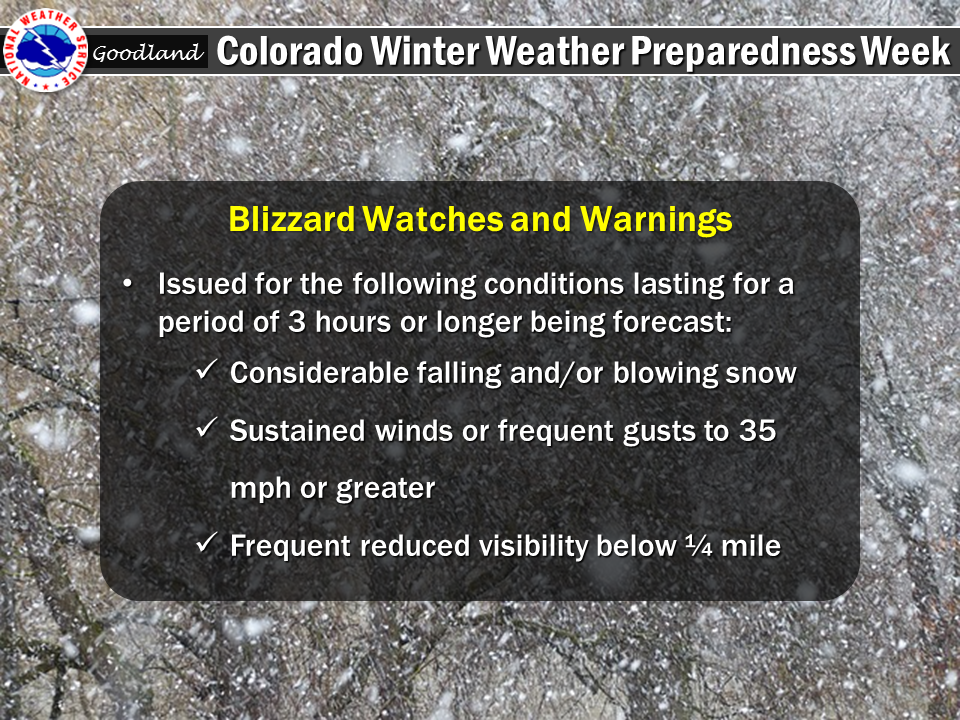
A Blizzard Warning is issued when the following conditions are expected to occur for at least 3 hours...
A High Wind Warning is issued for the following conditions...
A Wind Chill Warning will be issued for the following wind chill temperatures...
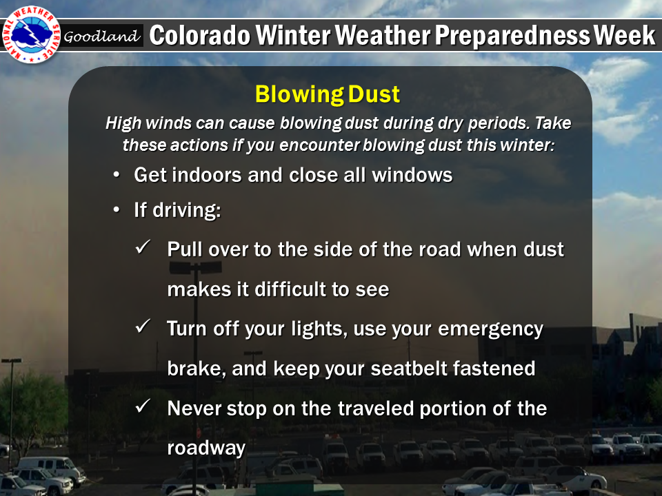
A Dust Storm Warning will be issued for the following conditions:
Visibility reduced to 1/4 mile or less in blowing dust...
Advisories
Advisories for winter weather are issued for potentially hazardous conditions which are considered more of a nuisance than a life-threatening situation. However, if caution is not taken, the advisory events could become life-threatening.
Tuesday's Social Media Posts
 |
 |
 |
 |
Wednesday:
...Widespread High Winds Visit Colorado During the Winter...
Governor John Hickenlooper has proclaimed this week through October 22nd as Winter Weather Preparedness Week in Colorado.
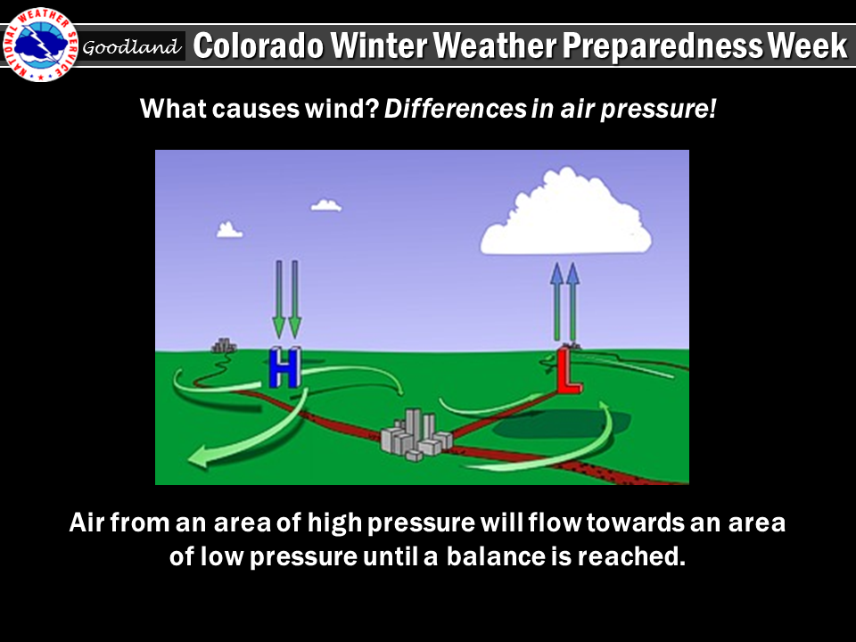
The two main causes of high winds in Colorado during the cold season are the air pressure difference between strong low pressure and cold high pressure systems, and chinook winds developing across the Front Range and other eastern mountain ranges.
A strong, cold high pressure system moving in from the north and setting up to the west of the Rockies can generate damaging winds down the leeward slopes of the mountains, known as a bora. These episodes feature widespread high winds from the west or northwest into the adjacent plains at speeds which can exceed 100 mph. Much rarer are those episodes when low pressure is across the Rockies, and strong, cold high pressure is across the Great Plains. The result is damaging winds from the east across the western slopes of mountain ranges and adjacent valleys.
Mid and upper level winds over Colorado are much stronger in the winter than in the warm season because of the huge difference in temperature from north to south across North America. West winds, under certain conditions, can bring warm, dry chinook winds cascading down the slopes of the eastern mountains. These winds can exceed 100 mph in extreme cases, bringing the potential for widespread damage. Winds of 60 to near 100 mph will occur in and near the foothills in areas such as Fort Collins, Boulder, Denver, Colorado Springs, Canon City, Westcliffe, Walsenburg and Trinidad. The areas around Boulder and Westcliffe are especially prone to these extreme wind episodes.
Dangers from high winds include flying debris, reduced visibility due to blowing dust and blowing snow, damaged or destroyed structures, downed power lines, and overturned vehicles. The National Weather Service will issue a high wind watch when there is around a 50 percent chance for high winds to develop during the next day or two. When the threat becomes more certain in a specific area, a high wind warning will be issued. Cold strong winds can also bring dangerously low wind chill values, prompting a wind chill advisory or wind chill warning. Blizzard warnings and dust storm warnings will be issued when significant blowing snow or blowing dust is forecast to reduce visibility below one quarter mile.
If high winds are forecast for your area, you should bring lightweight objects indoors, tie them down outdoors, or move them so they do not become dangerous missiles. Any downed power lines should not be approached. Instead, call the utility company. Stay clear from buildings under construction during high winds as they can easily collapse. Traveling on north south roads near the mountains along the Front Range during a high wind episode can also be dangerous. If you drive a lightweight or high profile vehicle, you may want to wait until the high winds die down.
Wednesday's Social Media Posts
 |
 |
 |
Thursday:
...Wind Chill, a Potentially Life-Threatening and Often Overlooked Killer...
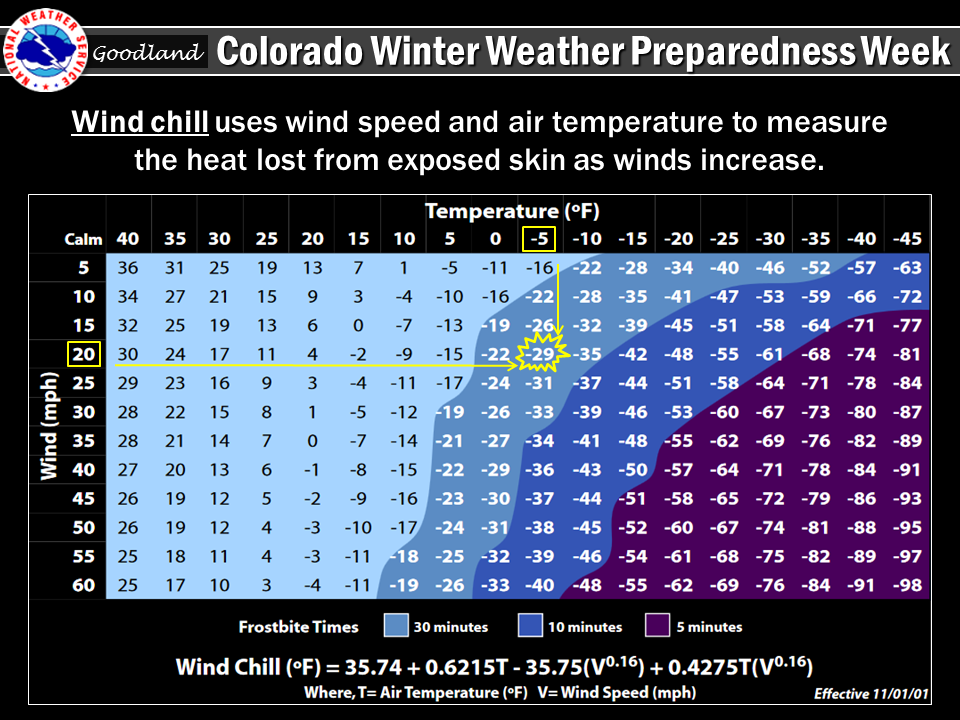
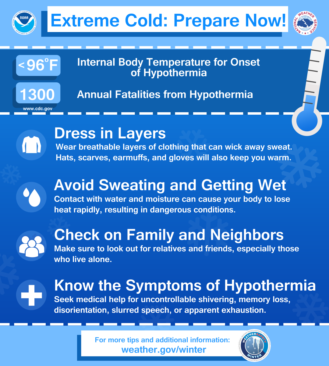
The combination of wind and low temperature in winter can be deadly. The Wind Chill Index helps you determine when dangerous conditions develop that could lead to frostbite or hypothermia. It takes into account heat loss from the human body to its surroundings during cold and windy weather. The calculation utilizes wind speed in miles per hour and temperature in degrees Fahrenheit. For example, a temperature of minus 5 degrees occurring with a 20 mph wind gives a wind chill near minus 30 degrees. This means that your body will lose heat at the same rate as it would if the air temperature were minus 30 degrees with no wind. Wind Chill values near minus 25 degrees mean that frostbite is possible within 15 minutes.
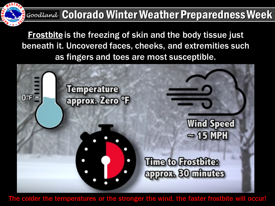
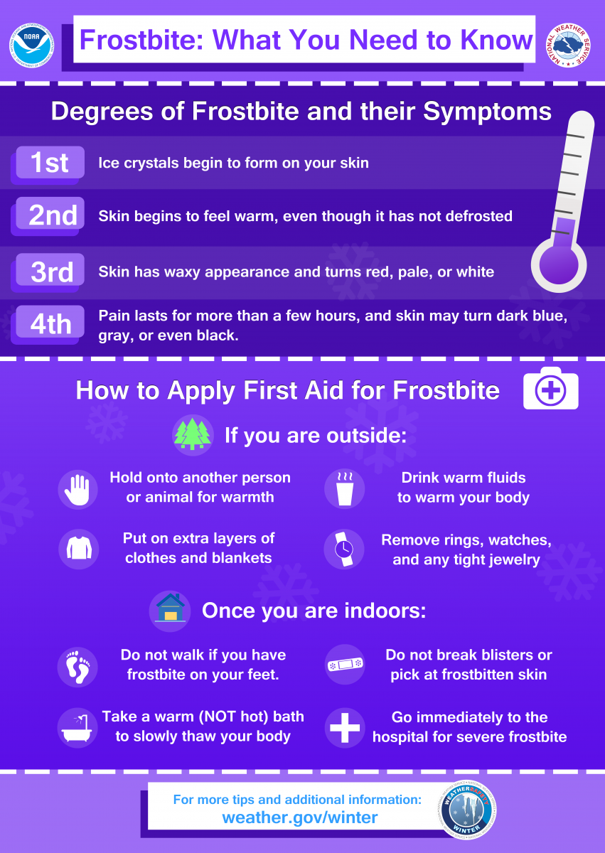
Frostbite is the freezing of skin and the body tissue just beneath it. It first affects exposed body tissue where blood circulation may be limited such as your fingers, toes, nose and ears. To minimize frostbite, make sure all body parts are well covered. When frostbite starts, feeling is lost in the affected area and the frozen tissue will take on a white or pale appearance. If you suspect you are experiencing frostbite, hold the frostbitten area closely against warm skin to return blood flow and warmth to the affected area.
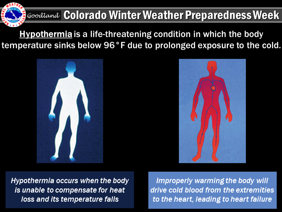
Hypothermia is a dangerously low body temperature and is the most common winter weather killer. When you hear of a hiker, climber, hunter or stranded traveler perishing from cold weather exposure, hypothermia was the cause. Most people are surprised to learn that hypothermia deaths can occur with temperatures between 30 and 50 degrees. If you or your clothing is wet, then hypothermia becomes even more likely.
Thursday's Social Media Posts
 |
 |
 |
 |
 |
Friday:
...Avalanches...Are You Prepared...
Thousands of avalanches occur each winter in the mountains of Colorado. With the enormous popularity of winter sports in Colorado, avalanches pose a risk to skiers, snowboarders, snowmobilers, and people traveling in the backcountry. On average, 6 people die in avalanches every year in Colorado alone. Anyone who travels into the high country during the winter should be prepared for avalanches and know how to avoid them.
The most important thing to know is how to get information on current avalanche conditions. Check the Colorado Avalanche Information Center Website at https://avalanche.state.co.us or call the center at 303-499-9650 for the current avalanche forecast. Check the National Weather Service website at www.weather.gov for the current weather forecast. Knowing the current and future conditions will help you make good decisions in the backcountry.
A little information about avalanche safety can go a long way. Most avalanches occur during or just after snowstorms on slopes between 30 to 45 degrees. A significant snowfall may result in an unstable snowpack. By waiting at least 36 hours after a big snow or wind storm before you go into the mountains, the snow may become more stable and less likely to avalanche. If you stay in valleys away from avalanche chutes, in stands of dense trees, or on gentle slopes, you can decrease the risk of being caught in an avalanche.
While avalanches will not impact the Tri-State Region, it is important to remember these helpful hints if you are planning winter activities in the mountains.
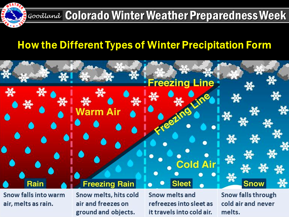
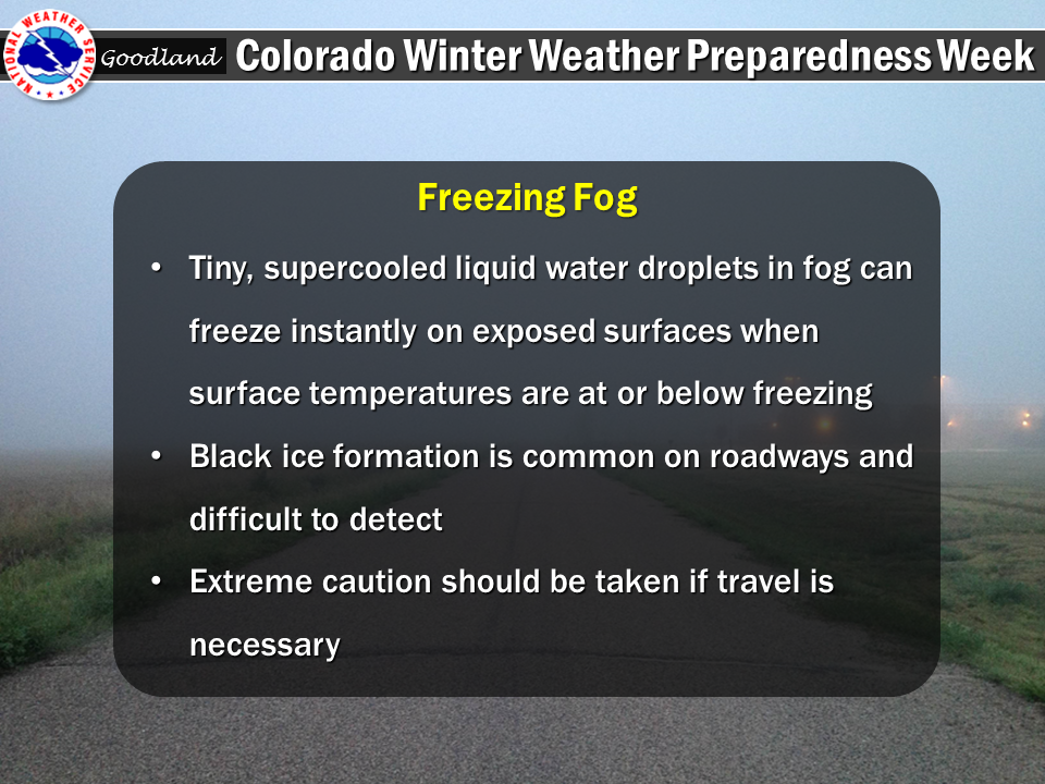
Aside from avalanches, the Tri-State Region commonly observes a different type of winter weather hazard…freezing precipitation. Freezing precipitation in the form of freezing rain, freezing drizzle and/or freezing fog often create hazardous travel conditions. Freezing precipitation results in a thin layer of ice on area roadways and sidewalks, commonly referred to as black ice. It is often difficult to detect this ice on roadways until it is too late.
Ice typical forms first on bridges and overpasses as these surfaces will cool quicker than roadways built on soil. When freezing precipitation is falling, travel should be avoided if possible. If travel is necessary, slow down below posted speed limits, especially on local highways and interstates. Only a thin layer of ice is needed to cause your vehicle to slide off the roadway. Slide offs become particularly dangerous at high rates of speed.
Now is the time to get prepared for winter so you can safely travel and enjoy the outdoors when the snow flies.
Friday's Social Media Posts
 |
 |
 |
Saturday
Enjoy the great outdoors in Colorado this winter season...but watch the weather.
The National Weather Service issues a variety of winter weather outlooks, watches, warnings, and advisories. These products were covered earlier during this winter weather preparedness week. Safety tips were also passed along.
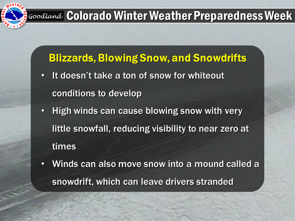
Two separate blizzards produced snow totals of a foot or more last winter season across the High Plains. The first blizzard struck on November 17th, 2015, just a day after a tornado outbreak struck northwest Kansas. This winter storm produced a band of heavy snow that dumped 20 or more inches from Atwood, Kansas to Colby, Kansas to Sharon Springs, Kansas. Within 35 miles of either side of this heavy snow band, only 3 to 5 inches of snow was received. Regardless, the combination of winds gusting 50 to 60 mph and persistent snowfall led to near zero visibility and impossible travel conditions for several hours.
A second significant blizzard impacted the Tri-State Region on February 1st and 2nd, 2016. Many locations across the Tri-State Region received a foot or more of snow. This blizzard produced winds gusting 50 to 60 mph, whiteout conditions for several hours, snow drifts of three to five feet, and impossible travel conditions. This blizzard will be one of the more memorable ones for many of us living in the Tri-State Region.
Before winter weather threatens this season, you should prepare a winter safety kit for your vehicle. When planning travel, check the latest weather forecasts. A valuable companion when heading out is a battery powered NOAA All Hazards Weather Radio, the voice of the National Weather Service. It provides you with the latest weather conditions, forecasts, and warning information. You can pick one up at your local electronics or department store.
Finally, if you need information on winter weather safety, winter weather safety brochures, or NOAA All Hazards Weather Radio, please visit the website of the National Weather Service office responsible for your area.
Denver/Boulder: www.weather.gov/bou
Grand Junction: www.weather.gov/gjt
Pueblo: www.weather.gov/pub
Goodland, Kansas: www.weather.gov/gld
All these efforts help us to build a Weather-Ready Nation...which will make America safer by saving more lives and protecting livelihoods.
Have a safe and enjoyable winter season in Colorado.
Saturday's Social Media Posts
 |
 |
 |
 |
Media use of NWS Web News Stories is encouraged! Please acknowledge the NWS as the source of any news information accessed from this site. |
|

