
Severe thunderstorms and heavy rain are expected across the central High Plains into parts of the central and southern Plains and in the the Mid-Atlantic today. Intense, dangerous heat will persist across the West, Southwest, and Southern Plains into the end of the week. Elevated to critical fire weather conditions expected in the Great Basin and Four Corners region. Read More >
| Click on the icons below to access individual briefing pages |
|
|
|
***Click Here for Probabilistic Snowfall Products***
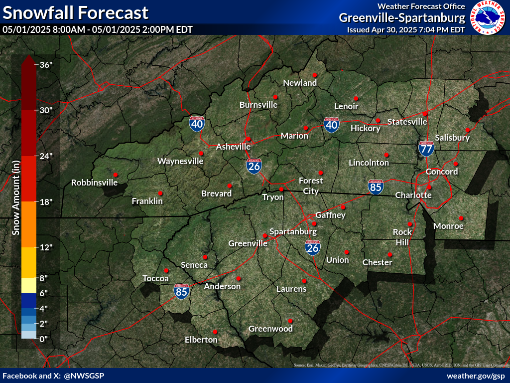
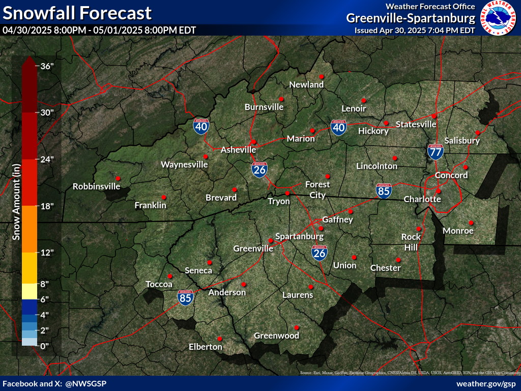
Snowfall Accumulation Forecast (click on thumbnails to display below)
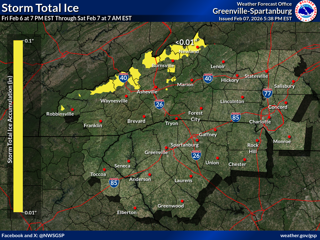
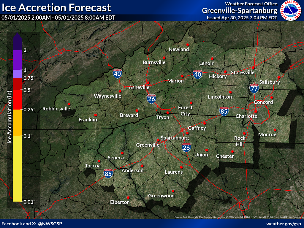
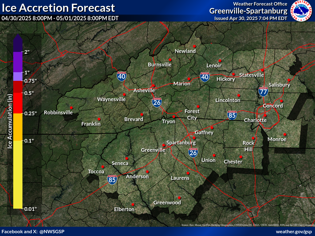
Ice Accumulation Forecast (click on thumbnails to display below)
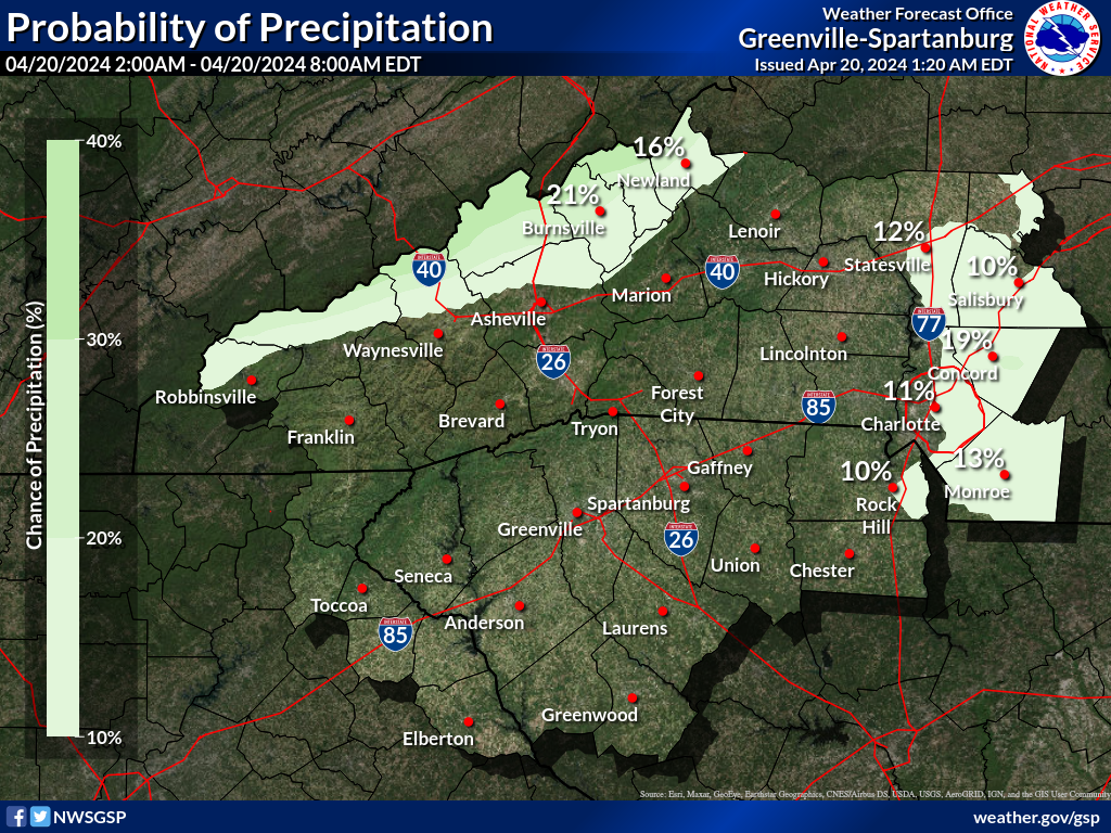
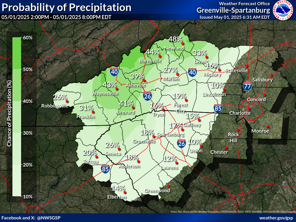
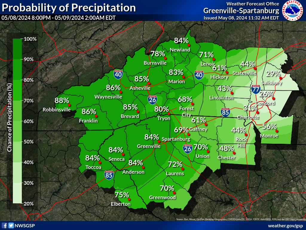
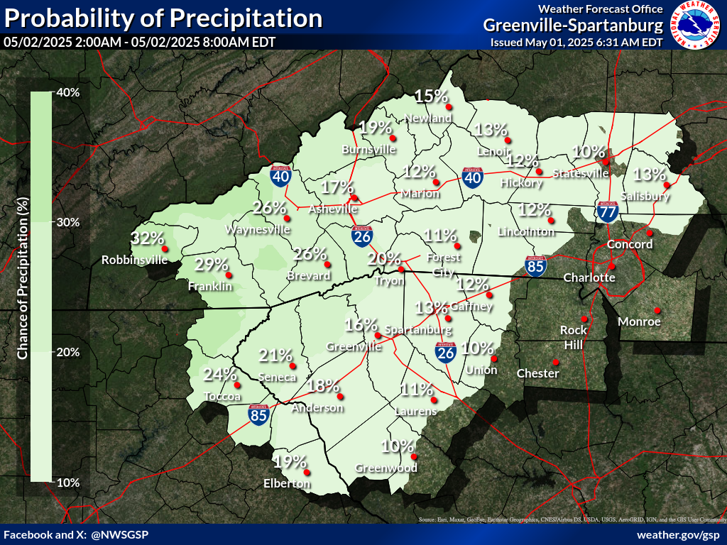
Probability of Precipitation (PoP) (click on thumbnails to display below)
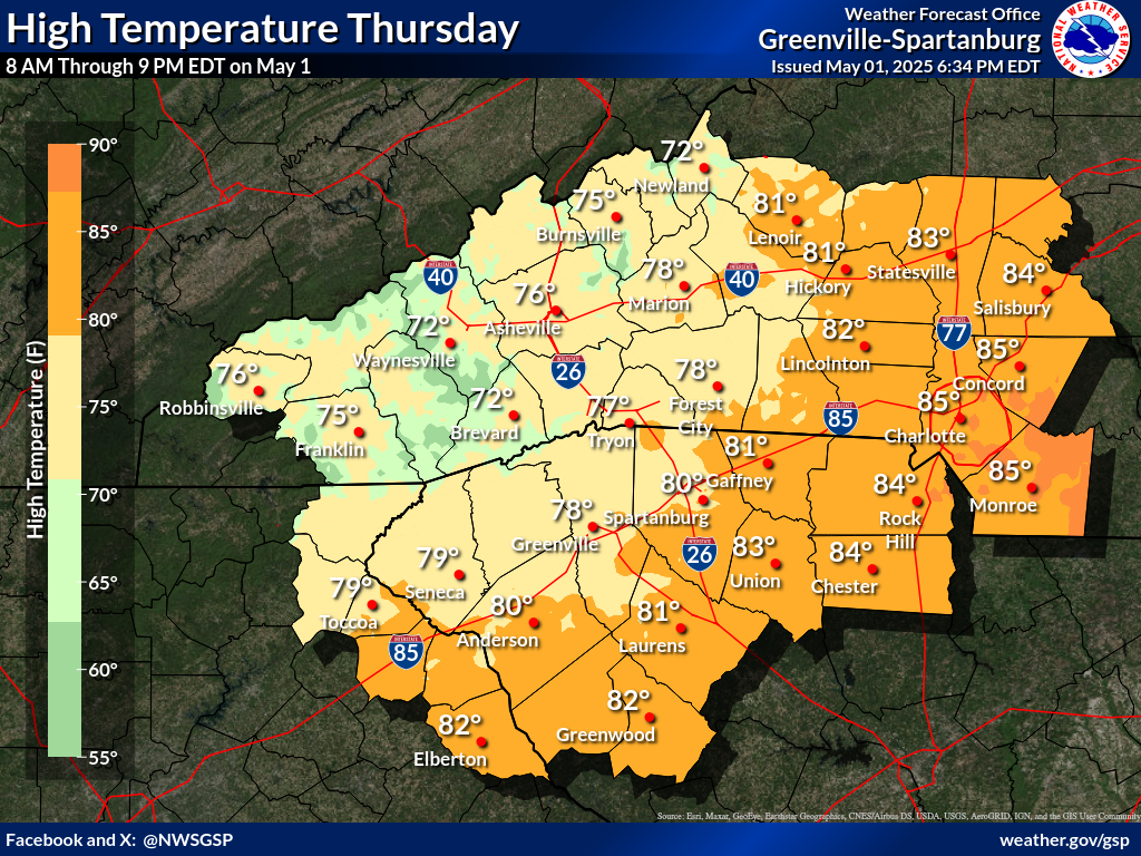
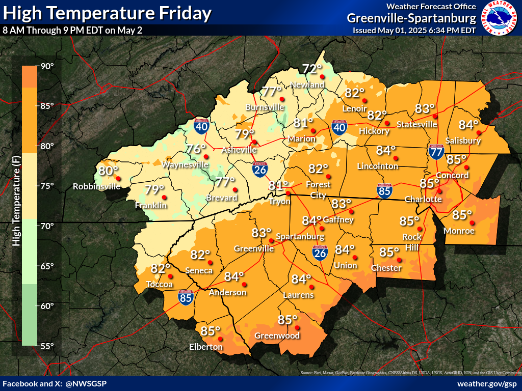
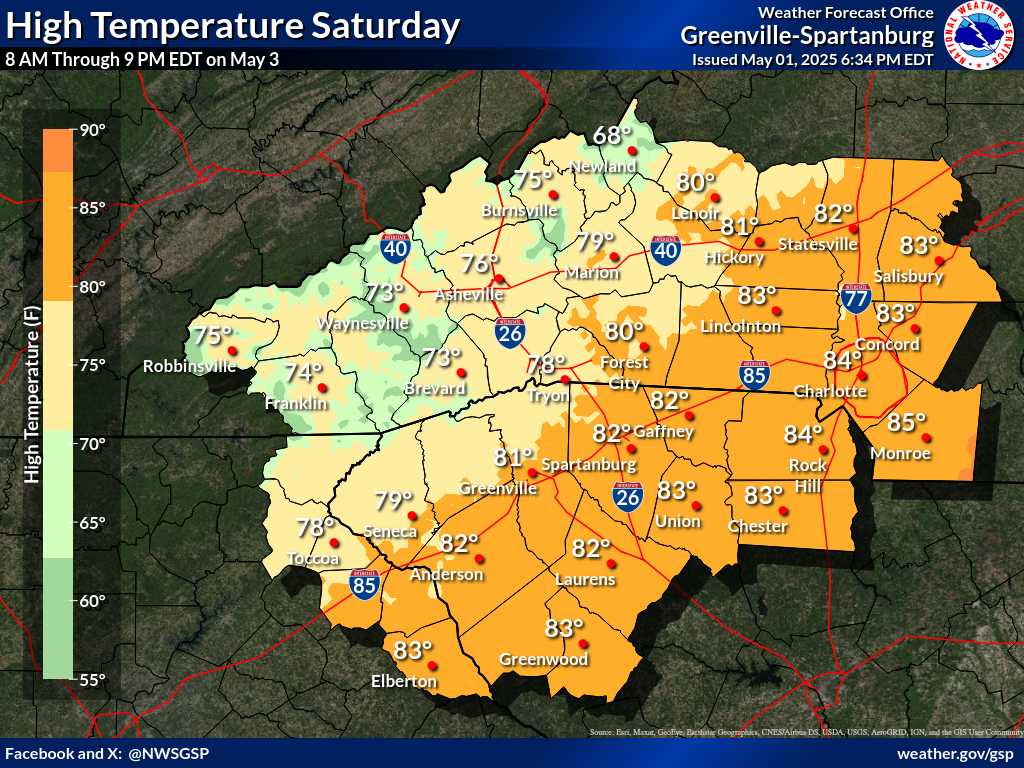
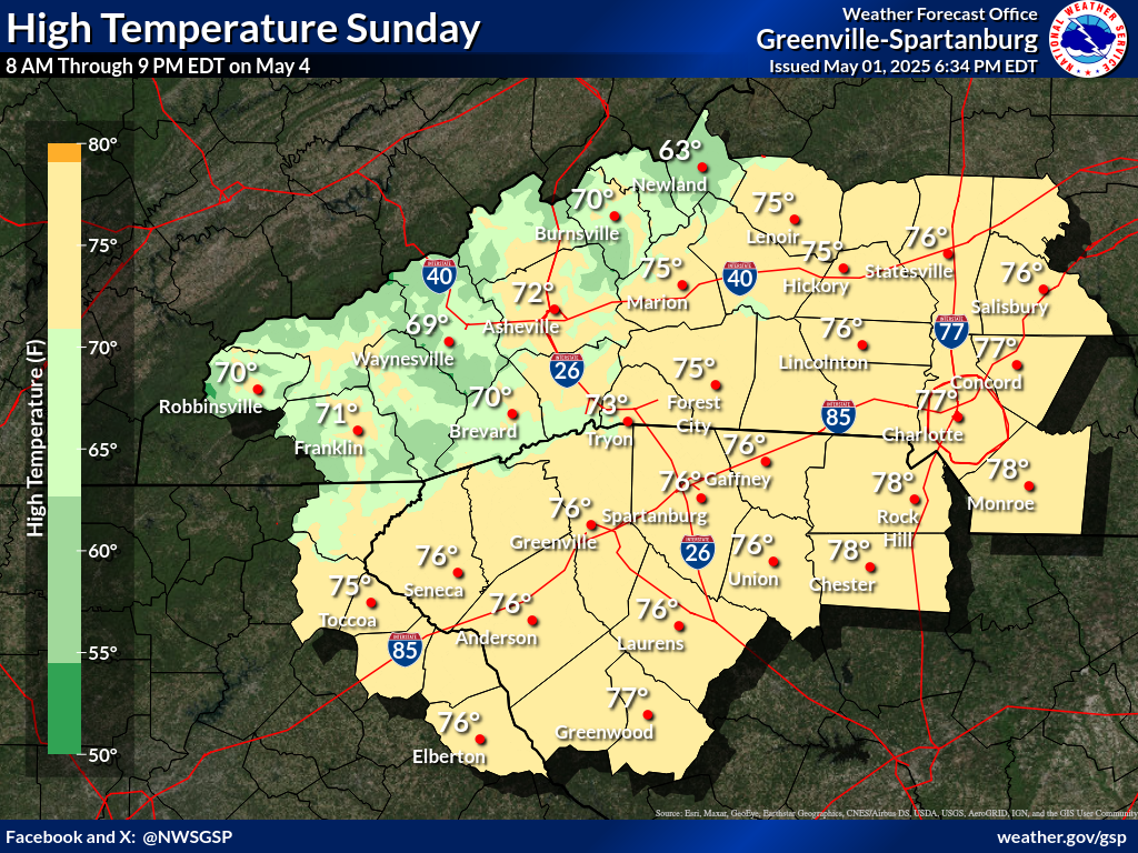
Days 1-4 Max Temperatures(click on thumbnails to display below)
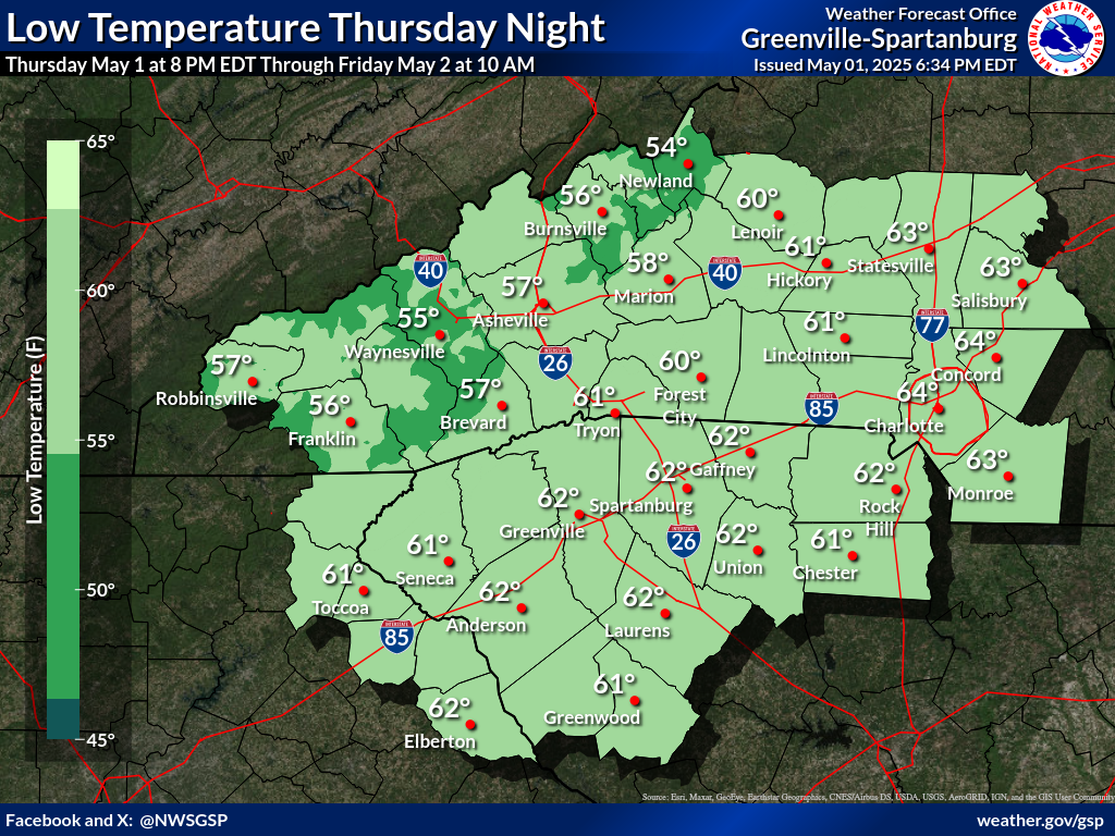
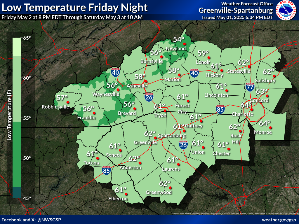
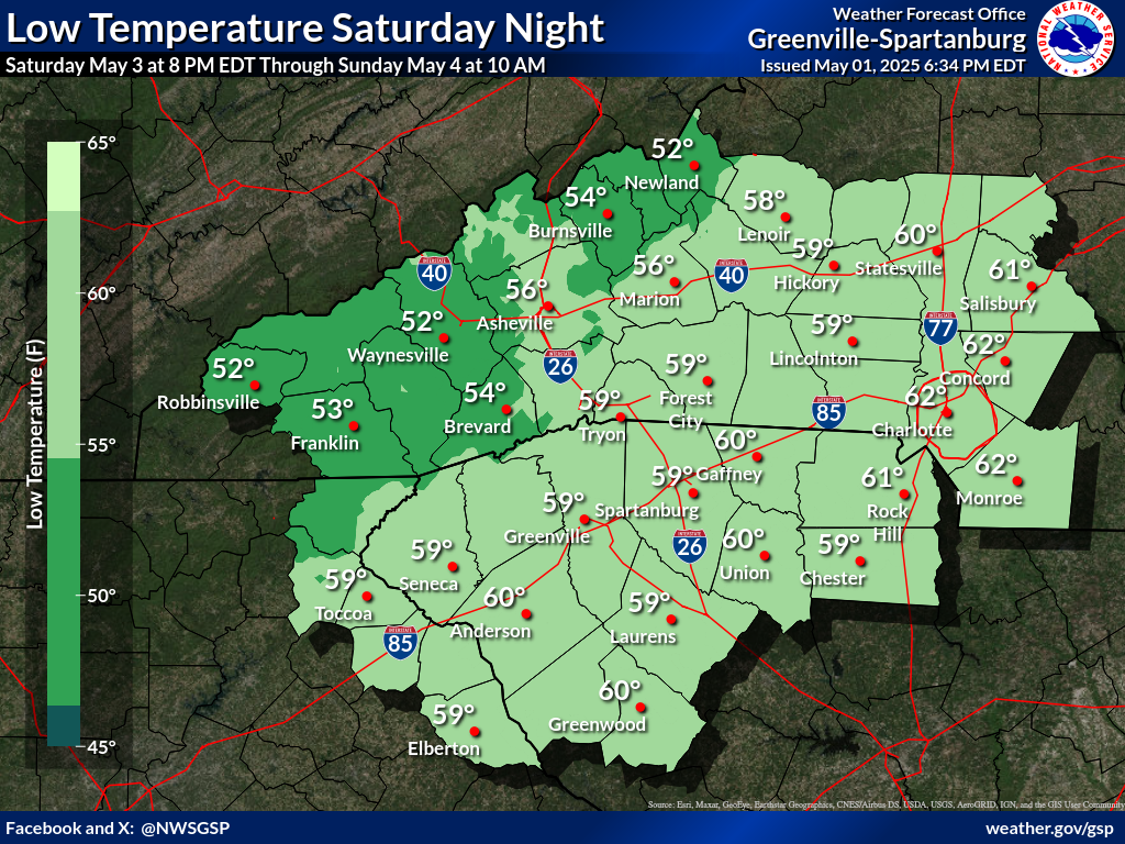
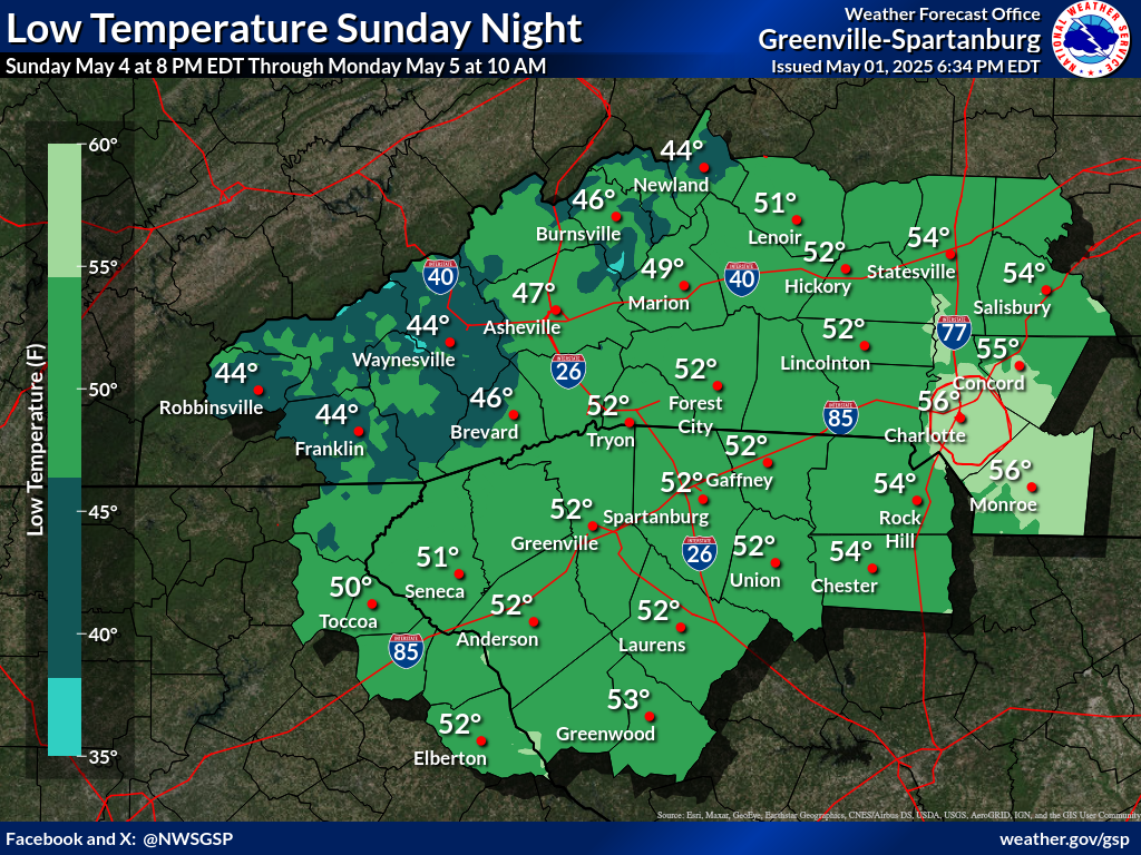
Nights 1-4 Min Temperatures(click on thumbnails to display below)
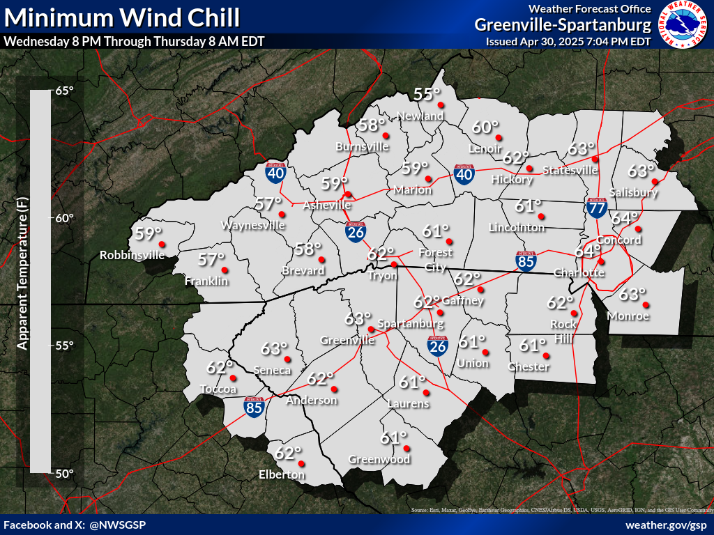
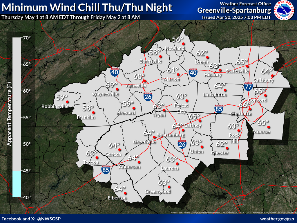
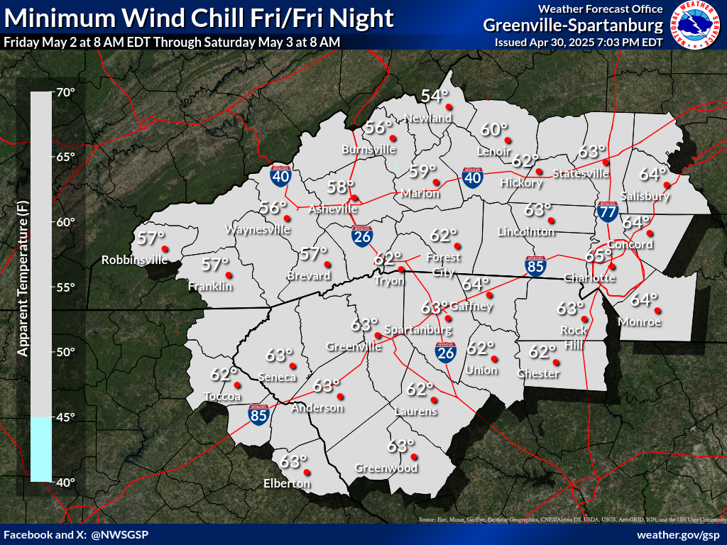
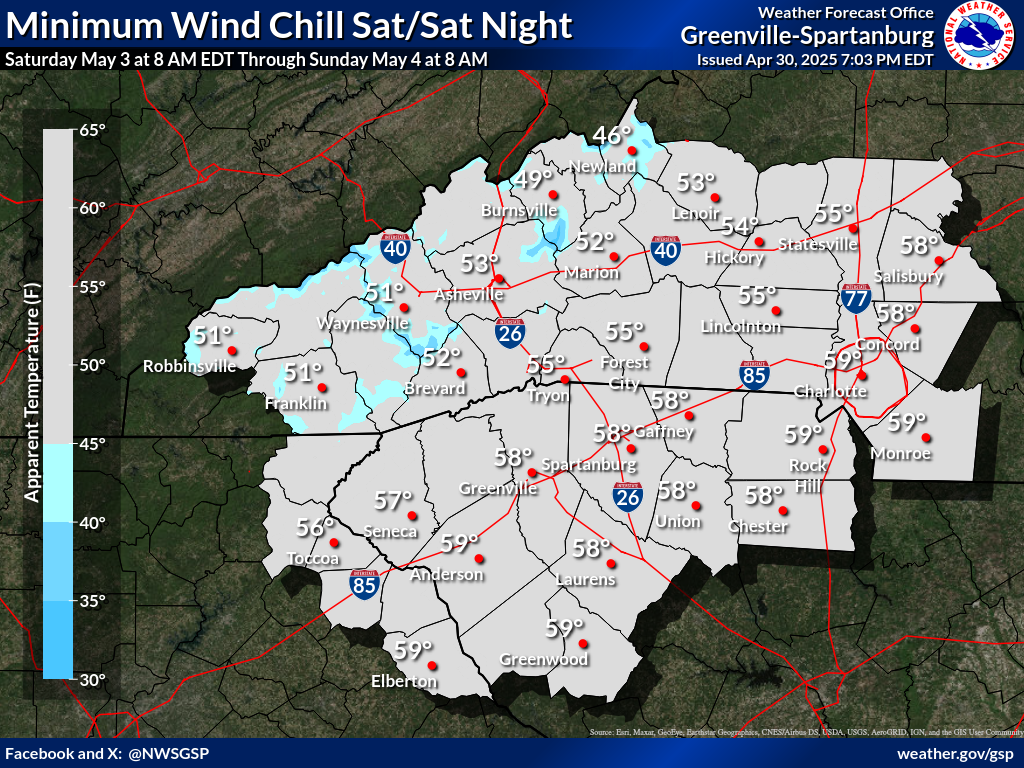
Days 1-4 Min Wind Chill(click on thumbnails to display below)
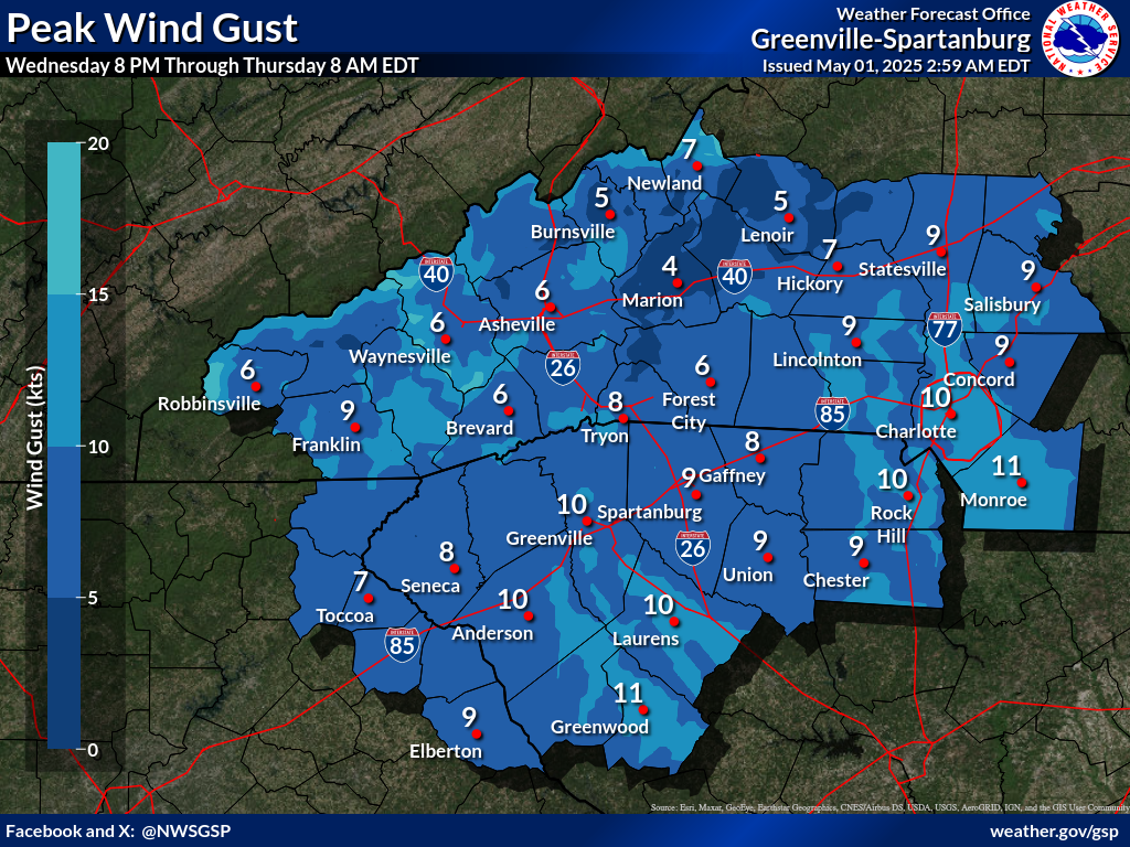
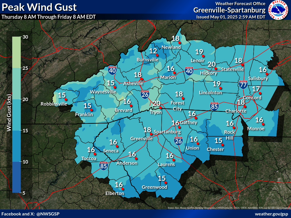
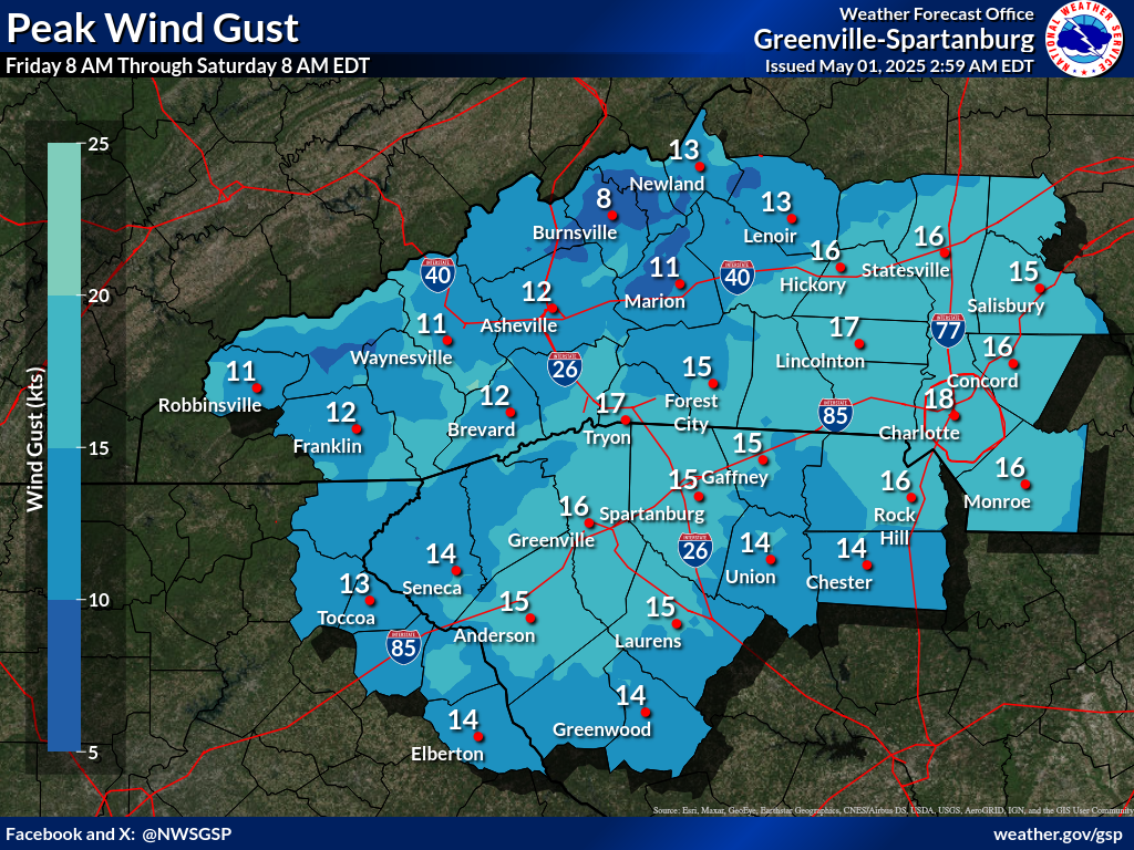
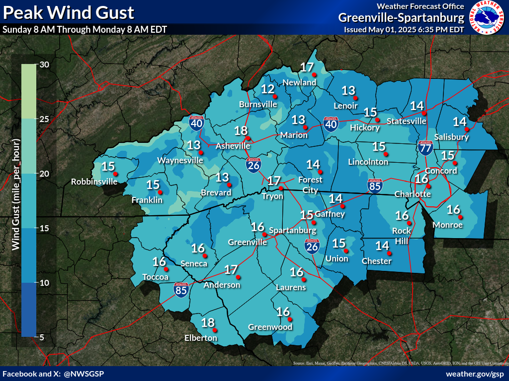
Days 1-4 Max Wind Gusts(click on thumbnails to display below)
|


 Tropical Weather
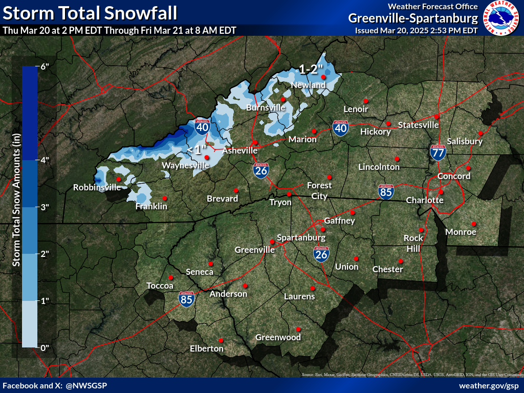


 Hourly Weather