Wichita, Kansas
Weather Forecast Office
Overview
|
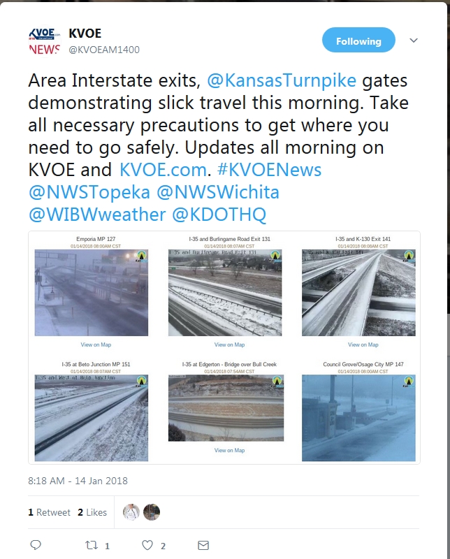
An upper level disturbance and associated strong Arctic cold front moving south across Mid-America supported areas of light to moderate snow spreading south across the region during the pre-dawn and morning hours of January 15th. Accumulations of around a dusting to one-half inch were common, although portions of central and southeast Kansas received 1 to 3 inches. Numerous traffic accidents no doubt occurred. The 0.3 inches measured at Wichita Eisenhower National Airport broke a record 393-day measurable snow drought in Wichita. Furthermore, breezy north winds and falling temperatures in wake of the Arctic cold front supported bitter cold wind chills. |
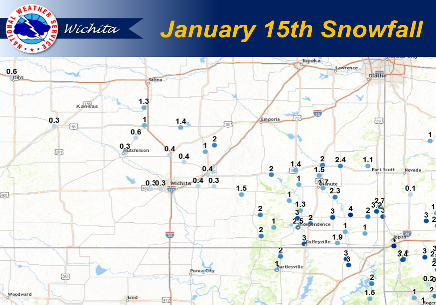 View entire accumulation map and list HERE |
Photos:
|
|
|
 |
|
|
|
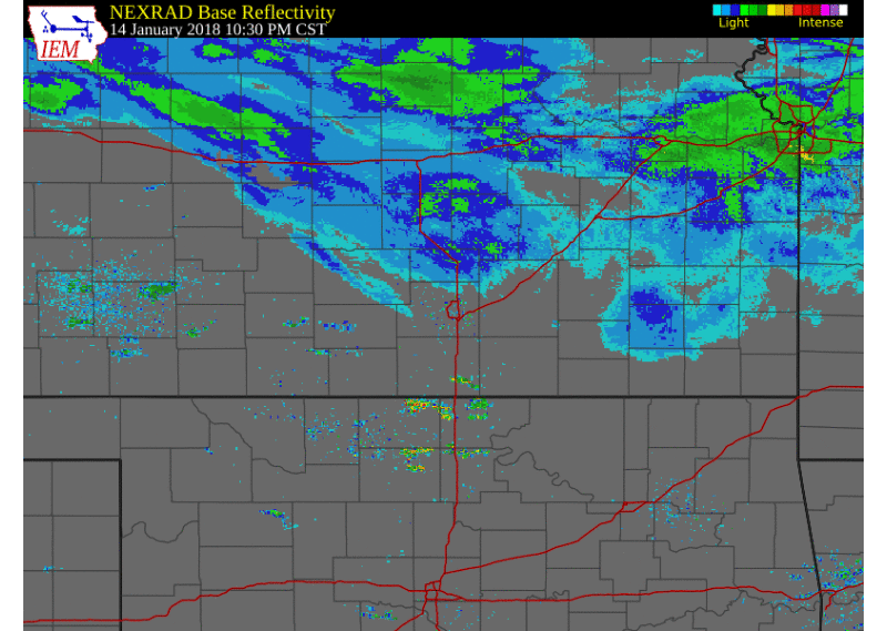 |
| Radar Animation from 1030pm Jan 14th through 12pm Jan 15th |
 |
Media use of NWS Web News Stories is encouraged! Please acknowledge the NWS as the source of any news information accessed from this site. |
|
Hazards
Briefing pages
Local weather story
Submit a storm report
Storm Prediction Center
Enhanced Hazardous Weather Outlook
Hazardous Weather Outlook Text
Current Conditions
Local Radar
National Radar
Satellite
Hourly weather(text)
Precip Analysis
Snowfall analysis
This day in weather history
7 Day Lightning Archive
Forecasts
Forecast Discussion
Weather Story
Fire Weather
Activity Planner
Aviation Weather
Soaring Forecast
Hurricane Center
Graphical Forecasts
Regional Weather Summary
Probabilistic Snow
Probabilistic QPF
Wet Bulb Globe temp
Climate
Local Climate Page
Daily/Monthly data(F6)
Daily Records
Climate Normals
Local drought page
Latest Climate Report(ICT)
Latest Climate Report(SLN)
Latest Climate Report(CNU)
CoCoRaHS
7 Day Lightning Archive
US Dept of Commerce
National Oceanic and Atmospheric Administration
National Weather Service
Wichita, Kansas
2142 S. Tyler Road
Wichita, KS 67209-3016
316-942-3102
Comments? Questions? Please Contact Us.

