Overview
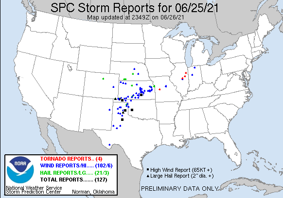
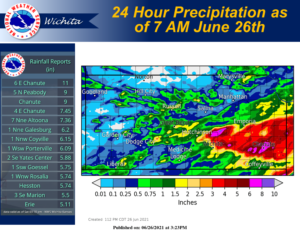
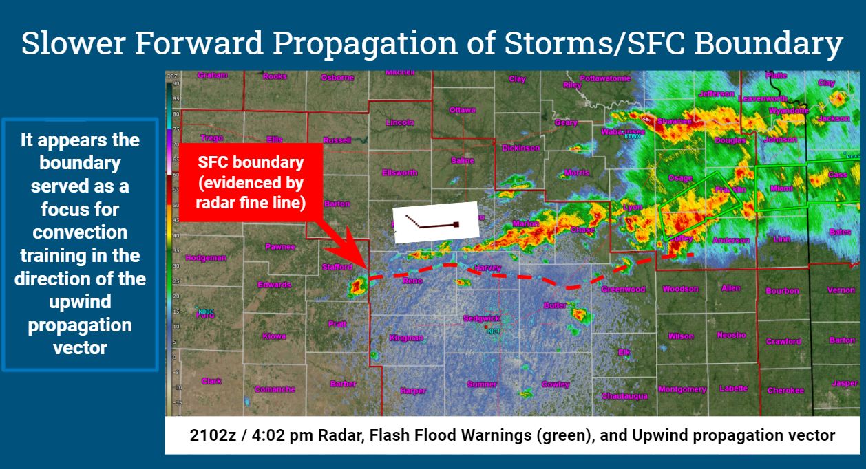
An extremely moist airmass was in place on June 25th as storms erupted along a stationary front during the afternoon hours. Due to the high moisture content of the airmass, the storms were very efficient rainfall producers with some producing 3 to 4 inches of rain per hour. Marion county saw the most impactful flooding with numerous evacuations and water rescues taking place across the county. Southeast Kansas also saw serious flooding with the Neosho River seeing significant rises.
These same storms also produced pockets of severe downburst winds with the town of Newton taking the brunt of the wind damage. These same storms resulted in an injury when straight-line winds severely damaged a mobile home in southeast Reno County.
Wind:
|
Radar animation from the afternoon & evening of June 25th |
Storm reports from June 25th |
|
|
|
|
Flooding
|
|
|
Hydrographs
.png) |
 |
.png) |
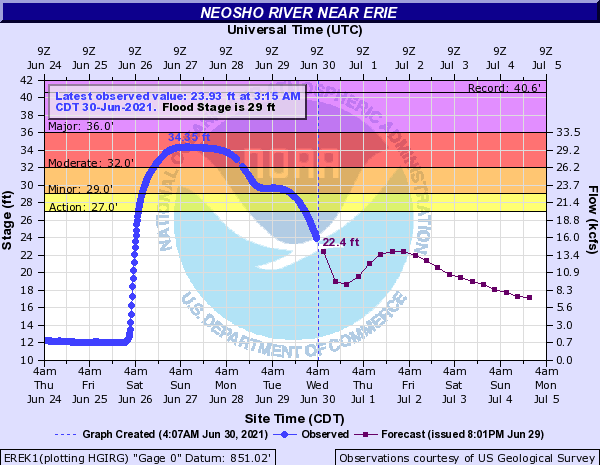
| Hydrograph for the Neosho River at Chanute | Hydrograph for the Neosho River at Erie | Hydrograph for the Neosho River at Parsons |
.png) |
 |
|
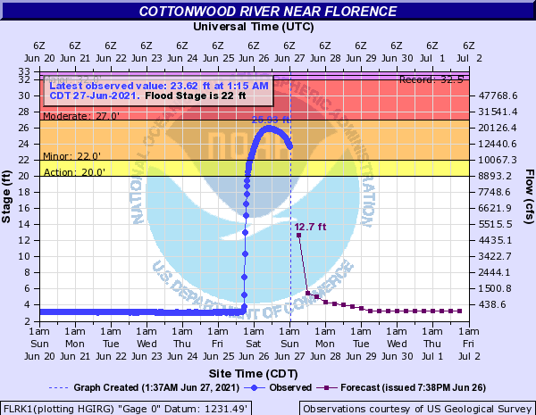
| Hydrograph for the Neosho River at Oswego | Hydrograph for the Cottonwood River at Florence |
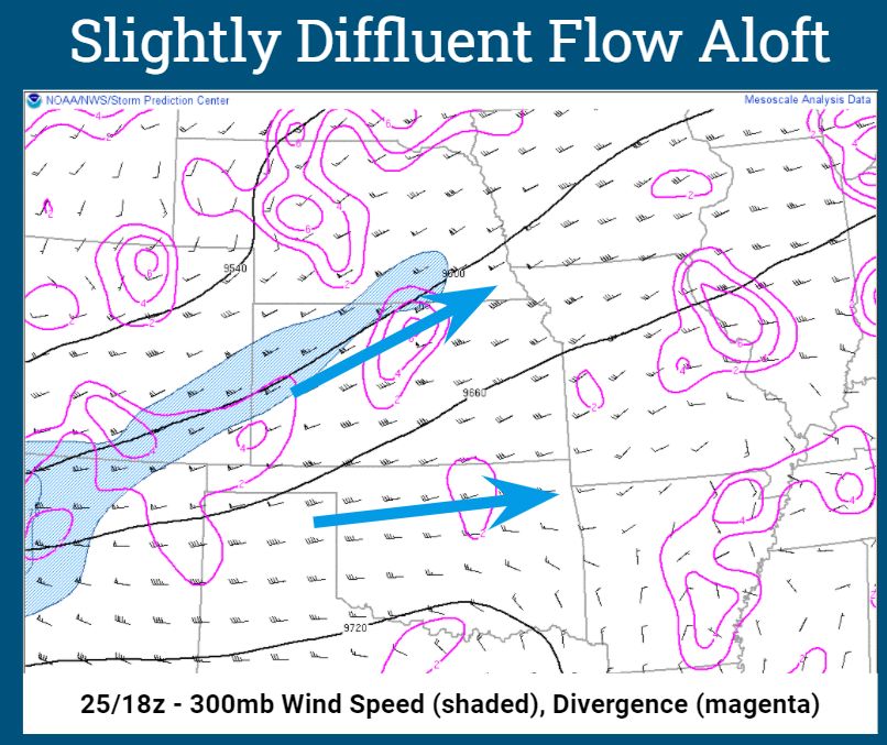
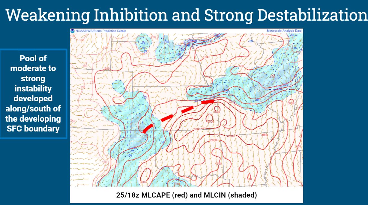
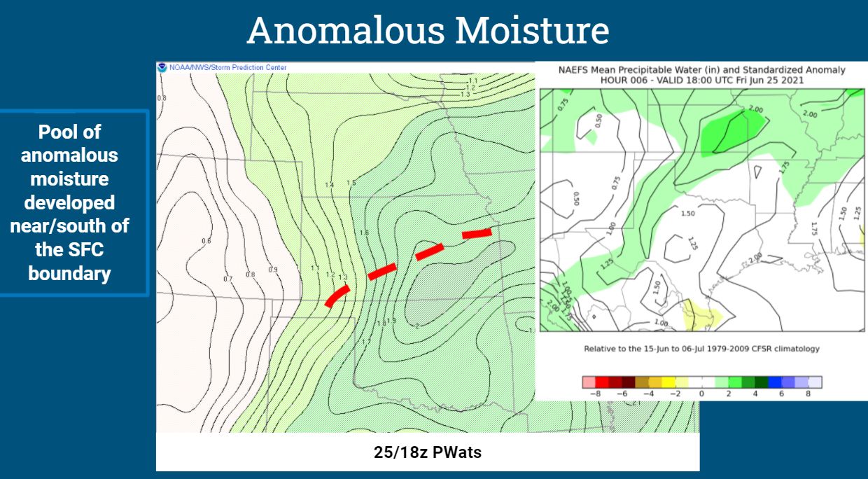
Environment
 |
 |
 |
 |
 |
 |
Media use of NWS Web News Stories is encouraged! Please acknowledge the NWS as the source of any news information accessed from this site. |
|