Central Illinois
Weather Forecast Office
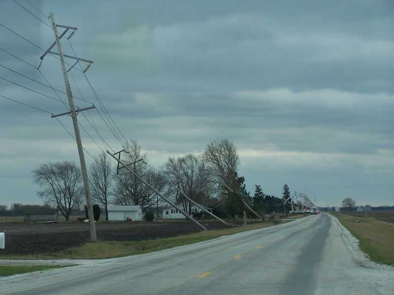
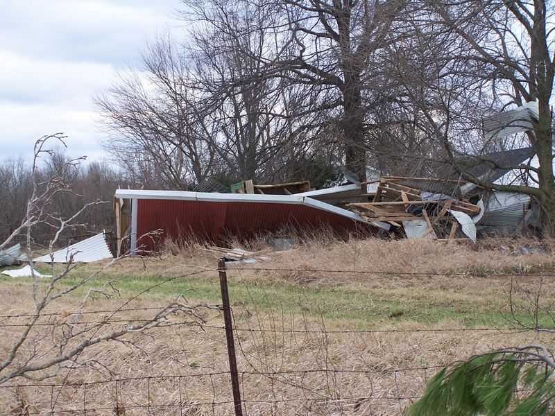
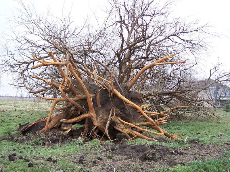
Tornado #3:
Franklin to Loami (shorter red line in the image below)
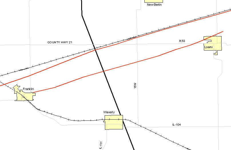
The third tornado of the outbreak was produced by this supercell, as it moved across Morgan and Sangamon Counties. This smaller tornado touched down just northeast of Franklin at 7:58 PM, crossing the Sangamon County line 4 miles northeast of Franklin at 8 PM. It continued northeast, lifting 2 miles north-northeast of Loami at 8:11 PM.
This storm was slightly weaker in intensity, than the one that tracked further north. It was F1 intensity with around 100 mph winds, and was 100 to 200 yards wide. The path length was 11.5 miles. Damage with this tornado consisted of snapped power poles, farm buildings damaged, and tree damage.
Pictures (click images to enlarge):
|
|
|
|
Event Links: Overview | Long-Track Tornado | Springfield | Franklin/Loami | Eastern Sangamon
Southern Logan | Greene/Scott #2 | Logan/Macon | Macon/De Witt | Radar&Satellite
US Dept of Commerce
National Oceanic and Atmospheric Administration
National Weather Service
Central Illinois
1362 State Route 10
Lincoln, IL 62656
217-732-7321 (forecast recording) or 217-732-3089
Comments? Questions? Please Contact Us.