Central Illinois
Weather Forecast Office
Tornado #8
Southeast Logan and Northwest Macon Counties
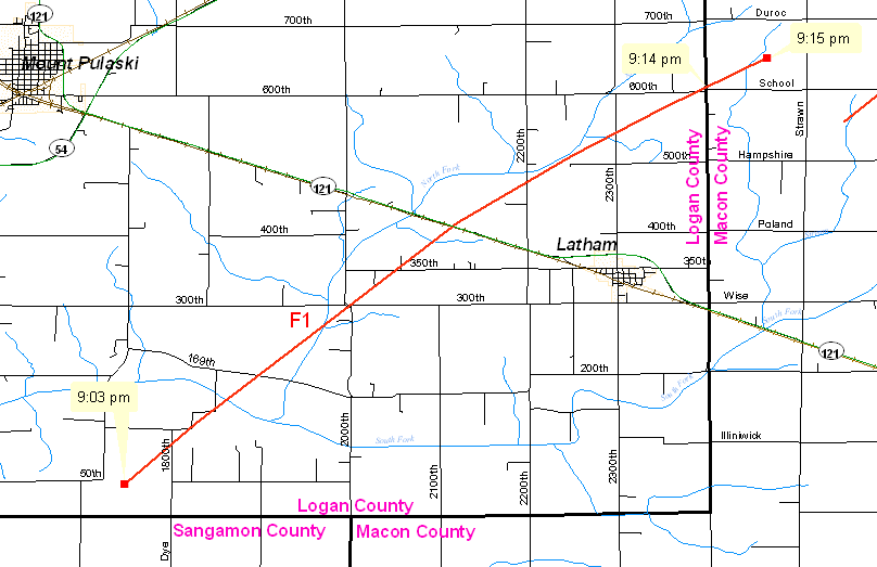
A tornado developed 6.5 miles southwest of Latham at 9:03 PM. This tornado moved across southeast Logan County, producing F1 damage, before it crossed the Logan/Macon County line at 9:14 pm, 3 miles north-northeast of Latham. The tornado continued to produce F1 damage for about a mile in northwest Macon County, before dissipating at 9:15 PM, 9 miles west-southwest of Maroa.
The tornado was on the ground for a total of 10 miles, and reached a maximum width of 400 yards.
Event Links: Overview | Long-Track Tornado | Springfield | Franklin/Loami | Eastern Sangamon
Southern Logan | Greene/Scott #2 | Logan/Macon | Macon/De Witt | Radar&Satellite
US Dept of Commerce
National Oceanic and Atmospheric Administration
National Weather Service
Central Illinois
1362 State Route 10
Lincoln, IL 62656
217-732-7321 (forecast recording) or 217-732-3089
Comments? Questions? Please Contact Us.

