Central Illinois
Weather Forecast Office
Tornado #9
Northwest Macon and Far Southern De Witt County
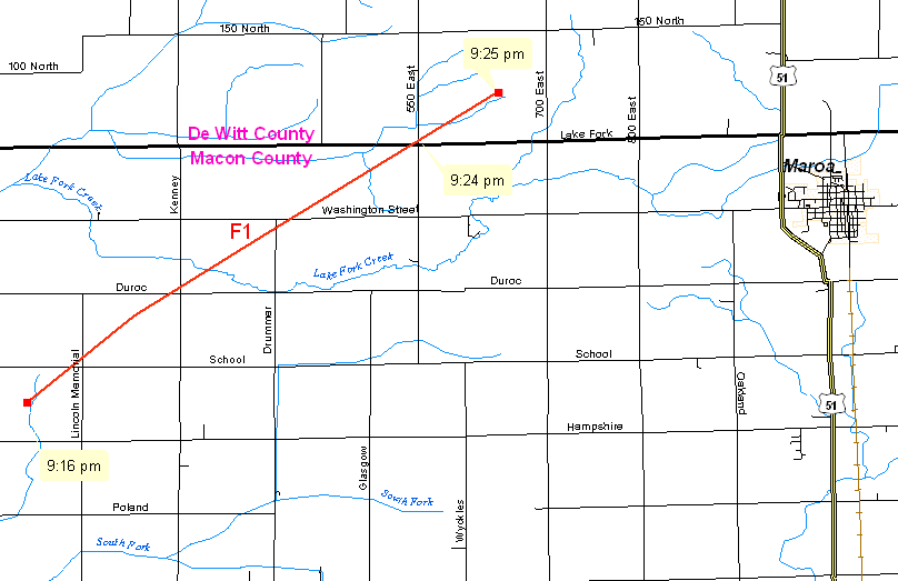
Another tornado developed 9 miles southwest of Maroa, around 9:16 PM, shortly after the previous tornado had dissipated. This tornado produced F1 damage as it moved across Austin Township in northwest Macon County. The tornado moved across the Macon/De Witt County line around 9:24 PM, 3.5 miles west-northwest of Maroa. The tornado dissipated in extreme southern De Witt County, 5 miles southeast of Kenney, at 9:25 PM.
The tornado was on the ground for 8 miles, and reached a maximum width of 600 yards.
Event Links: Overview | Long-Track Tornado | Springfield | Franklin/Loami | Eastern Sangamon
Southern Logan | Greene/Scott #2 | Logan/Macon | Macon/De Witt | Radar&Satellite
US Dept of Commerce
National Oceanic and Atmospheric Administration
National Weather Service
Central Illinois
1362 State Route 10
Lincoln, IL 62656
217-732-7321 (forecast recording) or 217-732-3089
Comments? Questions? Please Contact Us.

