Springfield Tornadoes
|
|
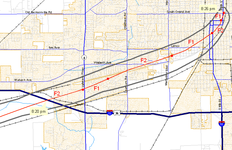
Between 8:20 and 8:30 PM on March 12, 2006, the city of Springfield, IL, was affected by a pair of F2-strength tornadoes. These tornadoes had a path nearly identical to the track of the June 14, 1957 F4 tornado (which killed 2 people, injured 50, and caused $2.5 million in damage).
 Tornado #1 (click image to enlarge)
This tornado was on the ground for about 60 miles before it moved into Springfield.
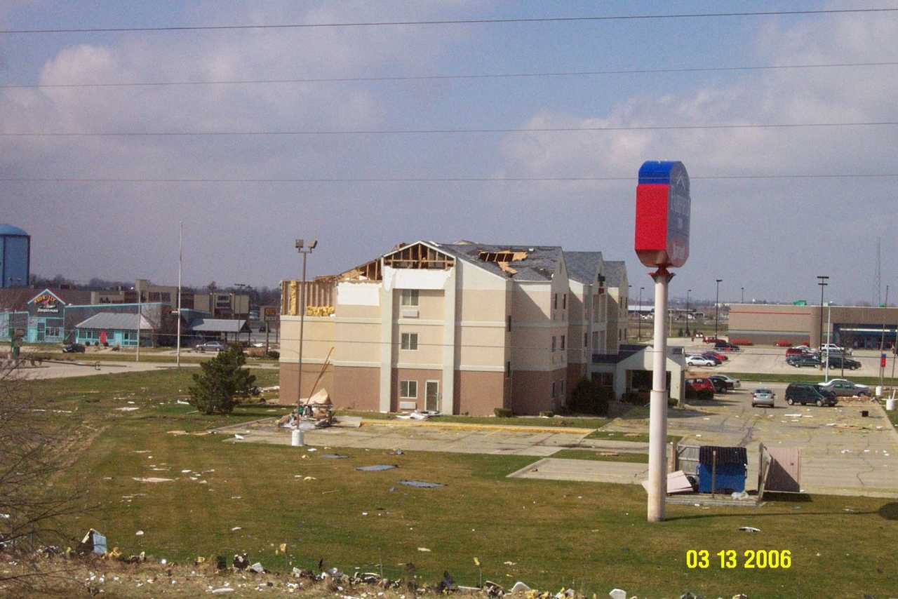
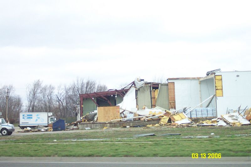
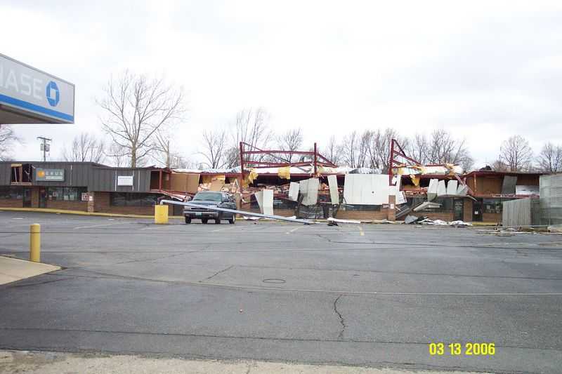
The tornado crossed Interstate 72 near mile marker 92, around 8:20 PM. It entered the city of Springfield near Cockrell Lane and Constitution Drive, tracking to the east-northeast around 50 mph. The tornado was about 300 yards wide, and produced F2 damage to several businesses from Constitution Drive, through Parkway Pointe, to Veterans Parkway and Lindbergh Blvd.
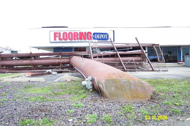
The tornado widened to about 0.4 mile wide as it continued to track east-northeast south of Wabash Avenue, between Veterans Parkway and Chatham Road. The tornado widened further, to just over 1/2 mile wide from Westchester Blvd to the village of Jerome. The damage was rated as F2 along Wabash Avenue, between Chatham Road and MacArthur Blvd.
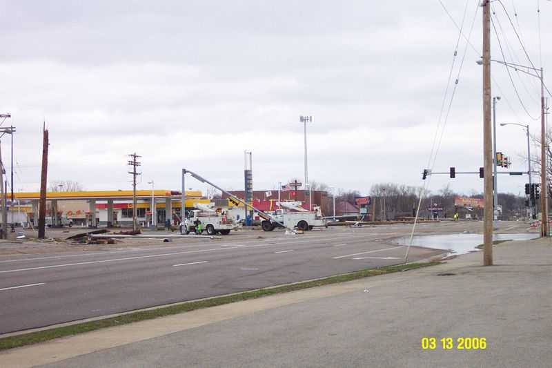
The tornado then weakened slightly, producing F1 damage, as it turned to the northeast, nearly parallel with the Norfolk & Southern Railroad tracks. The damage path remained nearly 1/2 mile wide. The width of the tornado decreased to about 1/4 mile wide as it strengthened again, and turned to the north-northeast near Iles Park and in the vicinity of Oak and Myrtle Streets, between 6th and 9th Streets. The damage was rated as F2 in these locations, with roofs blown off of homes and businesses, and garages severely damaged. This tornado dissipated just north of 9th Street and South Grand Avenue.
This first tornado was on the ground in the city of Springfield for nearly 5.5 miles, for approximately 6 minutes between 8:20 and 8:26 PM. The estimated wind speed with this F2 tornado in the city was around 120 mph.
 Tornado #2 (click image to enlarge)
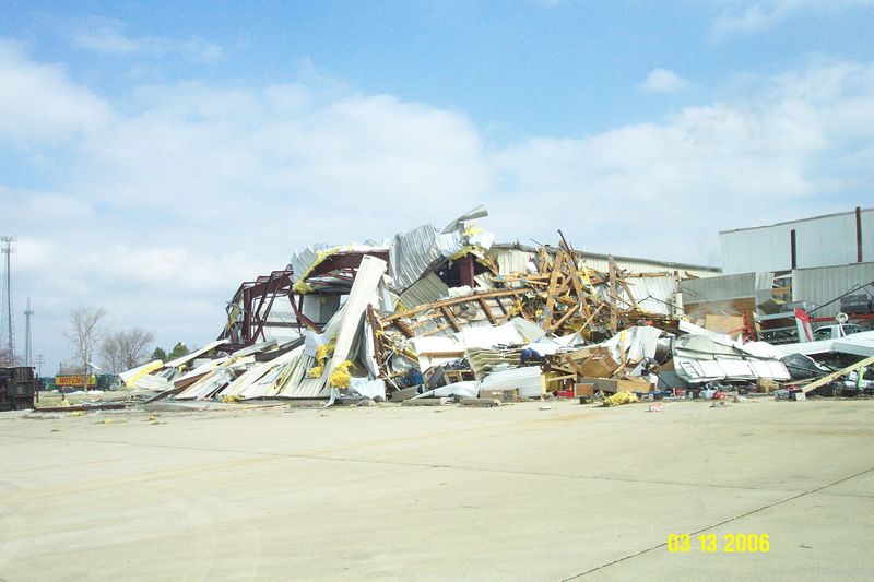
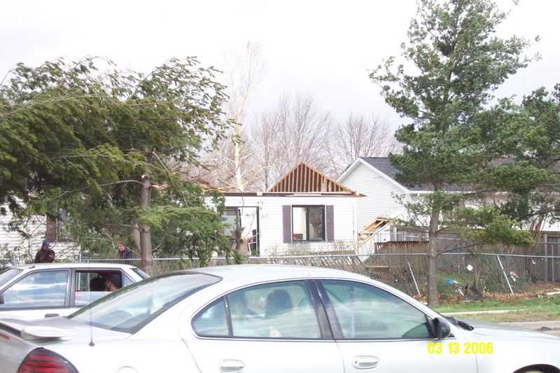
A second tornado developed as the first tornado was dissipating, around 8:25 PM. This tornado touched down about 1/4 mile north of the Bunn Park golf course, and tracked to the northeast. The strongest damage was bounded by 15th Street, Cornell Avenue, South Grand Avenue, and Pope Avenue. Several homes had roofs torn off, with extensive damage to power poles and lines, along with numerous downed trees.
The tornado continued to track northeast across Old Rochester Road, Singer Avenue, and Cook Street from White City Blvd. to a block east of Dirksen Parkway. The torando crossed I-55 at the Clear Lake Avenue interchange, and overturned a semi truck. This tornado dissipated near Old Route 36, about 3/4 mile southwest of the Village of Clear Lake.
This second tornado was on the ground for nearly 4 miles, for approximately 5 minutes between 8:25 and 8:30 PM. The estimated wind speeds with this tornado were also around 120 mph.
Pictures (click images to enlarge):
|
|
|
|
|
|
|
|
|
|
|
|
Event Links: Overview | Long-Track Tornado | Springfield | Franklin/Loami | Eastern Sangamon
Southern Logan | Greene/Scott #2 | Logan/Macon | Macon/De Witt | Radar&Satellite