Tornado #8: Villa Grove Tornado (Douglas County)
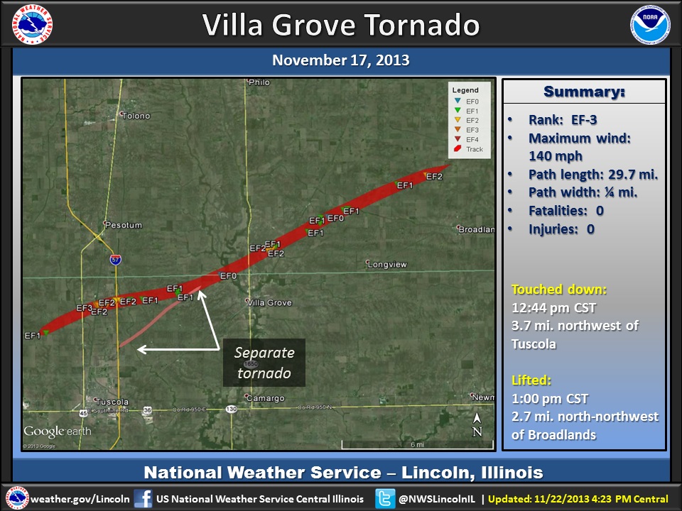
Summary:
|
Survey Results:
A tornado touched down 3.7 miles northwest of Tuscola at 12:44 PM CST, and was on the ground for 18 miles. The roof of a house and 2 outbuildings were damaged during the first 2 miles of the track. The tornado strengthened after it crossed U.S. Highway 45 doing major damage to 2 homes, several large farm buildings, numerous power poles, and a garage. The tornado then turned to the east, damaging the roofs of two homes and destroying several outbuildings. It then crossed I-57 near mile marker 218, where it destroyed a mobile home just east of the highway. The tornado did major damage to several more roofs and outbuildings before it merged with another tornado 2 miles west-northwest of Villa Grove, turned back to the northeast, and crossed into Champaign County about 1.5 miles northwest of Villa Grove at 12:52 PM. The tornado continued across southern Champaign County before lifting 2.7 miles north-northwest of Broadlands at 1:02 PM CST. The tornado moved through open fields for the first 2.5 miles in Champaign County, then took the roof off 1 home, destroyed about a dozen outbuildings, snapped numerous power poles and trees, and did roof damage to 6 homes.
Radar imagery (click to enlarge):
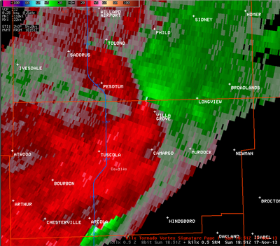 |
This particular radar image shows the wind motions within the storms. Circulations are indicated where the bright red and bright green come together in a small point. One such circulation is shown northwest of Villa Grove in this picture, along the Champaign and Douglas county line. |
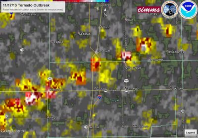 |
This image, from the National Severe Storms Laboratory, is a composite of radar rotations associated with this particular severe thunderstorm. Two tornadoes occurred along this path. The first was located near Atwood, and the second touched down northwest of Tuscola and moved north of Villa Grove into southern Champaign County. |
Event Links: Overview | Pekin | Washington | Pana | Altamont | West Liberty
Garrett | Gifford | Villa Grove | Tuscola | Westville | Radar

