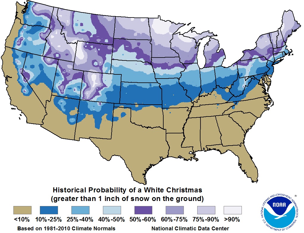
While climatology generally says the local area can expect a "white" Christmas (an inch of snow on the ground or falling that day) about 60-80% of the time, Mother Nature may not always cooperate.
The late November snows left several of inches of snow cover across much of the area. With the first half of December being unseasonably cold (not warming above freezing for much of the area), along with periodic light snow falls, a blanket of snow for Christmas morning looked assured.
However, a recent change in the weather pattern has brought much milder, above freezing temperatures to the region. Considerable melting of the snow pack has occurred.
More warmth is on the way as we inch toward the holiday. High temperatures above freezing are forecast most days, potentially topping 40 degrees for a few locations Wednesday and Christmas day. More melting will occur.
Aside from a weather system Monday bringing minor accumulations mostly north of I-94, the chance for additional snow accumulations is very low.
As it looks now, the likelihood for a "white" Christmas is quickly diminishing. Those north of I-94 harbor the higher chances to keep at least an inch around through Christmas morning. South of there? Keep your fingers crossed, but it's trending toward a "green" Christmas.
 |
 |
| White Christmas Climatology | MRCC - Morning Snow Depth |
Christmas climate for:


 Weather Story
 Weather Map
 Local Radar