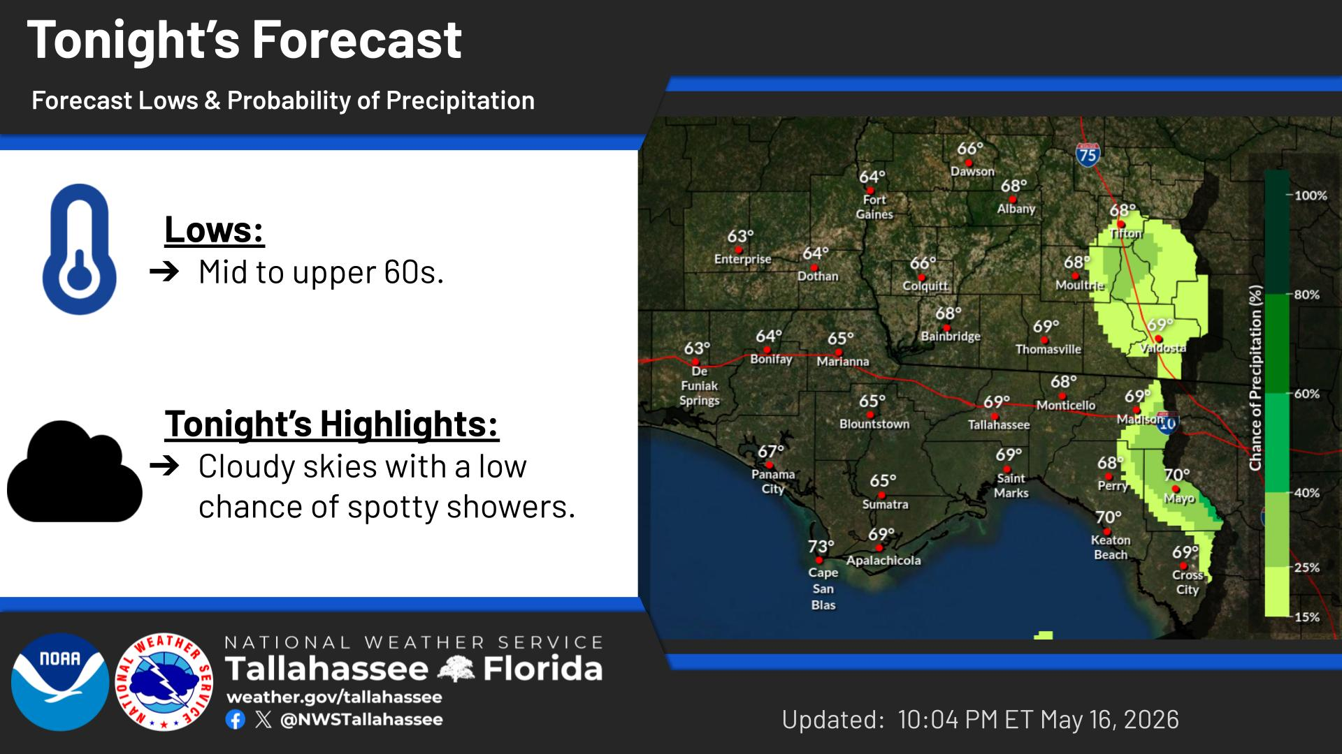
National Weather Service United States Department of Commerce

Widespread sub-freezing temperatures are expected once again tonight into Monday morning. Hard freezes are likely away from the immediate coast, so a Freeze Warning was issued for all inland counties.
The horizontal color-coded highlights across the EST time stamps represent the period of hard freeze conditions (purple 7am-9am EST; 1am-7am EST).
Although the winds will be easing a lot more tonight, hazardous sub-freezing wind chills are still expected for much of the Tri-State area.
The horizontal color-coded highlights across the EST time stamps represent the period of extreme cold conditions (dark blue 7am-10am EST) and cold weather advisory (light blue 10pm-8am EST) conditions.
In the eastern FL Panhandle and Big Bend, there is an increased potential for navigational hazards due to low water levels through Monday and Tuesday in bays, harbors, inlets, and tidal rivers.
Forecast high temperatures and precipitation chances for today.
Forecast low temperatures and precipitation chances for tonight.


Text Product Selector