National Weather Service United States Department of Commerce
Click a location below for detailed forecast.

Last Map Update: Wed, Jun 25, 2025 at 12:02:18 am EDT

Higher rain chances continue Today through Friday, decreasing trend as the weekend approaches. Today-Saturday: A chance of showers and slight chance of thunderstorms through Friday with the highest chances (~40%) Wednesday and Wednesday night. Rain chances then decrease to 20-30% for the weekend. Easterly winds 10-15 mph today slacken and become southeasterly by Thursday night.
TONIGHT...Partly cloudy with a chance of showers and a slight chance of thunderstorms. Lows near 80. East winds near 15 mph, decreasing to 10 to 15 mph. Chance of rain 30 percent.
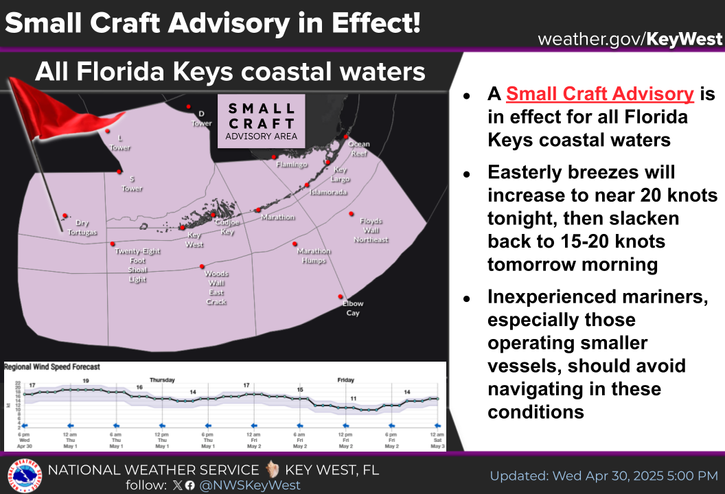
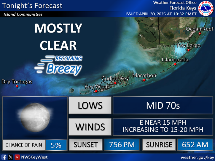
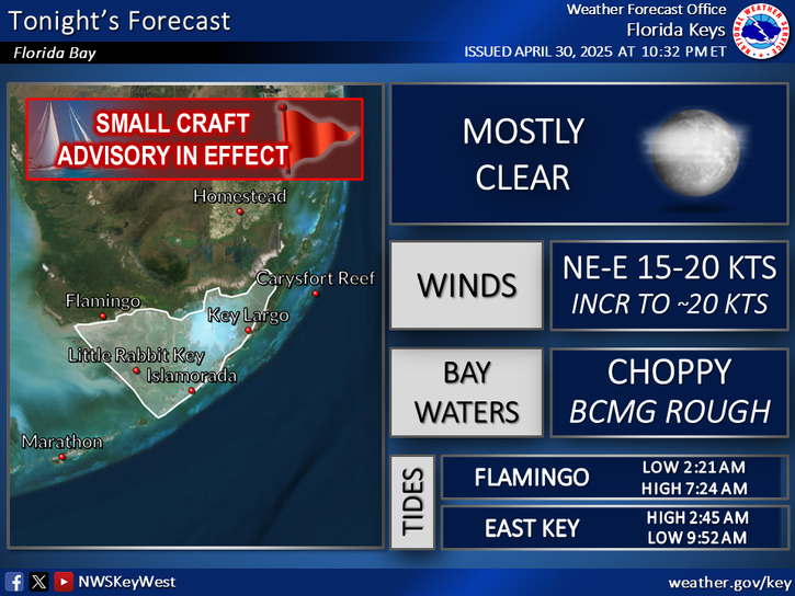
SMALL CRAFT SHOULD EXERCISE CAUTION IN THE NEARSHORE GULF, HAWK CHANNEL, AND FLORIDA STRAITS UNTIL WINDS DECREASE! Tonight: Moderate to fresh NE-E breezes will decrease to 10-15 knots. Nearshore and Bay waters a moderate chop to choppy (moderate chop for Bay) becoming a light to moderate chop. Seas north of the island chain generally 1-3 ft, south and west of the island chain generally 2-5 ft. Scattered showers & isolated thunderstorms.


Text Product Selector
(Selected product opens in a new window) 


Sunrise & Sunset

Sunrise & Sunset


Moon Rise & Set

Moon Rise & Set


Moon Illumination

Moon Illumination


Tide Information

Tide Information


Tropical

Tropical


Coastal Flooding

Coastal Flooding


Tallship

Marine


Nearshore Waves

Wave Prediction


Thumbnail for a local waterspouts website, showing 4 waterspouts.

Waterspouts


Airplane

Aviation


Key West & Marathon Climographs 2020

Climographs


Tropical

Forecast Discussion


NOAA Weather Radio

NOAA Weather Radio