National Weather Service United States Department of Commerce
Click a location below for detailed forecast.

Last Map Update: Thu, Jul 17, 2025 at 2:10:36 am EDT

Elevated rain and thunder chances are expected yet again today. Drier air will push through the Florida Keys beginning tonight, resulting in lower rain chances, lasting through the end of the work week. The weekend will feature near-to or slightly below normal chances for rainfall.
Current radar loop for the Florida Keys
TONIGHT: Mostly cloudy with a chance of showers and thunderstorms. Lows in the lower 80s. East to southeast winds 10 to 15 mph. Chance of rain 40 percent.
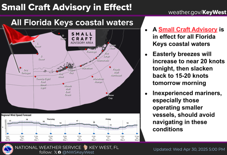
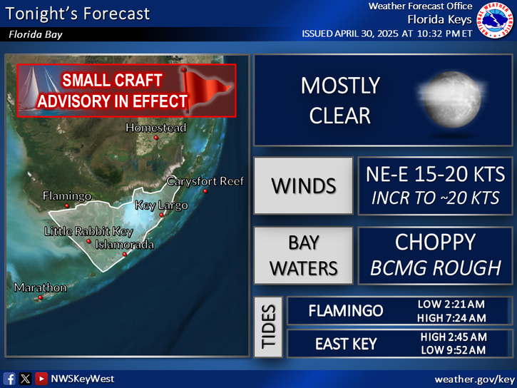
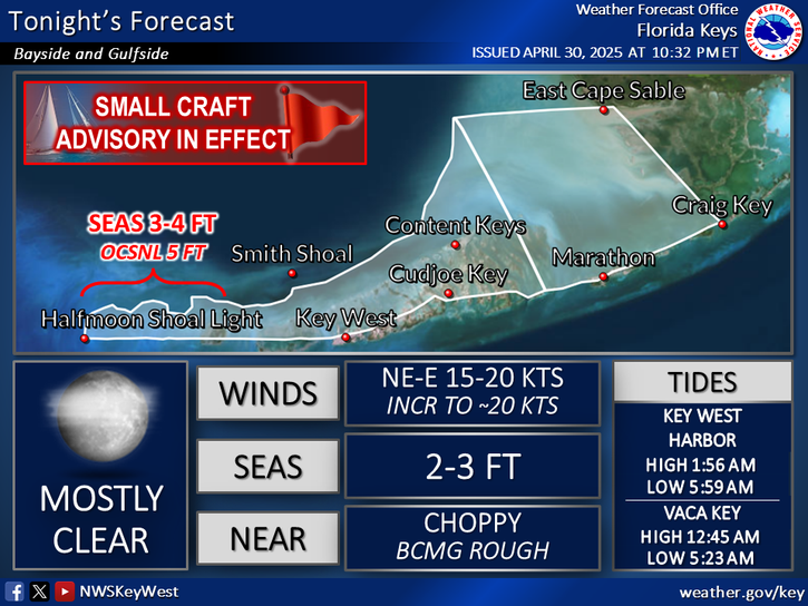
TONIGHT: E-SE moderate breezes, increasing to ~15 knots for most waters (Florida Bay E-SE ~10 knots, increasing to 10-15 knots. SE Gulf SE 10-15 knots). Bay waters a light chop, becoming a light to moderate chop. Nearshore waters a light to moderate chop, becoming a moderate chop. Seas generally 1-2 ft north of the island chain and 2-4 ft south. Scattered showers and thunderstorms.


Text Product Selector
(Selected product opens in a new window) 


Sunrise & Sunset

Sunrise & Sunset


Moon Rise & Set

Moon Rise & Set


Moon Illumination

Moon Illumination


Tide Information

Tide Information


Tropical

Tropical


Coastal Flooding

Coastal Flooding


Tallship

Marine


Nearshore Waves

Wave Prediction


Thumbnail for a local waterspouts website, showing 4 waterspouts.

Waterspouts


Airplane

Aviation


Key West & Marathon Climographs 2020

Climographs


Tropical

Forecast Discussion


NOAA Weather Radio

NOAA Weather Radio