National Weather Service United States Department of Commerce
Click a location below for detailed forecast.

Last Map Update: Wed, May 13, 2026 at 2:34:24 am EDT

Warm and muggy conditions will continue through the weekend, with moderate to major heat risk for the Florida Keys. Heat safety tips: wear light clothing, stay hydrated, and take frequent breaks when doing activities outdoors. Learn more with the HeatRisk Tool: heat.gov/tools-resources/heatrisk-tool
TODAY... Partly sunny in the morning, then becoming mostly cloudy. A slight chance of showers and thunderstorms. Highs in the upper 80s. West winds 10 to 15 mph. Chance of rain 10 percent.
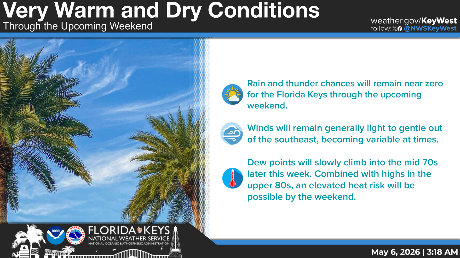
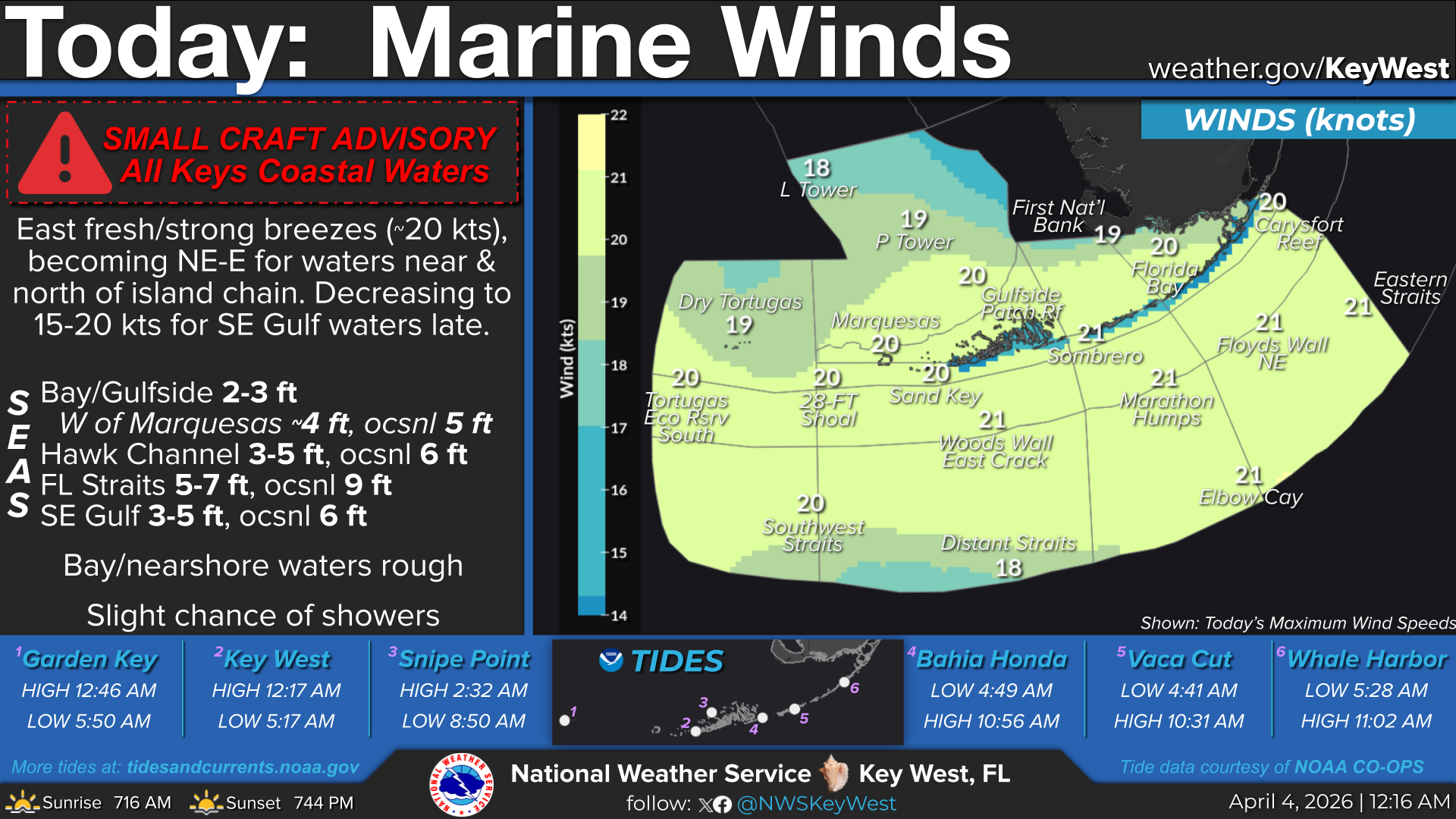
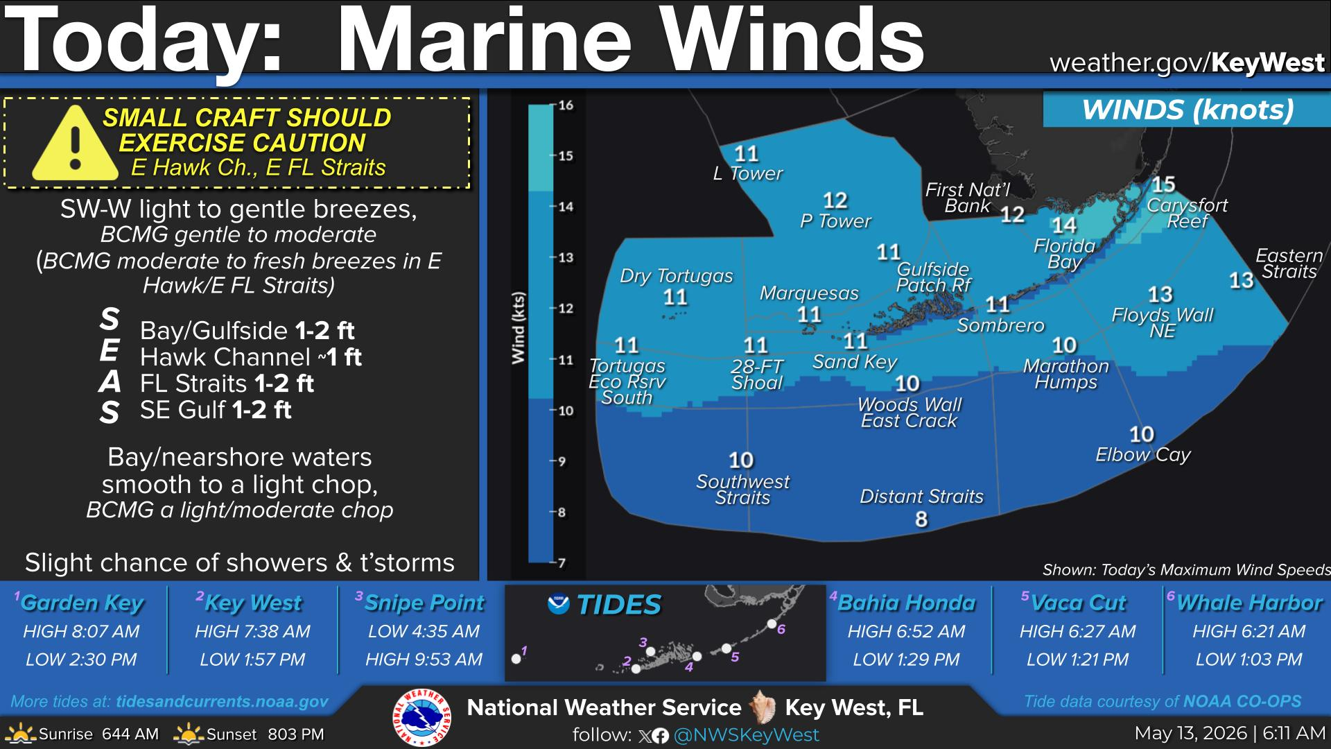
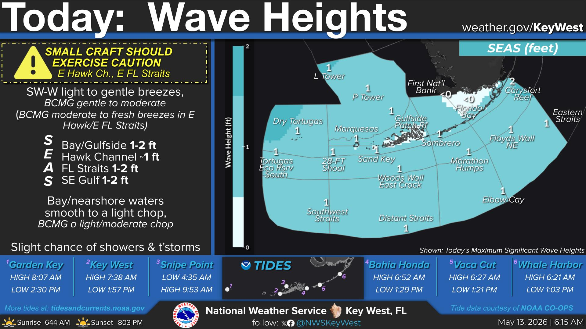
TODAY... SW-W light breezes, becoming moderate breezes. Seas: Bay/Gulfside ≤1 ft; Hawk Channel ~1 ft; FL Straits ~1 ft; SE Gulf ≤1 ft. Bay/nearshore waters smooth to a light chop, becoming a light/moderate chop. Chance of showers, slight chance thunderstorms N of the island chain. Slight chance of showers & thunderstorms elsewhere.


Text Product Selector
(Selected product opens in a new window) 


Sunrise & Sunset

Sunrise & Sunset


Moon Rise & Set

Moon Rise & Set


Moon Illumination

Moon Illumination


Tide Information

Tide Information


Tropical

Tropical


Coastal Flooding

Coastal Flooding


Tallship

Marine


Nearshore Waves

Wave Prediction


Thumbnail for a local waterspouts website, showing 4 waterspouts.

Waterspouts


Airplane

Aviation


Key West & Marathon Climographs 2020

Climographs


Tropical

Forecast Discussion


NOAA Weather Radio

NOAA Weather Radio