
Dangerous and extreme heat will remain across portions of the southern U.S. through the weekend. A heat wave over the Southwest U.S. will intensify this week, peaking and expanding into the Intermountain West and northern High Plains this weekend. Multiple rounds of thunderstorms will produce heavy to excessive rainfall with significant flash flooding across portions of southern New England. Read More >
Overview
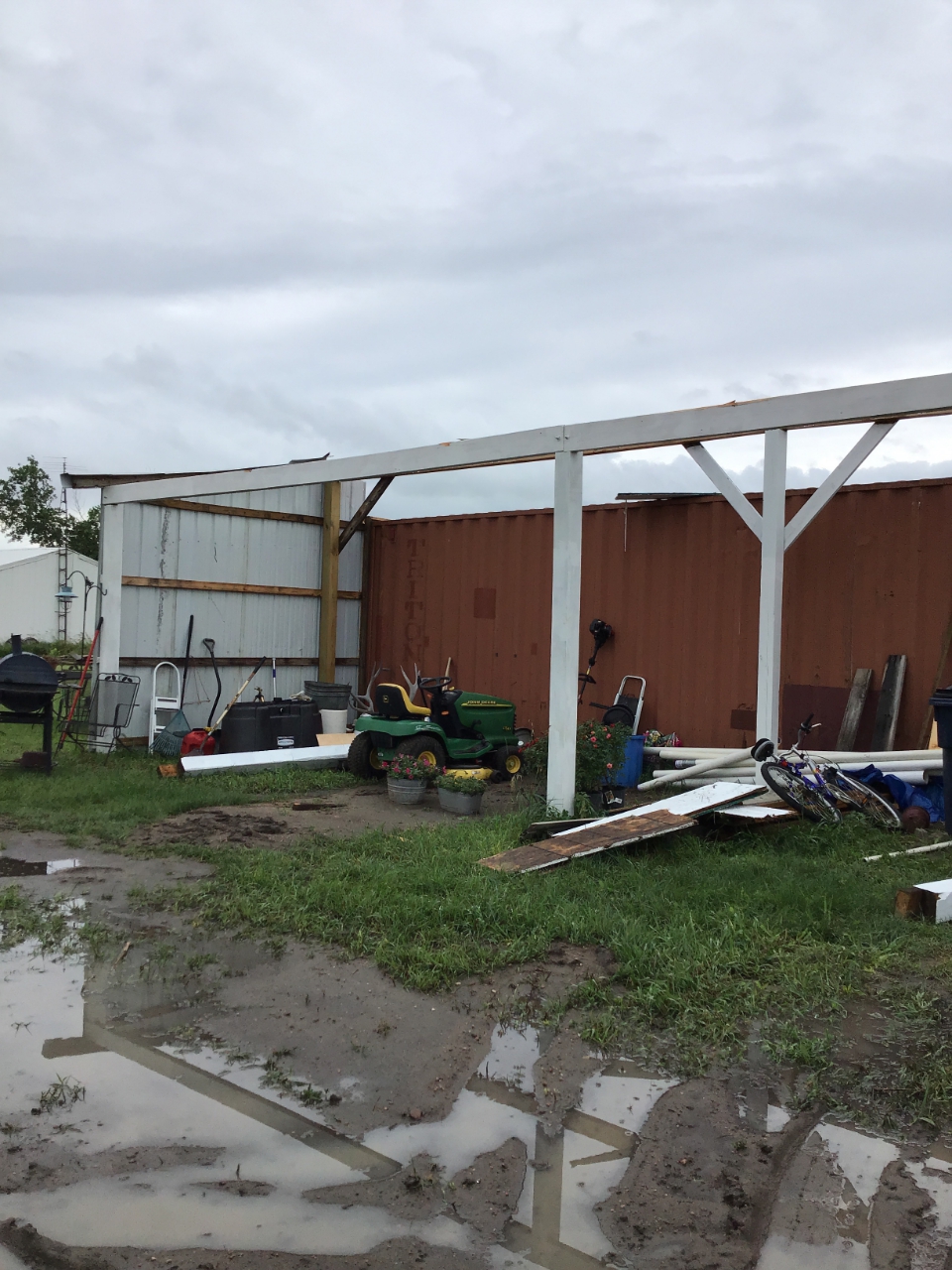
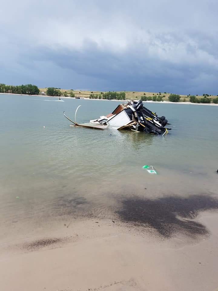
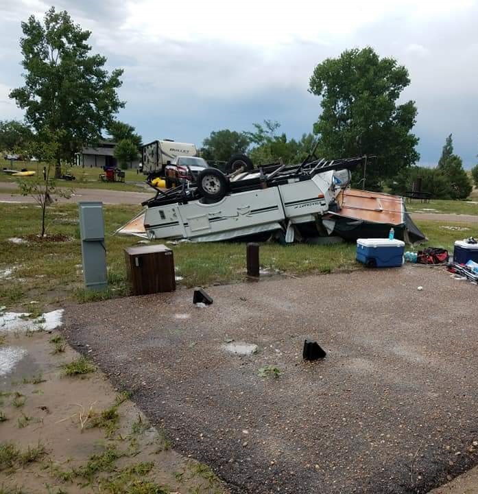
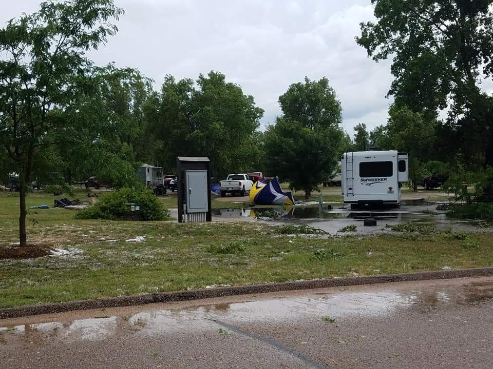
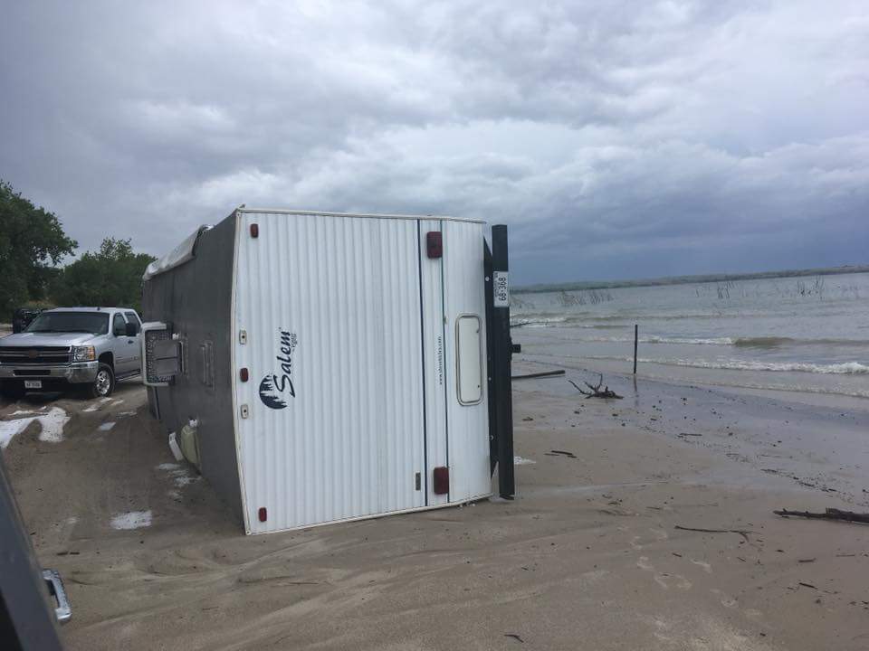
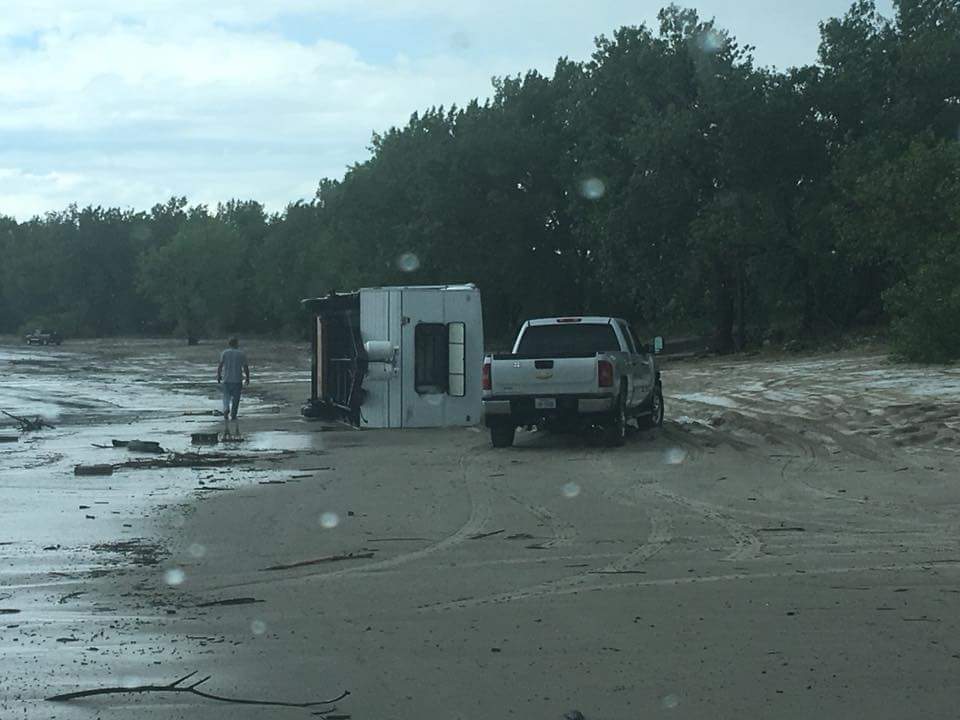
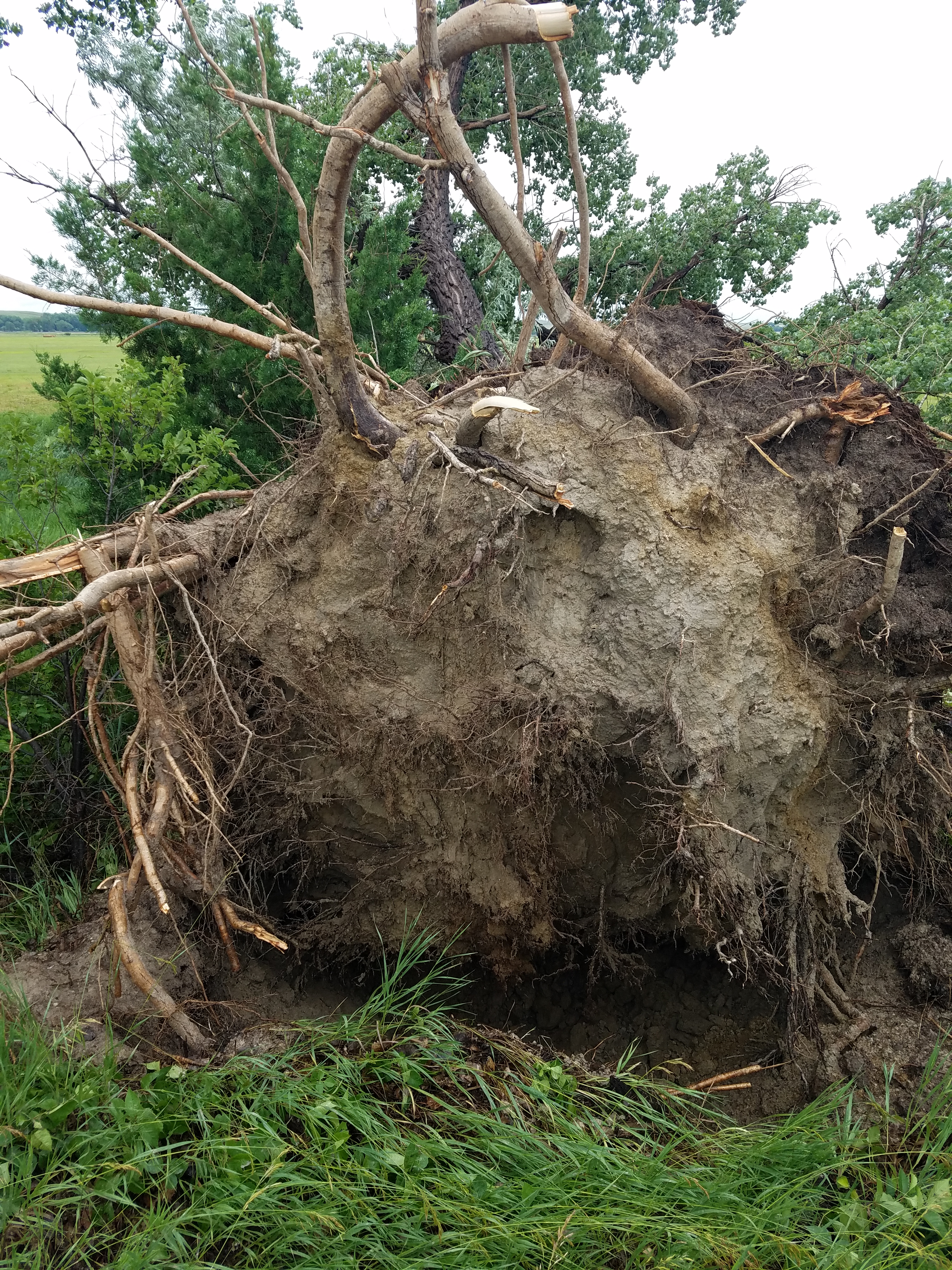
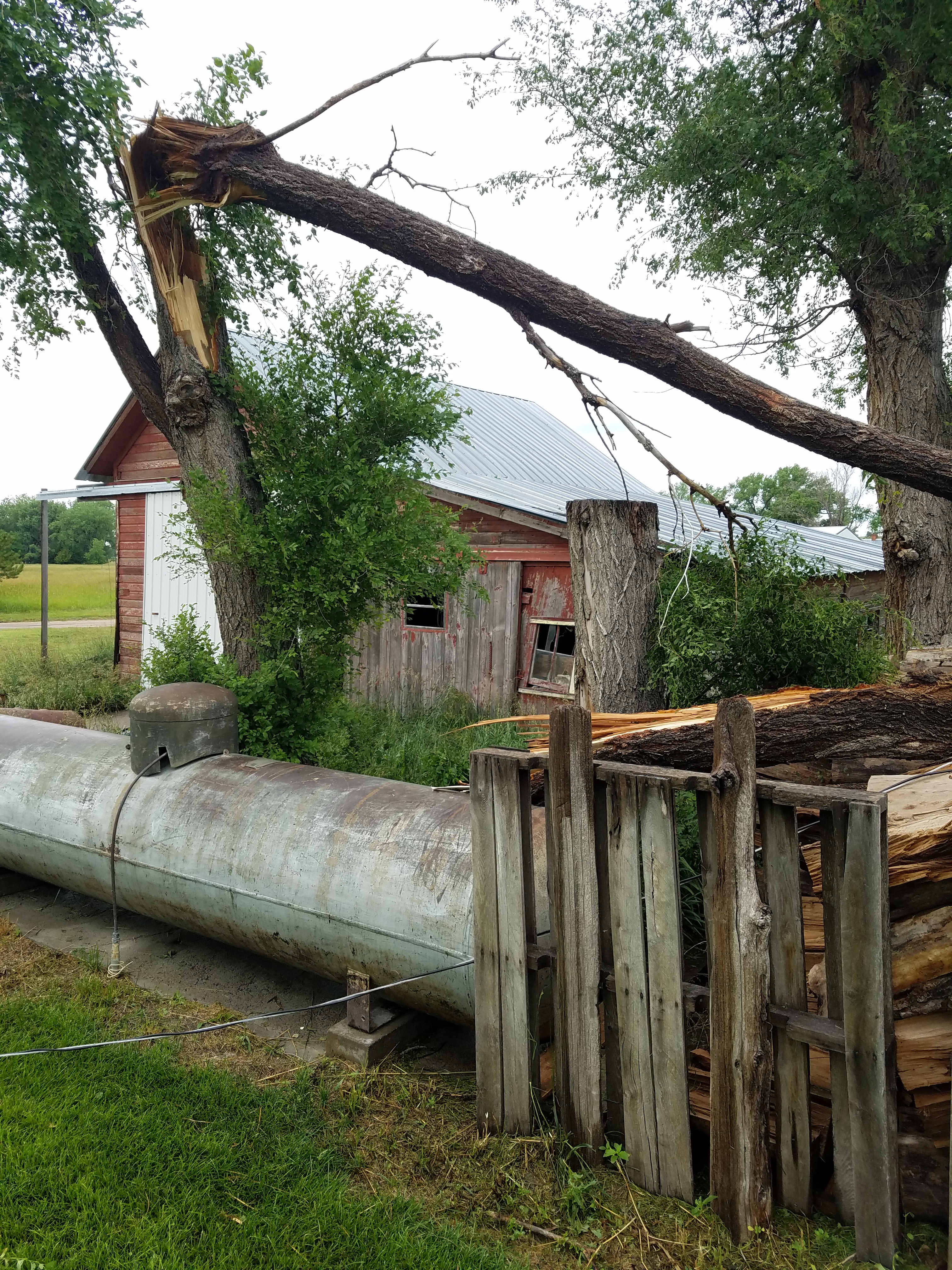
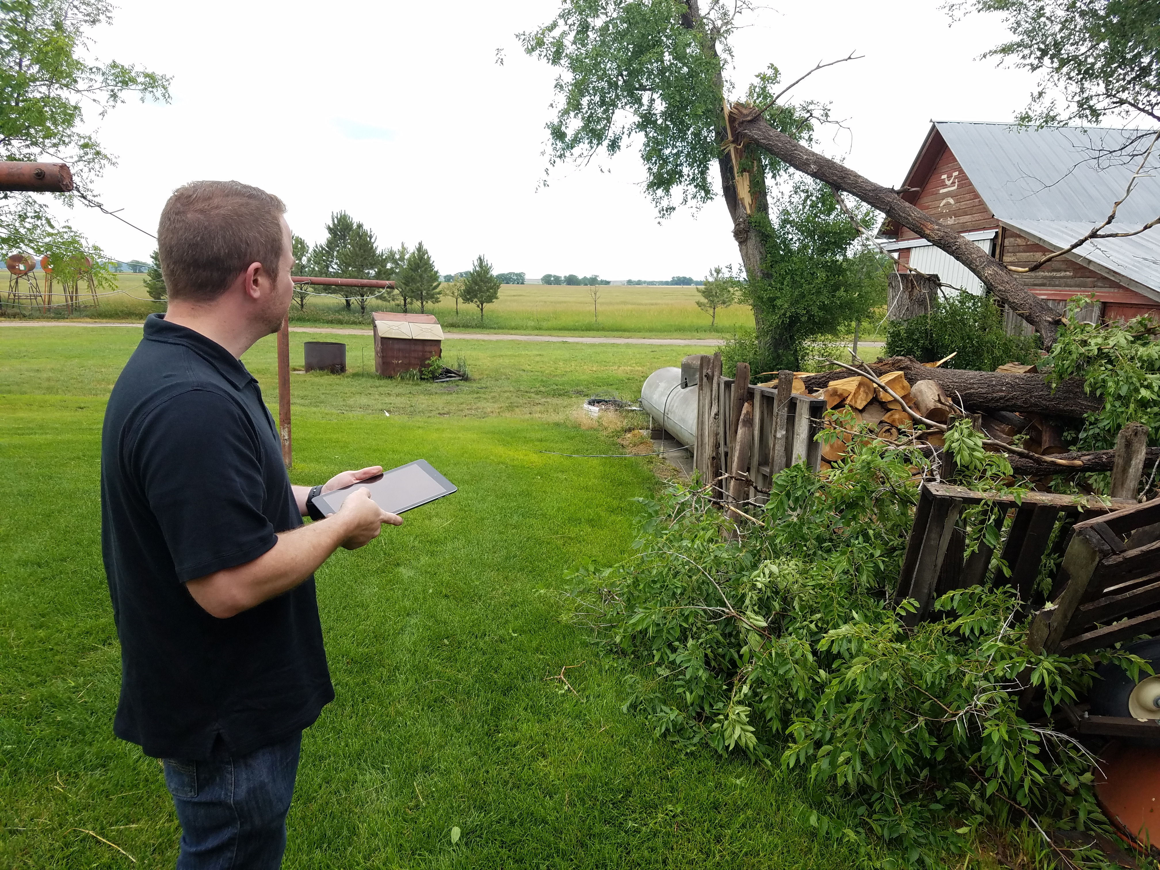
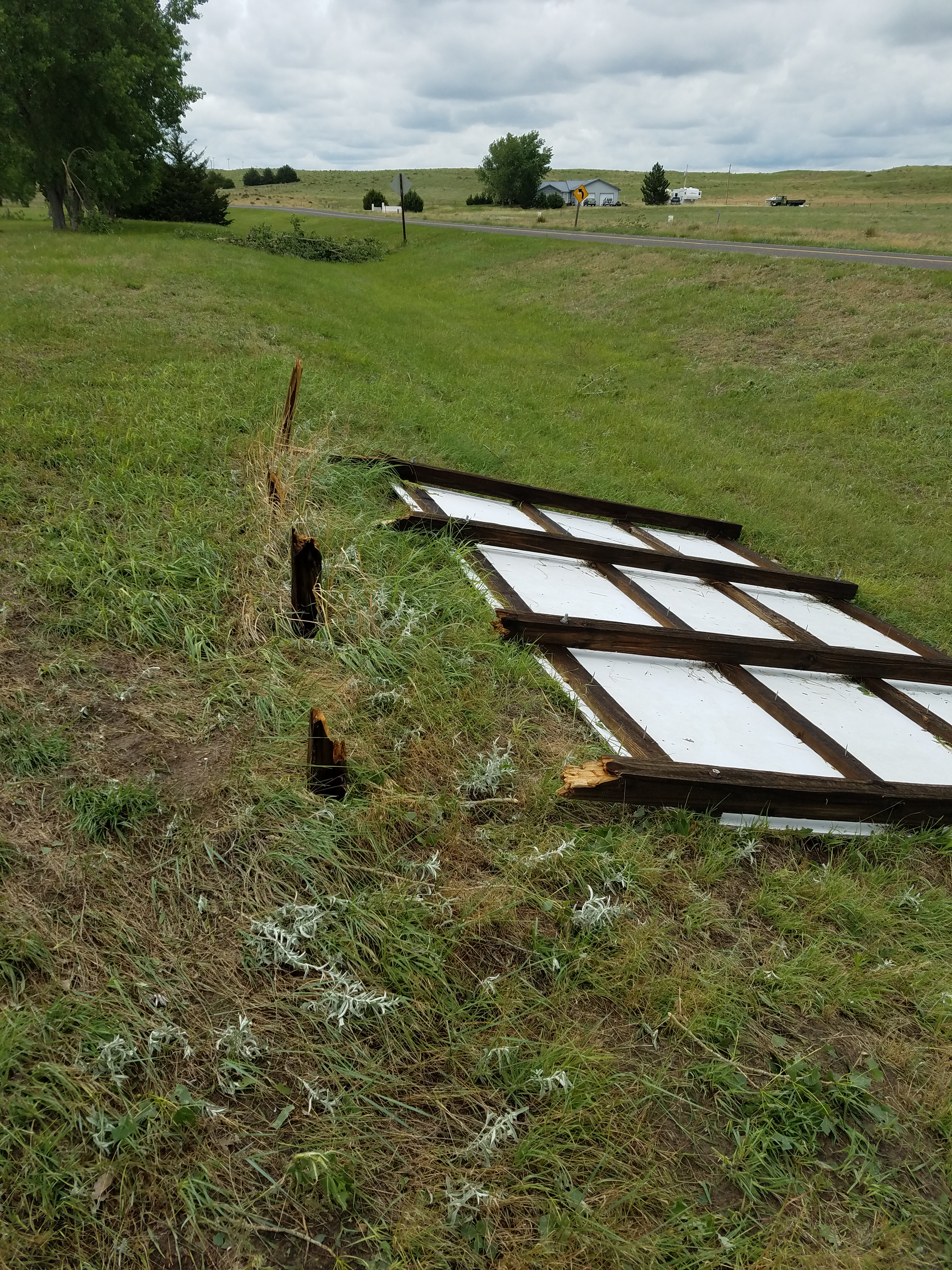
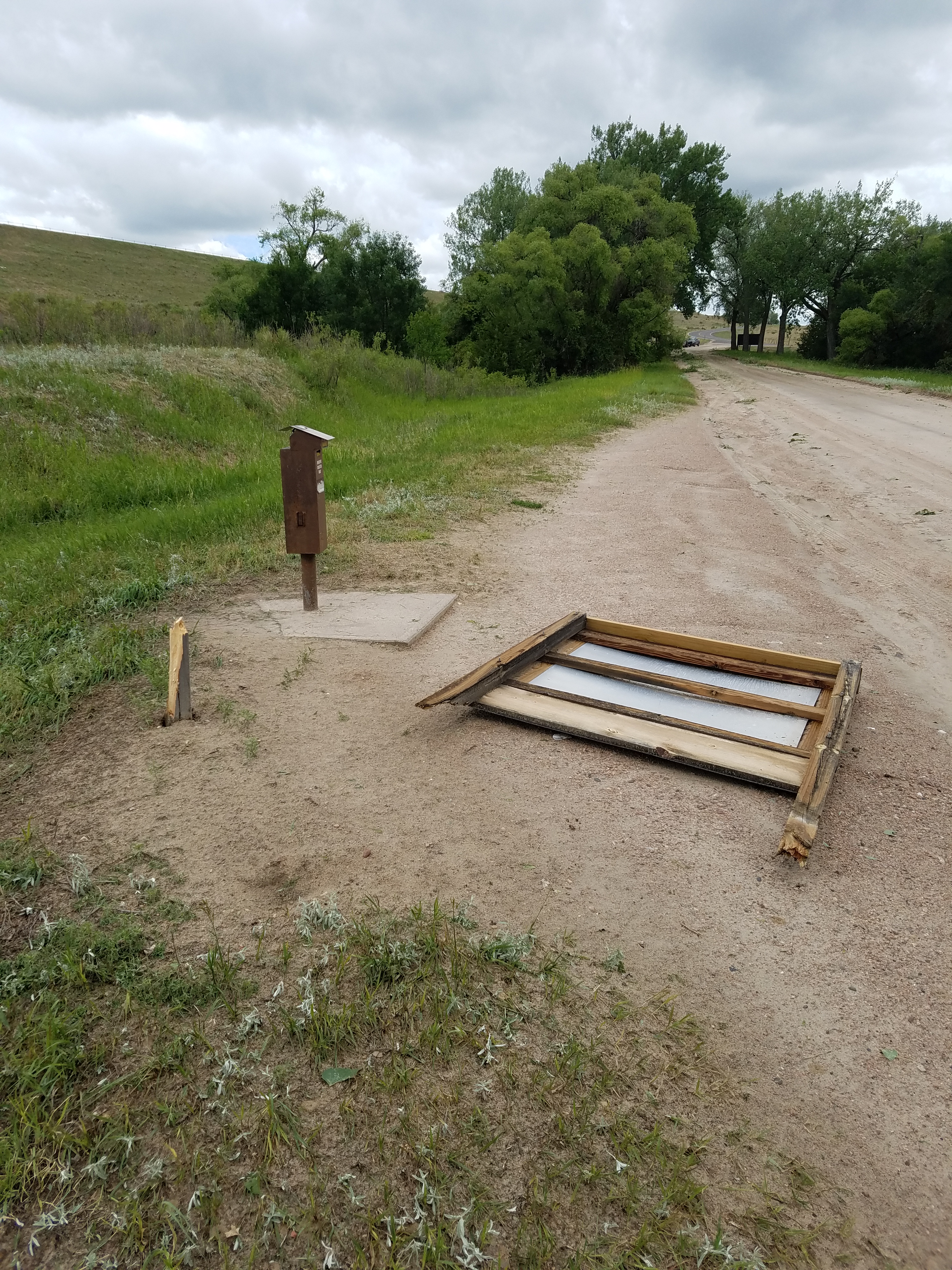
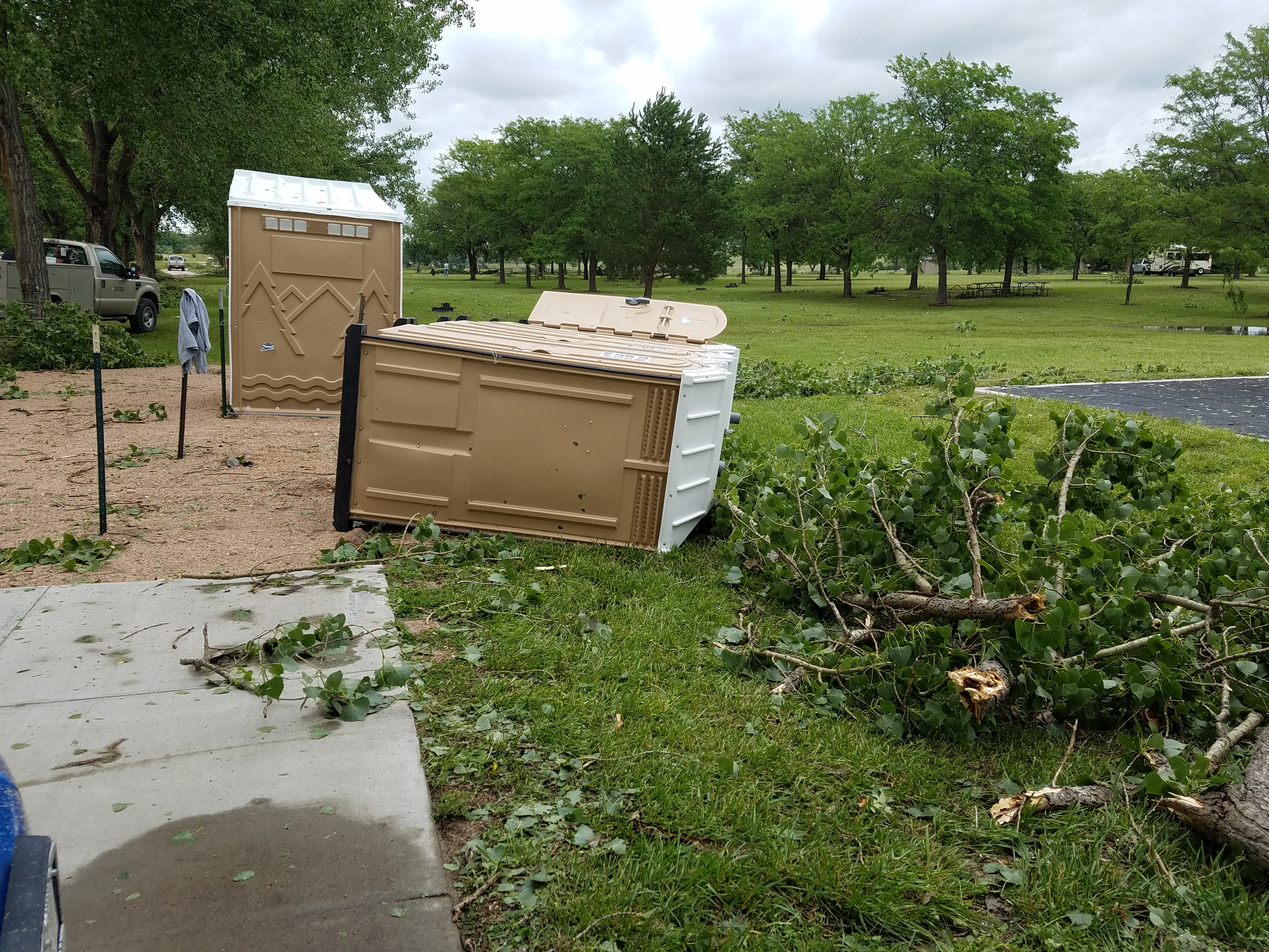
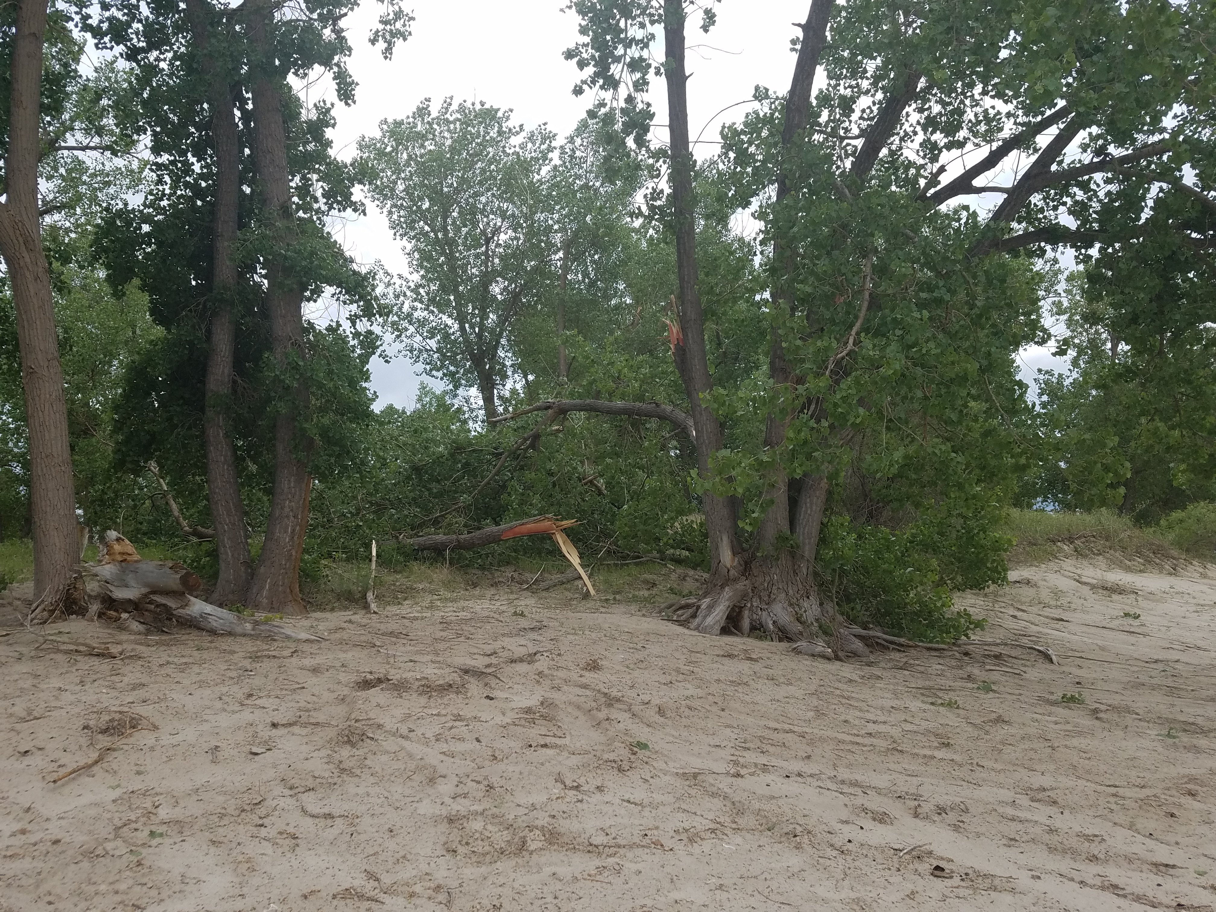
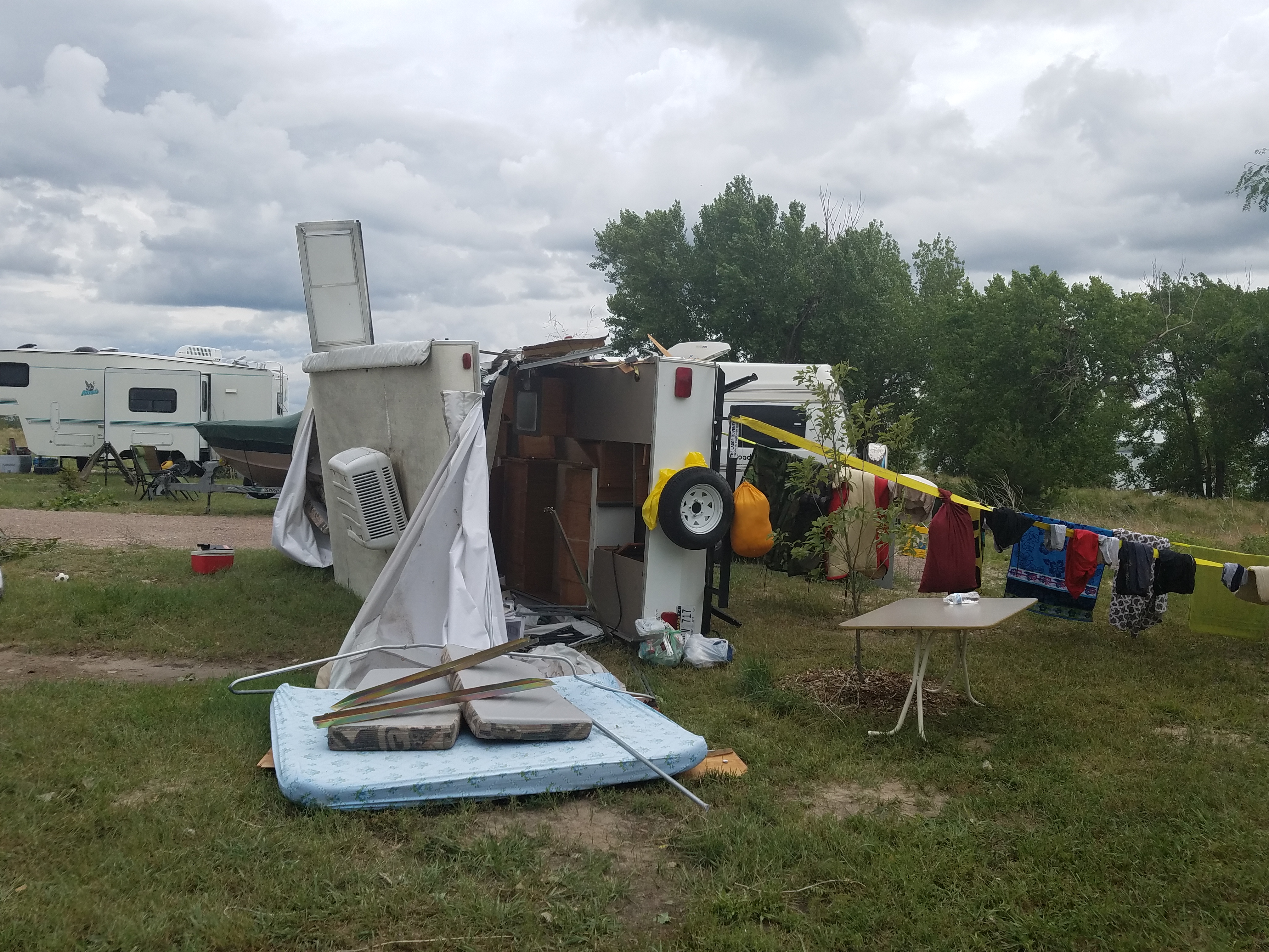
A strong low pressure system and abundant moisture provided a favorable environment for severe thunderstorms the afternoon of Sunday, June 24, 2018. One storm in particular formed southwest of Lake McConaughy and dropped a large amount of hail on Interstate 80 and produced 60 mph wind gusts near Big Springs. The storm rapidly intensified as it moved over Lake McConaughy and started to take on a "bow echo" shape on radar, indicative of high winds. Estimated gusts of 80 to 100 mph resulted in a swath of damage from Arthur Bay to Keystone. One person lost their life and another was injured at Little Thunder Bay Campground.
Windstorm Summary:
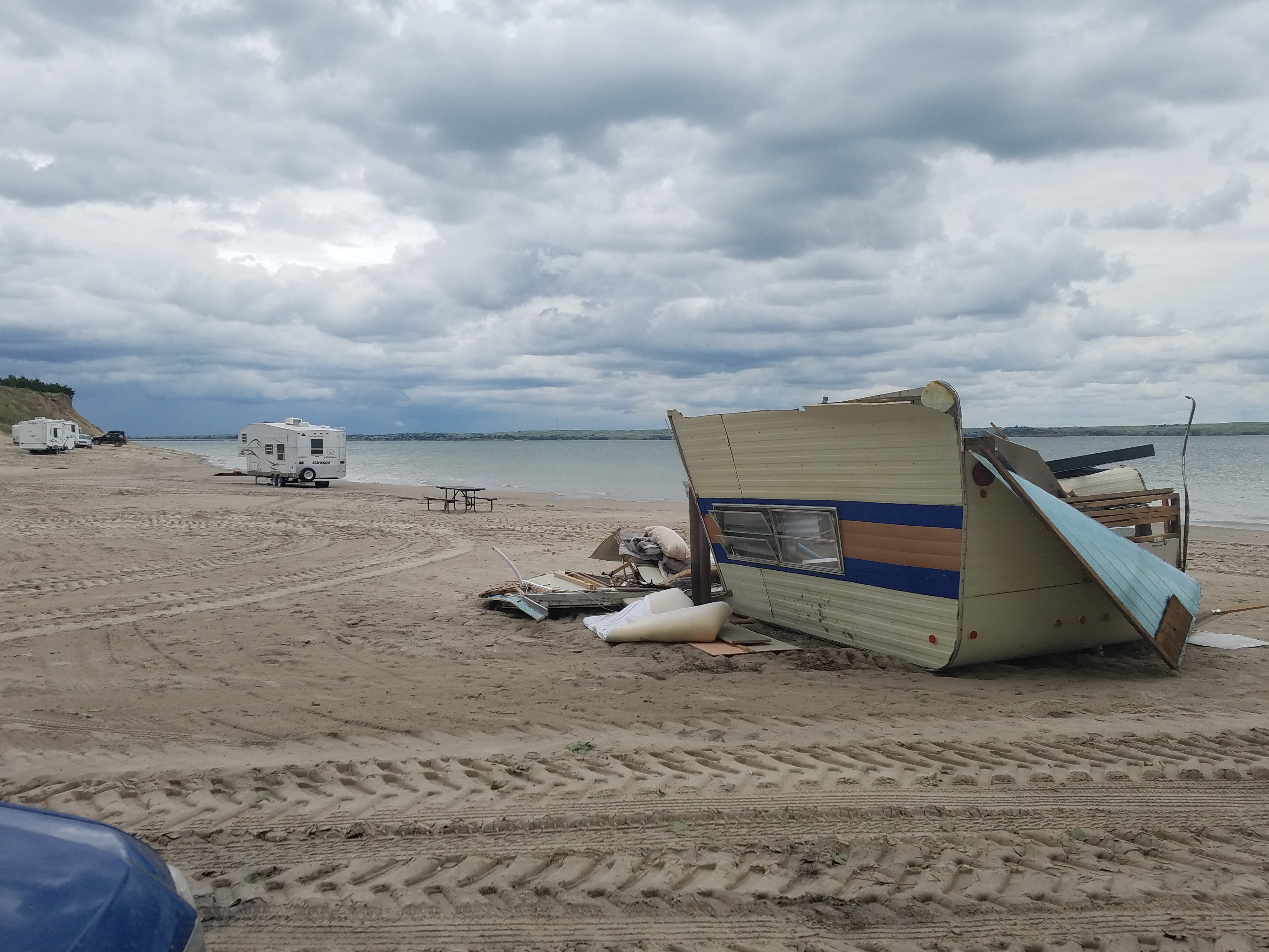 |
| 6 Campers were flipped by the wind with one injury. |
PEAK WIND ESTIMATED:    100 MPH
PATH LENGTH /STATUTE/:  8.3 MILES
PATH WIDTH /MAXIMUM/:   3,500 YARDS
FATALITIES:             1
INJURIES:               1

START DATE:             06/24/2018
START TIME:             1:13 PM MDT
START LOCATION:         ARTHUR BAY ON LAKE MCCONAUGHY, NE

END DATE:               06/24/2018
END TIME:               1:38 PM MDT
END LOCATION:           0.75 MILES NE OF KEYSTONE, NE
Photos:
 |
 |
 |
 |
| near Keystone (NWS) |
Keystone (NWS) |
Arthur Bay (Jason Jensen & Marcie Morrell) |
Little Thunder Campground (Jason Jensen & Marcie Morrell) |
 |
 |
 |
 |
| Little Thunder Campground (Jason Jensen & Marcie Morrell) |
Arthur Bay (Jason Jensen & Marcie Morrell) |
Arthur Bay (Jason Jensen & Marcie Morrell) |
near Keystone (NWS) |
 |
 |
 |
 |
| Keystone (NWS) |
Keystone (NWS) |
Lake Ogallala (NWS) |
Lake Ogallala (NWS) |
 |
 |
 |
|
| Lake Ogallala (NWS) |
Little Thunder Bay (NWS) |
Little Thunder Bay (NWS) |
Arthur Bay (NWS) |
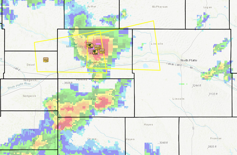
Radar:
.gif)
Radar loop courtesy of the Iowa Environmental Mesonet
Yellow outline = Severe Thunderstorm Warning
Storm Reports
Map of reports with Severe Thunderstorm Warnings and radar underlay (as of 1:45 PM MDT)
..TIME...   ...EVENT...      ...CITY LOCATION...     ...LAT.LON...
..DATE...   ....MAG....      ..COUNTY LOCATION..ST.. ...SOURCE....
            ..REMARKS..

0113 PM     TSTM WND DMG     5 ESE LEMOYNE           41.26N 101.71W
06/24/2018                   KEITH              NE   NWS STORM SURVEY

            *** 1 FATAL, 1 INJ *** ESTIMATED 88MPH WINDS UPROOTED
            TREES, SNAPPED TREE TRUNKS, AND BROUGHT DOWN LARGE
            BRANCHES. ONE PERSON DIED OF A HEART ATTACK DURING THE
            STORM. SEVERAL RV TRAILERS WERE ROLLED, ONE WAS ROLLED
            5 TIMES AND LANDED IN THE LAKE WITH AN OCCUPANT INSIDE
            WHO WAS INJURED.

0159 PM     TSTM WND GST     8 NW BIG SPRINGS        41.15N 102.18W
06/24/2018  E60.00 MPH       DEUEL              NE   PUBLIC

0230 PM     TSTM WND DMG     4 NW KINGSLEY DAM       41.26N 101.71W
06/24/2018                   KEITH              NE   PUBLIC

            *** 1 INJ *** ONE FOOT DIAMETER BRANCH DOWNED FROM
            HEALTHY TREE. WOODEN FENCE FLATTENED. CAMPERS
            ROLLED,THROWN INTO LAKE AT NEARBY CAMPSITE. LOCATION
            APPROXIMATE FOR INJURY.

0232 PM     TSTM WND GST     KINGSLEY DAM            41.21N 101.66W
06/24/2018  M78.00 MPH       KEITH              NE   MESONET

0232 PM     TSTM WND DMG     KINGSLEY DAM            41.21N 101.66W
06/24/2018                   KEITH              NE   PUBLIC

            A CAR TRAVELING ON THE HIGHWAY 61 CROSSING KINGSLEY DAM
            HAD THE DRIVER SIDE WINDOW SHATTERED BY HIGH WINDS. TIME
            APPROXIMATED FROM THE 78 MPH WIND GUST REPORTED AT
            KINGSLEY DAM.

0245 PM     TSTM WND GST     3 NNE KINGSLEY DAM      41.25N 101.64W
06/24/2018  M83.00 MPH       KEITH              NE   MESONET

            MESONET STATION UP362, KINGSLEY DAM 3NNE

0246 PM     TSTM WND GST     KEYSTONE                41.22N 101.59W
06/24/2018  E70.00 MPH       KEITH              NE   PUBLIC

0300 PM     TSTM WND DMG     5 NW KINGSLEY DAM       41.27N 101.73W
06/24/2018                   KEITH              NE   PUBLIC

            3 METAL LAWN CHAIRS BLOWN 150 YARDS. A 2-FOOT DIAMETER
            TREE SNAPPED AT THE TRUNK. TIME APPROXIMATE AND BASED ON
            THE TIME OF A MEASURED PEAK WIND GUST OF 62 MPH.

0300 PM     TSTM WND GST     5 NW KINGSLEY DAM       41.27N 101.73W
06/24/2018  M62.00 MPH       KEITH              NE   MESONET

            DAVIS WEATHER STATION REPORT
 |
Media use of NWS Web News Stories is encouraged! Please acknowledge the NWS as the source of any news information accessed from this site. |
|

