Dangerous and extreme heat will remain across portions of the southern U.S. this week. Heavy rainfall may bring significant flash flooding across portions of the Mid-Atlantic and Northeast through the night, and additional flash flooding concerns across New England on Wednesday. Monsoonal thunderstorms will bring a flash flood risk to the Four Corners region, especially in burn scar areas Read More >
Overview
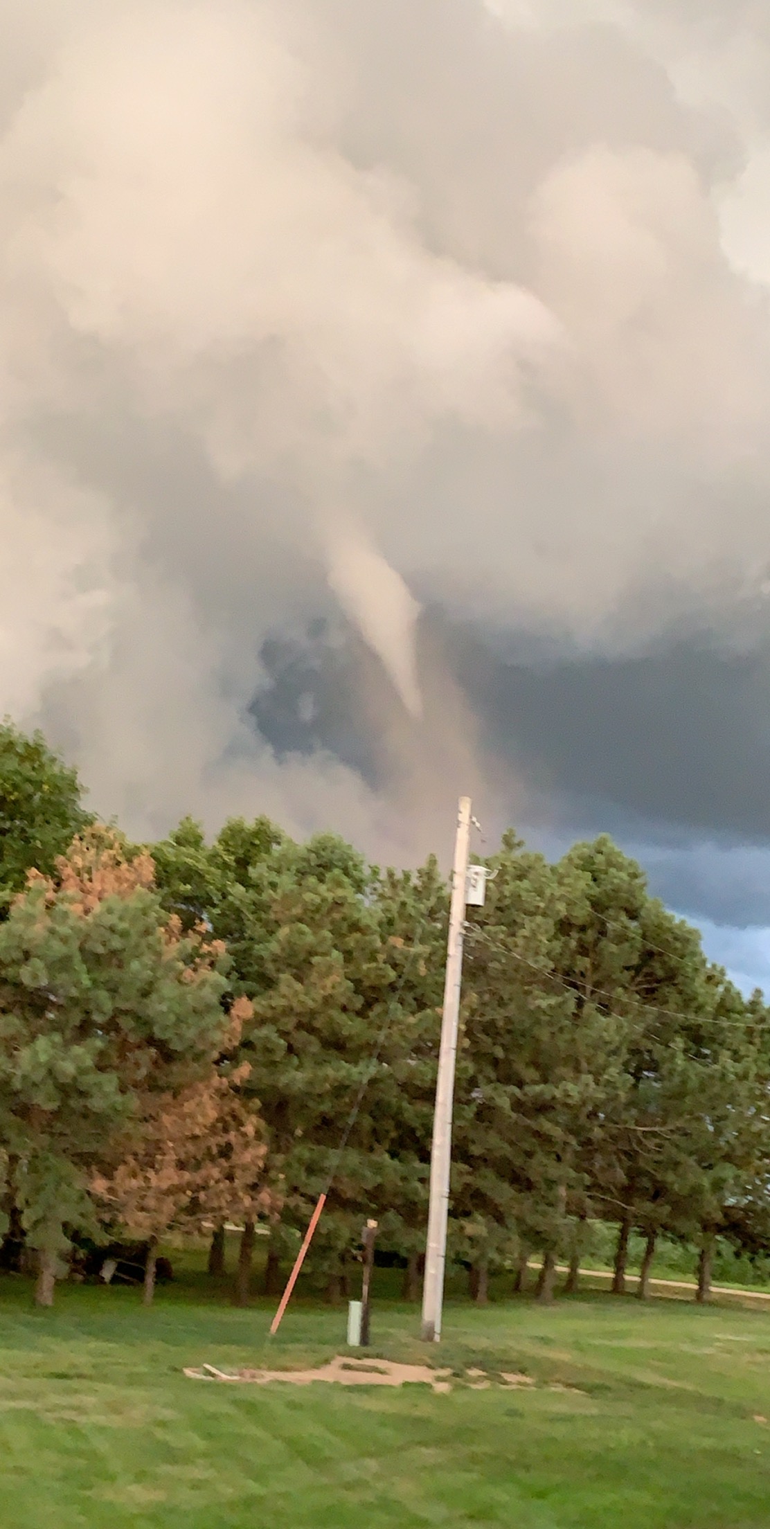
A line of strong and severe thunderstorms went through the eastern portions of north central Nebraska last evening. These storms were along the southwest flank of a larger line that originally evolved from north central South Dakota that moved southeast into north central and northeast Nebraska. The severe storms produced one confirmed tornado, damaging wind gusts, and half dollar sized hail.
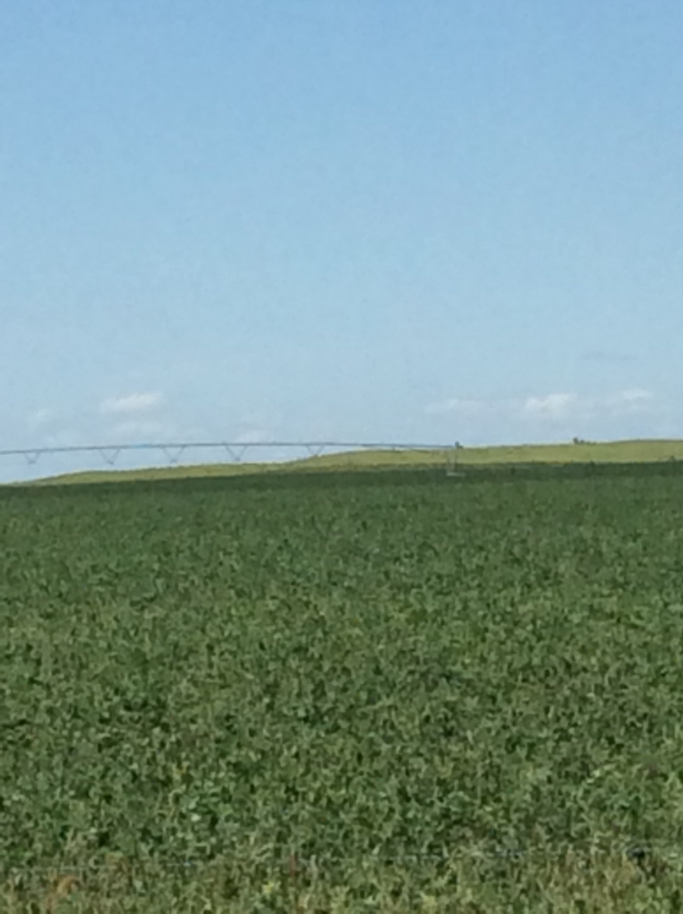
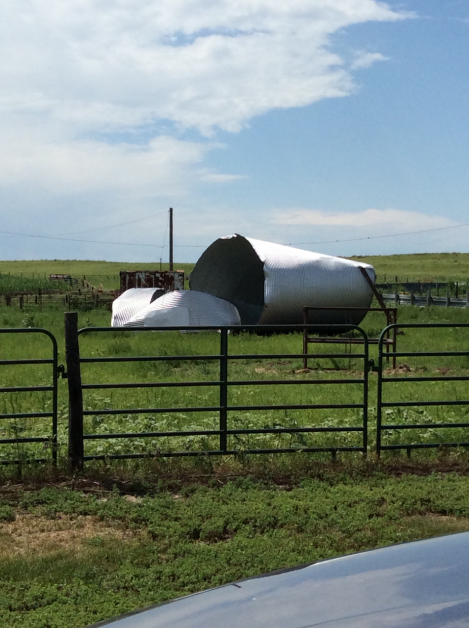
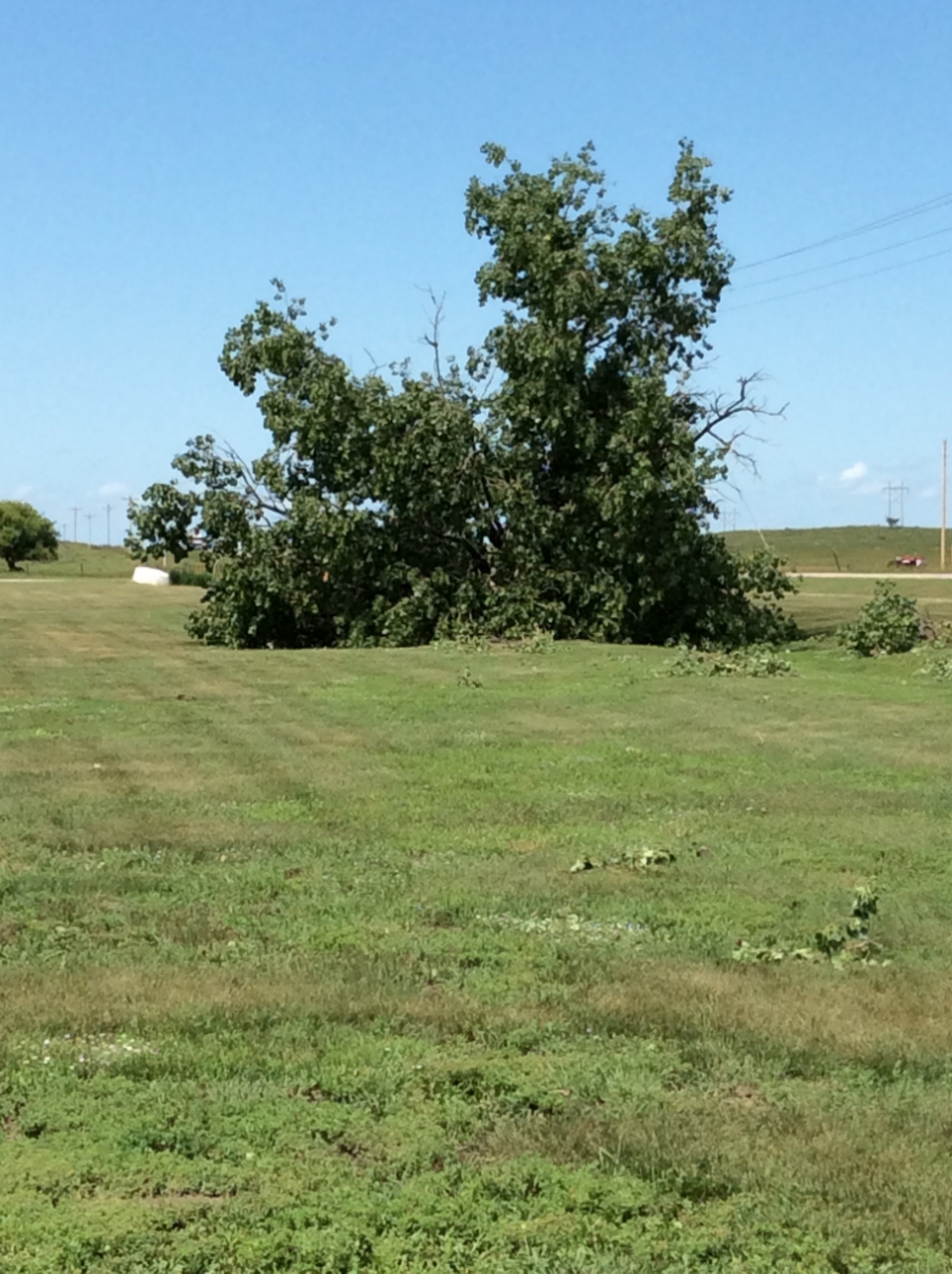
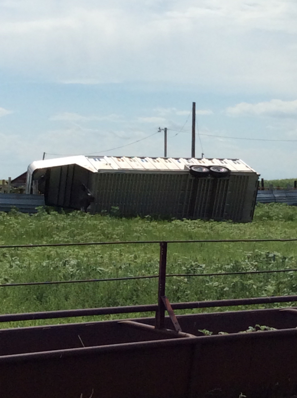
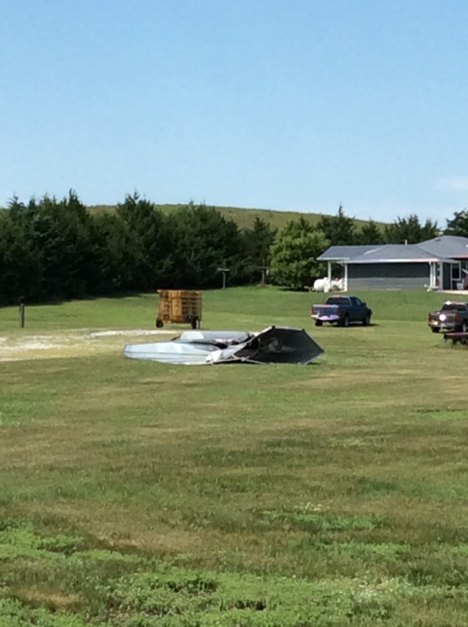
Damage was also reported in northern Holt county associated with a microburst. Damage included an empty grain bin that was destroyed, an uprooted tree, and a stock trailer that was tipped over. In addition, two pivots were overturned.
Tornado
|
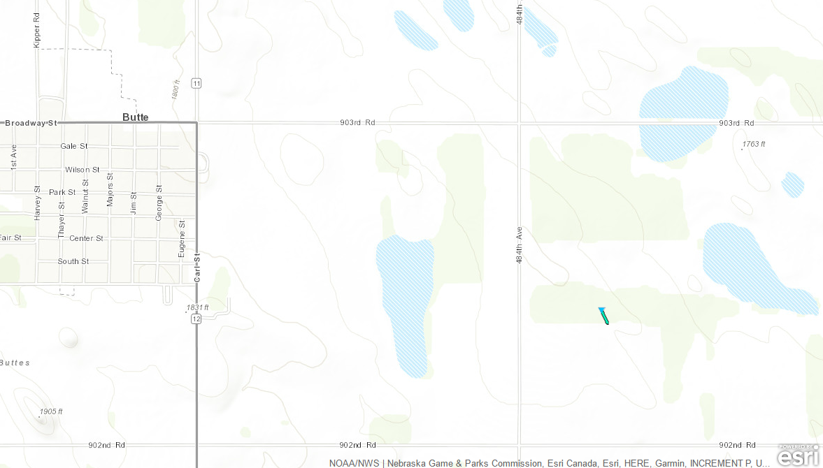
Tornado - 2 Miles East of Butte
Track Map 
(Click to Enlarge) |
||||||||||||||||
|
||||||||||||||||
The Enhanced Fujita (EF) Scale classifies tornadoes into the following categories:
| EF0 Weak 65-85 mph |
EF1 Moderate 86-110 mph |
EF2 Significant 111-135 mph |
EF3 Severe 136-165 mph |
EF4 Extreme 166-200 mph |
EF5 Catastrophic 200+ mph |
 |
|||||
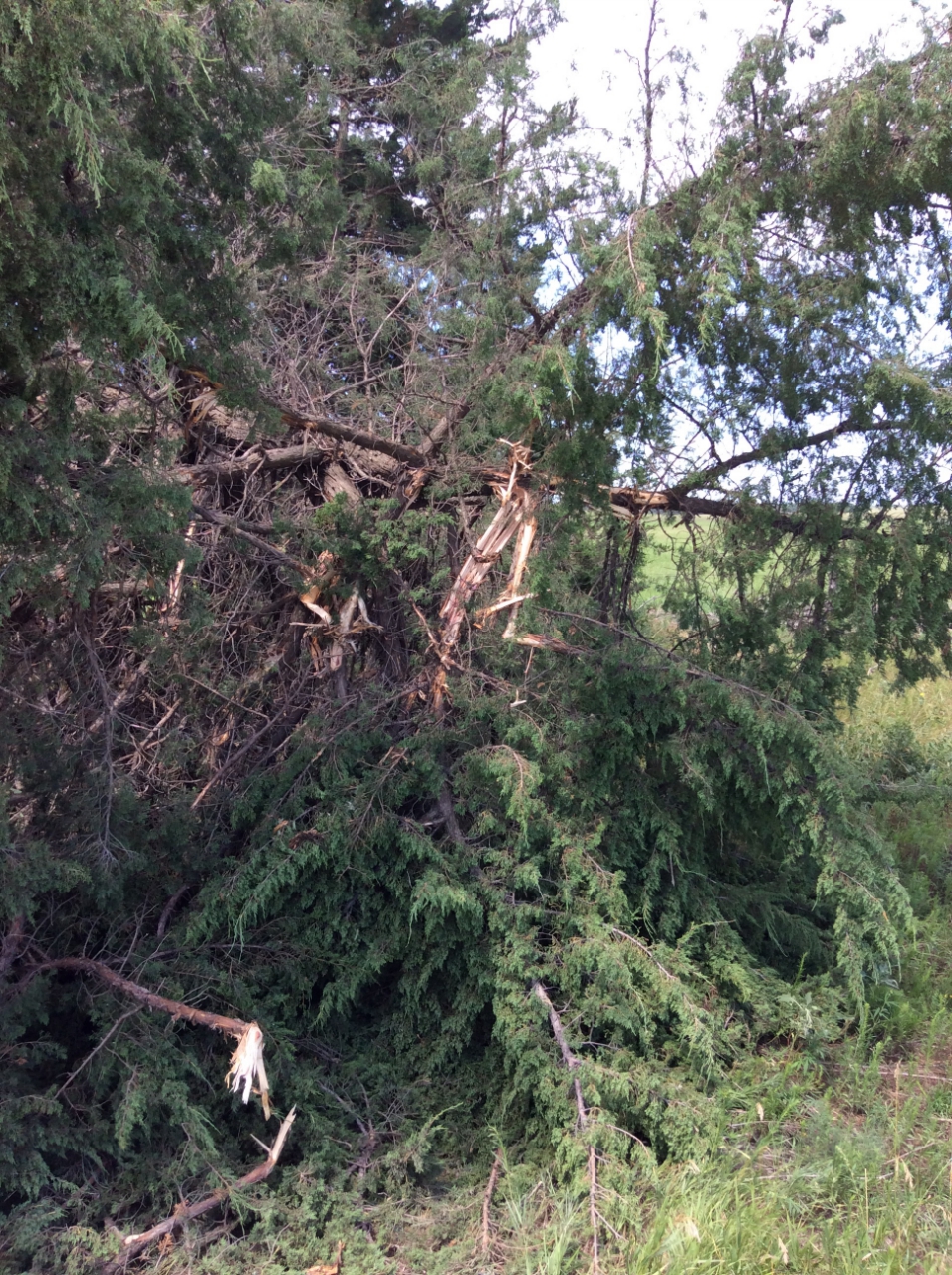
Holt County Wind Damage Photos
Multiple impacts were reported in northern Holt county, roughly 10 miles south of Spencer, NE or roughly 20 miles north of O'Neill, NE.
 |
 |
 |
| Large Branches Broken (1"-3" diameter) (Photo Source: NWS Employee) |
Overturned Pivot (Photo Source: NWS Employee) |
Grain Bin Blown Over (Photo Source: NWS Employee) |
 |
 |
 |
| Small Limbs Broken (Up to 1" diameter) (Photo Source: NWS Employee) |
Stock Trailer Tipped Over (Photo Source: NWS Employee) |
Grain Bin Destroyed (Photo Source: NWS Employee) |
Storm Reports
..TIME...   ...EVENT...      ...CITY LOCATION...     ...LAT.LON...
..DATE...   ....MAG....      ..COUNTY LOCATION..ST.. ...SOURCE....
            ..REMARKS..
0910 PM     TORNADO          2 E BUTTE               42.91N 98.81W
07/28/2019  F0               BOYD               NE   NWS STORM SURVEY

            BRIEF TORNADO TOUCH DOWN IN AN OPEN FIELD WITH NO
            REPORTED DAMAGE. SUBJECT TO CHANGE PENDING FINAL REVIEW
            OF THE EVENT AND PUBLICATION IN NWS STORM DATA.
0915 PM     HAIL             3 N SPENCER             42.92N 98.70W
07/28/2019  M1.00 INCH       BOYD               NE   LAW ENFORCEMENT
0930 PM     HAIL             7 SSW BRISTOW           42.75N 98.65W
07/28/2019  M1.25 INCH       BOYD               NE   PUBLIC

            QUARTER TO HALF DOLLAR SIZE HAIL.
0959 PM     TSTM WND GST     2 N ONEILL              42.49N 98.65W
07/28/2019  M52 MPH          HOLT               NE   MESONET

            DAVIS WEATHER STATION - MESONET
1025 PM     HAIL             14 S ONEILL             42.26N 98.65W
07/28/2019  M1.00 INCH       HOLT               NE   TRAINED SPOTTER
 |
Media use of NWS Web News Stories is encouraged! Please acknowledge the NWS as the source of any news information accessed from this site. |
|