
Tropical system in the Gulf expected to gradually strengthen the next couple of days off the Florida Panhandle and Alabama coasts. Instances of flash flooding will be possible through Thursday along the eastern and central Gulf Coast. Severe thunderstorms will develop and move along a cold front crossing the Upper Midwest, and through the Ohio Valley/Mid-Atlantic on Tuesday. Read More >
Overview
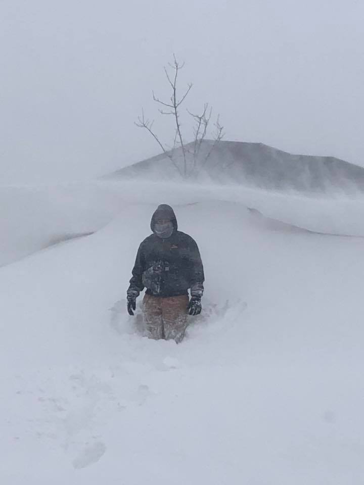
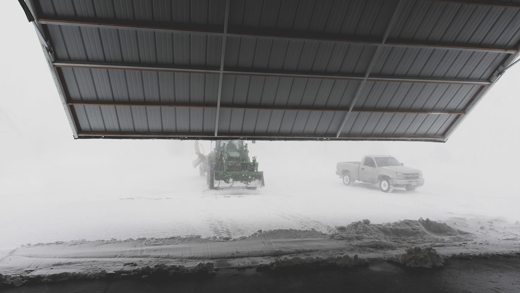
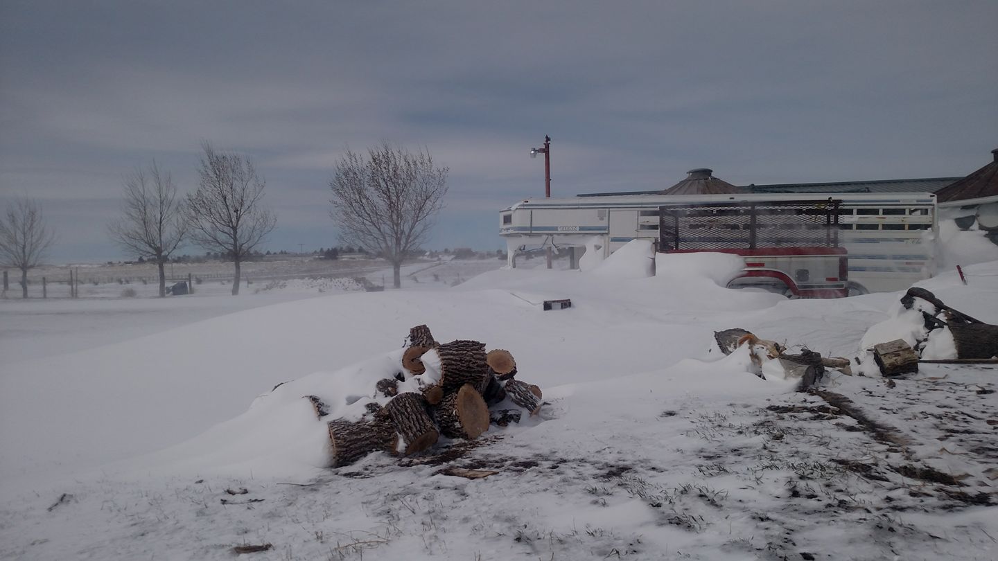
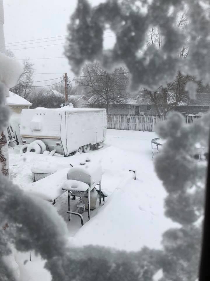
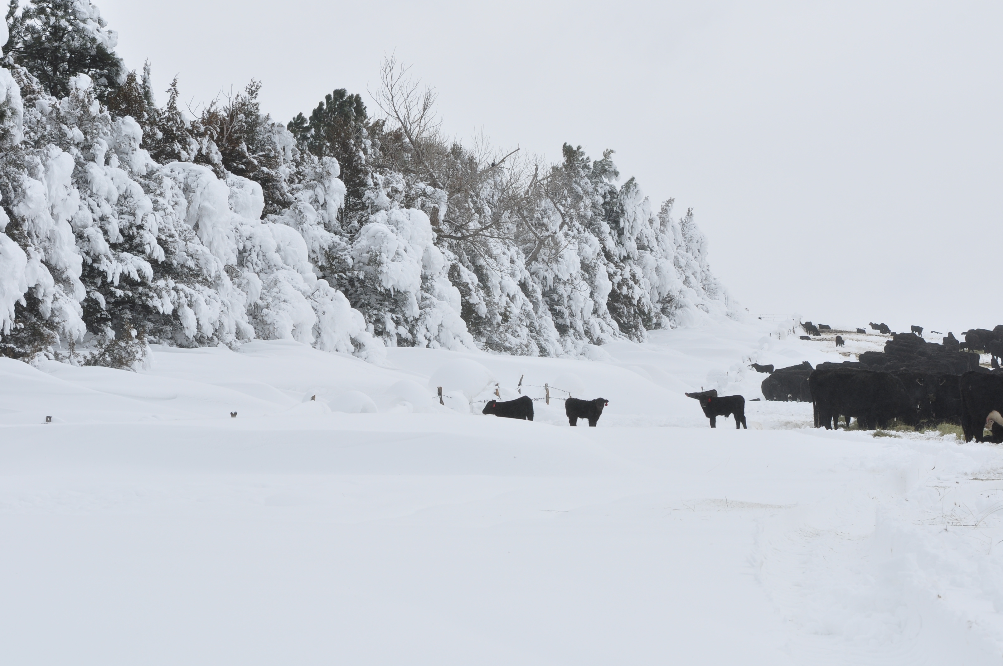
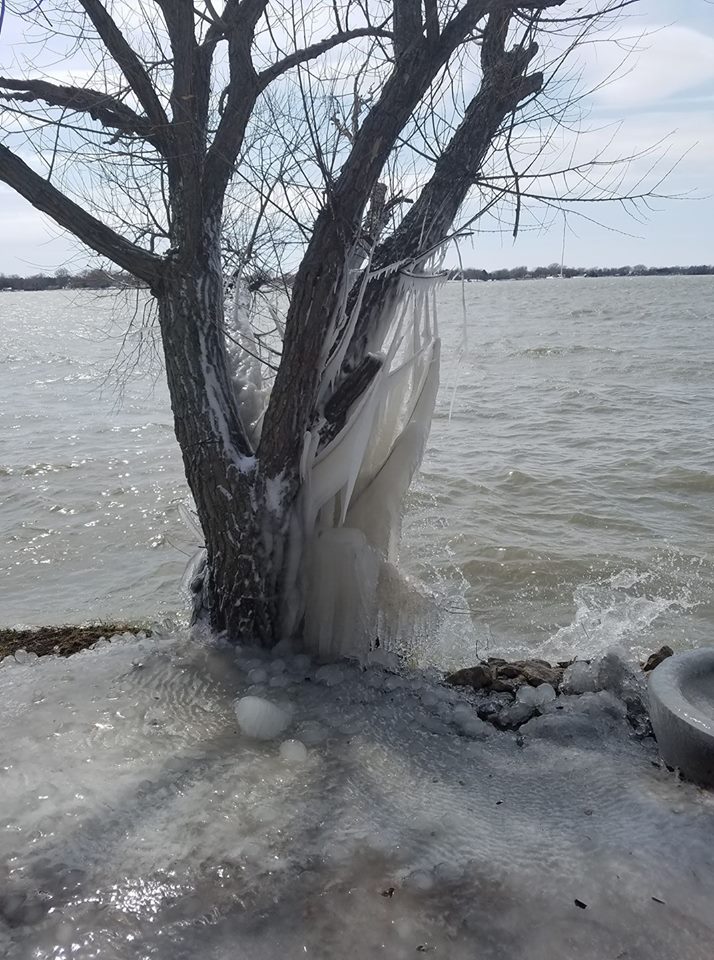
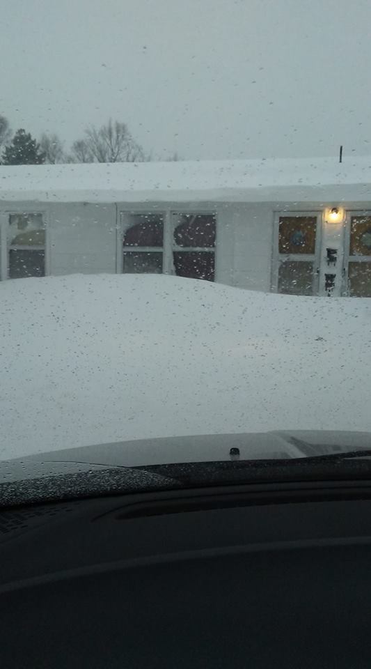
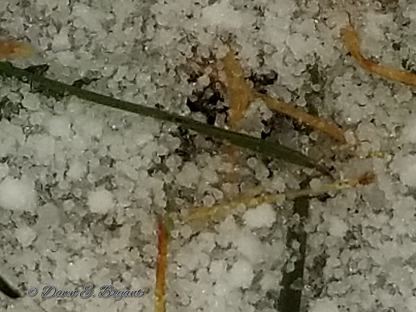
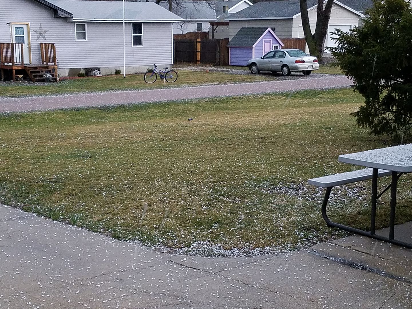
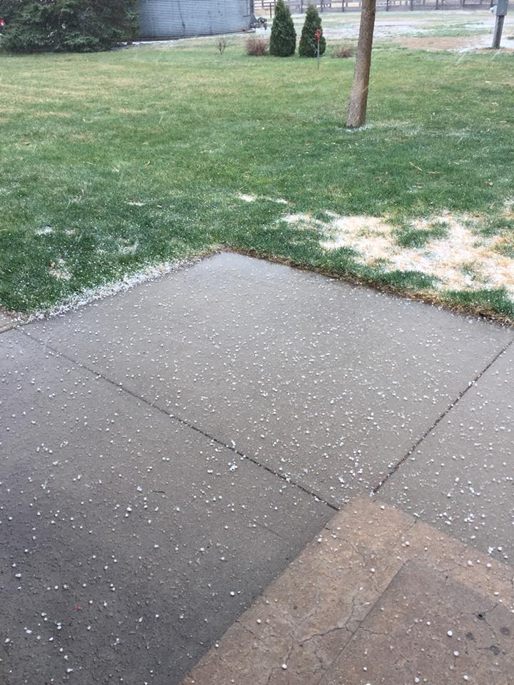
An expansive and multi-faceted storm system impacted the heart of the country in the middle of April 2018, bringing blizzard conditions to the northern Great Plains and severe weather to parts of the Midwest and Mississippi Valley. Western and north central Nebraska were primarily on the "cool side" of the storm with snow and high winds being the primary hazards. However, thunderstorms developed in north central Nebraska before the snow set in and produced hail.
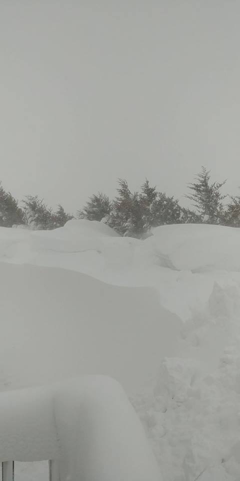
The snow developed and the winds intensified Friday morning, beginning in the panhandle and western Sandhills. The precipitation spread east through the evening and night, where the snow was mixed with graupel (soft hail or snow pellets) and sleet at times. The heaviest snow was confined to central Nebraska on Saturday, but strong winds continued for much of the area.
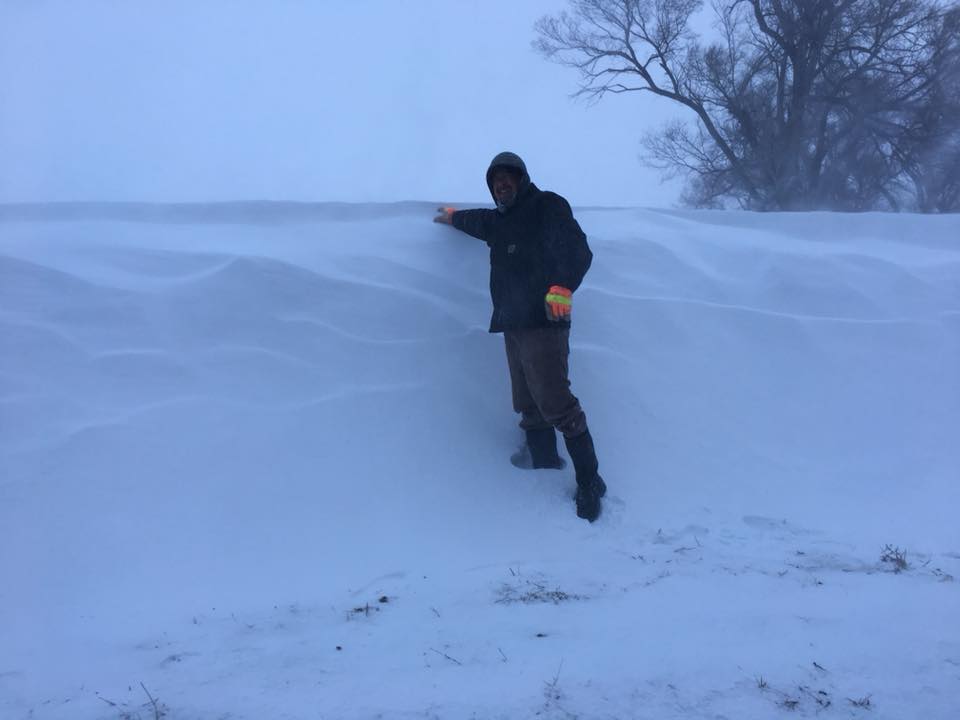
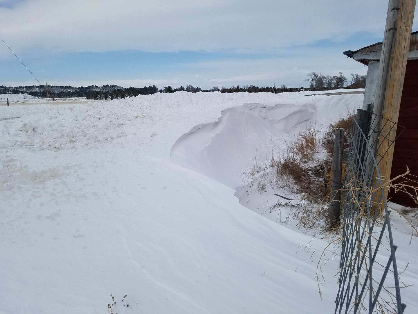
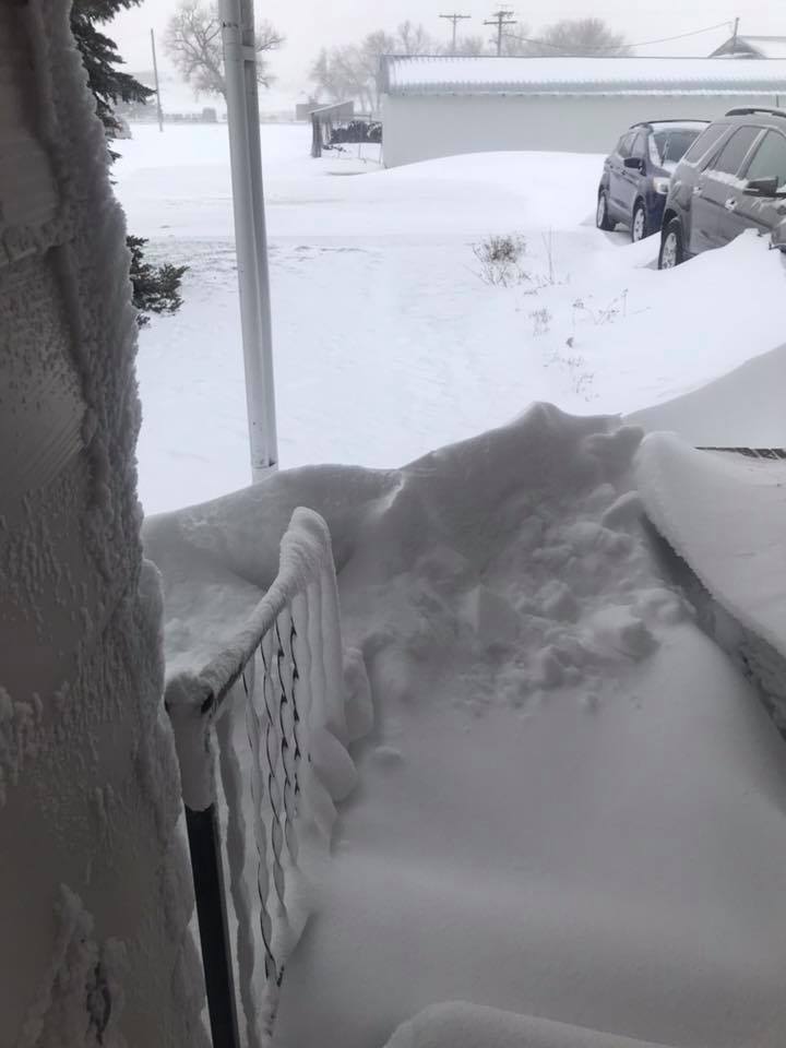
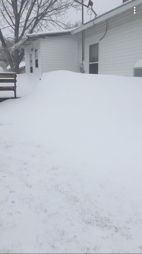
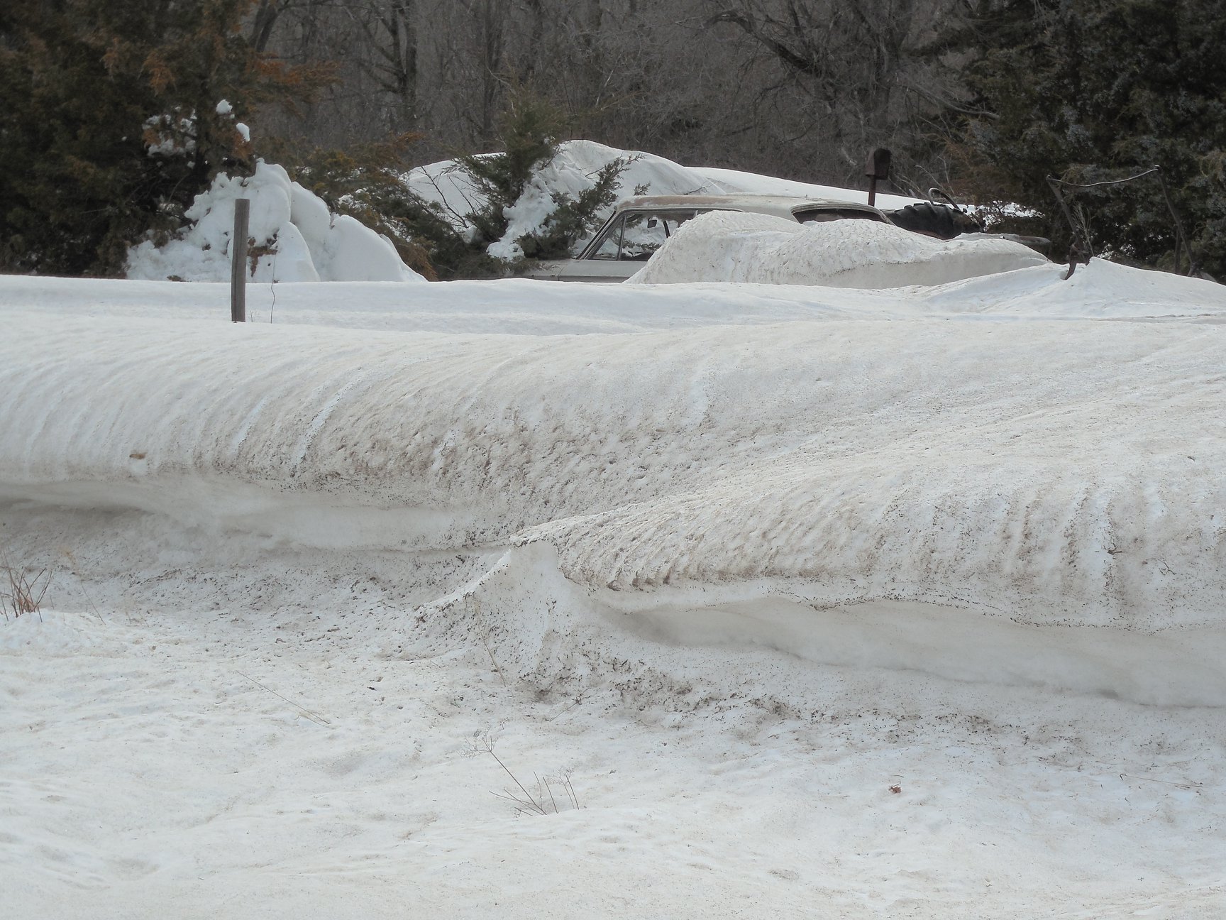
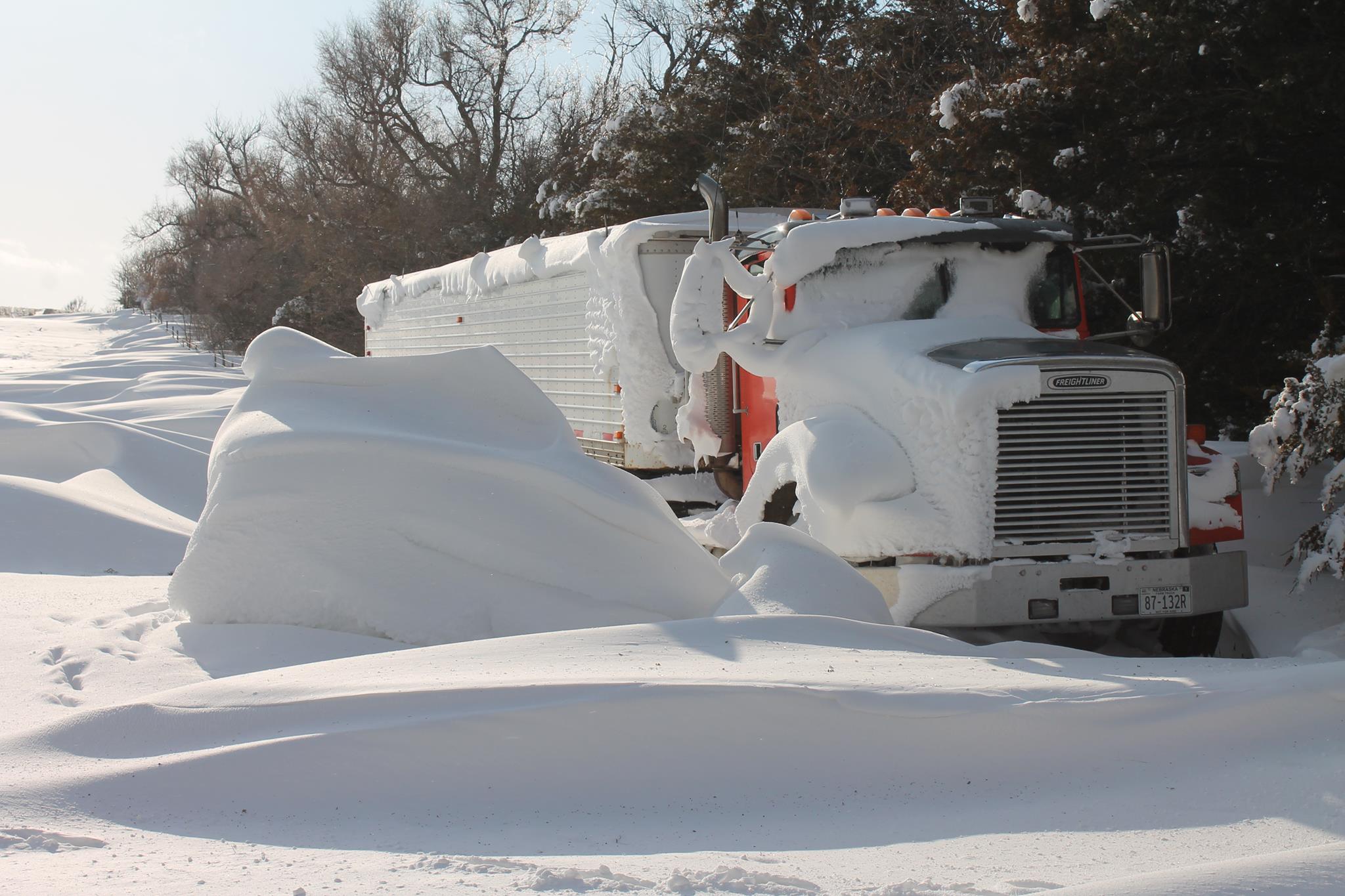
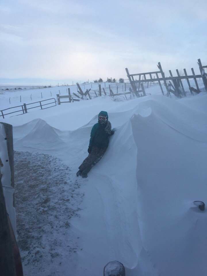
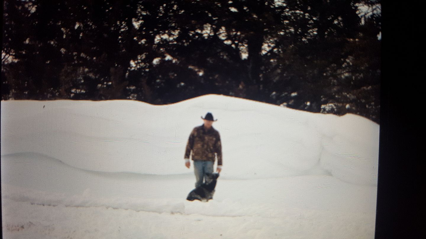
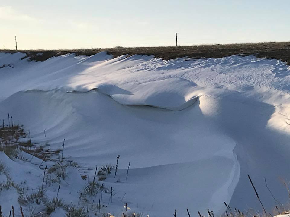
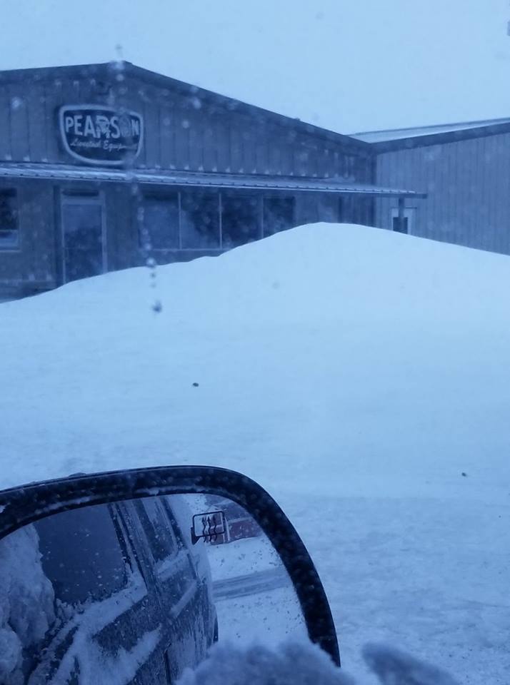
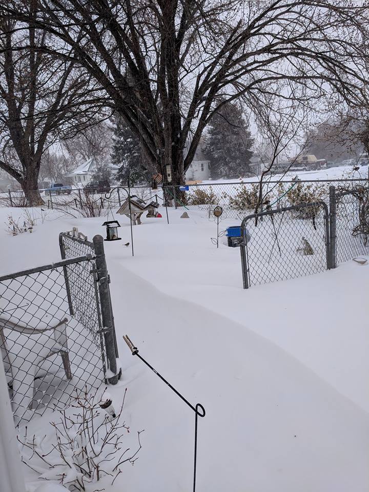
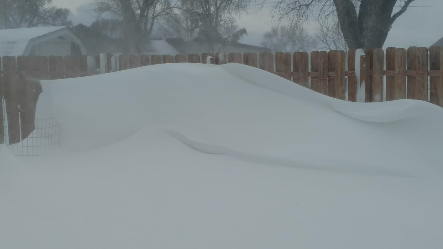
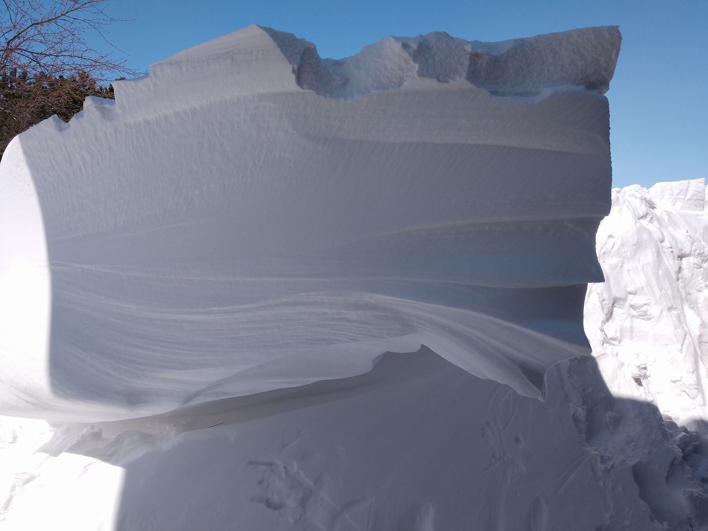
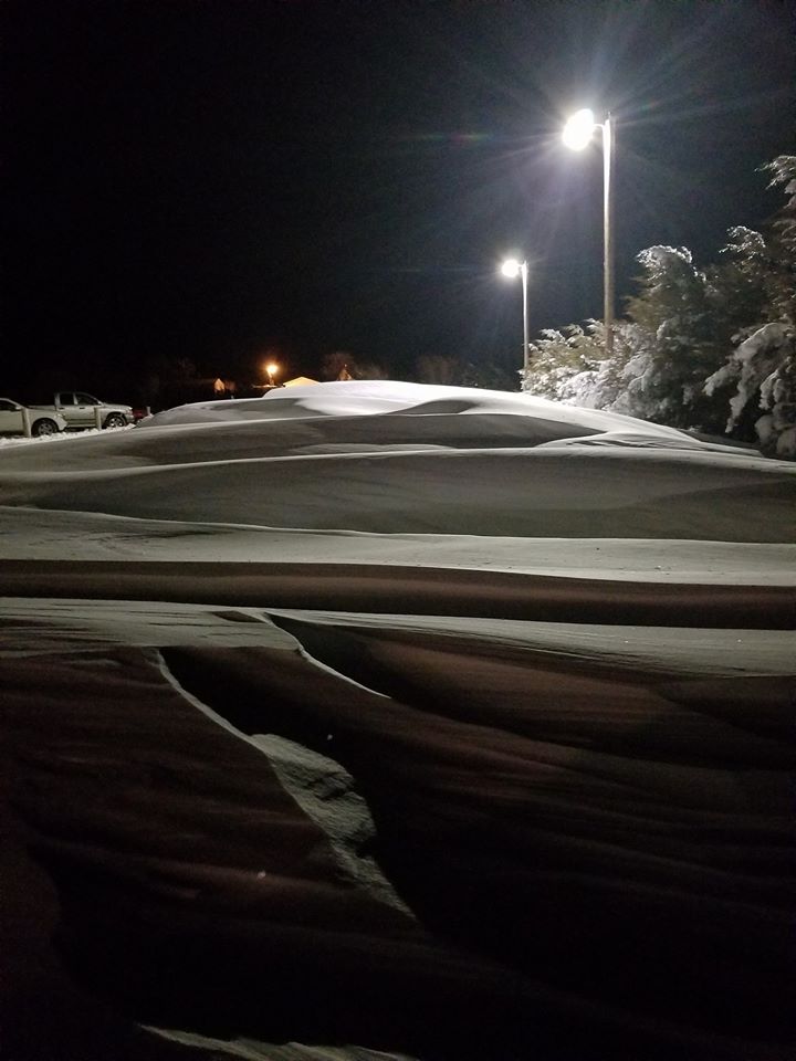
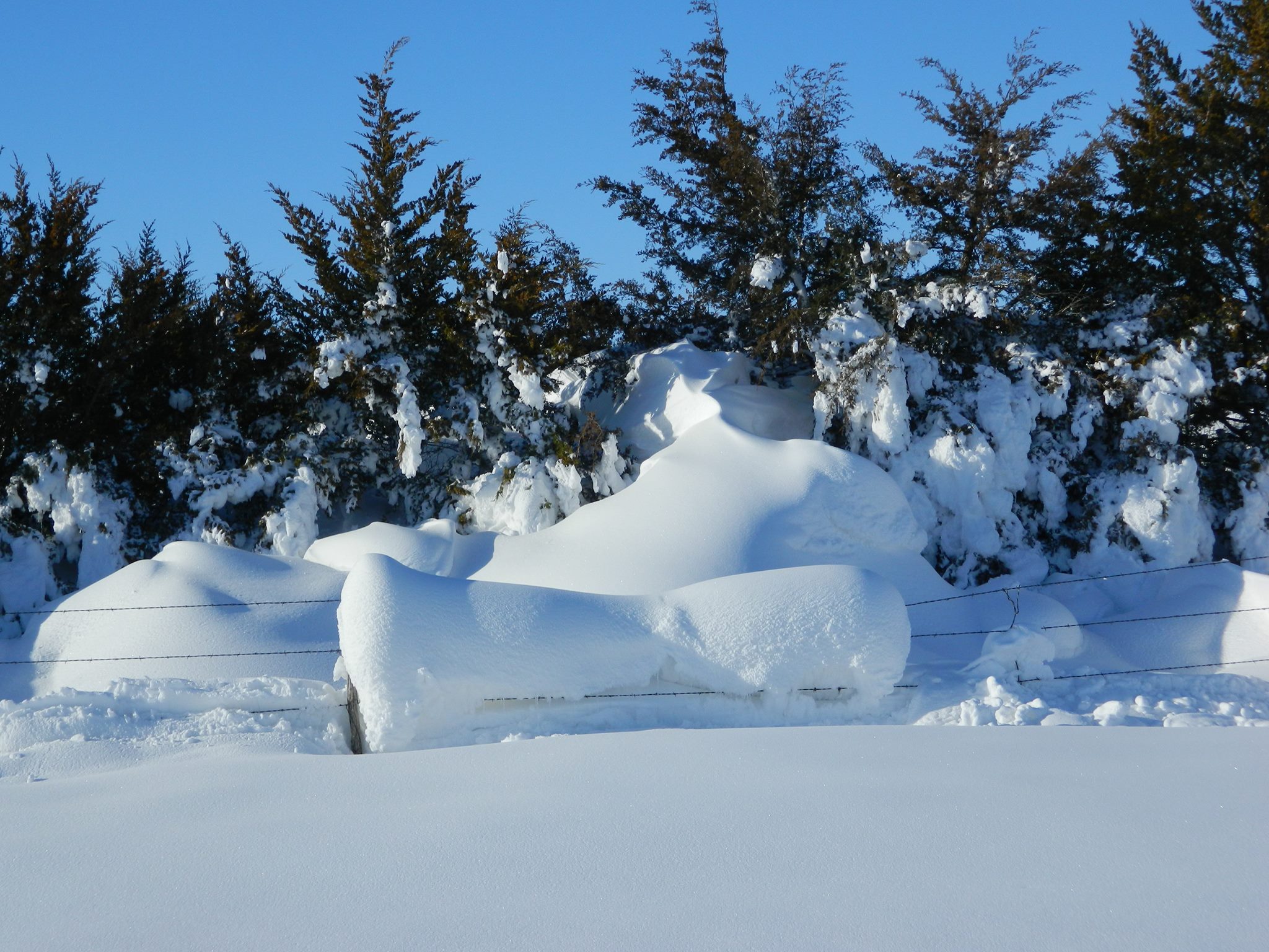
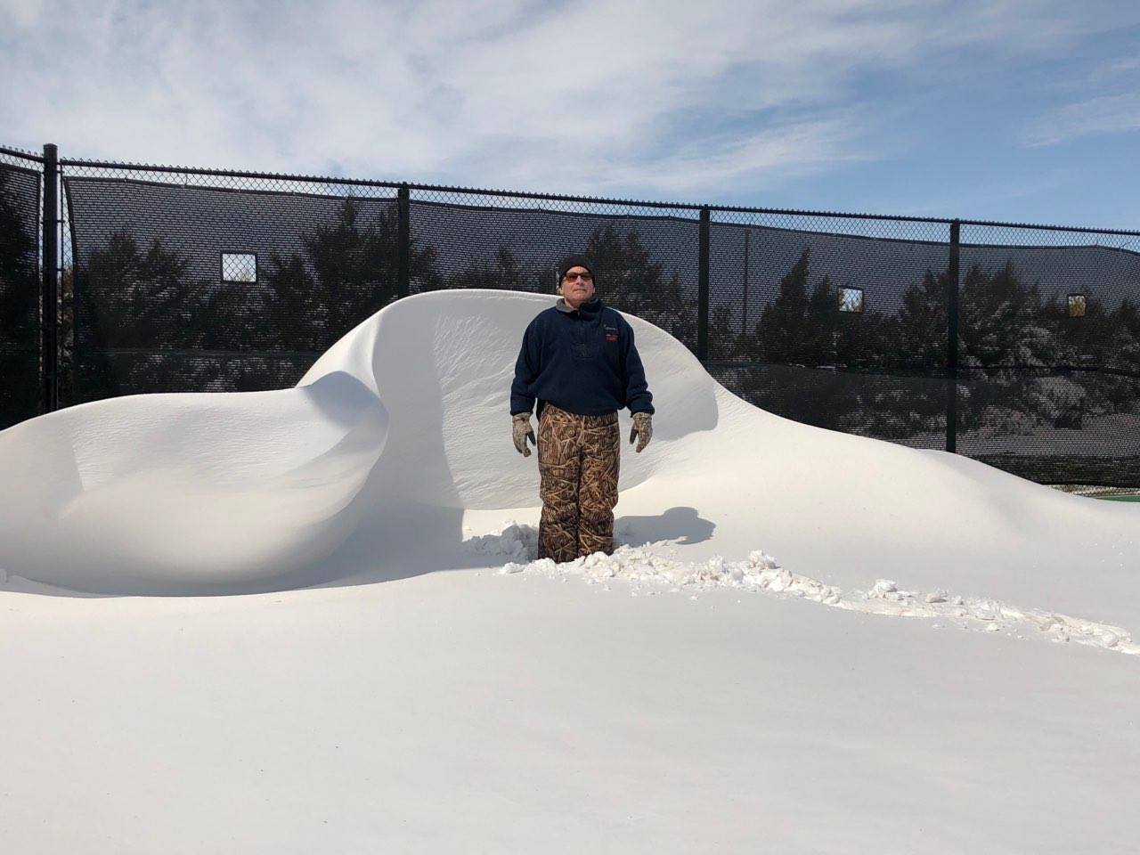
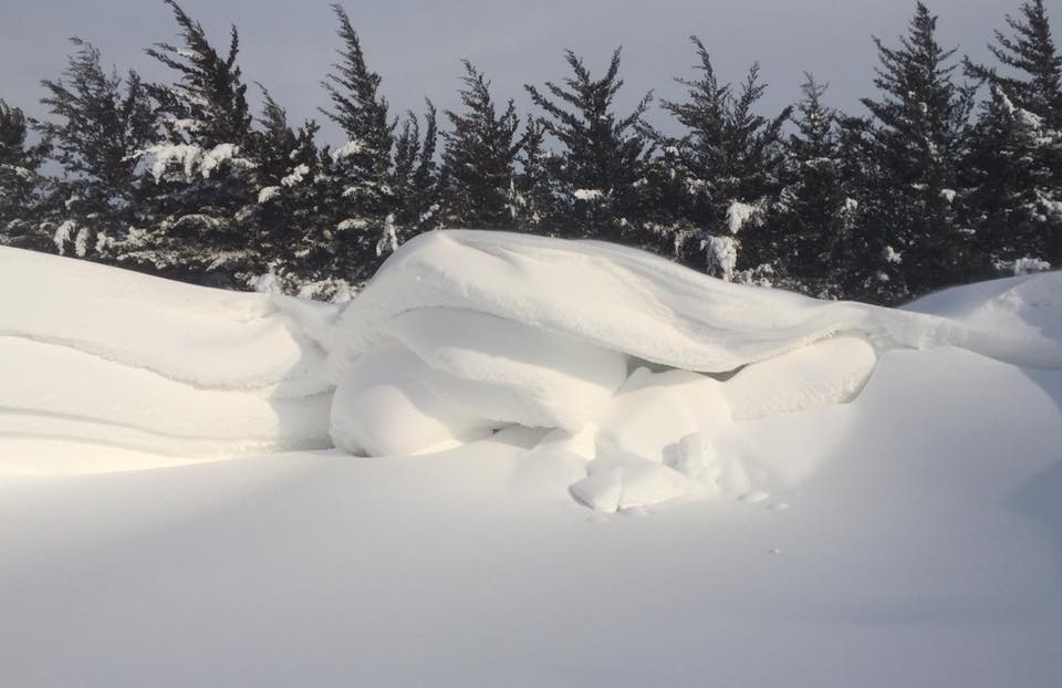
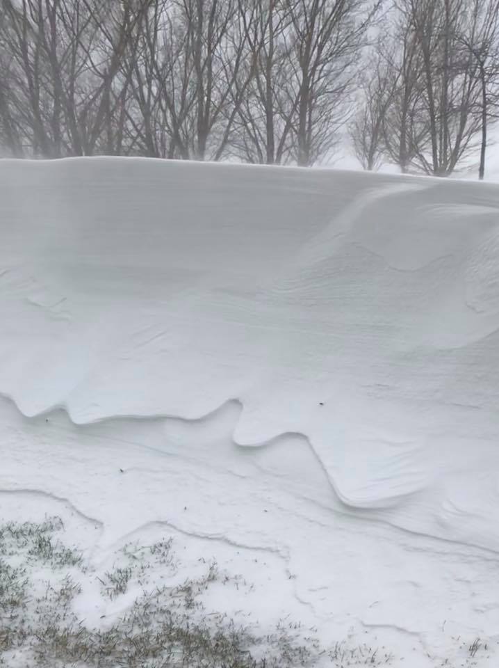
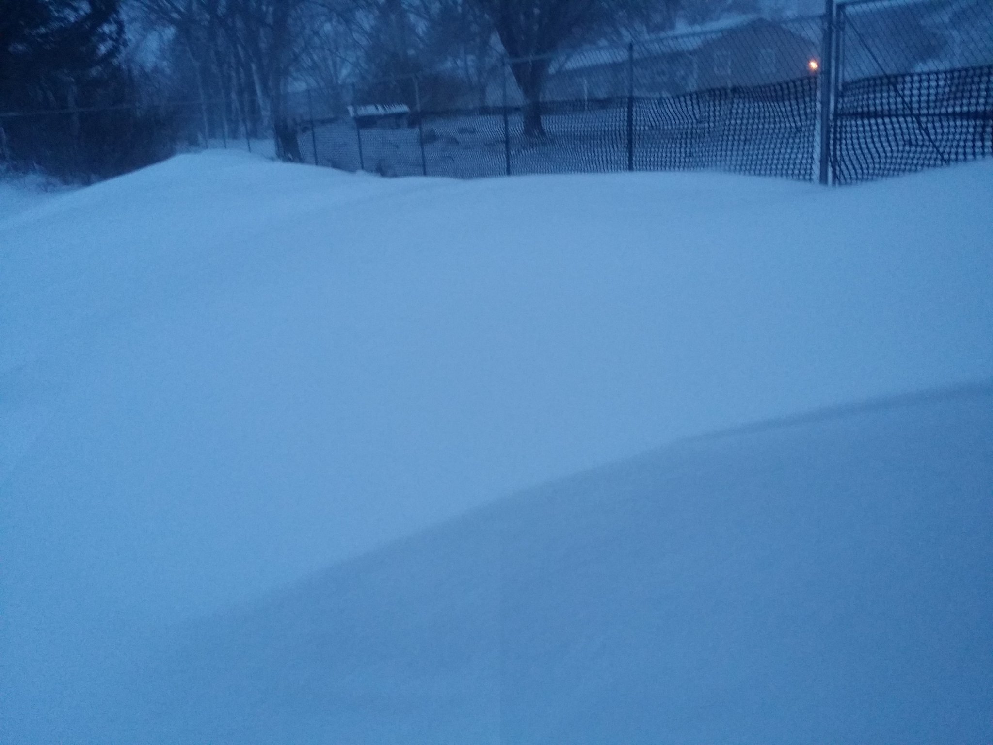
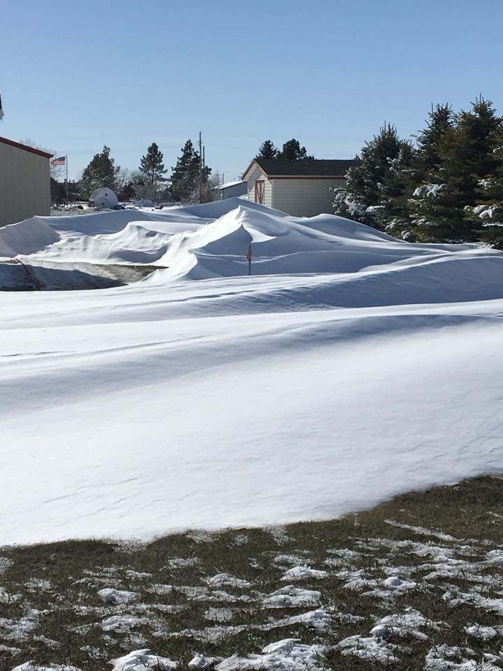
The blizzard resulted in snow drifts several feet high and multiple highway closures, including I-80. In the wake of the storm, temperatures dropped into the single digits and teens the following mornings, breaking record lows. This was the first Blizzard Warning issued in the month of April by NWS North Platte since 2011.
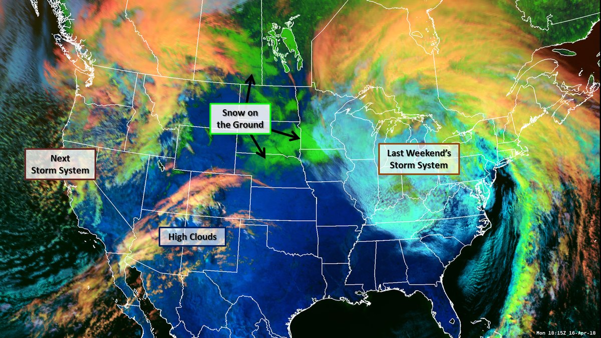
GOES-R satellite image from April 16, 2018, showing the leftover snowpack for Nebraska and surrounding states.
Photos:
 |
 |
 |
 |
| near Purdum Photo credit: Alaina Jensen |
near Sutherland Photo credit: Amy Coffman |
Valentine Photo credit: Austin Sinnett |
Kearney Photo credit: Brittany Blessing |
 |
 |
 |
 |
| Ellsworth Photo credit: Clay Bixby |
Big Springs Photo credit: Corey Munn |
Arnold Photo credit: Crystal Hanna |
Thedford Photo credit: David Ridings |
 |
 |
 |
 |
| Thedford Photo credit: Dawn Hansen Bryant |
Long Pine Photo credit: Dawn Thompson |
Elsie Photo credit: Deborah Biesecker |
near Mullen Photo credit: Don & Deb Cox |
 |
 |
 |
 |
| near Tryon Photo credit: Jacque Trumbull |
near Stapleton Photo credit: Jenni Joedeman |
near Lewellen Photo credit: Jill Saults |
Elsmere Photo credit: Julie McFadden |
 |
 |
 |
 |
| Ogallala Photo credit: Karmen Nolda-Rosno |
Thedford Photo credit: Leigh Collins Reiser |
Arnold Photo credit: Marshia Grant |
Lake Maloney Photo credit: Mitzi Kramer |
 |
 |
 |
 |
| Burwell Photo credit: Peggy Fisher Wegner |
Grant Photo credit: Richard Thurin |
Broken Bow Photo credit: Robert Knobbe |
near Mullen Photo credit: Sandy Munn |
 |
 |
 |
 |
| near North Platte Photo credit: Scott Odle |
near Grant Photo credit: Shari Sexson |
near North Platte Photo credit: Shelly Miller |
Valentine Photo credit: Sheri Dahlgren |
 |
 |
| Valentine Photo credit: @RandyinNebraska |
Clinton Photo credit: Ty Bourne |
 |
 |
 |
| Thedford Photo credit: Dawn Hansen Bryant |
Spencer Photo credit: John Wells |
North Platte Photo credit: Karla French-Janecek |
Radar & Environment:
.gif) |
|
Radar archive courtesy of the Iowa Environmental Mesonet Red county outline: Blizzard Warning ; Pink county outline: Winter Storm Warning |
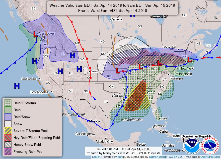
Surface analysis from Saturday morning, April 14, 2018 (courtesy of the NWS Weather Prediction Center)
Snowfall & Storm Reports:
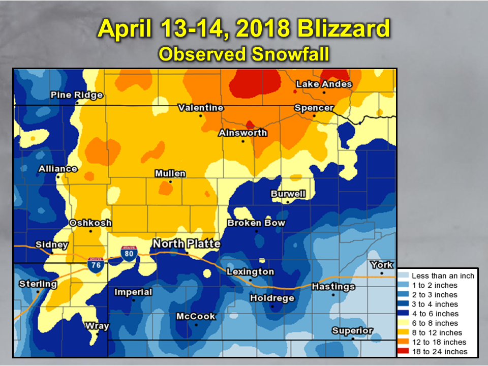
Snowfall map compiled from storm reports and radar estimates
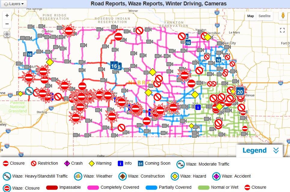
Road reports during the height of the blizzard: I-80 closed from Wyoming border to Grand Island, other US/state highways also closed.
Courtesy of Nebraska Department of Transportation (511.nebraska.gov)
..TIME...   ...EVENT...      ...CITY LOCATION...     ...LAT.LON...
..DATE...   ....MAG....      ..COUNTY LOCATION..ST.. ...SOURCE....
            ..REMARKS..

0122 PM     BLIZZARD         10 NE OSHKOSH           41.51N 102.21W
04/13/2018                   GARDEN             NE   CO-OP OBSERVER

            VISIBILITY 200 YARDS AND SNOWING HEAVILY. SNOW
            ACCUMULATION OF 1.5 INCHES SO FAR.

0122 PM     BLIZZARD         LISCO                   41.50N 102.62W
04/13/2018                   GARDEN             NE   CO-OP OBSERVER

            VISIBILITY 50 YARDS AND SNOWING HEAVY.

0310 PM     BLIZZARD         OGALLALA                41.13N 101.72W
04/13/2018                   KEITH              NE   CO-OP OBSERVER

            VISIBILITY OF 50 TO 100 YARDS WITH HEAVY SNOW AND BLOWING
            SNOW.

0322 PM     BLIZZARD         VALENTINE               42.87N 100.55W
04/13/2018                   CHERRY             NE   BROADCAST MEDIA

            RADIO STATION KVSH REPORTS ZERO VISIBILITY WITH SNOW AND
            BLOWING SNOW REPORTED.

0331 PM     BLIZZARD         MULLEN                  42.04N 101.04W
04/13/2018                   HOOKER             NE   LAW ENFORCEMENT

            WHITE OUT CONDITIONS REPORTED IN MULLEN.

0347 PM     BLIZZARD         4 N VALENTINE           42.93N 100.55W
04/13/2018                   CHERRY             NE   PUBLIC

            ZERO VISIBILITY IN HEAVY SNOW.

0427 PM     BLIZZARD         6 WSW PAXTON            41.09N 101.46W
04/13/2018                   KEITH              NE   FIRE DEPT/RESCUE

            OGALLALA FIRE AND RESCUE REPORTS MULTI-VEHICLE ACCIDENT
            ALONG I-80. NUMEROUS PEOPLE STRANDED WITH NUMEROUS
            INJURIES REPORTED.

0427 PM     BLIZZARD         IMPERIAL                40.52N 101.64W
04/13/2018                   CHASE              NE   CO-OP OBSERVER

            POWER OUTAGE REPORTED IN THE TOWN OF IMPERIAL.

0427 PM     BLIZZARD         6 N GORDON              42.89N 102.20W
04/13/2018                   SHERIDAN           NE   CO-OP OBSERVER

            VISIBILITY LESS THAN 1/8TH OF A MILE WITH AN ESTIMATE OF
            5 INCHES ON THE GROUND AND STILL SNOWING.

0451 PM     BLIZZARD         10 NE OSHKOSH           41.24N 99.62W
04/13/2018                   CUSTER             NE   CO-OP OBSERVER

            1-2 SNOWFALL RATES THE PAST COUPLE HOURS.

0509 PM     BLIZZARD         2 E SUTHERLAND          41.16N 101.09W
04/13/2018                   LINCOLN            NE   911 CALL CENTER

            WHITEOUT CONDITIONS ON HWY 30.

0512 PM     BLIZZARD         5 WSW MAXWELL           41.05N 100.61W
04/13/2018                   LINCOLN            NE   911 CALL CENTER

            SEMI ACCIDENT BLOCKING I-80 AT MILEPOST 185.

0631 PM     BLIZZARD         BUTTE                   42.91N 98.85W
04/13/2018                   BOYD               NE   UTILITY COMPANY

            POWER OUTAGE AFFECTING BUTTE. REPORT VIA NPPD
            OUTAGE TRACKER.

0654 PM     BLIZZARD         ELSIE                   40.85N 101.39W
04/13/2018                   PERKINS            NE   UTILITY COMPANY

            POWER OUTAGES IN AND AROUND ELSIE. REPORT VIA NPPD OUTAGE
            TRACKER.

0714 PM     BLIZZARD         2 SE ANSELMO            41.60N 99.84W
04/13/2018                   CUSTER             NE   CO-OP OBSERVER

            POWER OUTAGE REPORTED IN THE AREA SINCE APPROXIMATED
            515PM CDT.

0800 PM     BLIZZARD         THEDFORD                41.98N 100.57W
04/13/2018                   THOMAS             NE   PUBLIC

            REPORT AND PHOTO VIA SOCIAL MEDIA OF WHITEOUT CONDITIONS
            WITH ZERO VISIBILITY IN TOWN.

0826 PM     BLIZZARD         3 W ARNOLD              41.42N 100.25W
04/13/2018                   CUSTER             NE   DEPT OF HIGHWAYS

            HIGH WINDS HAVE BLOWN A SEMI OVER ON HWY 92. REPORT VIA
            NDOT.

0842 PM     BLIZZARD         INMAN                   42.38N 98.53W
04/13/2018                   HOLT               NE   UTILITY COMPANY

            POWER OUTAGES IN AND AROUND INMAN. REPORT VIA NPPD OUTAGE
            TRACKER.

0847 PM     BLIZZARD         8 WSW CALLAWAY          41.25N 100.06W
04/13/2018                   CUSTER             NE   CO-OP OBSERVER

            NEAR WHITEOUT CONDITIONS WITH VISIBILITY LESS THAN 500
            FEET.

0908 PM     BLIZZARD         1 ENE NORTH PLATTE      41.14N 100.75W
04/13/2018                   LINCOLN            NE   ASOS

            ASOS VISIBILITY IS 1/4 MILE. EYE LEVEL VISIBILITY 100
            YARDS.

0920 PM     BLIZZARD         4 W BURWELL             41.78N 99.21W
04/13/2018                   GARFIELD           NE   LAW ENFORCEMENT

            ROADS ARE SNOW/ICE COVERED. ZERO VISIBILITY

0921 PM     BLIZZARD         IMPERIAL                40.52N 101.64W
04/13/2018                   CHASE              NE   CO-OP OBSERVER

            TOTAL SNOW OF 4 INCHES ESTIMATED THUS FAR, STILL SNOWING.
            ZERO VISIBILITY WITH POWER RESTORED.

0931 PM     BLIZZARD         ATKINSON                42.53N 98.98W
04/13/2018                   HOLT               NE   UTILITY COMPANY

            POWER OUTAGES IN AND AROUND ATKINSON. REPORT VIA NPPD
            OUTAGE TRACKER.

1014 PM     BLIZZARD         OGALLALA                41.13N 101.72W
04/13/2018                   KEITH              NE   UTILITY COMPANY

            POWER OUTAGES REPORTED ALONG A BIG SPRINGS TO OGALLALA
            LINE, AFFECTING BRULE THE HARDEST. REPORT VIA NPPD OUTAGE
            TRACKER.

1115 PM     BLIZZARD         1 ENE NORTH PLATTE      41.14N 100.75W
04/13/2018                   LINCOLN            NE   ASOS

            ASOS VISIBLITY 1/4 MILE, EYE LEVEL VISIBILITY 100 YARDS
            OR LESS IN HEAVY BLOWING SNOW.

0700 AM     BLIZZARD         2 SE ANSELMO            41.60N 99.84W
04/14/2018                   CUSTER             NE   CO-OP OBSERVER

            DRIFT 1 1/2 FEET DEEP. LIQUID PRECIPITATION OF 1.10
            INCHES.

0700 AM     BLIZZARD         8 WSW CALLAWAY          41.25N 100.06W
04/14/2018                   CUSTER             NE   CO-OP OBSERVER

            ESTIMATED 3 TO 5 INCHES AS OF 7AM CDT.5 FOOT DRIFTS, LOST
            ELECTRICITY.

0832 AM     BLIZZARD         BASSETT                 42.58N 99.54W
04/14/2018                   ROCK               NE   CO-OP OBSERVER

            OBSERVER REPORTING 8.5 INCHES OF SNOW WITH ESITMATED 3 OR
            4 FOOT DRIFTS. WHITE OUT CONDITIONS.

0834 AM     BLIZZARD         ATKINSON                42.53N 98.98W
04/14/2018                   HOLT               NE   CO-OP OBSERVER

            OBSERVER REPORTING 7.0 INCHES OF SNOW WITH 3-4 FEET
            DRIFTS. 1.10 INCHES OF MOISTURE WITH THE SYSTEM. WHITE
            OUT CONDITIONS.

0834 AM     BLIZZARD         7 SW AMELIA             42.16N 99.06W
04/14/2018                   HOLT               NE   TRAINED SPOTTER

            NEAR ZERO VISIBILITY WITH SNOW AND BLOWING SNOW.
            ESTIMATED 2-3 INCHES OF SNOW ACCUMULATION.

0856 AM     BLIZZARD         ONEILL                  42.46N 98.65W
04/14/2018                   HOLT               NE   BROADCAST MEDIA

            ESTIMATED 4 INCHES OF SNOW HAS FALLEN. REPORTS OF
            NUMEROUS POWER POLES DOWN AROUND THE COUNTY.

0856 AM     BLIZZARD         BROKEN BOW              41.02N 100.37W
04/14/2018                   LINCOLN            NE   BROADCAST MEDIA

            MEDIA REPORTING AS MUCH AS A THIRD OF THE CUSTER POWER
            DISTICT IS WITHOUT POWER. NUMEROUS ACCIDENTS DUE TO ICY
            ROADS AND ZERO VISIBILITY. ESTIMATED 4-5 INCHES OF SNOW
            ACCUMULATIONS WITH 2-3 FOOT DRIFTS.

0912 AM     BLIZZARD         TAYLOR                  41.77N 99.38W
04/14/2018                   LOUP               NE   EMERGENCY MNGR

            SHERIFF REPORTING 2-3 FOOT DRIFTS ACROSS HIGHWAYS WITH AN
            ESITMATED 3-4 INCHES OF SNOW. ZERO VISIBILITY.

0923 AM     BLIZZARD         AINSWORTH               42.55N 99.86W
04/14/2018                   BROWN              NE   CO-OP OBSERVER

            ESTIMATED 8 INCHES OF SNOW WITH KNEE OR WAIST HIGH
            DRIFTS. ZERO VISIBILITY.

0924 AM     BLIZZARD         10 S NORTH PLATTE       40.99N 100.77W
04/14/2018                   LINCOLN            NE   NWS EMPLOYEE

            CURRENTLY ZERO VISIBILITY WITH SIGNIFICAND DRIFTS ROADS.
            SOME COUNTY ROADS ARE IMPASSABLE.

0930 AM     BLIZZARD         AINSWORTH               42.55N 99.86W
04/14/2018                   BROWN              NE   BROADCAST MEDIA

            REPORT OF WELL OVER A FOOT A SNOW, RURAL CUSTOMERS
            WITHOUT POWER. POWER LINES DOWN NEAR ROSE. PARTS OF BROWN
            AND CHERRY COUNTY WITHOUT POWER.

1004 AM     BLIZZARD         BIG SPRINGS             41.06N 102.07W
04/14/2018                   DEUEL              NE   CO-OP OBSERVER

            ESTIMATED 7-10 SNOW ACCUMULATIONS WITH 6 FOOT DRIFTS AND
            ZERO VISIBILITY. NUMEROUS ACCIDENTS ACROSS DEUEL AND
            KEITH COUNTIES. STRANDED MOTORISTS ON HIGHWAY 138 AND THE
            INTERSTATE. NUMEROUS POWER OUTAGES.

1013 AM     BLIZZARD         BIG SPRINGS             41.06N 102.07W
04/14/2018                   DEUEL              NE   TRAINED SPOTTER

            WHITE OUT CONDITIONS, 8-10 FOOT DRIFTS WITH ESTIMATE FOOT
            OF SNOW ACCUMULATIONS. ZERO VISIBILITY YESTERDAY
            AFTERNOON AND OVERNIGHT. POWER IS OUT AS OF 2100 LAST
            NIGHT.

1043 AM     BLIZZARD         1 S NORTH PLATTE        41.12N 100.77W
04/14/2018                   LINCOLN            NE   PUBLIC

            REPORTS OF CARS IN DITCHES AND WHITE OUT CONDITIONS.

0244 PM     BLIZZARD         18 N MULLEN             42.30N 101.04W
04/14/2018                   CHERRY             NE   PUBLIC

            ESTIMATED 10-15 INCHES OF SNOW. REPORTS OF DRIFTS MIDWAY
            UP THE SHELTER BELT. ESTIMATED 20 FOOT HIGH DRIFTS.
..TIME...   ...EVENT...      ...CITY LOCATION...     ...LAT.LON...
..DATE...   ....MAG....      ..COUNTY LOCATION..ST.. ...SOURCE....
            ..REMARKS..

0347 PM     SNOW             10 W LEMOYNE            41.29N 101.99W
04/13/2018  M2.5 INCH        KEITH              NE   TRAINED SPOTTER

            SNOWING HEAVILY WITH 1/4 MILE VISIBILITY.

0450 PM     HEAVY SNOW       1 W VALENTINE           42.87N 100.57W
04/13/2018  M6.0 INCH        CHERRY             NE   COCORAHS

            6 INCHES IN PAST 6 HOURS

0628 PM     SNOW             11 E LEWELLEN           41.33N 101.93W
04/13/2018  E6.5 INCH        KEITH              NE   PUBLIC

            ESTIMATED 6.5 INCHES ON THE GROUND. WIND GUSTS OF 27 TO
            34 MPH WITH VISIBILITES OF HALF MILE OR LESS.

1017 PM     HEAVY SNOW       10 NE OSHKOSH           41.51N 102.21W
04/13/2018  E7.0 INCH        GARDEN             NE   CO-OP OBSERVER

            STILL SNOWING WITH VISBY UNDER 1/4 MI

1200 AM     SNOW             3 ENE NORTH PLATTE      41.15N 100.72W
04/14/2018  M4.0 INCH        LINCOLN            NE   OFFICIAL NWS OBS

1232 AM     HEAVY SNOW       VALENTINE               42.87N 100.55W
04/14/2018  M6.9 INCH        CHERRY             NE   OFFICIAL NWS OBS

0500 AM     HEAVY SNOW       W VALENTINE             42.87N 100.55W
04/14/2018  E11.0 INCH       CHERRY             NE   TRAINED SPOTTER

            11 INCHES OF SNOWFALL AS OF 5AM CDT. OVER 3 FOOT SNOW
            DRIFTS. 0.82 INCHES OF LIQUID PRECIPITATION, 0.11 INCHES
            OF THIS IS RAINFALL.

0600 AM     SNOW             KINGSLEY DAM            41.21N 101.66W
04/14/2018  E5.0 INCH        KEITH              NE   CO-OP OBSERVER

            5.0 INCHES OF SNOW WITH 0.52 INCHES OF LIQUID
            PRECIPITATION.

0700 AM     SNOW             LISCO                   41.50N 102.62W
04/14/2018  M7.5 INCH        GARDEN             NE   CO-OP OBSERVER

0700 AM     SNOW             KILGORE                 42.94N 100.96W
04/14/2018  M5.0 INCH        CHERRY             NE   CO-OP OBSERVER

0700 AM     SNOW             8 WSW CALLAWAY          41.25N 100.06W
04/14/2018  E4.0 INCH        CUSTER             NE   CO-OP OBSERVER

            ESTIMATED 3 TO 5 INCHES OF SNOW AS OF 7AM CDT.

0800 AM     SNOW             NEWPORT                 42.60N 99.33W
04/14/2018  E14.0 INCH       ROCK               NE   CO-OP OBSERVER

            14 INCHES OF SNOWFALL AS OF 8AM, STILL SNOWING. 2.19
            INCHES OF LIQUID PRECIPITATION.

0800 AM     SNOW             2 SW BURWELL            41.76N 99.16W
04/14/2018  M3.0 INCH        GARFIELD           NE   COCORAHS

0800 AM     HEAVY SNOW       4 WSW BIG SPRINGS       41.04N 102.15W
04/14/2018  M10.0 INCH       DEUEL              NE   COCORAHS

0800 AM     SNOW             9 NW ANSELMO            41.71N 99.99W
04/14/2018  M5.0 INCH        CUSTER             NE   COCORAHS

0800 AM     SNOW             3 S LAMAR               40.53N 101.98W
04/14/2018  M4.0 INCH        CHASE              NE   COCORAHS

0800 AM     SNOW             8 W CHAMPION            40.46N 101.86W
04/14/2018  M5.5 INCH        CHASE              NE   COCORAHS

0800 AM     HEAVY SNOW       2 W HALSEY              41.90N 100.31W
04/14/2018  M6.6 INCH        THOMAS             NE   COCORAHS

0800 AM     SNOW             1 NNE GRANT             40.86N 101.72W
04/14/2018  M5.5 INCH        PERKINS            NE   COCORAHS

0800 AM     HEAVY SNOW       9 WSW WALLACE           40.79N 101.32W
04/14/2018  M6.8 INCH        PERKINS            NE   COCORAHS

0800 AM     HEAVY SNOW       8 SSE BIG SPRINGS       40.96N 102.02W
04/14/2018  M8.5 INCH        PERKINS            NE   COCORAHS

0800 AM     SNOW             8 SW MADRID             40.77N 101.65W
04/14/2018  M5.2 INCH        PERKINS            NE   COCORAHS

0800 AM     SNOW             BUTTE                   42.91N 98.85W
04/14/2018  M10.3 INCH       BOYD               NE   CO-OP OBSERVER

0800 AM     SNOW             12 S EWING              42.08N 98.34W
04/14/2018  M1.3 INCH        WHEELER            NE   COCORAHS

0800 AM     SNOW             7 NE MILBURN            41.81N 99.65W
04/14/2018  M5.5 INCH        LOUP               NE   COCORAHS

0800 AM     SNOW             2 WNW NORTH PLATTE      41.14N 100.81W
04/14/2018  M3.0 INCH        LINCOLN            NE   COCORAHS

0800 AM     SNOW             1 NW SUTHERLAND         41.17N 101.14W
04/14/2018  M4.0 INCH        LINCOLN            NE   COCORAHS

0850 AM     SNOW             10 NE OSHKOSH           41.51N 102.21W
04/14/2018  M8.0 INCH        GARDEN             NE   CO-OP OBSERVER

            8.0 INCHES OF SNOWFALL WITH 0.80 INCHES OF PRECIPITAION.


0900 AM     HEAVY SNOW       2 S MULLEN              42.01N 101.04W
04/14/2018  M14.0 INCH       HOOKER             NE   COCORAHS

1000 AM     SNOW             3 ENE NORTH PLATTE      41.15N 100.72W
04/14/2018  M5.5 INCH        LINCOLN            NE   OFFICIAL NWS OBS

            AS OF 10 AM CDT 5.5 INCHES OF SNOWFALL AT THE OFFICE.

1045 AM     SNOW             ELSIE                   40.85N 101.39W
04/14/2018  E2.0 INCH        PERKINS            NE   PUBLIC

            REPORT VIA SOCIAL MEDIA OF 2 INCHES OF SNOW.

1128 AM     SNOW             6 N GORDON              42.89N 102.20W
04/14/2018  M6.5 INCH        SHERIDAN           NE   CO-OP OBSERVER

            6.5 INCHES STORM TOTALS WITH 0.86 INCHES OF LIQUID
            PRECIPITATION AND 3 FOOT SNOW DRIFTS.

0600 PM     SNOW             8 WSW CALLAWAY          41.25N 100.06W
04/14/2018  M4.6 INCH        CUSTER             NE   CO-OP OBSERVER

            STORM TOTAL OF 4.6 INCHES.

0600 PM     SNOW             BRADY                   41.02N 100.37W
04/14/2018  M4.4 INCH        LINCOLN            NE   COCORAHS

0600 PM     SNOW             BASSETT                 42.58N 99.54W
04/14/2018  M9.0 INCH        ROCK               NE   CO-OP OBSERVER

            STORM TOTAL OF 9.0 INCHES.

0600 AM     HEAVY SNOW       2 NW SPRINGVIEW         42.85N 99.78W
04/15/2018  M12.0 INCH       KEYA PAHA          NE   CO-OP OBSERVER

0700 AM     HEAVY SNOW       5 W STAPLETON           41.48N 100.61W
04/15/2018  M7.2 INCH        LOGAN              NE   CO-OP OBSERVER

0700 AM     HEAVY SNOW       BURWELL                 41.78N 99.13W
04/15/2018  M7.0 INCH        GARFIELD           NE   COCORAHS

1200 PM     HEAVY SNOW       15 NNE NORTH PLATTE     41.33N 100.66W
04/15/2018  E6.0 INCH        LINCOLN            NE   PUBLIC
0255 PM     NON-TSTM WND GST 1 W OGALLALA            41.13N 101.74W
04/13/2018  M68.00 MPH       KEITH              NE   AWOS

0325 PM     NON-TSTM WND GST 2 E BIG SPRINGS         41.06N 102.04W
04/13/2018  M64.00 MPH       KEITH              NE   MESONET

0330 PM     NON-TSTM WND GST 6 WNW BRULE             41.13N 101.99W
04/13/2018  M66.00 MPH       KEITH              NE   MESONET

            NEBRASKA MESONET

0445 PM     NON-TSTM WND GST 3 E OGALLALA            41.13N 101.66W
04/13/2018  M60.00 MPH       KEITH              NE   MESONET

0558 PM     NON-TSTM WND GST CRESCENT LAKE NWR       41.74N 102.41W
04/13/2018  M60.00 MPH       GARDEN             NE   PARK/FOREST SRVC

0641 PM     NON-TSTM WND GST VALENTINE               42.87N 100.55W
04/13/2018  M59.00 MPH       CHERRY             NE   ASOS

0707 PM     NON-TSTM WND GST BROKEN BOW              41.41N 99.64W
04/13/2018  M59.00 MPH       CUSTER             NE   ASOS

0714 PM     NON-TSTM WND GST 27 S VALENTINE          42.48N 100.55W
04/13/2018  M60.00 MPH       CHERRY             NE   PARK/FOREST SRVC

            RAWS STATION

0922 PM     NON-TSTM WND GST VALENTINE               42.87N 100.55W
04/13/2018  M64.00 MPH       CHERRY             NE   ASOS

0930 PM     NON-TSTM WND GST IMPERIAL                40.52N 101.64W
04/13/2018  M61.00 MPH       CHASE              NE   ASOS

1206 AM     NON-TSTM WND GST 4 E NORTH PLATTE        41.13N 100.69W
04/14/2018  M58.00 MPH       LINCOLN            NE   ASOS

0203 AM     NON-TSTM WND GST BROKEN BOW              41.41N 99.64W
04/14/2018  M64.00 MPH       CUSTER             NE   ASOS

1035 AM     NON-TSTM WND GST BROKEN BOW              41.41N 99.64W
04/14/2018  M61.00 MPH       CUSTER             NE   ASOS
1020 AM     HAIL             22 NE ATKINSON          42.76N 98.67W
04/13/2018  E0.75 INCH       HOLT               NE   PUBLIC

1030 AM     HAIL             2 W SPENCER             42.87N 98.74W
04/13/2018  E0.25 INCH       BOYD               NE   PUBLIC

            PEA SIZE HAIL COVERED THE GROUND.

1035 AM     HAIL             11 S BUTTE              42.75N 98.85W
04/13/2018  E0.75 INCH       HOLT               NE   PUBLIC

1044 AM     HAIL             5 N SPENCER             42.95N 98.70W
04/13/2018  E0.25 INCH       BOYD               NE   PUBLIC

            PEA SIZE HAIL COVERED THE GROUND.

1251 PM     HAIL             ATKINSON                42.53N 98.98W
04/13/2018  E0.25 INCH       HOLT               NE   CO-OP OBSERVER
 |
Media use of NWS Web News Stories is encouraged! Please acknowledge the NWS as the source of any news information accessed from this site. |
|

