
Dangerous and extreme heat will remain across portions of the southern U.S. through the weekend. A heat wave over the Southwest U.S. will intensify this week, peaking and expanding into the Intermountain West and northern High Plains this weekend. Multiple rounds of thunderstorms will produce heavy to excessive rainfall with significant flash flooding across portions of southern New England. Read More >
Overview
Tornadoes
Select a tornado from the table to zoom into the track and view more information. The default table view is limited to 8 tracks, but can be scrolled by a mouse wheel or dynamically expanded. Additionally, the table can fill the entire window by clicking the small circular expanding arrow icon at the very top right of the table and returned to its original size by clicking the button again. The side information panel that opens over the map can be closed using the "X" on the upper right corner of the pop-up. Zoom into the map and click damage points to see detailed information and pictures from the surveys.
|
NOTE: times shown below are local to your device's time zone. NOTE: An additional 4 tornadoes occurred on April 27th that produced no observable damage and were rated EF-U. |

The Enhanced Fujita (EF) Scale classifies tornadoes into the following categories:
| EF0 Weak 65-85 mph |
EF1 Moderate 86-110 mph |
EF2 Significant 111-135 mph |
EF3 Severe 136-165 mph |
EF4 Extreme 166-200 mph |
EF5 Catastrophic 200+ mph |
 |
|||||
| Tornadoes that fail to impact any ratable structures on the EF-Scale are rated EF-Unknown (EF-U) | |||||
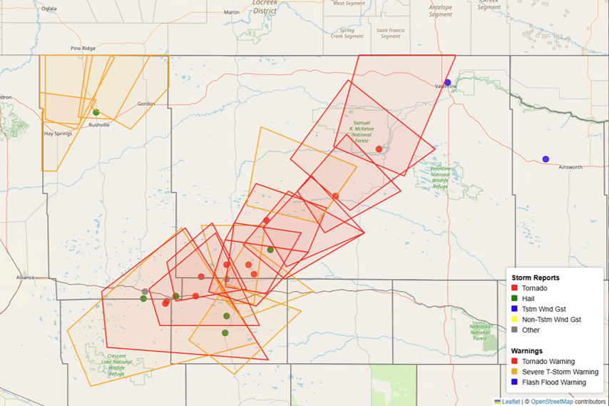
Storm Reports and Warnings
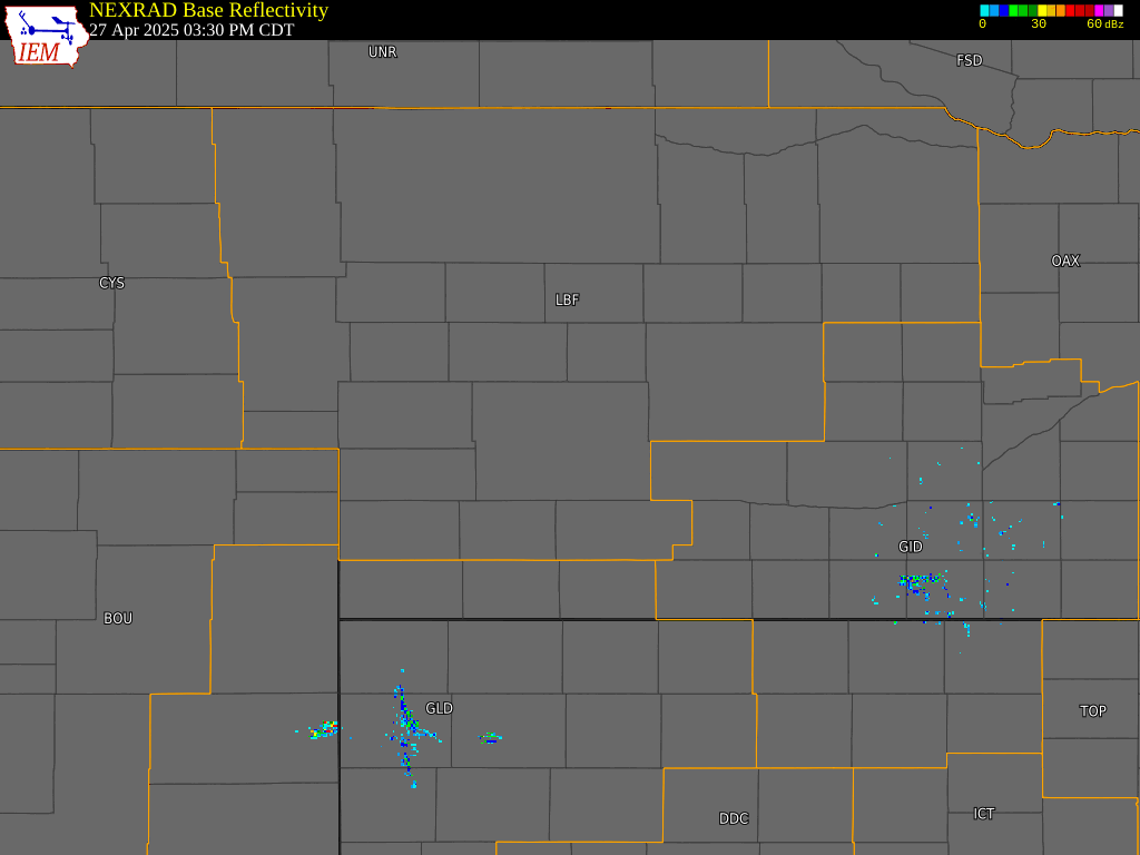
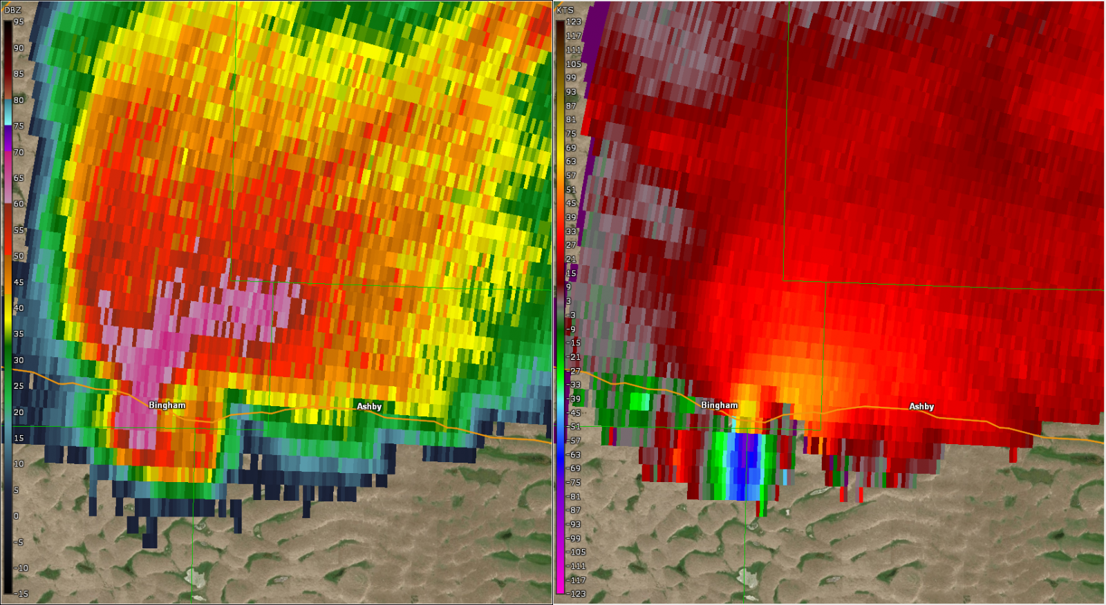
Radar
 |
 |
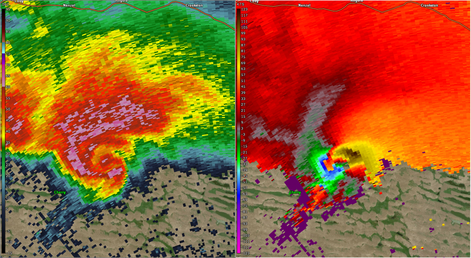 |
| Radar Loop from 3 PM to 11 PM CDT on April 27th | Radar image as the Bingham/Ashby Tornado crossed Highway 2. | Radar image of the Merritt Tornado |
Environment
 |
 |
 |
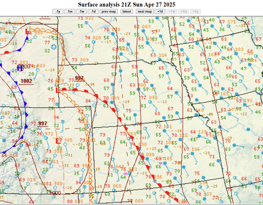 |
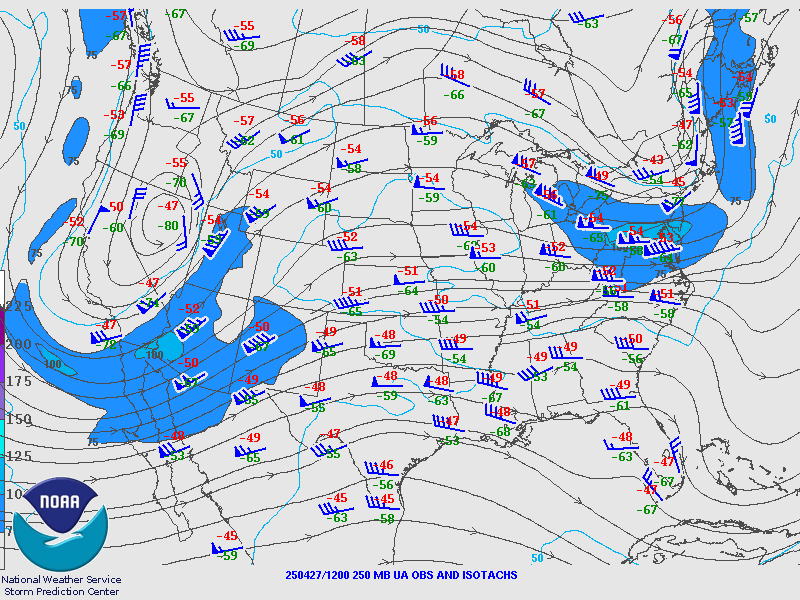
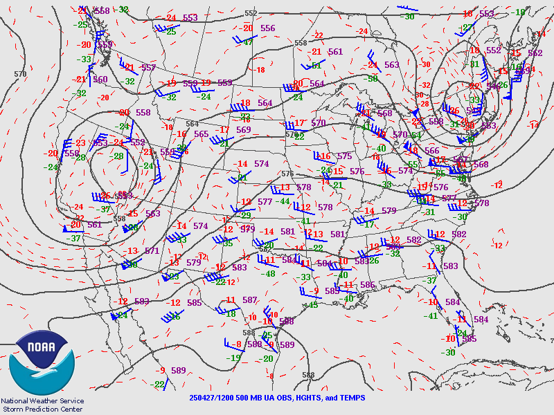
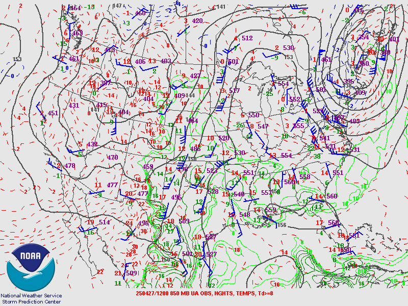
| Figure 1: 12Z 250mb Map | Figure 2: 12Z 500mb Map | Figure 3: 12Z 850mb Map | Figure 4: 21Z Surface Obs |
Near-storm environment summary.
 |
 |
 |
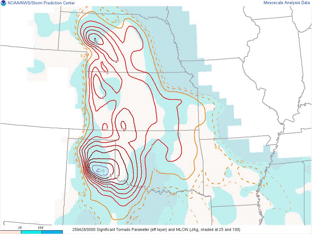 |
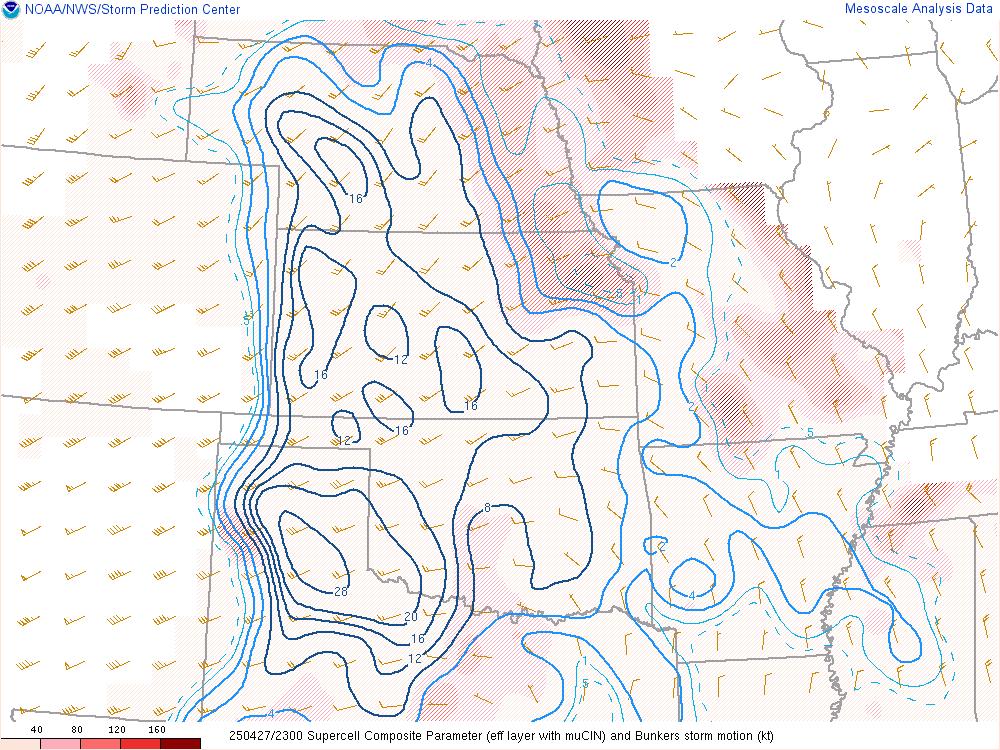
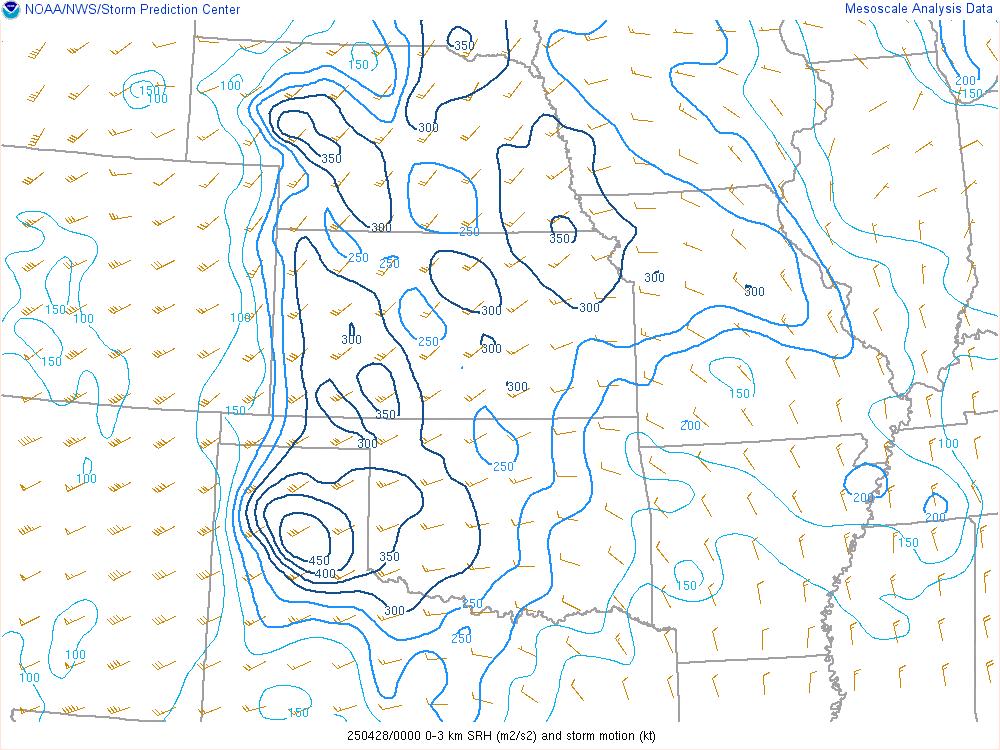
| Figure 5: Surface Based CAPE | Figure 6: Supercell Composite Parameter | Figure 7: 0-3km Storm Relative Helicity | Figure 8: Significant Tornado Parameter |
Photos & Video
 |
 |
 |
 |
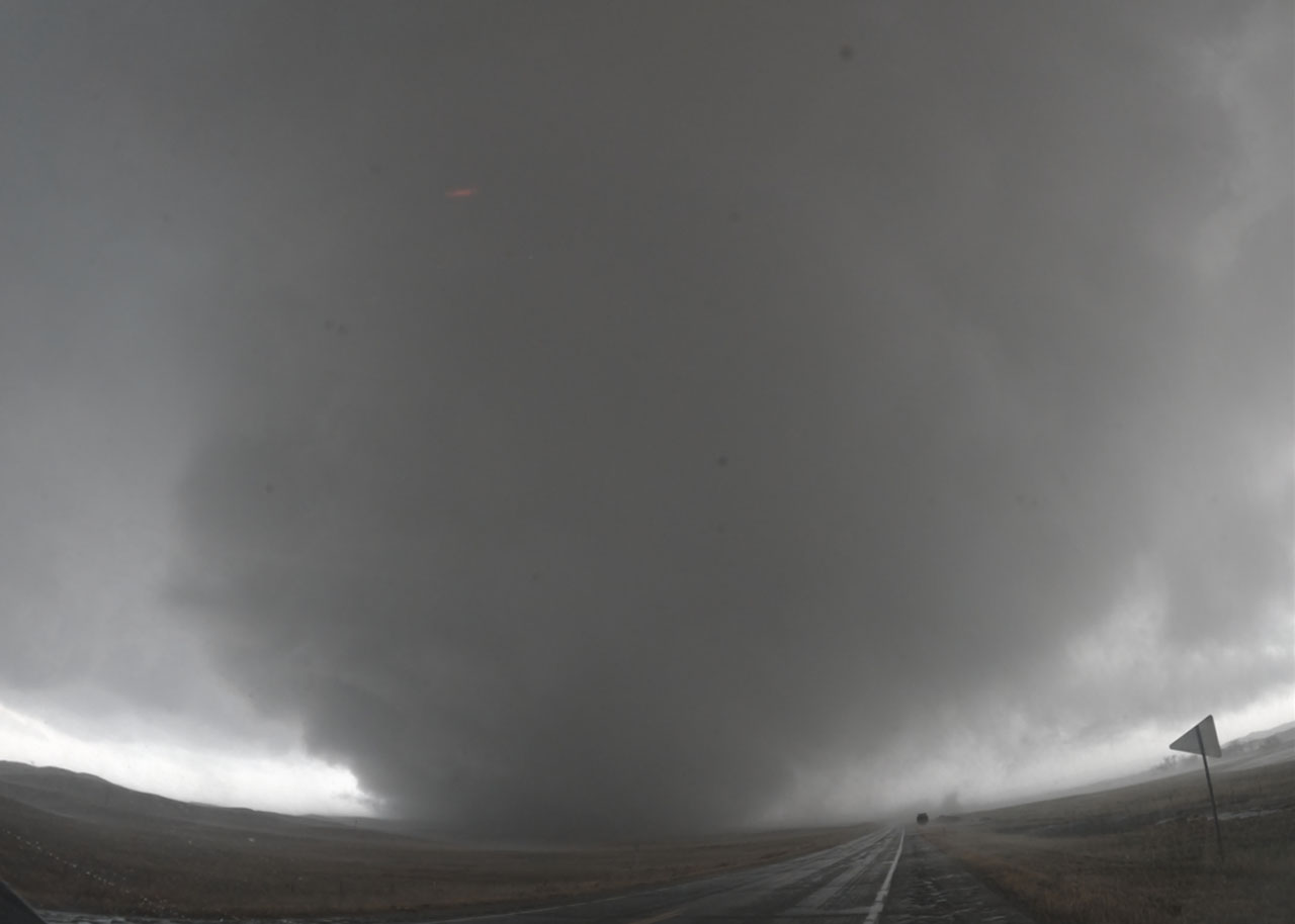
| Tornado crossing Highway 2. (Source: Gage Gibson) |
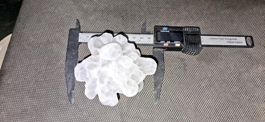
Large hail near Ashby, NE. (Source: Dan Fitts) |
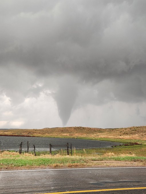
Tornado near Bingham, NE. (Source: John McKinney) |
Tornado NW of Hyannis, NE. (Source: Tim H) |
 |
Media use of NWS Web News Stories is encouraged! Please acknowledge the NWS as the source of any news information accessed from this site. |
|

