
Scattered thunderstorms with severe gusts, hail and a tornado risk are possible near a cold front from the Ohio Valley to the Mid-Atlantic tonight. Tropical Storm Bertha is expected to bring tropical storm conditions to portions of the Gulf Coast from the panhandle of Florida into Louisiana through Wednesday. Read More >
North Platte, NE
Weather Forecast Office
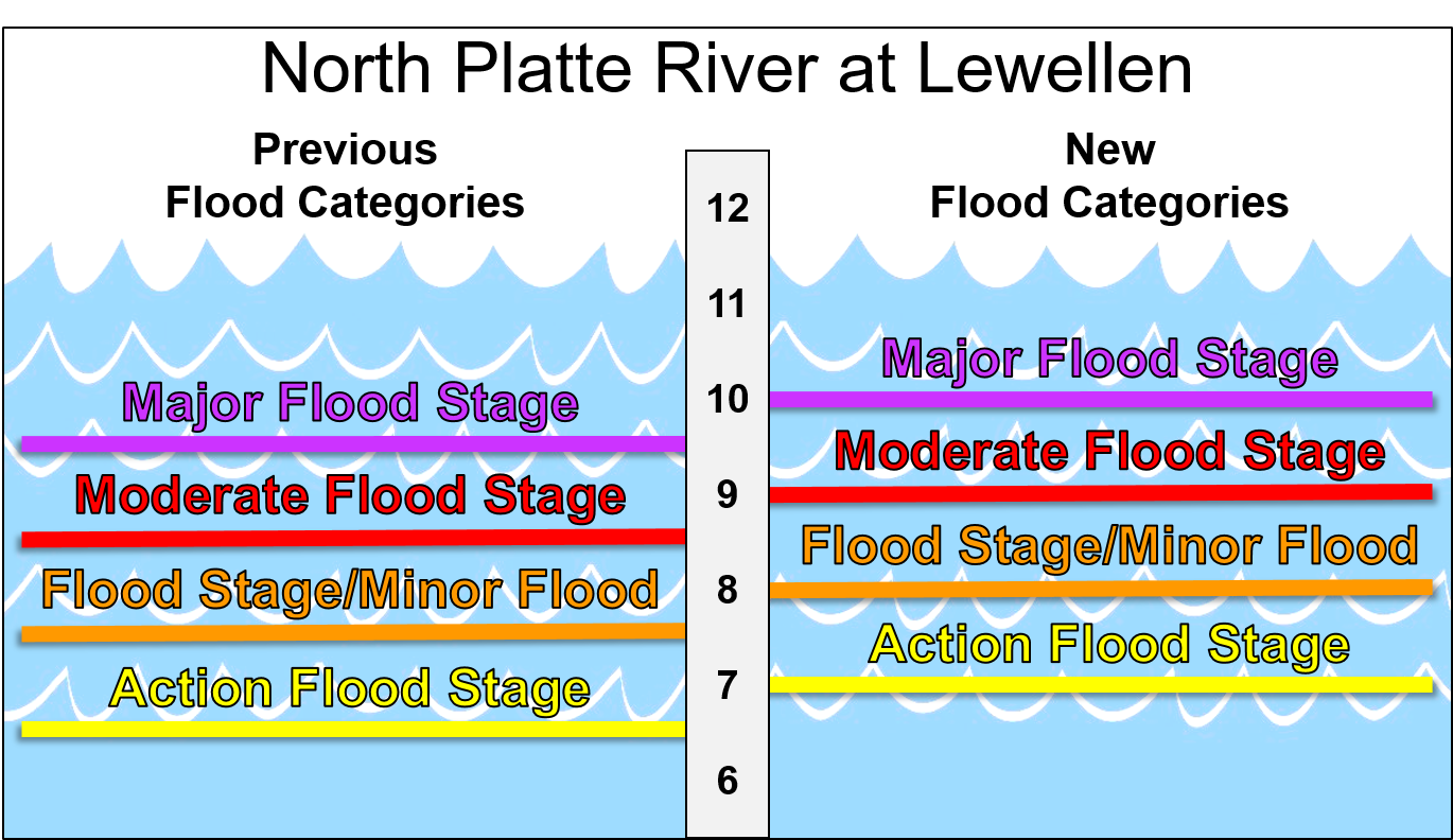
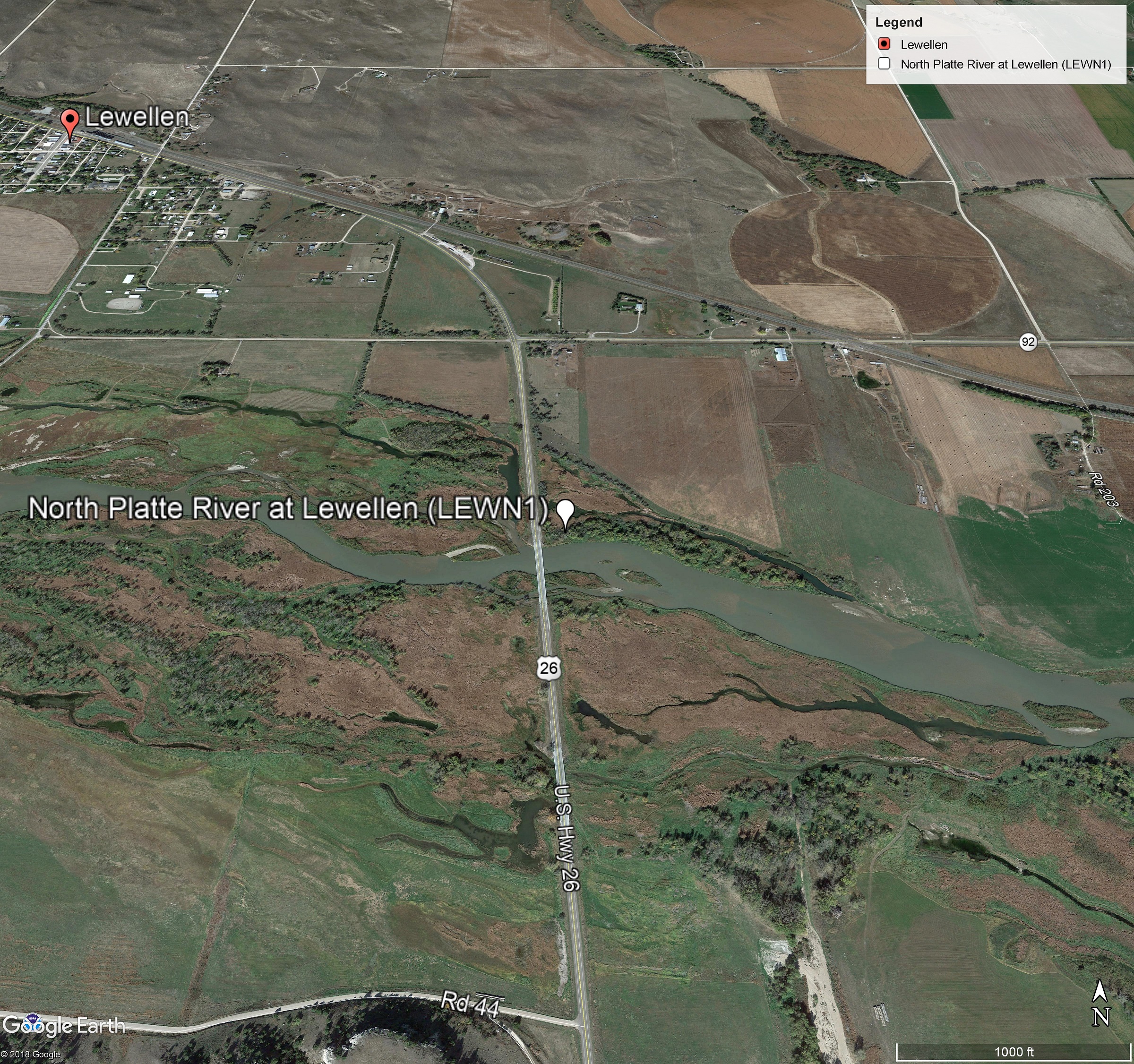
Effective August 28, 2019, the National Weather Service (NWS) in North Platte, NE will change the flood category stages for the North Platte River at Lewellen (LEWN1).
All NWS flood warnings, flood statements, flood advisories, flood watches, probability outlooks, and NWS hydrographs on the Advanced Hydrologic Prediction Service (AHPS) will reference the new category levels. This change is part of a recent evaluation of the levels based on high water, flood events, and impacts over the past 10 years.
The new flood categories will be as follows (all values at level above gage zero datum) at the North Platte River at Lewellen:
| New Flood Categories | Previous Flood Categories |
|---|---|
| Action Stage: 7.0 ft | Action Stage: 6.5 ft |
| Flood Stage: 8.0 ft | Flood Stage: 7.5 ft |
| Moderate Flood Stage: 9.0 ft | Moderate Flood Stage: 8.5 ft |
| Major Flood Stage: 10.0 ft | Major Flood Stage: 9.5 ft |
| Gage zero datum: 3286.992 ft above MSL NAVD88 | |
The National Weather Service welcomes public feedback. If you have any questions or comments on this change, please contact:
Kenneth Roberg
Lead Forecaster/Hydrology Focal Point
(308) 532-4936
kenneth.roberg@noaa.gov
National Weather Service
5250 East Lee Bird Dr
North Platte, NE 69101
HAZARDS
Active Alerts
National Radar
National Hurricane Center
Storm Prediction Center
Weather Prediction Center
River Flooding
Decision Support
Submit a Storm Report
Recent Storm Reports
CURRENT CONDITIONS
CoCoRaHS
Enhanced Data Display
Local Radar
National Radar Mosiac
Observations
National Snow Cover
Precipitation Mapped
Regional Links
Satellite
Snowfall Analysis
FORECASTS
Area Forecast Discussion
Aviation Weather Center
Local Aviation Weather
Fire Weather
Recreation Forecast
National Graphical Forecast
Local Graphical Forecast
CLIMATE
Local Climate
National Climate
North Platte - Daily
North Platte - Monthly
Valentine - Daily
Valentine - Monthly
Broken Bow - Daily
Broken Bow - Monthly
Imperial - Daily
Imperial - Monthly
NIDIS Drought
NOAA Climate Science
Local Storm Reports
Local Drought Statement
US Dept of Commerce
National Oceanic and Atmospheric Administration
National Weather Service
North Platte, NE
5250 E. Lee Bird Drive
North Platte, NE 69101-2473
308-532-4936
Comments? Questions? Please Contact Us.

