
Dangerous heat will expand from the Gulf Coast into the Southern Plains and Desert Southwest through week's end. Additional extreme heat impacting the Pacific Northwest will shift to the northern Plains by the weekend. Tropical Storm Bertha is expected to continue to impact portions of the northern Gulf Coast from the western Florida Panhandle to southeastern Louisiana through tonight. Read More >
North Platte, NE
Weather Forecast Office
Overview
|
On the afternoon of May 12, 2022 strong winds gusting to around 70mph behind a cold front lofted dust into the air. The cloud of dust quickly consolidated into a Dust Storm just behind the front as it pushed across southwest Nebraska. The Dust Storm produced near zero visibility and resulted in multiple vehicle accidents including a multi vehicle pileup on highway 30 near mile marker 160. This memorable event produced many stunning images that will not soon be forgotten! |
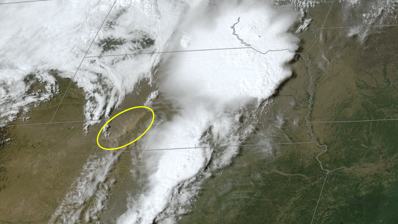 GOES-East GeoColor satellite image of Dust Storm moving across southwest Nebraska during the afternoon of May 12, 2022. |
 |
 |
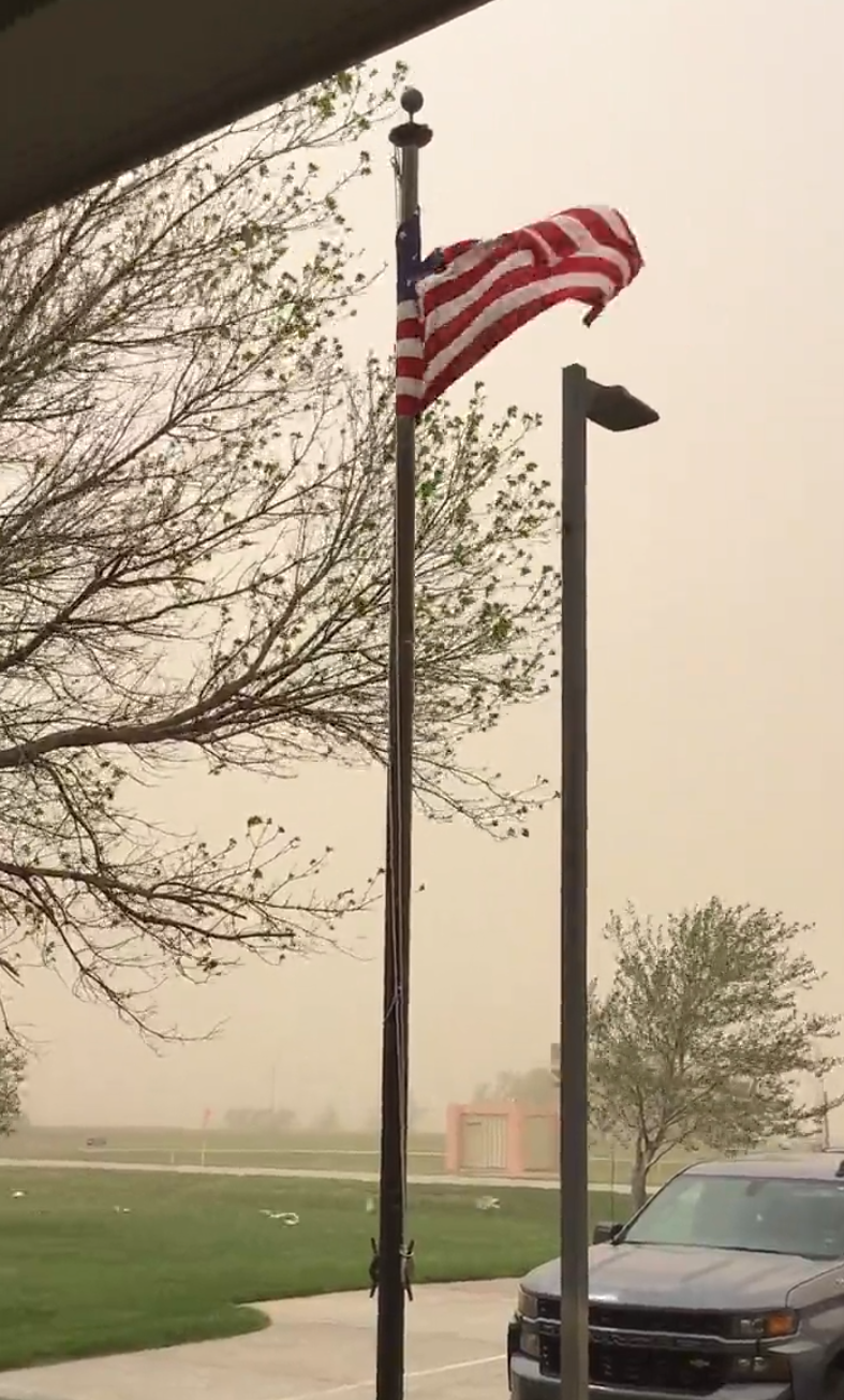 |
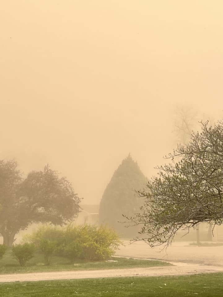
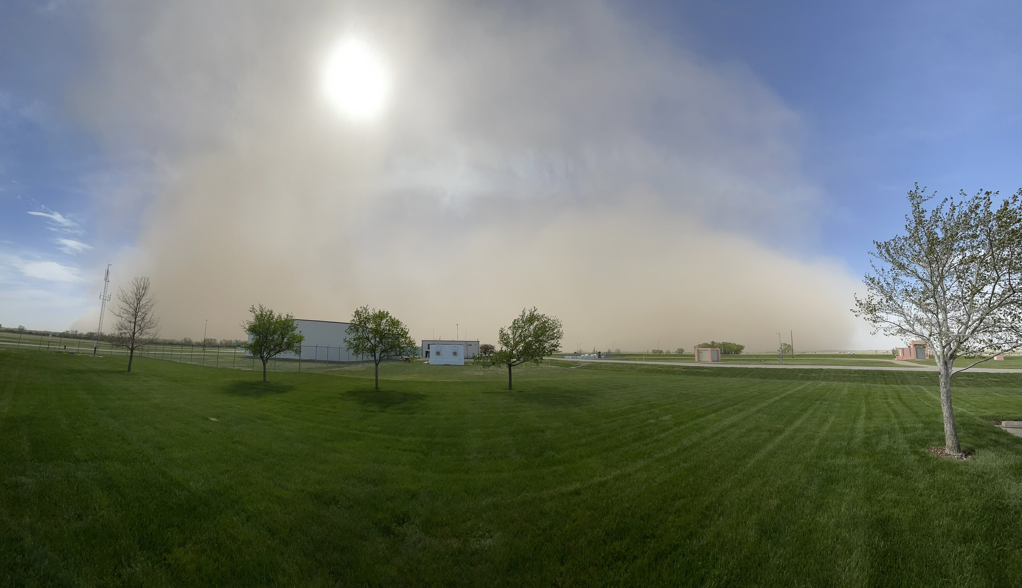
| Dust storm in progress at 2:26PM MDT in Grant, Nebraska (image courtesy of Lacey Parker via Facebook). | Dust cloud approaching the NWS North Platte, Nebraska Weather Forecast Office 4:16PM CDT. | Dust Storm in progress at the NWS North Platte, Nebraska Weather Forecast Office 4:27PM CDT. |
Storm Reports
0420 PM     DUST STORM       3 E SUTHERLAND          41.16N 101.07W
05/12/2022                   LINCOLN            NE   EMERGENCY MNGR

            MULTI VEHICLE ACCIDENT ON HWY 30 NEAR MILE MARKER 160 DUE
            TO ZERO VISIBILITY IN BLOWING DUST

0435 PM     NON-TSTM WND GST 4 E NORTH PLATTE        41.13N 100.69W
05/12/2022  M69.00 MPH       LINCOLN            NE   ASOS

0441 PM     NON-TSTM WND GST 4 W NORTH PLATTE        41.13N 100.85W
05/12/2022  M70.00 MPH       LINCOLN            NE   ASOS
 |
Media use of NWS Web News Stories is encouraged! Please acknowledge the NWS as the source of any news information accessed from this site. |
|
HAZARDS
Active Alerts
National Radar
National Hurricane Center
Storm Prediction Center
Weather Prediction Center
River Flooding
Decision Support
Submit a Storm Report
Recent Storm Reports
CURRENT CONDITIONS
CoCoRaHS
Enhanced Data Display
Local Radar
National Radar Mosiac
Observations
National Snow Cover
Precipitation Mapped
Regional Links
Satellite
Snowfall Analysis
FORECASTS
Area Forecast Discussion
Aviation Weather Center
Local Aviation Weather
Fire Weather
Recreation Forecast
National Graphical Forecast
Local Graphical Forecast
CLIMATE
Local Climate
National Climate
North Platte - Daily
North Platte - Monthly
Valentine - Daily
Valentine - Monthly
Broken Bow - Daily
Broken Bow - Monthly
Imperial - Daily
Imperial - Monthly
NIDIS Drought
NOAA Climate Science
Local Storm Reports
Local Drought Statement
US Dept of Commerce
National Oceanic and Atmospheric Administration
National Weather Service
North Platte, NE
5250 E. Lee Bird Drive
North Platte, NE 69101-2473
308-532-4936
Comments? Questions? Please Contact Us.

